Pico Canyon Historic Well Photos
There has been many changes in the more than 130 years since the oldest of these photos were taken. The road has been expanded and re-aligned in some places. The river bed has naturally changed its course or has been forcibly changed by man. Cameras have changed. Therefore, it has sometimes been difficult to exactly reproduce the old photos. Luckily, we know the exact position of CSO 4, which enables us to identify that well from any photo. We also have a survey plat map from 1877 that shows the position of CSO (Pico in those days) 1, 2, 3, 4, and the Sanford Lyon well. (See the Pico Canyon Surveys webpage.)
We are very fortunate that in June of 1877 Carleton Watkins journeyed into Pico Canyon and took some of the following photos. These must have been the very first taken here. Check out the Stereoviews of Carleton Watkins website for more information on him. Using the following plat map, all the wells in Watkins' photographs can be easily identified.
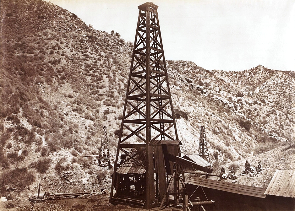
This almost unknown 1877 photo (view toward the north) by Carleton Watkins shows (from right to left) Pico 2, Pico 3, Pico 1, Pico 4, and the short Sanford Lyon well on the far left. It is probably the only photo that shows Pico 3, which is a spring-pole well. Pico 3 was never upgraded to a steam engine driven well with a full sized derrick because it was too close to Pico 1 and 2. It would be abandoned in a few years. Although all of Watkins' photos are important, I consider this photo the most important historic photo of Pico Canyon because it shows the first five wells ever drilled in the canyon. To get a sense of sizes, note the man on top of the Pico 1 derrick in the middle of the photo, the man standing on the building on the right next to the rig with his arm on the walking beam and the people sitting on the hill behind the rig.
Scanned from Carleton Watkins: The Complete Mammoth Photographs, Weston Naef and Christine Hult-Lewis
J. Paul Getty Museum, 2011, p.437. Photo owned by the Hispanic Society of America.
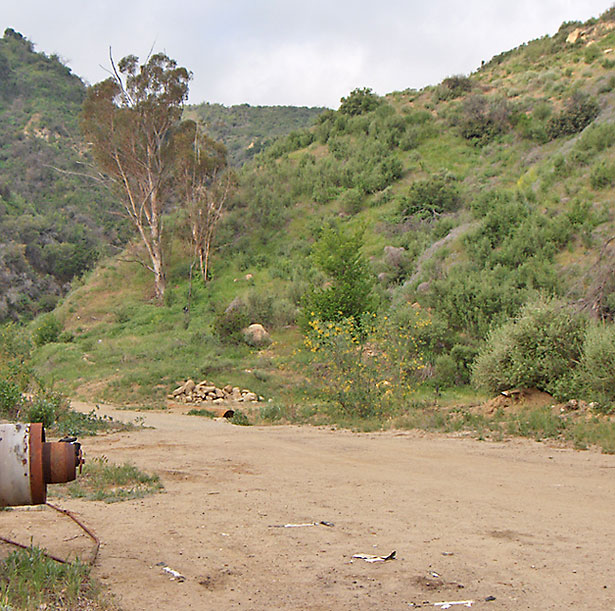
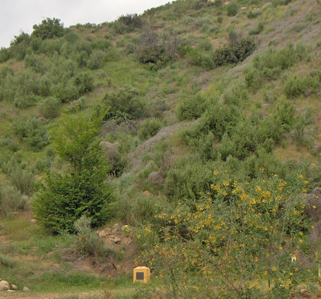
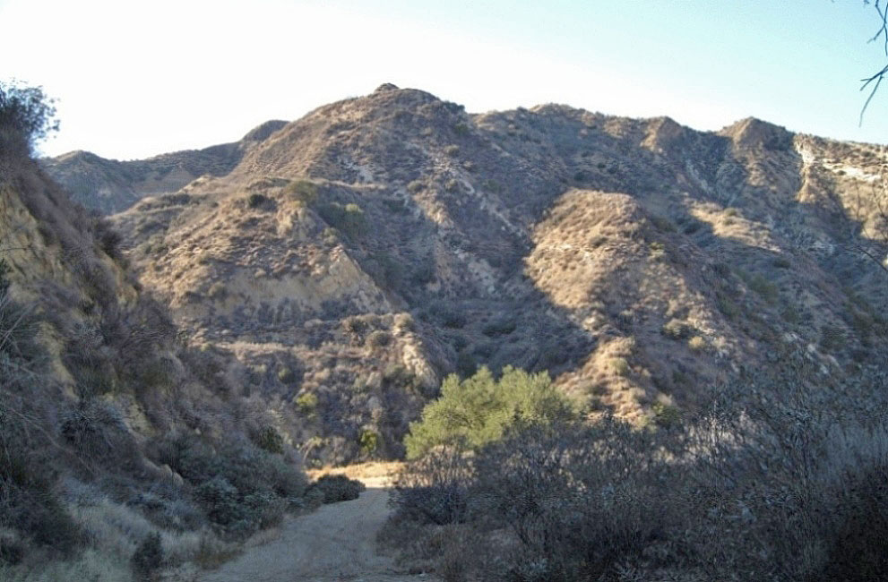
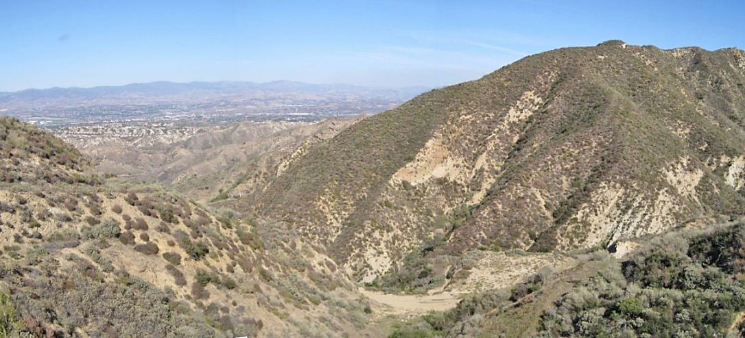
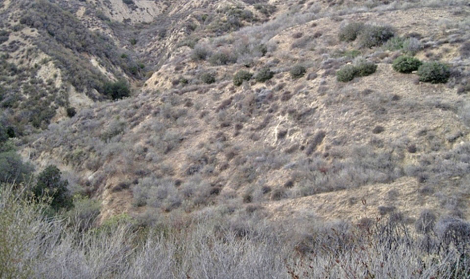
5/10/2014. It was impossible to completely reproduce the previous photo because of changes at the hairpin curve, which obviously did not exist at that time. The hill behind me (now just about a cliff) has also been greatly changed so I couldn't get up high enough.
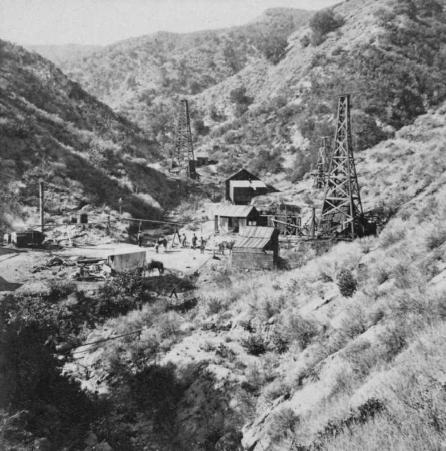
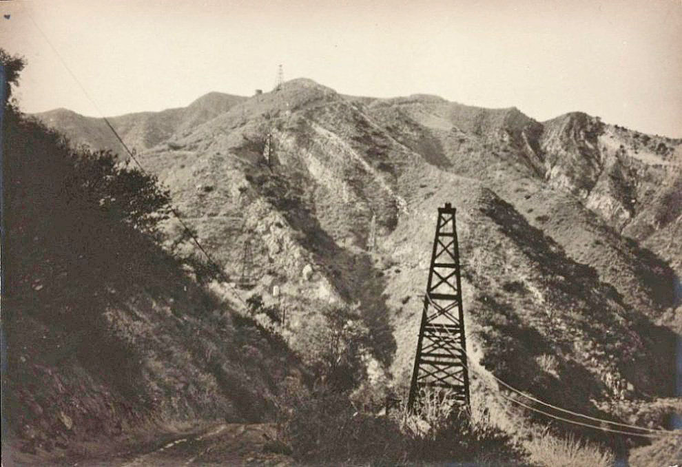
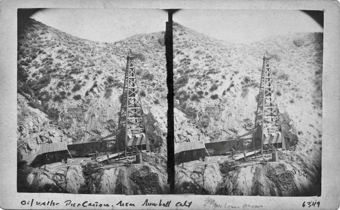
Another 1877 photo by Carleton Watkins showing CSO 4 on the right and CSO 1 on the left. A small spring-pole derrick is just behind CSO 4. This is the Sanford Lyon well. At one time it was believed that CSO 4 and the Lyon well were the same well, but that is not true. CSO 2 and 3 are out of view to the left of CSO 1.
In 1877, so that the wells could be drilled deeper with steam engines, the derricks for CSO 1 and 2 (which is out of view to the left of CSO 1) were replaced with taller, standard derricks. The drilling stem for a steam engine is longer and heavier then for a spring pole rig. CSO 4 was drilled with a steam engine in 1876, so that derrick was built before the others. The unusual "pinched" shape of CSO 4 makes it easy to recognize in old photos.
This image is NOT in the public domain and is used by permission of The Society of California Pioneers. All rights are reserved by the Society of California Pioneers. Unauthorized reproduction is prohibited.

4/19/2008
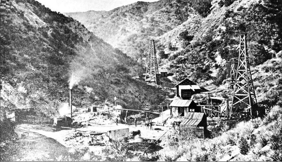
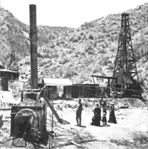
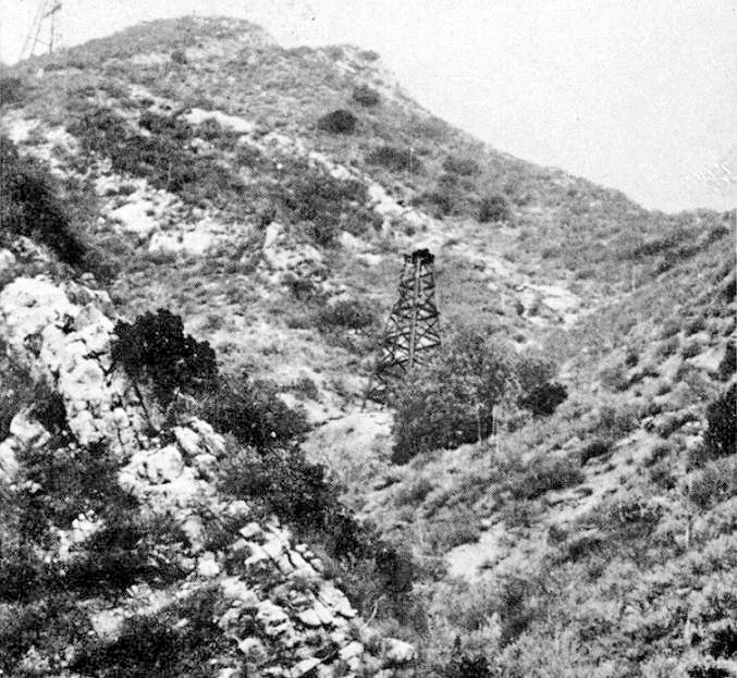
Similar to the first photo, this photo by Carleton Watkins has smoke coming from a boiler's smoke stack. Maybe that ruined the photo for Watkins and he took another. The people are in a different position then the previous photo.
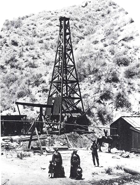
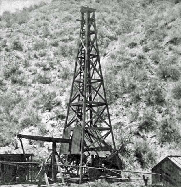
Another 1877 Carleton Watkins photo with a narrower view then the above photos shows the distinctive early shape of CSO 4 on the right with the smaller Lyon well behind it. CSO 1 is on the left. Again, the people have changed positions.
This image is NOT in the public domain and is used by permission of carletonwatkins.org. Unauthorized reproduction is prohibited.
Carleton Watkins photo showing CSO 4 on the right with the Lyon well in the left background.
This image is NOT in the public domain and is used by permission of The Society of California Pioneers. All rights are reserved by the Society of California Pioneers. Unauthorized reproduction is prohibited.
4/19/2008
Now the people have turned around in this Carleton Watkins photo
4/19/2008
Close-up of CSO 4 by Carleton Watkins
This image is NOT in the public domain and is used by permission of The Society of California Pioneers. All rights are reserved by the Society of California Pioneers. Unauthorized reproduction is prohibited.
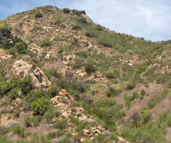
4/19/2008. The differences in the brush between 1877 and 2008 is amazing. It looks like it was so much drier in 1877.
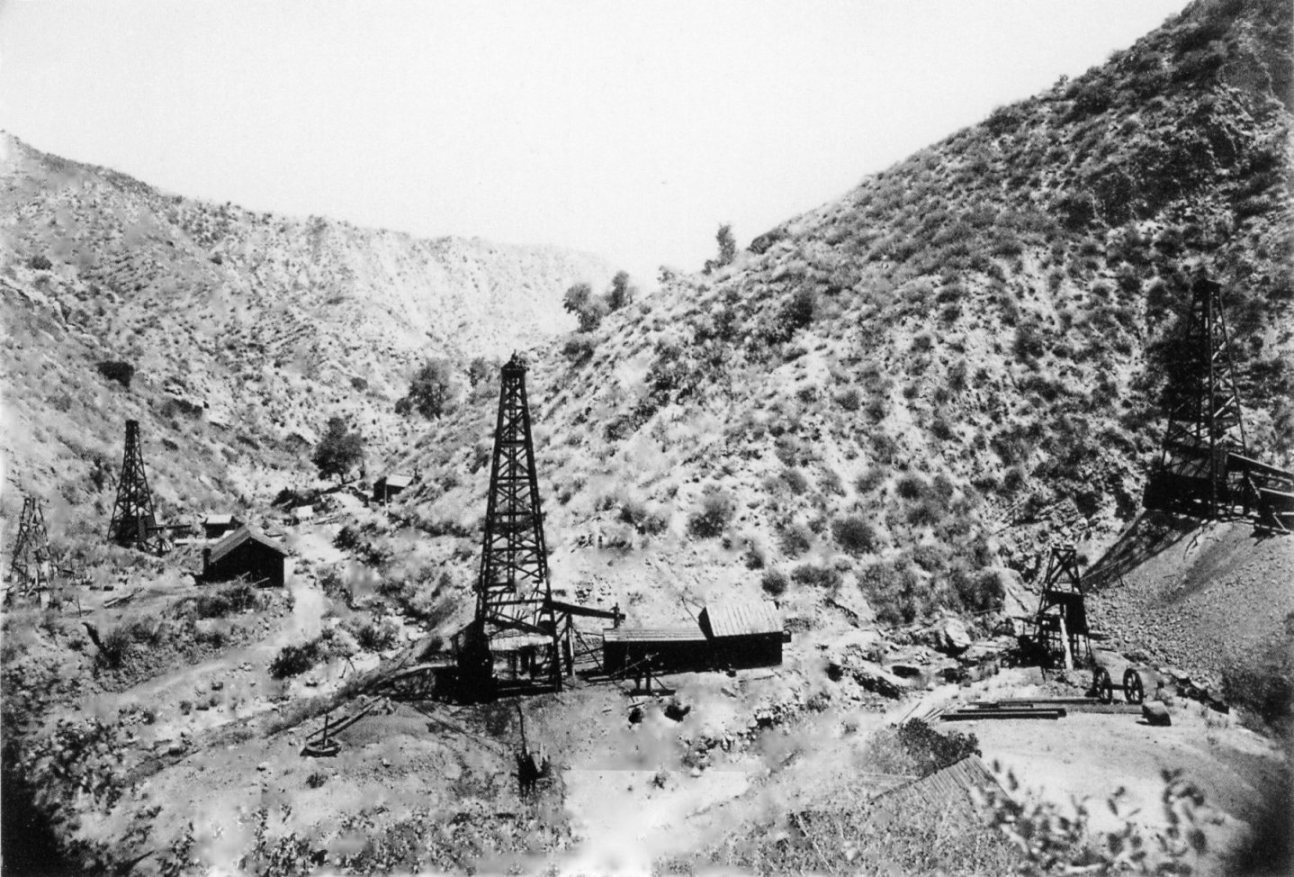
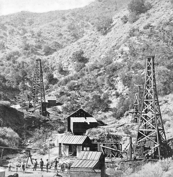
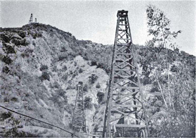
Here is yet another great 1877 photo taken by Carleton Watkins. I have to thank Daniel Wolf, Inc., for allowing me to show this rare image. The derrick in the foreground is CSO 1. The derrick in the right background is the famous CSO 4. The one in the left background is the Sanford Lyon well. In 1877, obviously before Mr. Watkins' visit, the smaller spring-pole derricks of 1 and 2 were replaced by taller derricks to accomodate cable-tool drilling with steam power. A steam engine was always used for CSO 4, spudded in 1876, so that derrick is older than the others and looks different. The spring-pole derrick for CSO 3 (and the Lyon well) would never be replaced. CSO 3 (and the Lyon well) would be abandoned in a couple of years. CSO 3 was located between CSO 1 and CSO 2 to the right of the view in this photo.
Copyright Note: This image is NOT in the public domain and is protected by the copyright laws of the United States.
CARLETON WATKINS:
"California Star Oil Works, Los Angeles County"
June 26, 1877
Photo courtesy: Daniel Wolf, Inc., New York
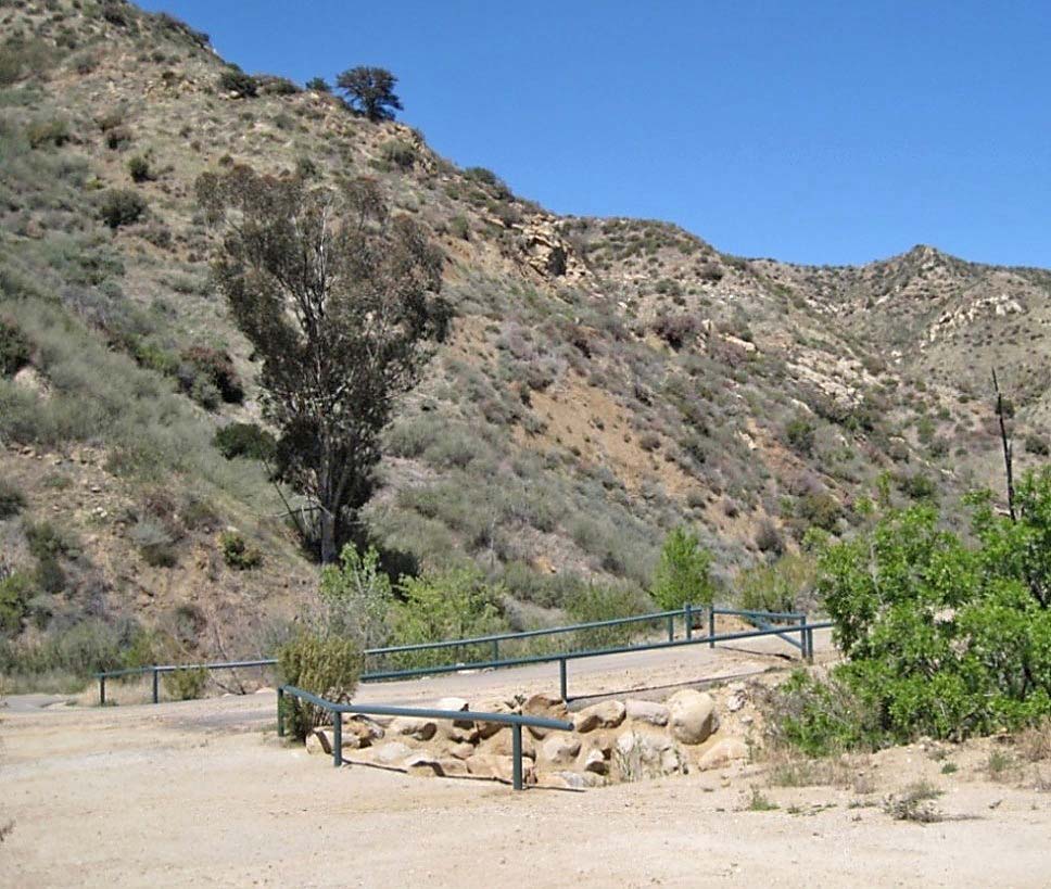
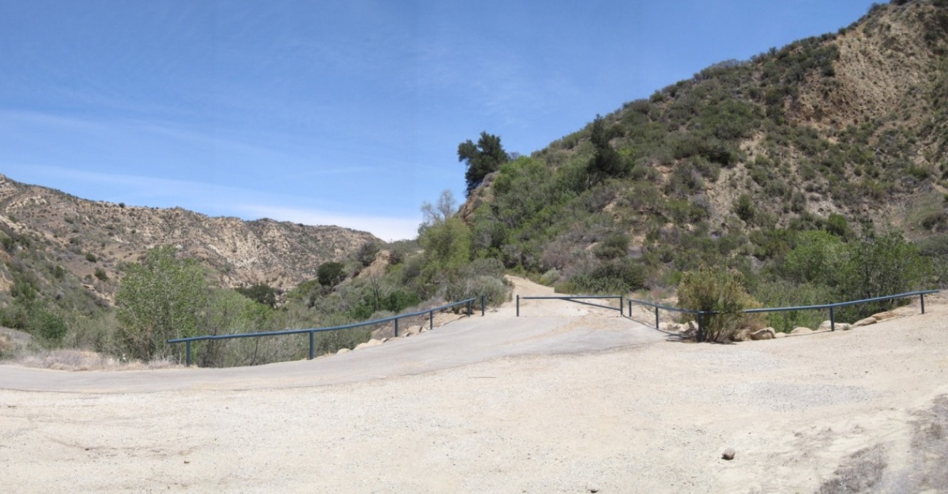
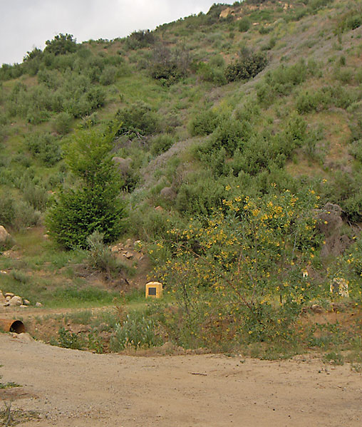
4/15/2012. This photo was taken at the hairpin curve facing north.
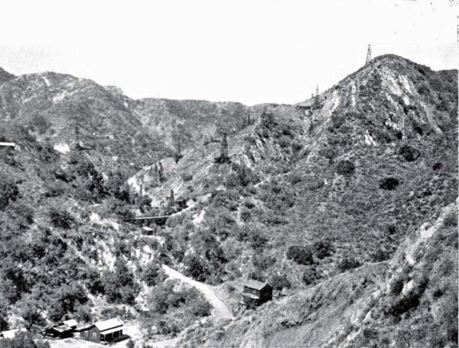
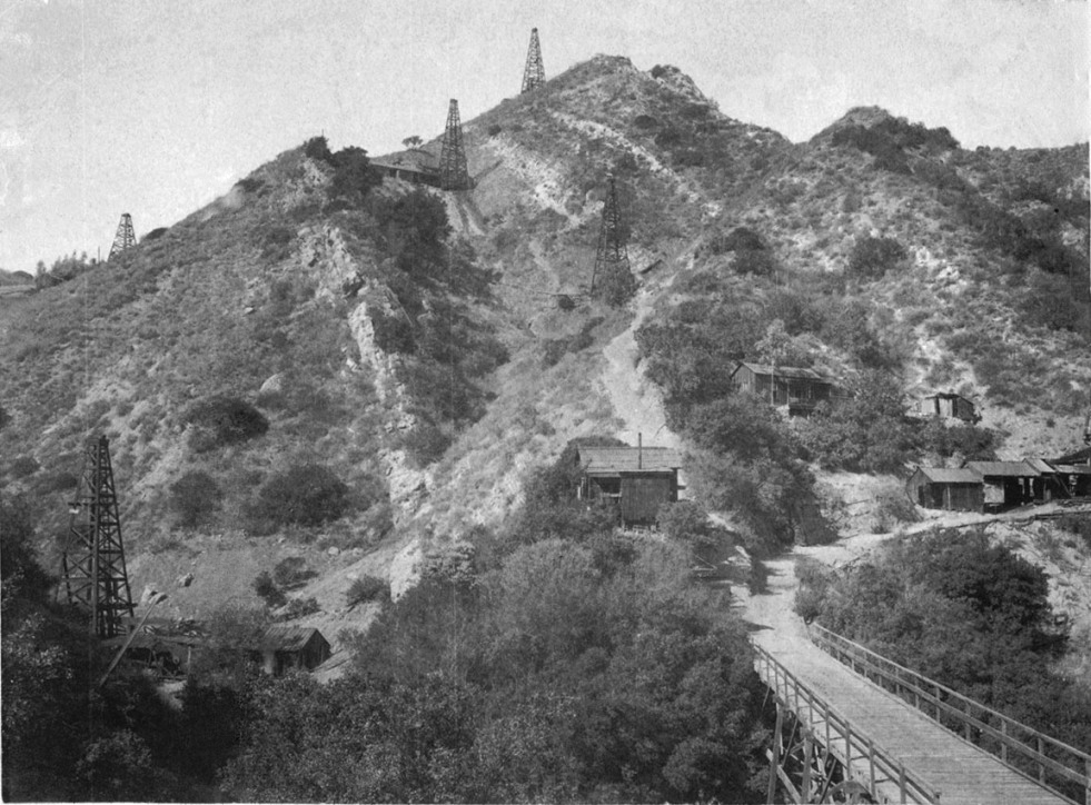
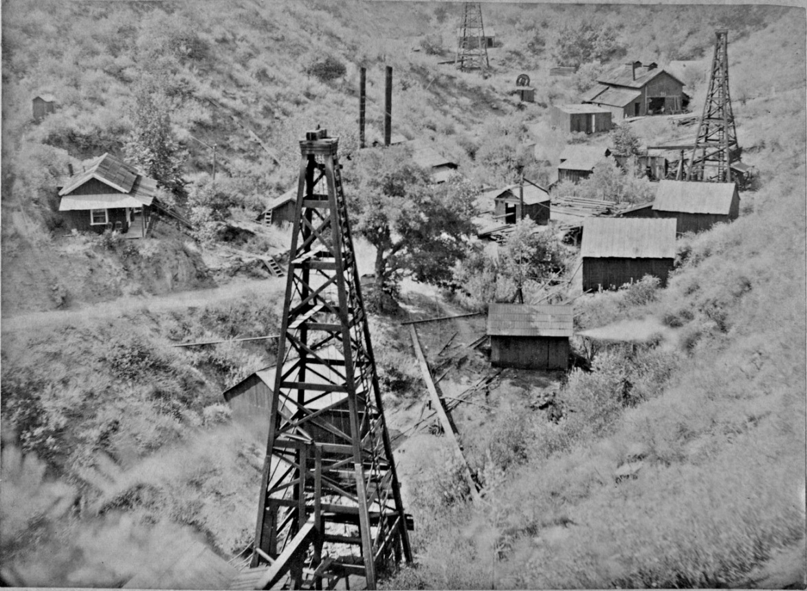
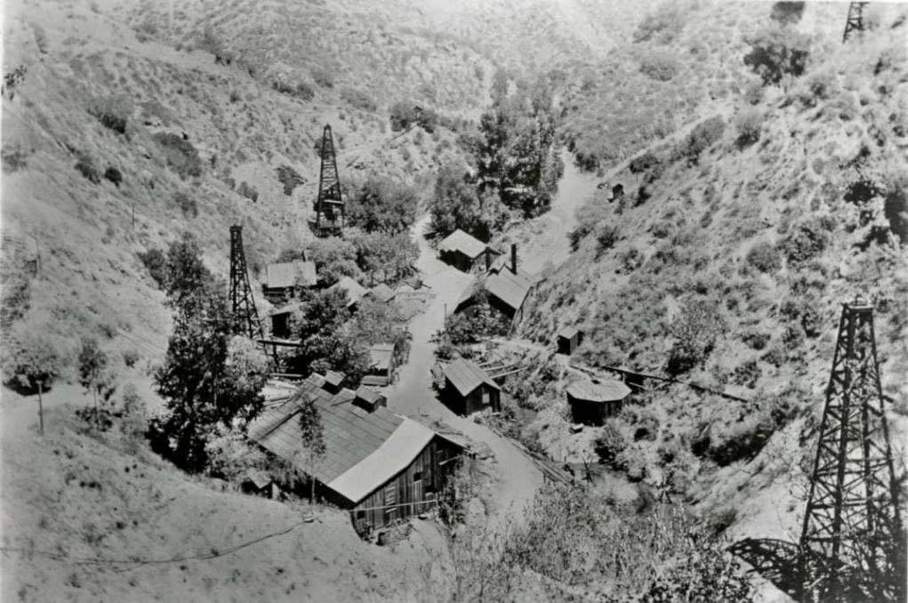
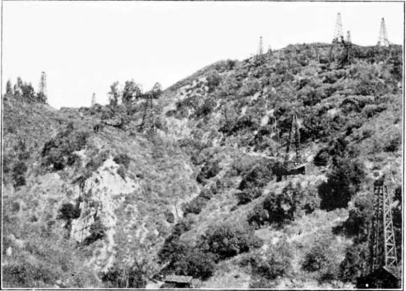
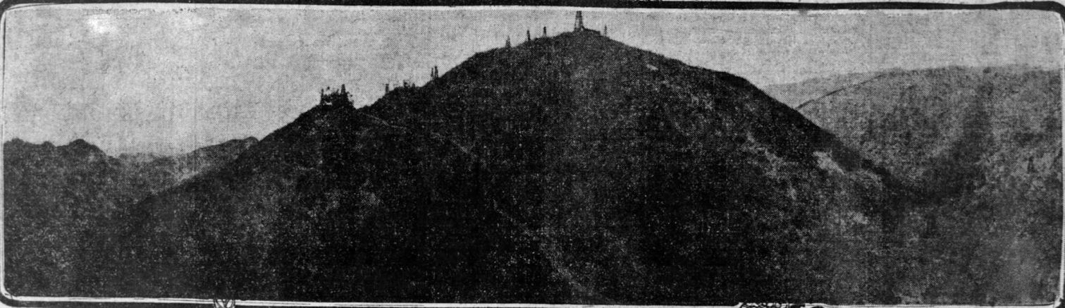
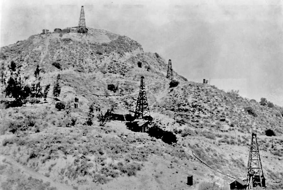
This image was scanned from "Oil and Gas Yielding Formations of California", by W. L. Watts, 1900, Cal. State Mining Bureau, Bulletin No. 19. That is CSO Hill to the right with the derricks on it. Not only does the image show at least 10 derricks, but also a few buildings. The actual photo in the bulletin was 3.5 x 4.5 inches in size so this scan is not as detailed as I would have liked. The derrick in the middle of the picture is CSO 24, spudded in 1896. That places the date of the photo between late 1896 and 1900 (the date of the publication).
Note that you can see the so-called "Long Bridge" in the middle left of the photo. The bridge was reportedly destroyed, and never rebuilt, during the Pico earthquake of 1893. Based on reports at the time (see the 1893 earthquake page) and this photo, the bridge was not destroyed by the earthquake. Just past the far end of the Long Bridge is CSO 5.
The building in the lower left hand corner is the Walton Young home (see next historic photo). The main building there would be widened to create a boarding house (see next historic photo) after 1900. Young became the superintendent after Mentry died in 1900 and remained the superintendent until 1922. According to Darryl Manzer (who lived in the canyon from 1960-66 and benefitted from many old-timers who returned to the canyon and told their stories), the two-story building opposite the Young home is a boarding house. Supposedly, the two-story building only lasted about four years. The two-story bunk house was mentioned in an entry (of supplies received) from December 12, 1909, in a journal in the possession of the Santa Clarita Valley Historical Society.
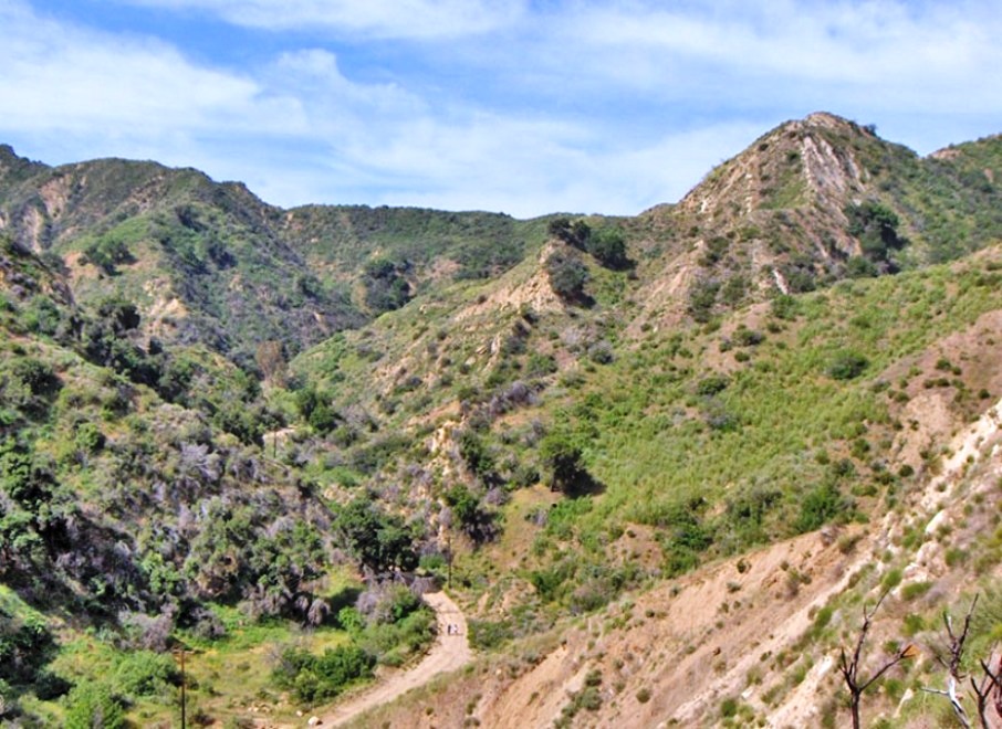
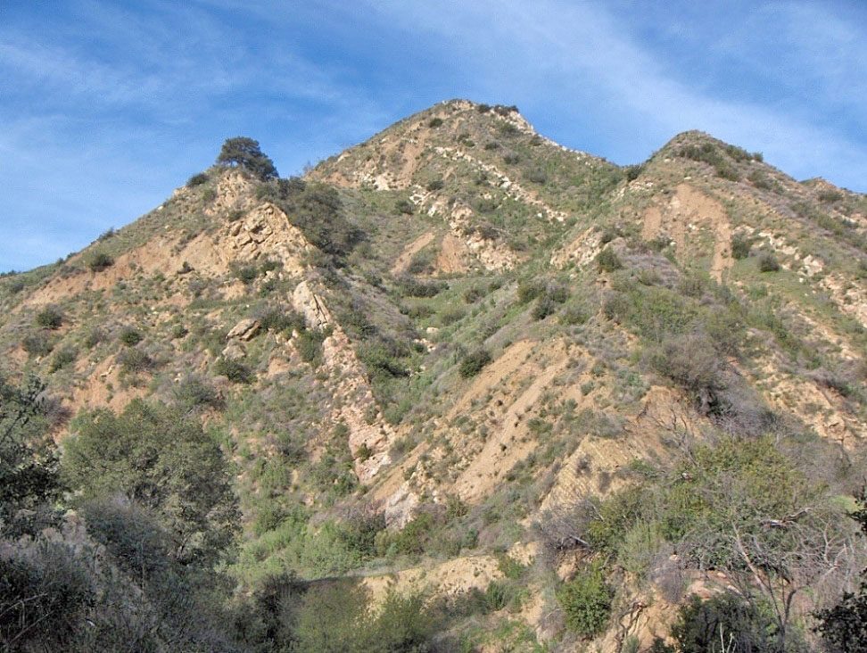
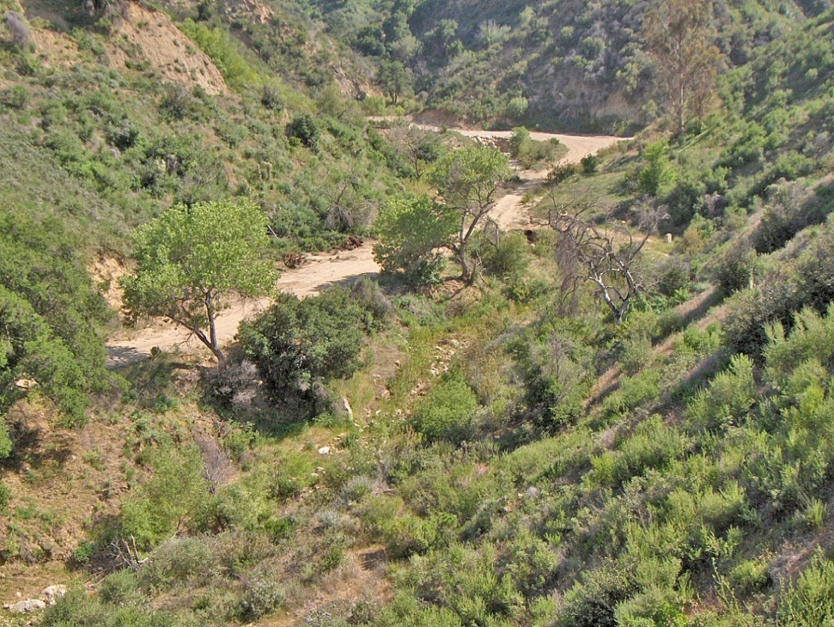
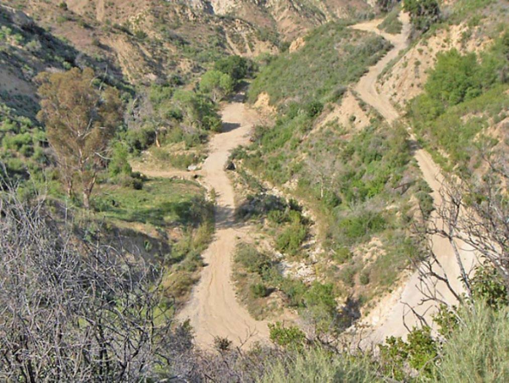
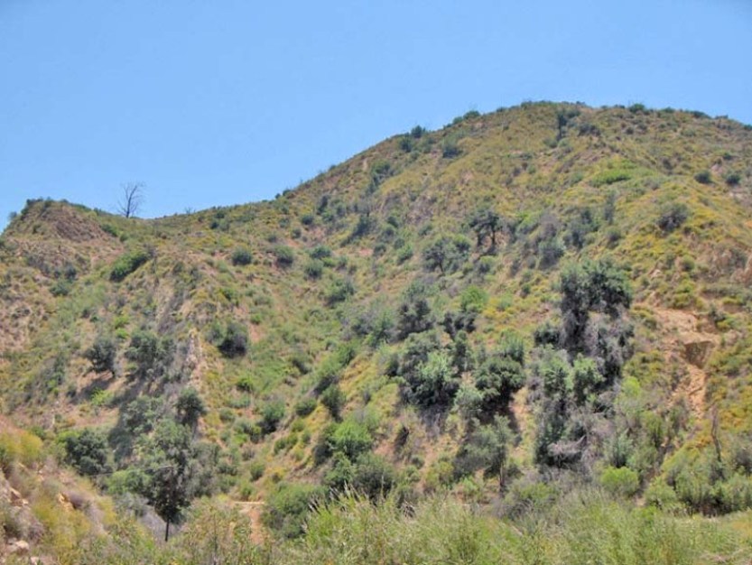
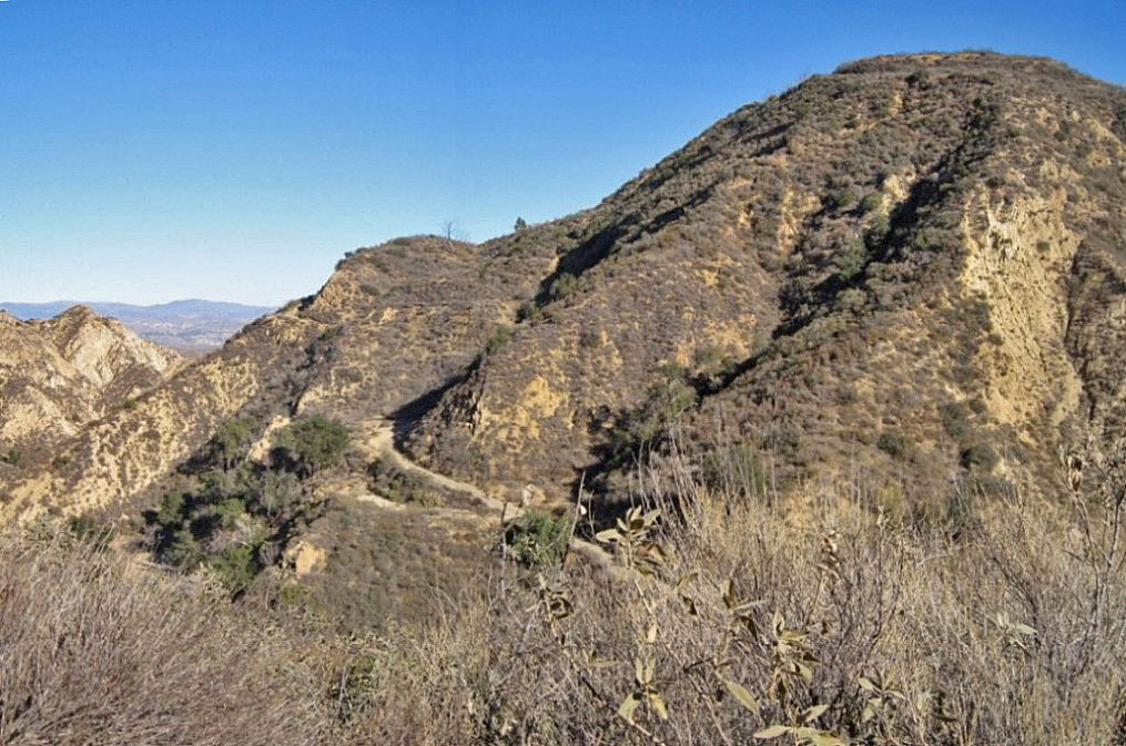
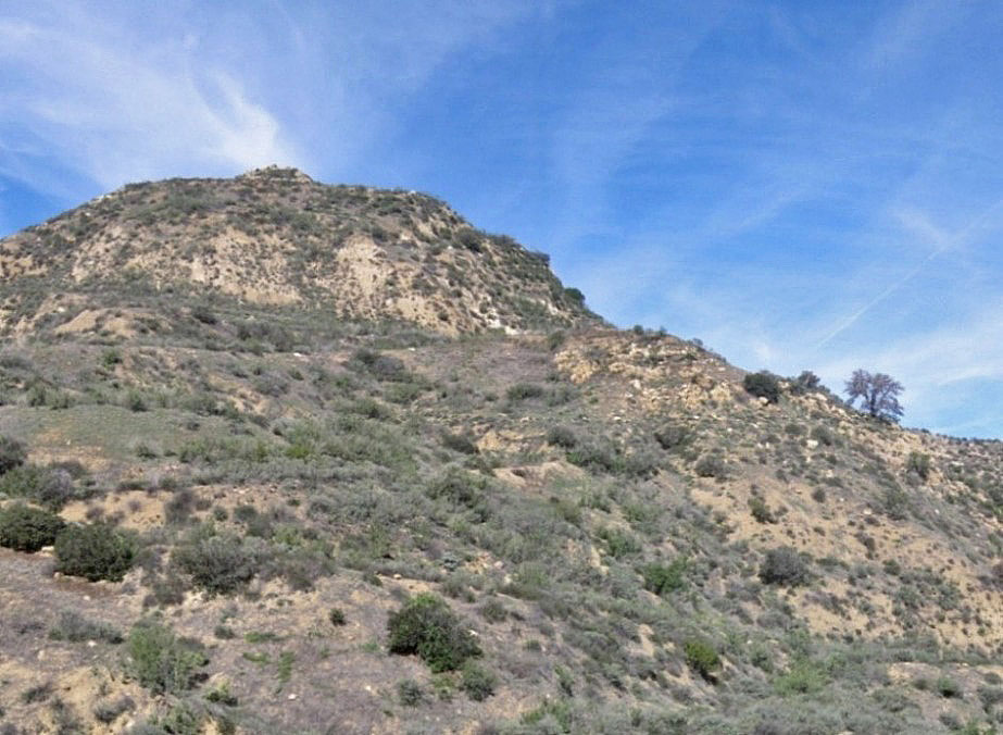
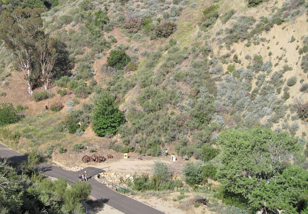
4/27/2008. About the same view with a couple of hikers on the road
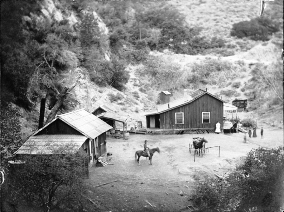
This is a closer view of the Walton Young property. Sometime after Mentry died in 1900, new superintendent Young moved into the Pico Cottage (or Big House as we call it today). After Young was gone, his house was expanded into a boarding house (next photo). Photo used by permission of the Santa Clarita Valley Historical Society
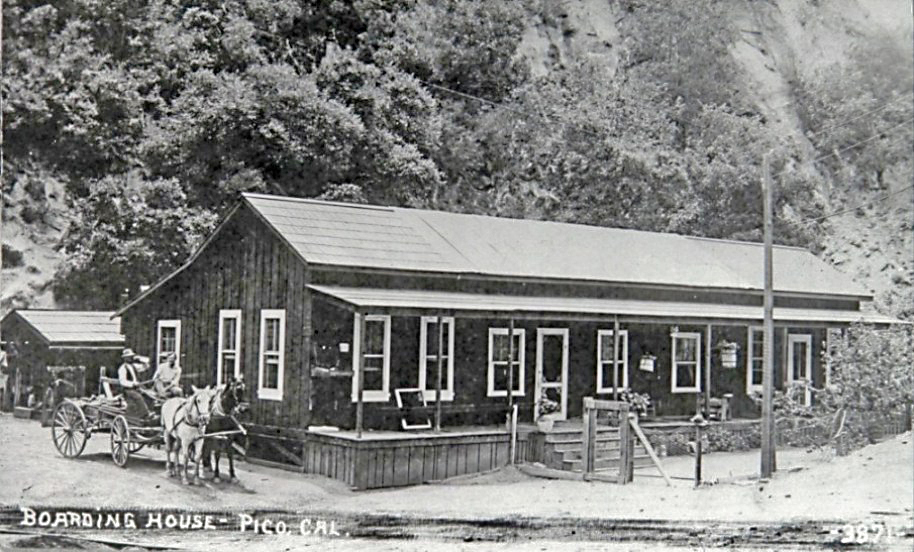
Here is the boarding house that was on the Walton Young property. Both ends of the original structure were added on to to create a structure about twice as wide. Used by permission of the Santa Clarita Valley Historical Society, Barbara Sitzman Cook Collection.
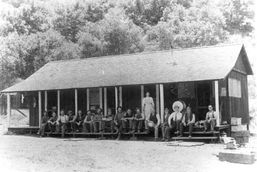
This is a different boarding house than the Young house conversion. A journal in the possession of the Santa Clarita Valley Historical Society indicates that a boarding house was built in 1909. This could have been it. Used by permission of the Santa Clarita Valley Historical Society.
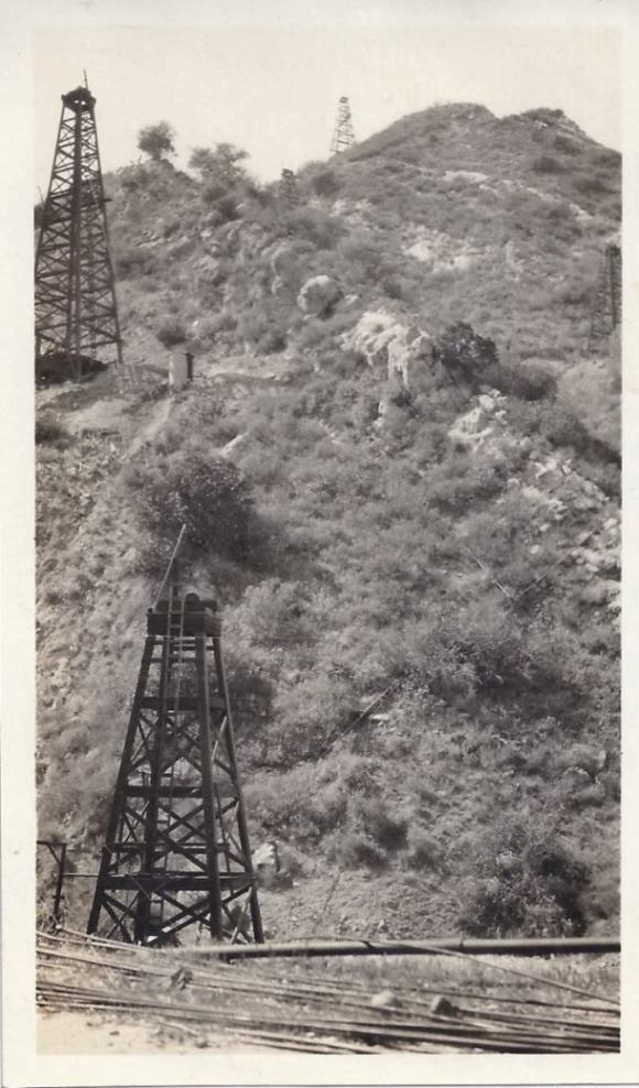
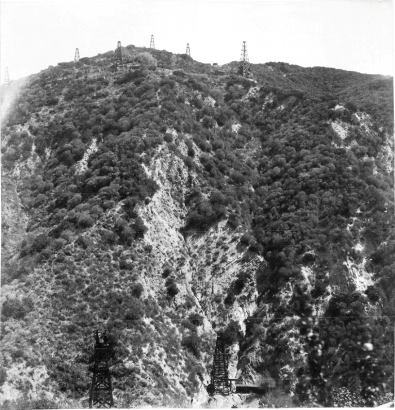
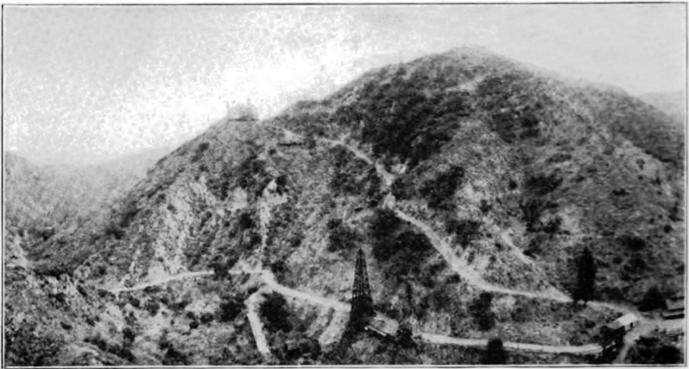
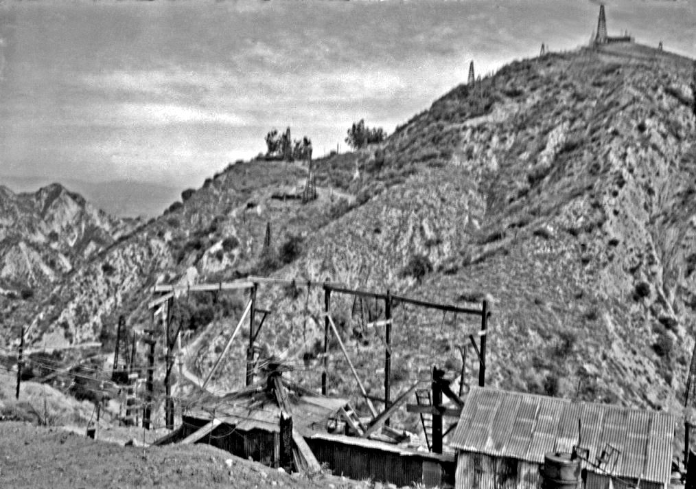
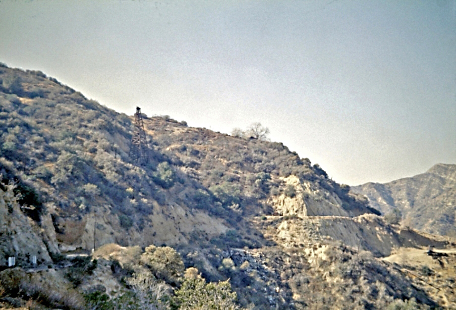
Here is closer image of CSO Hill from the road looking west. It shows (from bottom to top) CSO 5 (spudded in 1880), Star 1 (spudded in 1884), CSO 21 (spudded in 1893), and CSO 15 (spudded in 1888). It does not show CSO 24, shown in the previous historic photo, spudded in 1896. The incorrect photo title is "P.C.O. Hill Pico Canon. 1893". It should say C.S.O. Hill.
The "Long Bridge" was built in 1884 by the Hardison & Stewart Company for access to their Star 1 well. The well would be on a small lot leased to them by PCO. The bridge was 105 feet long and 45 feet high. It was reportedly destroyed, and never rebuilt, during the Pico earthquake of 1893, but, as I have previously stated, this could not be true.
Image from The Barry Lawrence Ruderman Collection courtesy Stanford University Libraries
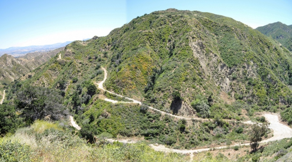
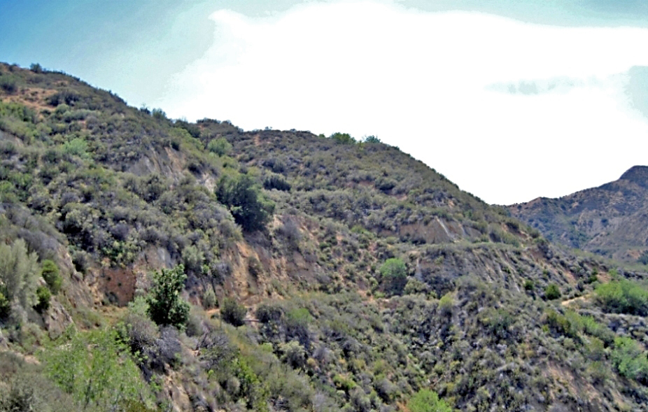
3/9/2008
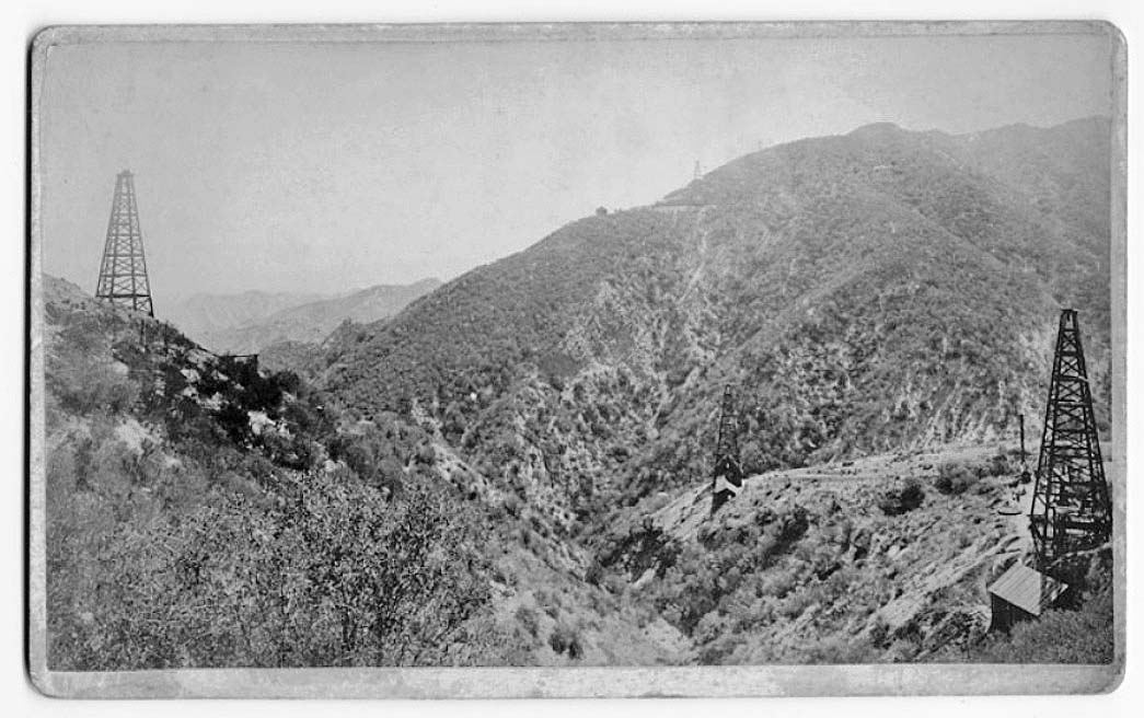
This is a slightly different view of CSO Hill taken on the road going up PCO Hill. At the top is well CSO 15 (1888). Below that is CSO 21 (1893) and below that is CSO 24 (1896). In the center background is Star 1 (1884). The well closest to the camera is probably CSO 22 (spudded in 1892). CSO 32 (1903) should be in the photo, but isn't, so I believe the photo was taken between 1896 and 1903.
Copyright Note: This image is NOT in the public domain and is protected by the copyright laws of the United States.
Image courtesy of the Robert B. and William R. Moran papers. Mss 282, Department of Special Collections, University Libraries, University of California, Santa Barbara.
1/17/2014. The original road went about straight down to the main road from here and did not curve to the left and run down to today's hairpin curve, like this photo (taken in January 2014) shows.
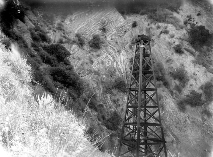
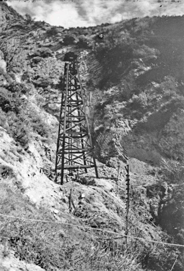
The rig in the middle of the image is Star 1 (spudded in 1884). CSO 15 (spuddded in 1888) is in the upper left. The actual date of the photo is unknown, but it was taken no earlier than 1888.
Star 1 was on land leased from PCO (the owners of CSO) by Hardison and Stewart on CSO hill. At 1620 feet they hit oil. After drilling another 30 feet they pulled out the equipment and put the well on the pump. It produced 75 barrels per day. They continued to receive profits from this well until 2/1/1889 when well show when they sold out to CSOW.
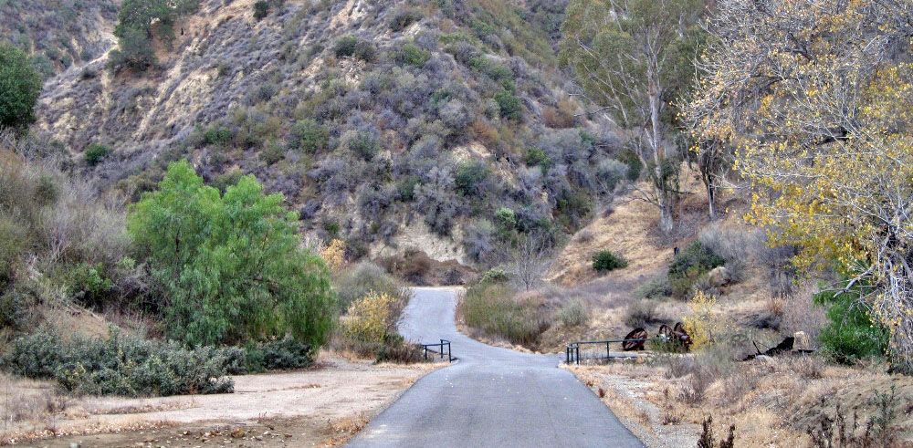
5/3/2008. This picture was taken slightly farther away then the older one because the creek has eroded away much of the older road plus there are a lot of trees and bushes in the way.
This image shows (from front to back) CSO 5, 4, and 1. It also shows the machine shop between 4 and 1. Title: First wells in California, Pico Oil Works, Pico Canyon, Newhall, 1885 (view south).
Copyright Note: This image is NOT in the public domain and is protected by the copyright laws of the United States.
Courtesy of Southern Methodist University, Central University Libraries, DeGolyer Library
4/22/2008

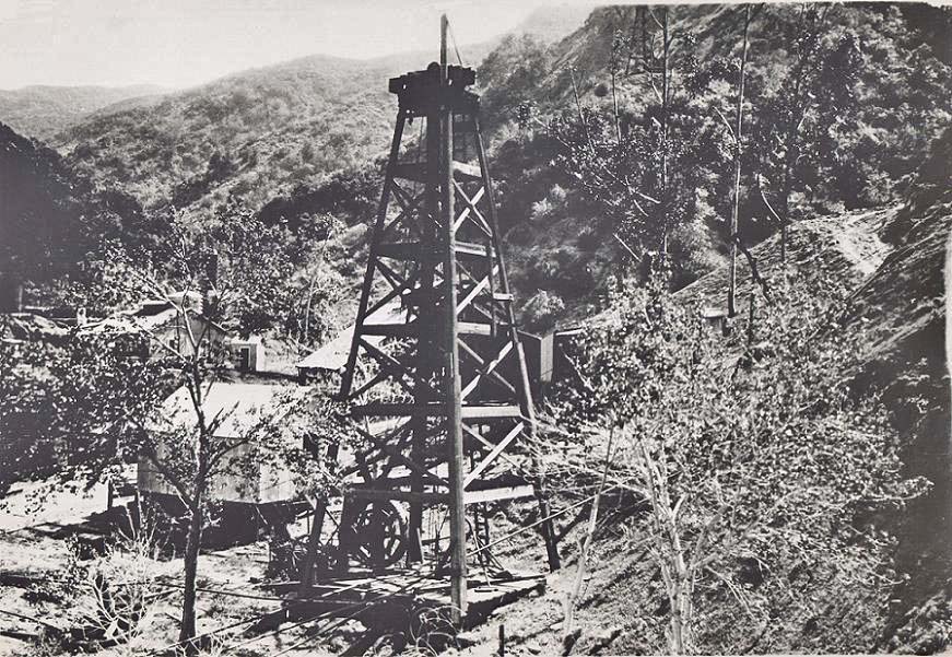
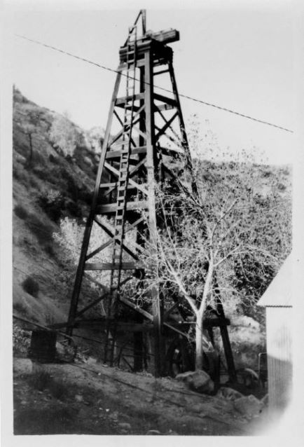
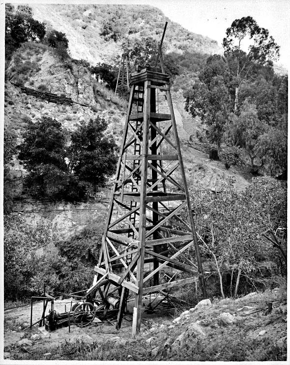
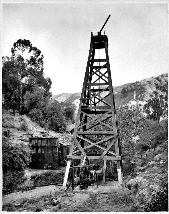
From the Petroleum Industrial and Technical Review of October 27, 1900, p. 367. Looks like CSO 4 viewed towards the east.
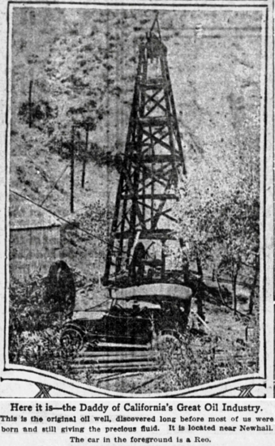
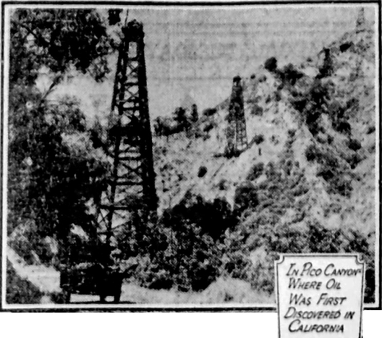
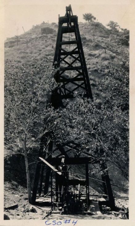
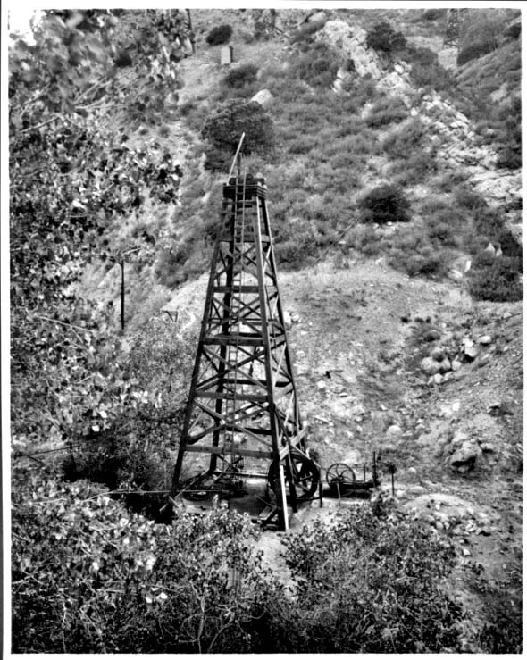
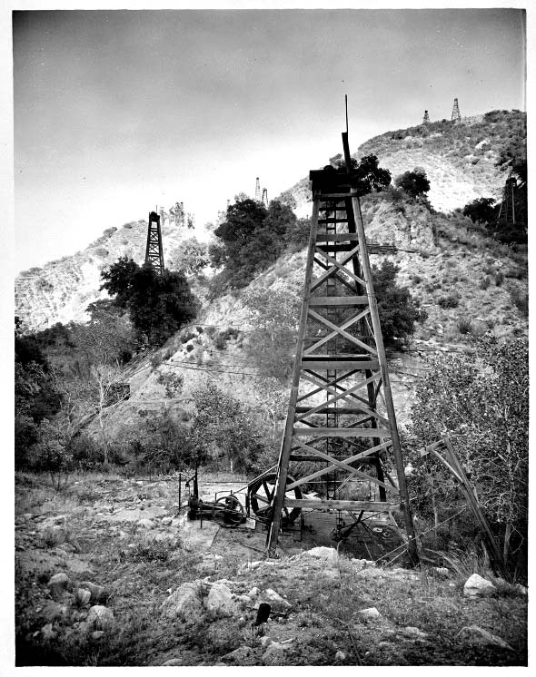
Photo of CSO 4 from the Los Angeles Times of October 27, 1918. Note that the derrick is not "pinched" at the top anymore. This is a different derrick then the 1877 one.
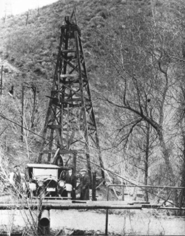
CSO 4 photo from around 1919. It is almost exactly like the previous one except for the car and the tree to the left of the derrick is a little more mature. The features are much easier to see. Those are jackline supports on the hill in the background.
Copyright Note: This image is NOT in the public domain and is protected by the copyright laws of the United States.
Historical Society of Southern California Collection - Charles C. Puck Collection. Courtesy of The Huntington Library, San Marino, California
Used by permission.
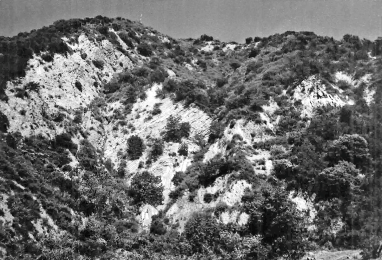
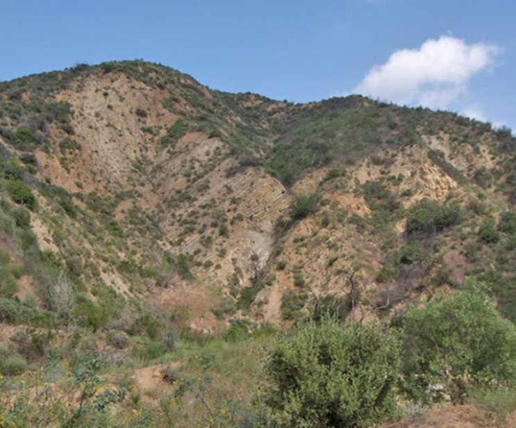
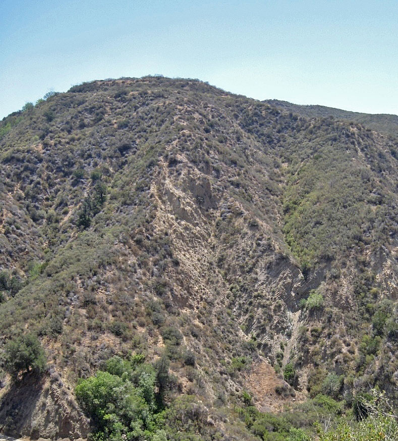
1924 photograph of CSO Hill facing west. The diagonal layer of rocks is very distinctive. The closest well in the lower left is CSO 5 (1880). Based on a DOGGR map of the well sites, the next well up on the left is CSO 24 (1896). On the far right is Star 1 (1884-85). Higher up on the left is CSO 21 (1892) and the top well is CSO 15 (1888). Image from an old postcard.
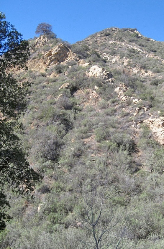
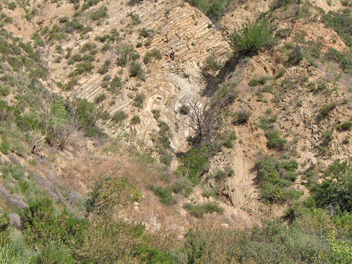
About the same view on 2/9/2016
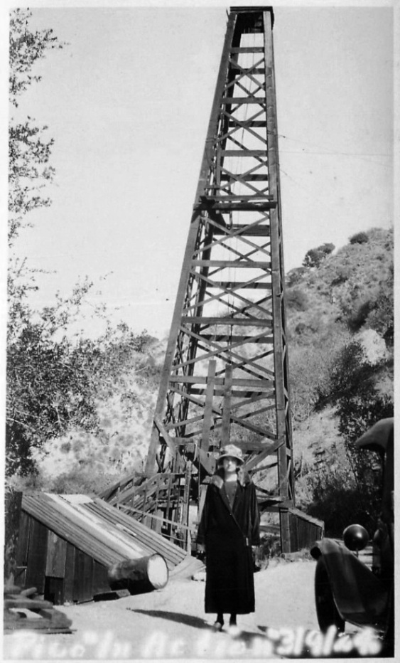
Words at the bottom of this photo say 'Pico "In Action" 3/9/24'. The well here is for sure not CSO 4. The derrick is too tall and narrow. Known photos of CSO 4 in the 1920's show six sections in the derrick. This derrick has about 10 sections. Just look at the next photo of CSO 4.
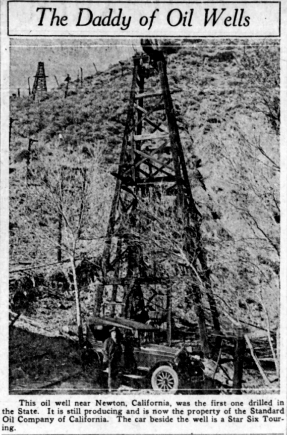
CSO 4. From the San Francisco examiner of February 28, 1926. The Daddy of Oil Wells with the mother of all typos. It's Newhall not Newton. And this is not the first oil well drilled in California.
This poor quality image is from the Pomona Progress of May 31, 1927. I wish I had the original photo. This is CSO hill with probably CSO 32 the large derrick on the left. View is to the west. Oil was not first discovered in Pico Canyon.
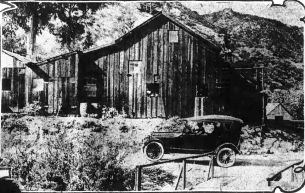
Photograph of a half-tone image depicting an automobile in front of California's first producing oil well (CSO 4), June 1, 1928.
California Historical Society, University of Southern California Libraries
4/27/2008
This image again shows CSO 4 with the machine shop area in the background. The road on the right still exists but is covered with brush. To the right of the top of the derrick you can see the bottom of another derrick. This is CSO 29, spudded in 1898. The photo is dated March 11, 1931, but it is older then that. I saw it in the Standard Oil Bulletin of September 1930. That white building just to the left of CSO 4 is the same building in both of the following machine shop photos. The actual machine shop is behind the derrick.
Copyright Note: This image is NOT in the public domain and is protected by the copyright laws of the United States.
Used by permission of the Herald-Examiner Collection/Los Angeles Public Library.
4/19/2008. The flat area for CSO 29 is hidden by the tree.
CSO 4 (from the Santa Clarita Valley Historical Society)
Another view of CSO 4 (from the Santa Clarita Valley Historical Society)
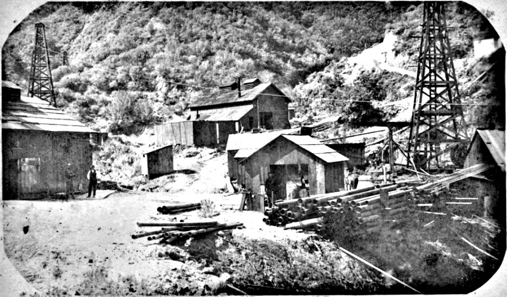
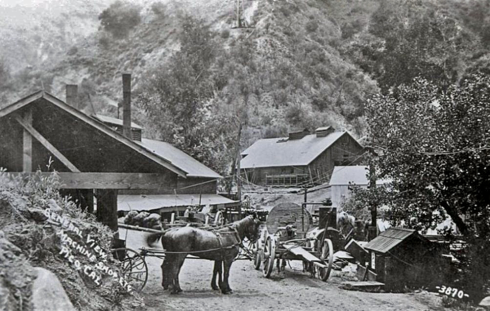
One of the earliest photos of the machine shop area. This is just at the hairpin curve. CSO Hill is on the right and PCO Hill is on the left. CSO 4 is on the right and CSO 1 is on the left. Behind CSO 1 is the top of probably CSO 10. The first road ascending CSO Hill is on the right behind CSO 4. (ca. 1890-1892)
Copyright Note: This image is NOT in the public domain and is protected by the copyright laws of the United States.
Courtesy of the Bancroft Library, University of California, Berkeley, Ca. Used by permission.
12/17/2013
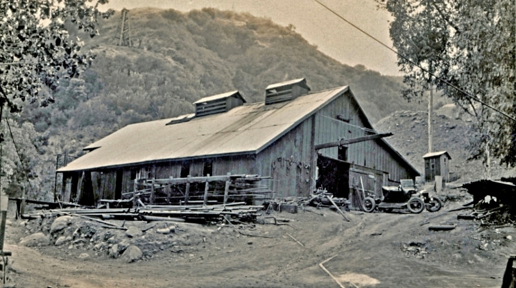
Machine shop area. CSO 4 is just out of the photo to the right of the white building in the right part of the photo. The machine shop was built in 1879. You can see the bottom of CSO 29 at the top of the picture. It was spudded in 1898 so this date of this photo can't be any earlier then that.
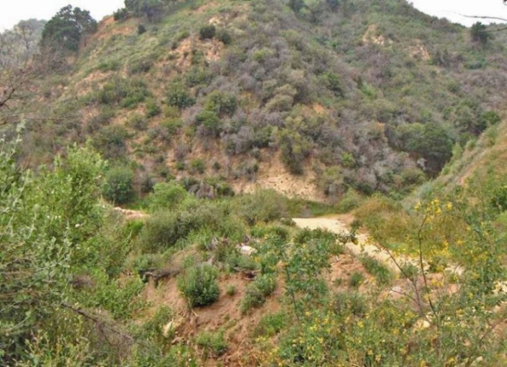
4/19/2008. There has been a lot of changes here so this was the best I could do.

Here is a closer view of the machine shop
Copyright Note: This image is NOT in the public domain and is protected by the copyright laws of the United States.
American Petroleum Institute Photograph and Film Collection, Archives Center, National Museum of American History, Smithsonian Institution
Machine shop around 1927. Used by permission of the Santa Clarita Valley Historical Society, Barbara Sitzman Cook Collection.
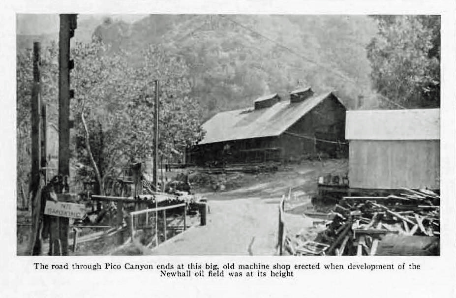
Machine shop. Note the No Smoking sign on the left. CSO 4 is just out of the photo on the right to the right of the white building in the right part of the photo. This is from the September 1930 issue of the Standard Oil Bulletin magazine.
Looking north down from the site of CSO 29 showing the machine shop area, CSO 4 on the left with CSO 5 just above it. CSO 1 is in the lower right. CSO Hill is on the left and PCO Hill is on the right. In the Pioneer Oil Refinery dedication ceremony program dedication document, this photo is shown with a date of November of 1910.
Copyright Note: This image is NOT in the public domain and is protected by the copyright laws of the United States.
American Petroleum Institute Photograph and Film Collection, Archives Center, National Museum of American History, Smithsonian Institution
4/22/2008. Note the difference in the road ascending PCO Hill to the right.
From the San Francisco Chronicle of December 1, 1918. This looks like the southern end of the machine shop so we should be able to see CSO 4 in the background. The photo is not very clear, but there seems to be a derrick behind the highest point of the building. The small, white building at the lower right also looks correct.
1904 photo showing CSO 2 in the background and CSO 1 in the foreground. There are also some wells visible on top of PCO Hill. The machine shop area is behind the photographer. This image was scanned from "Petroleum and Use of Petroleum in California" by Paul Prutzman, California State Mining Bureau, Bulletin No. 32, 1904.
1947 photo only showing one derrick on the top of PCO Hill. Plate III from "A Study of the Subsurface Conditions Prevailing in the Newhall-Potrero Oil Field", by James W. Edmundson, Thesis for the California Institute of Technology, Pasadena, California, 1947
8/21/2013. Right at the hairpin curve.
The photo title is "Oil Wells Near Newhall" (ca 1890s). This is looking east at PCO Hill. At the middle bottom is CSO 2 and the well at the bottom left is CSO 1. Note the two men standing on top of the CSO 1 derrick. Similar to previous but taken from higher up on CSO Hill.
Image from The Barry Lawrence Ruderman Collection courtesy Stanford University Libraries
5/26/2013
1905 photo by Ralph Arnold showing CSO 2. Note the little white sign on the derrick near the top. It says "CSO 2". You can see the same sign in the previous historic photo. This photo is from "The Santa Clara Valley, Puente Hills and Los Angeles Oil Districts, Southern California", by Eldridge and Arnold, United States Geological Survey Bulletin No. 309, 1907.
4/22/2008. Besides showing where CSO 2 used to be, this photo also shows the "break" (see geology page).
Pre-1916 photo of CSO 2. You can just make out the CSO 2 sign near the top of the derrick.
Copyright Note: This image is NOT in the public domain and is protected by the copyright laws of the United States.
Image courtesy of the Robert B. and William R. Moran papers. Mss 282, Department of Special Collections, University Libraries, University of California, Santa Barbara.
CSO 1 looking north. CSO 4 is on the left distance. Maybe PCO 32 is on the upper right making this photo no earlier then 1903.
Image from "The History of the San Fernando Valley with Special Emphasis on the City of San Fernando", 1930, unpublished master thesis by Clifford M. Smith, University of Southern California, p. 117 (no photo credit given). Direction is down the creek mostly north.
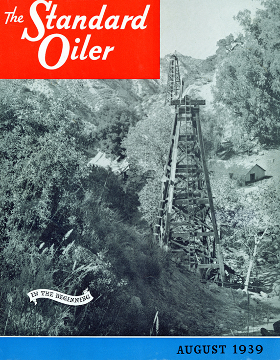
CSO 4 on the cover of The Standard Oiler magazine of August 1939. This was a company magazine. The photo was taken a little further down the creek (north) of the previous photo and doesn't show CSO 1, but does still show what is probably CSO 32 in the distance above CSO 4..
This poor-quality photo was scanned from "Sixth-Three Years in the Oilfield" by W. E. Youle. The derrick in the foreground is probably CSO 19, spudded in 1889 so the photo is from no earlier than 1889.
5/18/2008. The historic photo was tough to duplicate, but this is pretty close. This shot is to the northeast from CSO Hill with PCO hill in the background
This photo is from "Production and Use of Petroleum in California", California State Mining Bureau, Bulletin No. 32, by Paul Prutzman, 1904. The view is about east looking at PCO Hill. Based on positions, the four nearest derricks are (from lower right to upper left) CSO 32 (lower right), CSO 22, PCO 4, and PCO 23 (upper left).
5/30/2008. The small hill on the left has been cut back for the new alignment of the road.
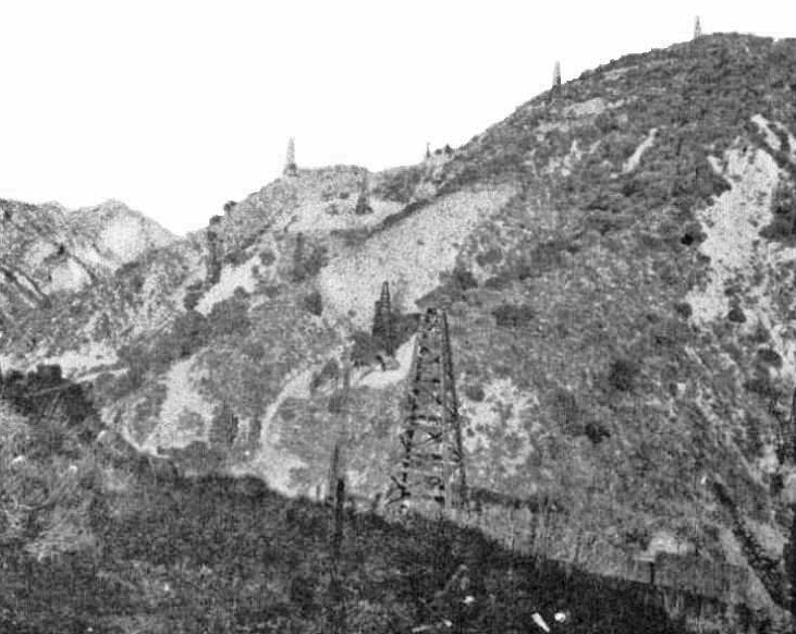
This 1910 photo of the is from "The Turbulent Romance of Oil" by W.C. Jenkins in the National Magazine of Aug - Sept 1910. This is a view of PCO Hill toward the east. The hairpin curve is in the lower right. The original photo in the magazine was very small so the quality here is poor. If the quality was better, you could see the three derricks by the road, but you can only really see the one on the lower road (probably CSO 32 drilled in 1903). Note that the machine shop area at the hairpin curve is not as built up as it was in the earlier photo shown a few photos above. By 1910, Pico Canyon was dying down.
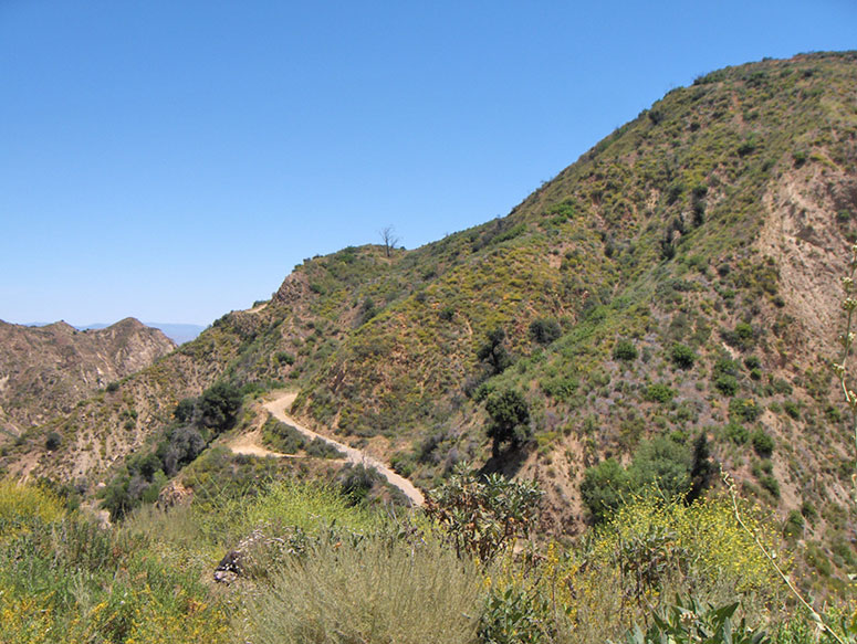
5/28/2010. Not an easy photo to duplicate. Here is an approximate view. The road position was obviously moved down.
From the San Francisco Call of June 8, 1910. Wide (and poor quality) view of PCO Hill.
Pre-1916 photo of PCO Hill taken from CSO Hill just above the CSO Hill jack plant.
Copyright Note: This image is NOT in the public domain and is protected by the copyright laws of the United States.
Image courtesy of the Robert B. and William R. Moran papers. Mss 282, Department of Special Collections, University Libraries, University of California, Santa Barbara.
1/17/2014
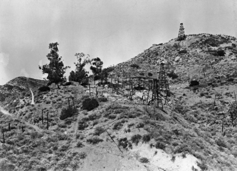
ca 1883 photo of "Christian Hill". This is a view looking northeast from PCO Hill. I believe that the derrick in the far distance is Hill 1, drilled in 1883 and shut down in December of 1883 after no commerical deposits of oil were found. This was the first well drilled in Pico Canyon by Hardison and Stewart. The well below that, in the foreground, may be Hill 3. That is about the correct location for it. I can't really identify the other wells. There were just too many wells drilled in this area of PCO Hill, where the photo was taken.
Copyright Note: This image is NOT in the public domain and is protected by the copyright laws of the United States.
Courtesy of the California History Room, California State Library, Sacramento, California.
3/21/2012
Stereoview of unknown well in Pico Canyon (ca. 1890-1892)
Copyright Note: This image is NOT in the public domain and is protected by the copyright laws of the United States.
Courtesy of the Bancroft Library, University of California, Berkeley, Ca. Used by permission.
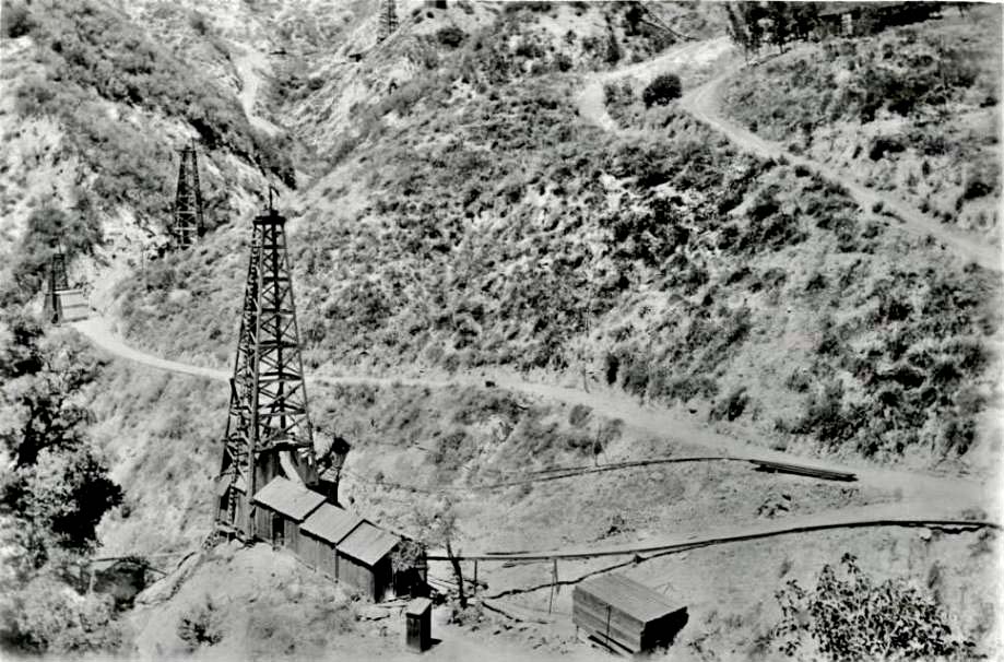
This is CSO 5 spudded in 1880. Star 1 is the well in the upper right of the photo. View toward the west. Date of this, and the following four photos of CSO 5 is unknown, but is probably past 1910 based on how mature the field looks in the following images.
Copyright Note: This image is NOT in the public domain and is protected by the copyright laws of the United States.
Eugene Swarzwald "Pictorial California and the Pacific" Collection of Photographs. Courtesy of The Huntington Library, San Marino, California. Used by permission.
Another view of CSO 5 this time toward the southeast.
Copyright Note: This image is NOT in the public domain and is protected by the copyright laws of the United States.
Eugene Swarzwald "Pictorial California and the Pacific" Collection of Photographs. Courtesy of The Huntington Library, San Marino, California. Used by permission.
CSO 5. View toward the south. CSO 4 is in the right background and CSO 29 is in the far background higher up.
Copyright Note: This image is NOT in the public domain and is protected by the copyright laws of the United States.
Eugene Swarzwald "Pictorial California and the Pacific" Collection of Photographs. Courtesy of The Huntington Library, San Marino, California. Used by permission.
CSO 5. View toward the east looking up at PCO Hill.
Copyright Note: This image is NOT in the public domain and is protected by the copyright laws of the United States.
Eugene Swarzwald "Pictorial California and the Pacific" Collection of Photographs. Courtesy of The Huntington Library, San Marino, California. Used by permission.
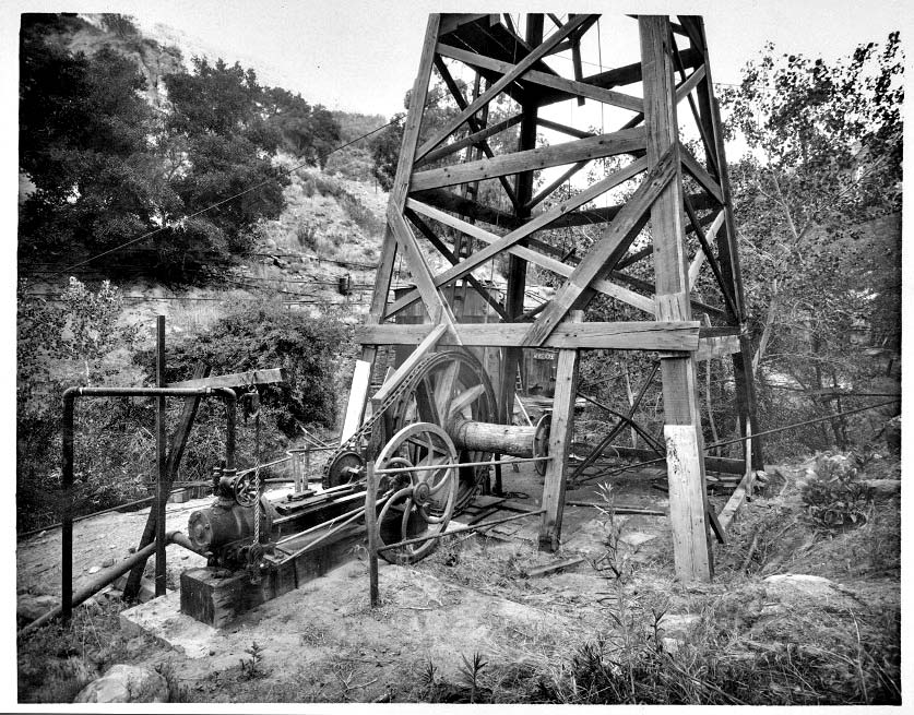
Close up of CSO 5. You can make out the pump jack inside of the derrick. It would have been powered by a nearby jack plant. The engine would only be used to pull the sucker rods out of or lower them into the well hole.
Copyright Note: This image is NOT in the public domain and is protected by the copyright laws of the United States.
Eugene Swarzwald "Pictorial California and the Pacific" Collection of Photographs. Courtesy of The Huntington Library, San Marino, California. Used by permission.
Bottom of CSO Hill on the south side (date unknown)
Copyright Note: This image is NOT in the public domain and is protected by the copyright laws of the United States.
American Petroleum Institute Photograph and Film Collection, Archives Center, National Museum of American History, Smithsonian Institution
1/21/2014: The roads on this side of the PCO Hill have been greatly altered since the previous photo was taken.
Looks like the top of CSO Hill toward the northwest. The date is between 1892-1900.
Copyright Note: This image is NOT in the public domain and is protected by the copyright laws of the United States.
American Petroleum Institute Photograph and Film Collection, Archives Center, National Museum of American History, Smithsonian Institution
CSO Hill has changed greatly since the previous photo was taken. New roads have been built and old roads have been improved or abandoned. I believe that this is a view (from 2/28/2016) of the last image. I'm also guessing (based on DOGGR oil records) that, in the previous photo, the well in the lower right is CSO 19 (drilled in 1889-90). The next well above that is CSO 6 (1880), then CSO 21 (1892), and on the top of the hill, CSO 15 (1888).
CSO Hill. Similar to the previous historic photo but viewed towards the west. Post 1900, trees are taller and jack plant (in the shade just to left of derrick in the middle of photo) looks like it is probably in operation. The poles are for jack lines from the wells to the jack plant.
Copyright Note: This image is NOT in the public domain and is protected by the copyright laws of the United States.
Union Oil Company of California records (Collection 449). Department of Special Collections, Charles E. Young Research Library, UCLA
From the PCO Hill road looking northwest. Using DOGGR records, the derrick is for well PCO 9. Photo taken by Barbara Sitzman around 1958. Used by permission of the Santa Clarita Valley Historical Society, Barbara Sitzman Cook Collection.
About the same view on 5/12/2013.
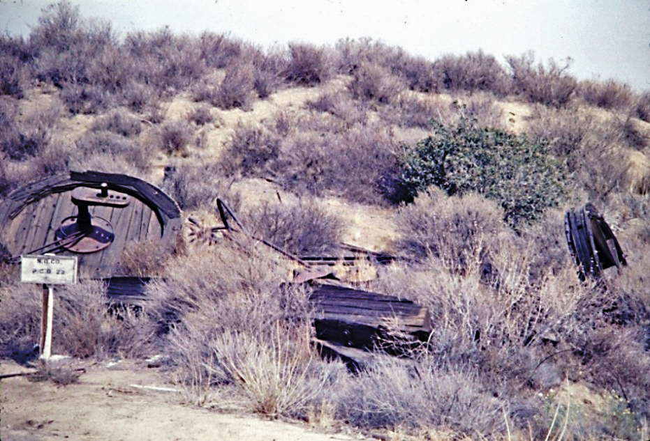
The remains of PCO 23. Photo taken by Barbara Sitzman around 1958. Used by permission of the Santa Clarita Valley Historical Society, Barbara Sitzman Cook Collection.
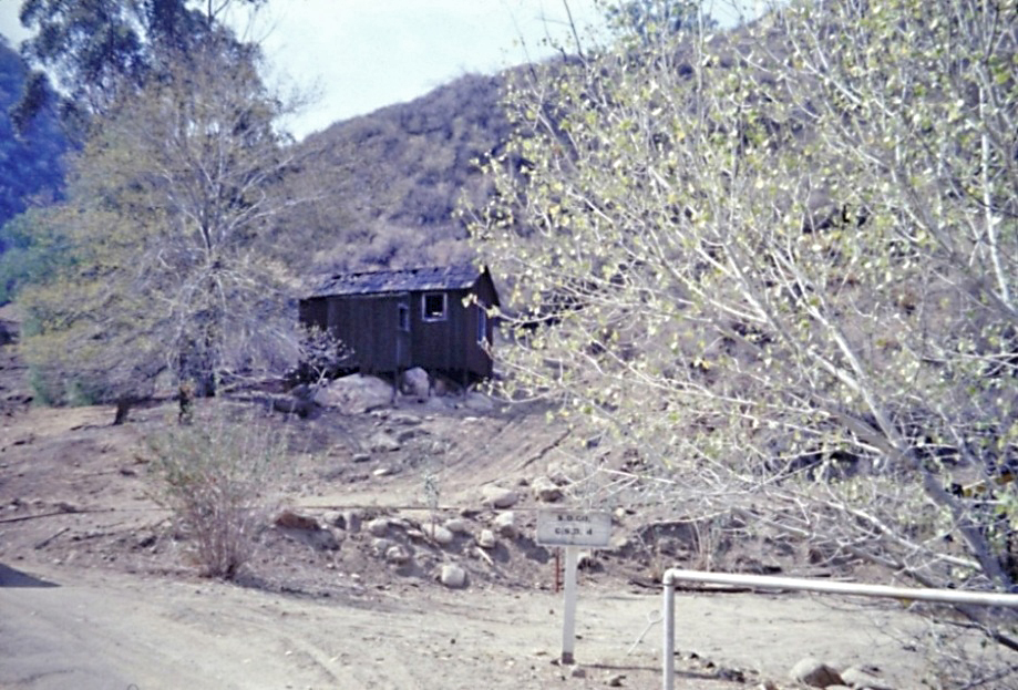
Standard Oil field office at the base of CSO Hill near CSO 4. Photo taken by Barbara Sitzman around 1958. Used by permission of the Santa Clarita Valley Historical Society, Barbara Sitzman Cook Collection.
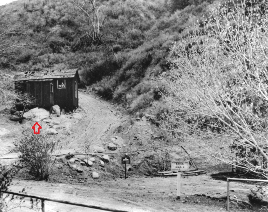
Another view of the field office in 1961 or 62. Darryl Manzer is looking out of the window. Used by permission of the Santa Clarita Valley Historical Society.
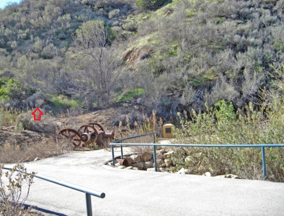
About the same view on 1/17/2017. The big rock in front of the building (red arrow) is all that is left.
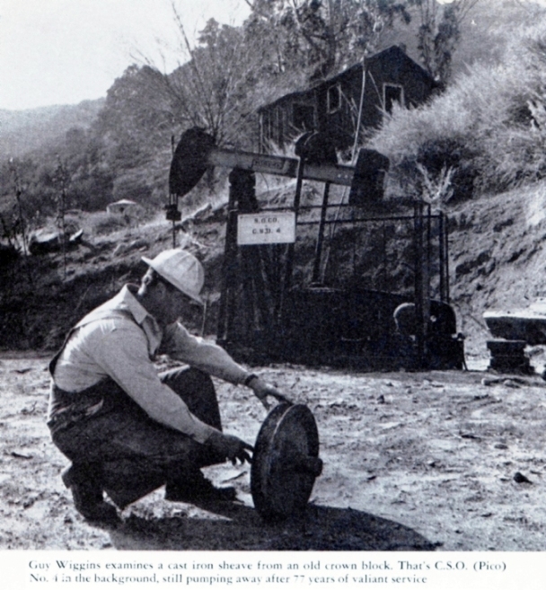
From the Standard Oiler magazine of August 1953.
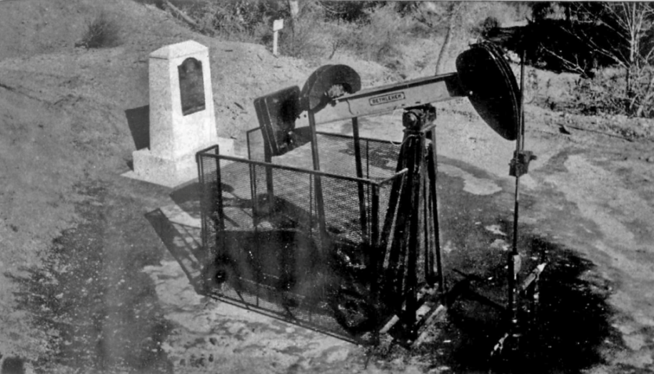
This photo is from the World Oil magazine of May, 1954. It was in an advertisement for Bethlehem Supply Company. The pump is a Bethlehem.
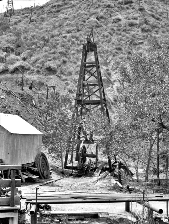
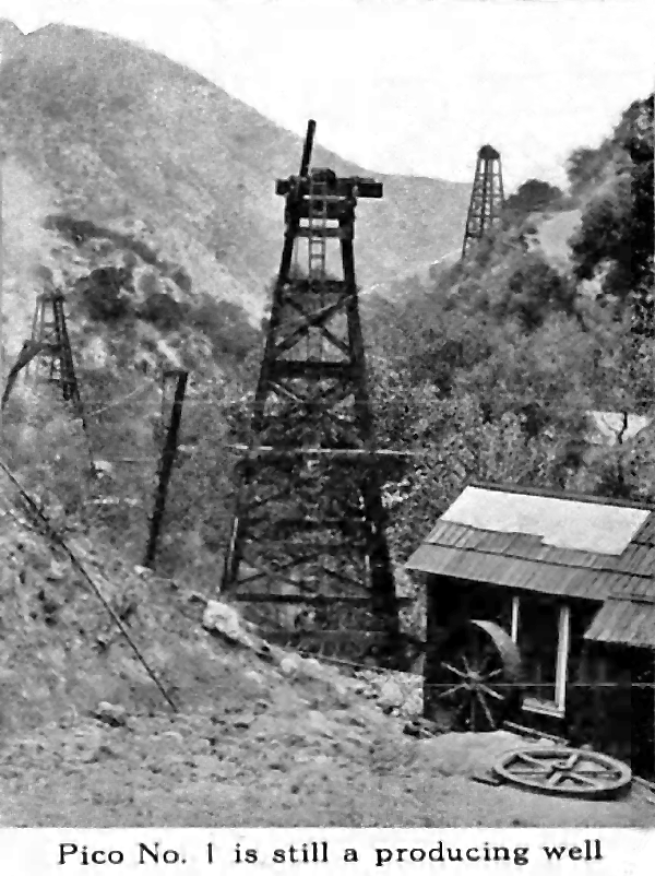
Photograph caption dated October 26, 1957 reads, "California's first rig - Situated in almost inaccessible country is the state's first oil producer, Old Pico No. 4, located in Pico Canyon, six miles West of Newhall. Although several other wells drilled in Pico Canyon yielded small amounts of oil, Pico No. 4 is recognized as first commercial rig in state and still produces today." From the Valley Times Collection at the Los Angeles Public Library.
This was CSO 4 in 1961. It was taken by the National Park Service during a survey of historic sites and buildings they were conducting.
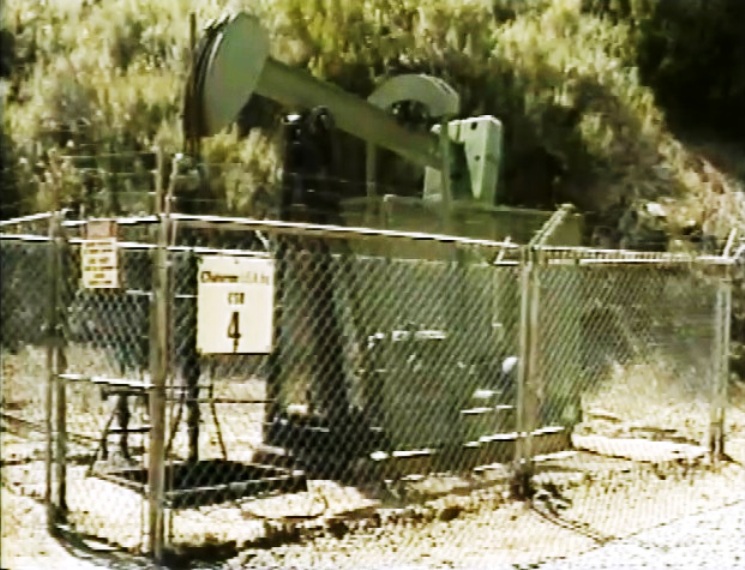
Still from an 1985 Doggr video. The part with CSO 4 (and the Pioneer Refinery) is shown here.
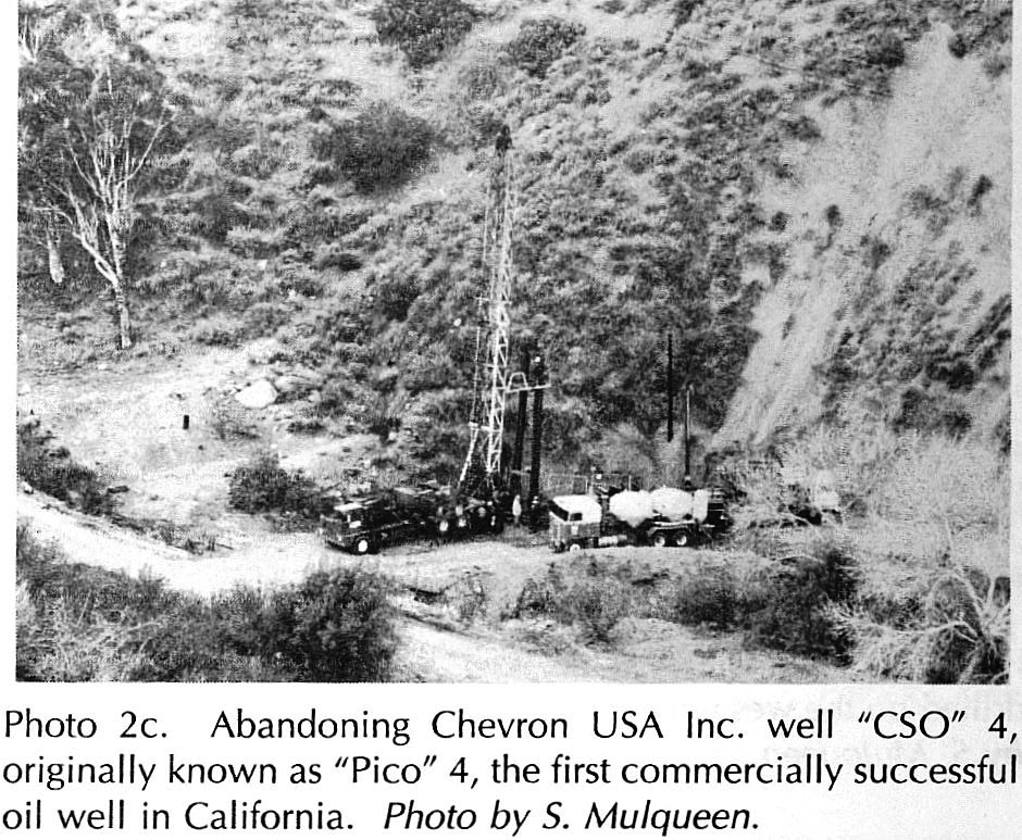
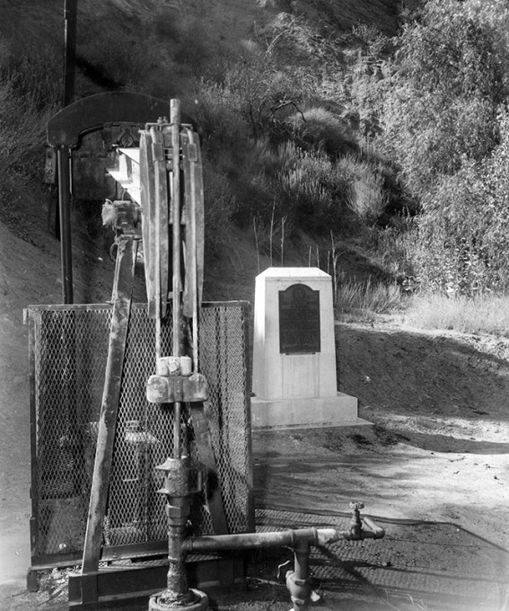
Photo from the 76th Annual Report of the State Oil & Gas Supervisor for 1990, California Department of Conservation, Division of Oil & Gas, Publication No. PR06, Sacramento, 1991, p. 18. From the publication: "CSO 4 was plugged and abandoned in February 1990. The well had produced faithfully for 113 years and holds the record for the longest continuous production of oil in the state." I tried to get the original photo from the DOGGR, but, unfortunately, they could not find it.
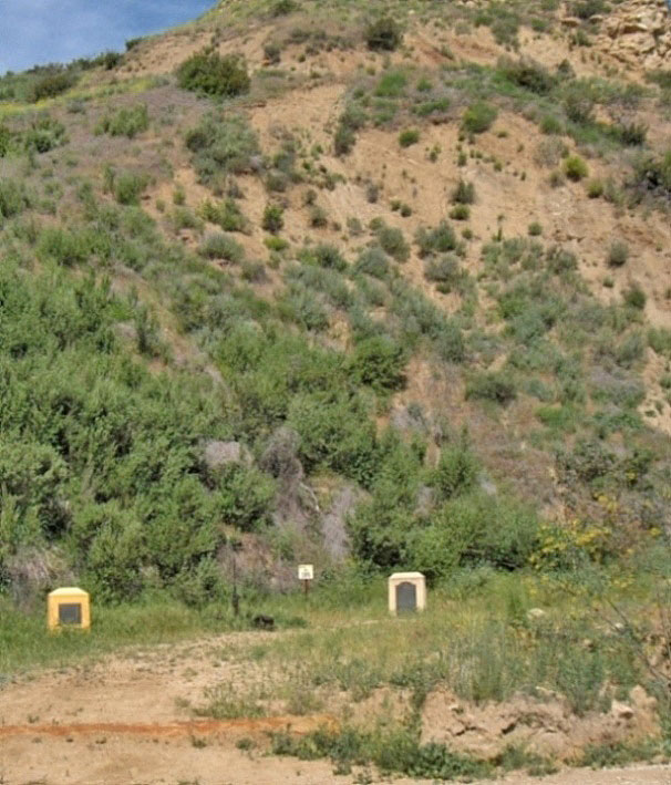
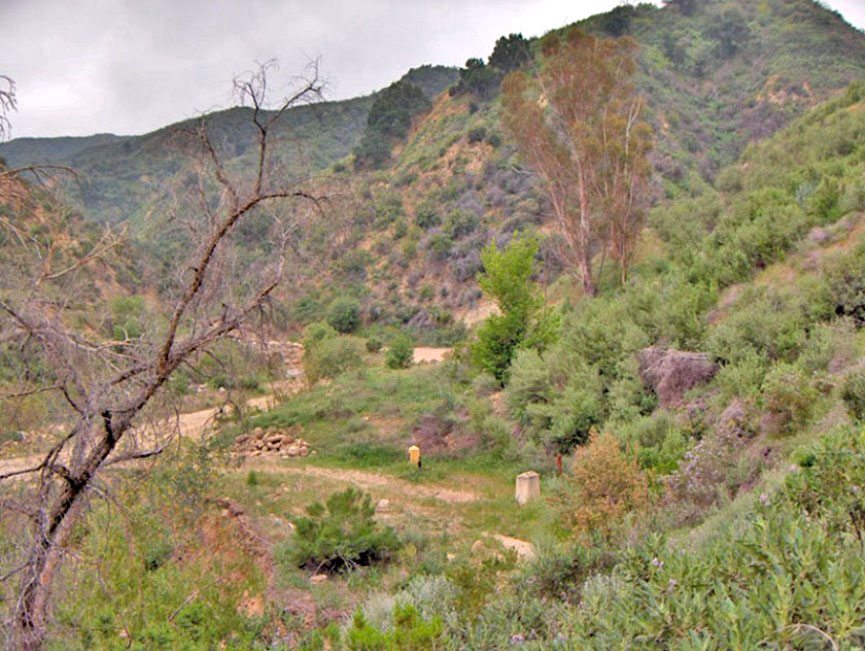
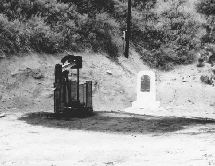
View of CSO 4 site on 5/26/2012