According to Darryl Manzer (who had a lot of contact with oldtimers who came back to the town in the 1960's), Mentryville was actually more of a derogatory name for Pico. The oil workers had to go travel five miles to Newhall to get their liquor, which naturally did not make them very happy. The land was owned by the oil company (PCO then Standard). Either the oil company or Superintendent Charles A. Mentry banned liquor from the little town. Many maps label the town as Pico.
Charles Alexander Mentry was a well-known Pennsylvanian oil driller. He came to the west in 1873 and eventually became the superintendent for the Star Oil Works company in 1875 and then the California Star Oil Works Company in 1876. He moved to Pico Canyon with his family around 1876.
In a June 26, 1877, article in the Los Angeles Evening Express the author, on a visit to Pico Canyon, wrote that after entering a canyon "We passed an embryo town of three or four houses, which the settlers in the neighborhood have facetiously named 'Hoodlumtown,' doubtless from the fact that it is a very orderly place."
However, homes soon became scattered among the wells up and down the canyon. When people left, they often just took the whole house with them. A schoolhouse was reportedly built in 1885 (although I have not seen any documentation to prove that). The town was also heated and lighted by natural gas, a common commodity in an oil field. Up to 100 families supposedly lived here and up the canyon by 1880.
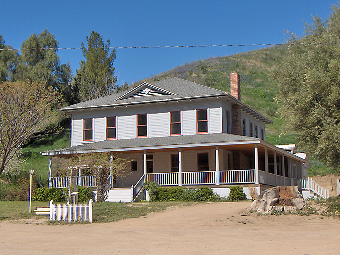
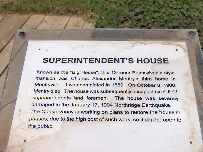
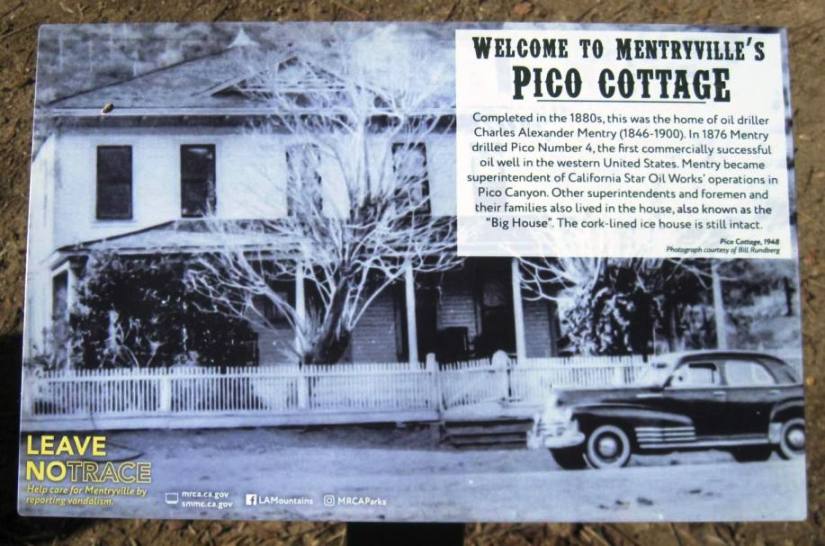
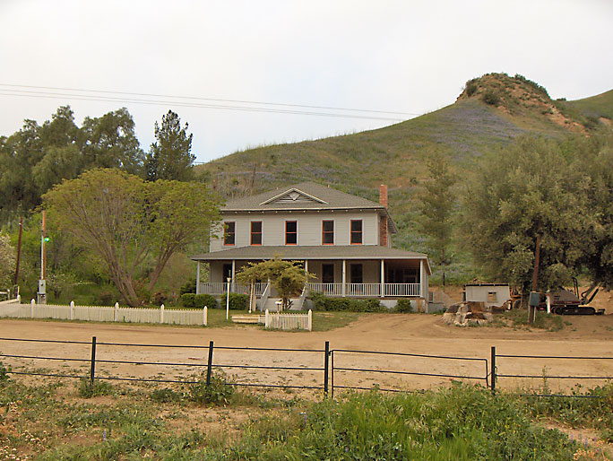
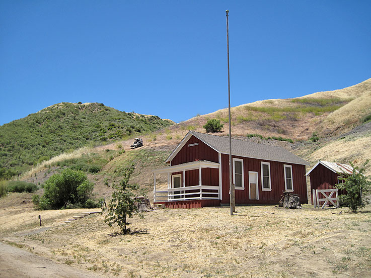
The Pico Cottage (now usually given the modern name of the Big House) was built in 1896. The Los Angeles Times of August 30, 1896, reports on its construction. The Los Angeles County survey map showing Mentryville done in June, 1891, does not show the Pico Cottage (but does show the school house). After the house was completed, it was used by all superintendents and foremans until it was severely damaged by the 1994 Northridge earthquake and abandoned.
The 1910 United States Census shows that Pico Canyon had a population of 121. There were 26 heads of households, so we can say there were at least 26 families in the canyon. There were 52 Standard Oil employees, 2 bee farm workers, and 3 hotel workers. There were 22 males and 13 females under the age of 17. There were two 82 year old Standard workers. There was one 15 year old wife. There were 26 male borders for the hotel workers to take care of. Unfortunately, Pico Canyon was not indicated on any census before, or after, the 1910 census.
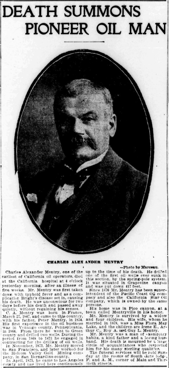
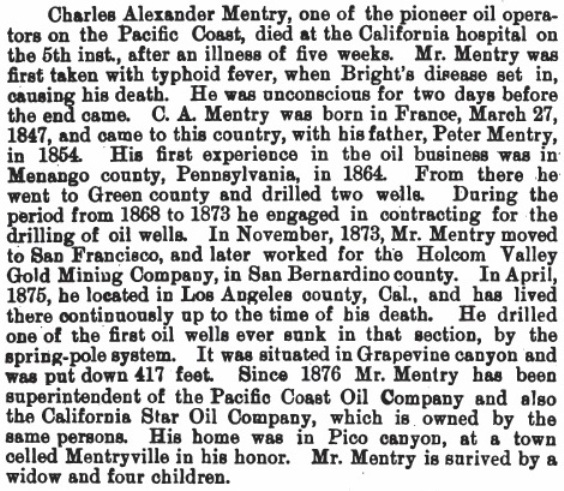
On October 4, 1900, Charles Mentry died (according to his death certificate) from typhoid fever with chronic nephritis as a contributing factor.
Walton Young became the superintendent after Mentry until 1927.
By the 1920's, and even before, the boom in Pico Canyon was fading and Mentryville was starting to die. In 1927, Charles Sitzman became the superintendent until 1937. He spent much of his time roaming the hills and bringing back old oil equipment to town. He had visions of a museum. Unfortunately, this vision never became reality. As you will see in the following pictures, much of the old equipment now is just piled up like junk. I hear that more artifacts are locked up somewhere so they won't be stolen. The current owners (Santa Monica Mountains Conservancy) seem to be more interested in preserving the few remaining structures then preserving the reason the structures were there in the first place. And even these last structures need help.
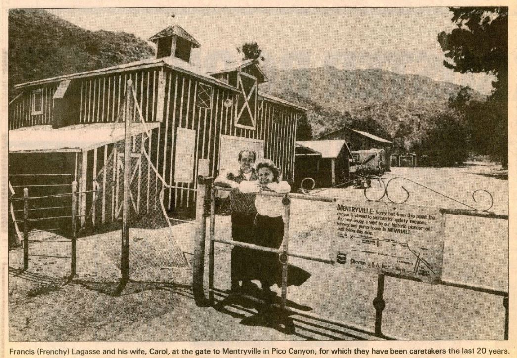
The last superintendent was John Blaney. His short reign was only from 1937 to 1938. After him, there were only foremans. The Manzers lived in the Pico Cottage from 1960 - 1966. Darryl Manzer still returns occasionally and has written articles about his time there (see The Only Kid in Mentryville). The last Chevron foreman to live there was Frenchy Lagasse (who help build the little derrick in Johnson Park) and his family. They stayed there from 1967 until the 1994 Northridge earthquake, which caused extensive damage to the Pico Cottage. In 1995, Chevron sold Mentryville and their Pico Canyon land (and much more land from the other canyons) to the Santa Monica Mountains Conservancy. It is managed by the MRCA (Mountains Recreation and Conservancy).
A MRCA ranger and his family lived there until 2003, when floods forced them to move out. The ranger residence needed to be being renovated. In March of 2011, a MRCA employee moved into a trailer next to the superintendent's house and is still there.
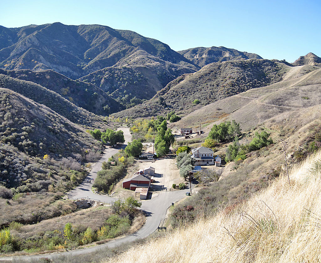
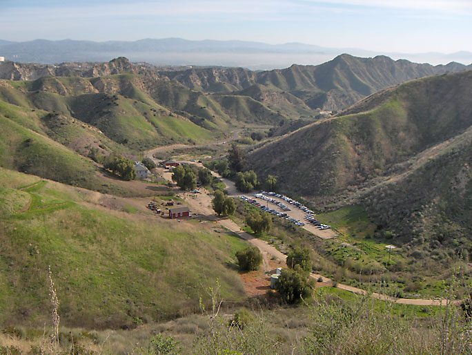
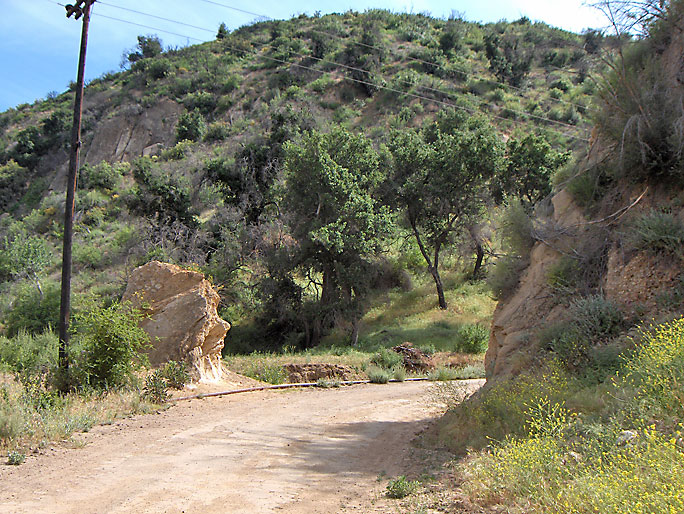
Looking north down at the "Y" intersection on Pico Canyon Road (which runs horizontally in the photo). The upper limb goes into Potrero Canyon. The lower limb goes into Mentryville. There is free parking at this point, but you will have about a 10 minute hike to Mentryville. The fenced off canyon on the north side of Pico Canyon Road just before "Y" is called Dead Horse Canyon. (Photo taken on 12/19/2008)
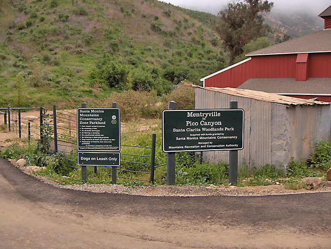
Entrance to Mentryville. Turn to the left to the parking area after you pay $5 at the iron ranger behind the picture. (3/30/2008)
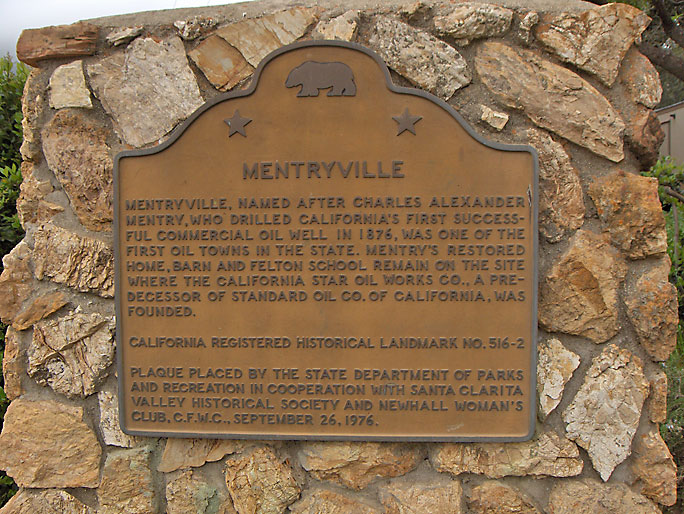
The Mentryville California historical landmark marker. (3/30/2008)
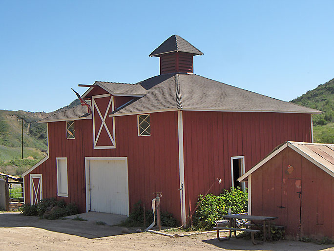
The barn is the first structure you will pass. Frenchy Lagasse said that it was a mule barn and was constructed in 1887, about the same time construction on the Pico Cottage started (although construction didn't start on the cottage until 1896, so this date is suspect). (See A Visit to Mentryville on Scorza's Points of Interest on SCVTV).
Pico Cottage (a.k.a. the Big House) (3/23/2008)
The superintendent's house was actually known as the Pico Cottage not the "Big House". The "Big House" name was first used after the Lagasse family moved in. For some reason, that name is now used although there is no historical reason to use it. When the Manzers moved there in 1960, they rented the Pico Cottage from Standard and never heard of the "Big House." (personal communication). Bill Rundberg, who lived there before the Manzers, never heard of the Big House either (personal communication). Also, the date on the marker is incorrect. The Pico Cottage was built in 1896 (according to LA Times of August 30, 1896).
The sign was changed in 2020. It still has errors (1/4/2022).
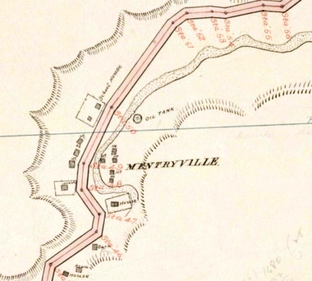
Here is Mentryville on the June, 1891, Los Angeles Country survey map. It does not show the Pico Cottage. It does show the school house, reportedly built in 1885 (although, as I mentioned earlier, I have seen no documentation to support that date).
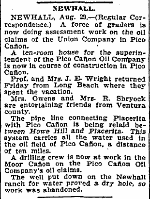
From the Los Angeles Sunday Times of August 30, 1896. The Pacific Coast (not Pico Canyon) Oil Company owned Pico Canyon and Moore Canyon at that time. Moore Canyon is often misspelled as Moor Canyon. Today it is DeWitt Canyon.
(3/30/2008)
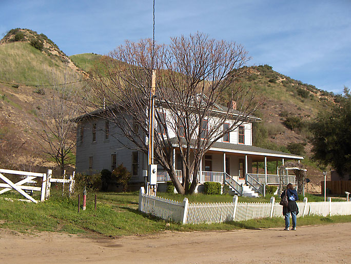
Sightseeing at the Pico Cottage. Hard to do because the gates on both ends of the road are locked. (3/13/2009)
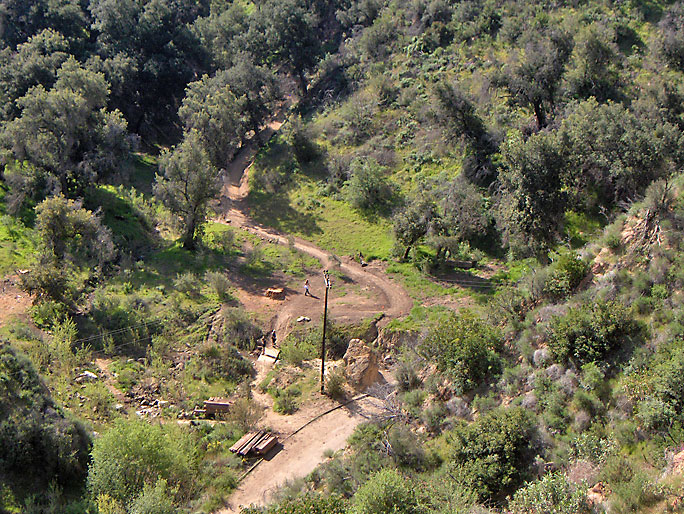
From higher up. (12/19/2008)
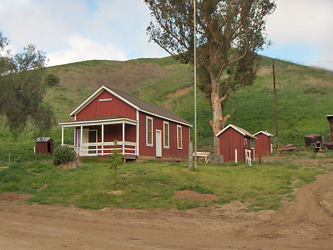
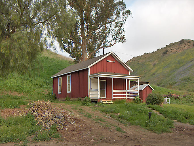
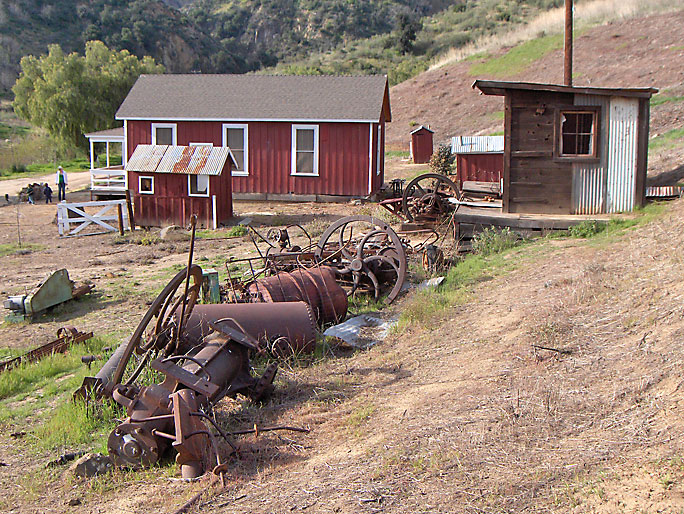
The Felton school was named for Charles N. Felton the president of the Pacific Coast Oil Company. Reportedly built in 1885, it was closed in 1932. (3/30/2008)
The small white "Felton School" sign near the top of the roof was removed a few years ago. (3/30/2008)
Since the last picture was taken, the MRCA decided that the historic tree was not desirable anymore. It was cut down sometime in the week of 4/20/08 - 4/26/08. The base was about 3-feet in diameter. That's a lot of firewood. The MRCA says the trees are not healthy in this Signal article. Here is part two of the article. (4/27/2008)
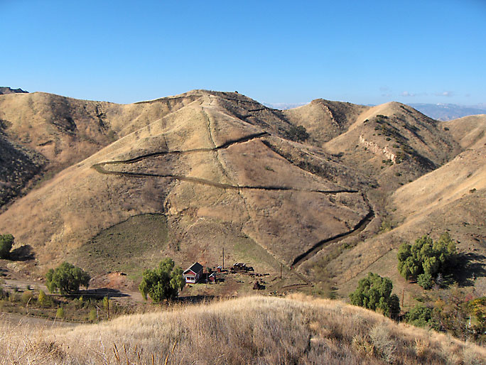
From higher up. Note the new (as of late 2008) trail zigzaging up Mustard Hill. I suppose the MRCA has a reason for building this trail, but it sure ruins Mustard Hill. To the left (west) of this picture is an old road that was used to get up to a water tank that was on top of the hill. If you look in the distance, you can see the road going diagonally up the hill to the water tank in this picture and this picture on the Santa Clarita Valley History in Pictures website. Why the MRCA decided to chop up Mustard Hill when they could have just used the old road is a mystery to me, but that is how the MRCA operates. (12/19/2008)
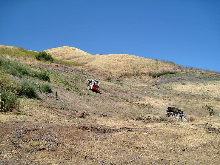
To clean up the weeds on Mustard Hill behind the school house, the MRCA uses tractors. (12/19/2008)
(12/19/2008)
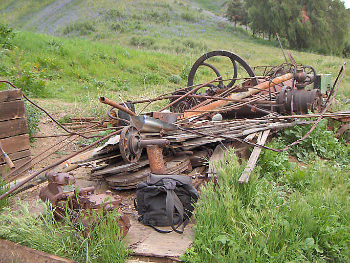
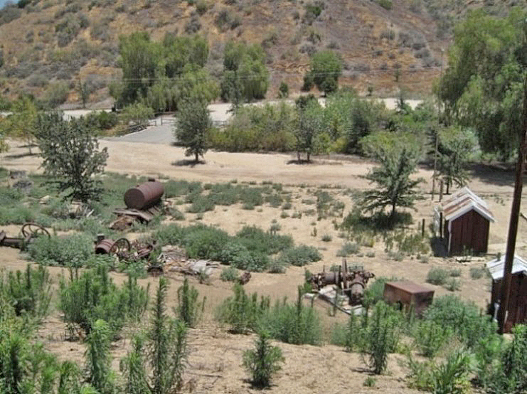
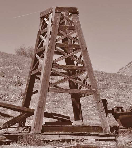
In the area to the right of the Felton school (in the background) is this pile of oil industry related, and other, artifacts collected by Frenchy Lagasse when he lived there. (3/14/2009)
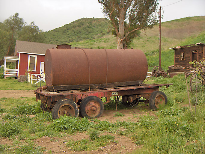
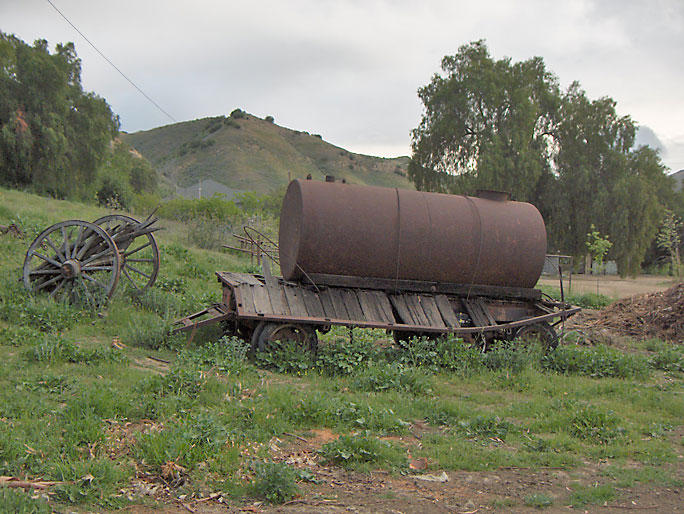
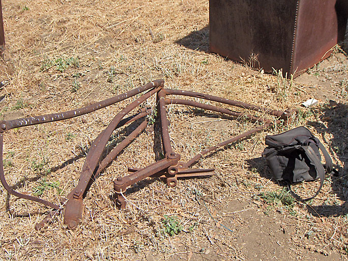
Early oil tank wagon. According to Darryl Manzer, it did not come from Pico Canyon but from somewhere else. (3/30/2008)
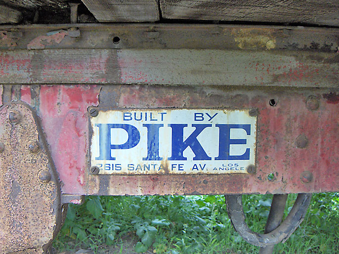
Built by Pike of Los Angeles. Pike is evidently Pike Trailer Company. In 1953, it was described as "one of the oldest trailer builders in the U.S." (3/30/2008)
The wagon is breaking down on one side. (3/30/2008)
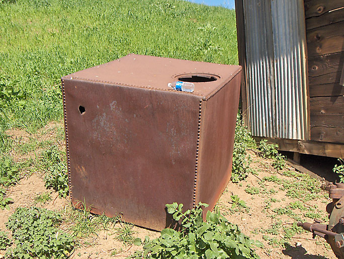
Square riveted box probably used to condense steam (3/23/2008)
Pump jack (6/21/2008)
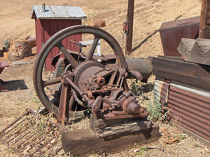
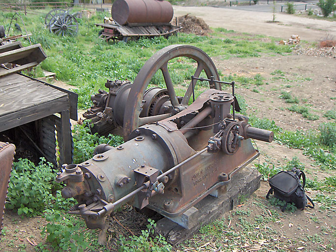
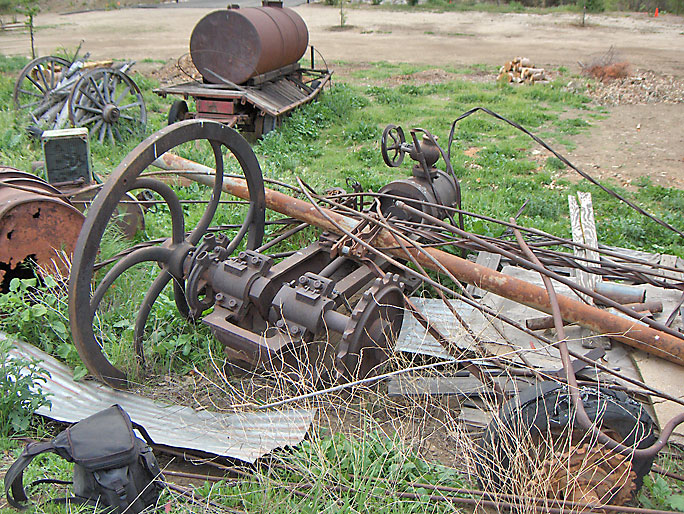
Union Tool engine. More info on the engines here can be found on my Pico engines webpage. (6/21/2008)
Another view of the Union Tool engine (6/21/2008)
"Union Tool - Torrance, Cal" on base of engine (6/21/2008)
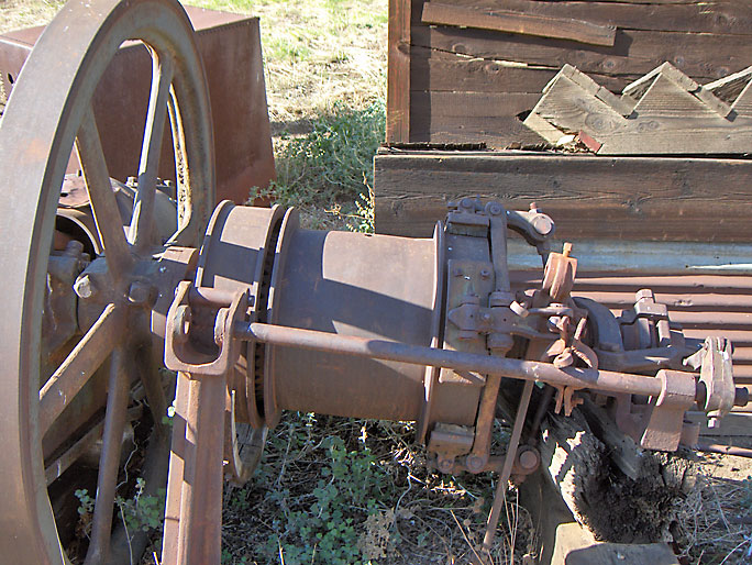
(3/30/2008)
Closer view of pulley (3/30/2008)
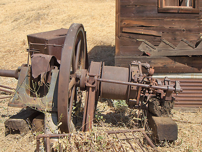
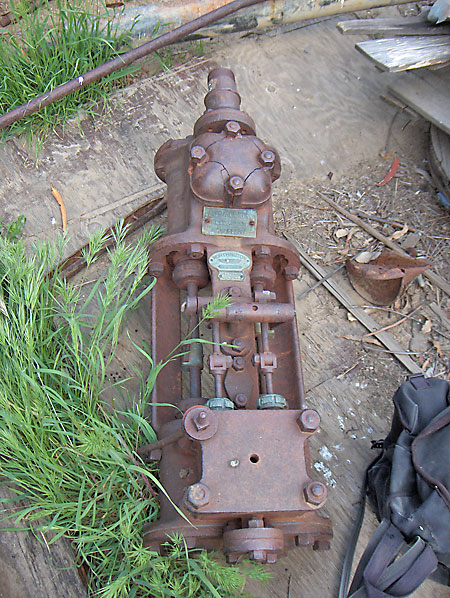
Baker Iron Works pump (3/30/2008)
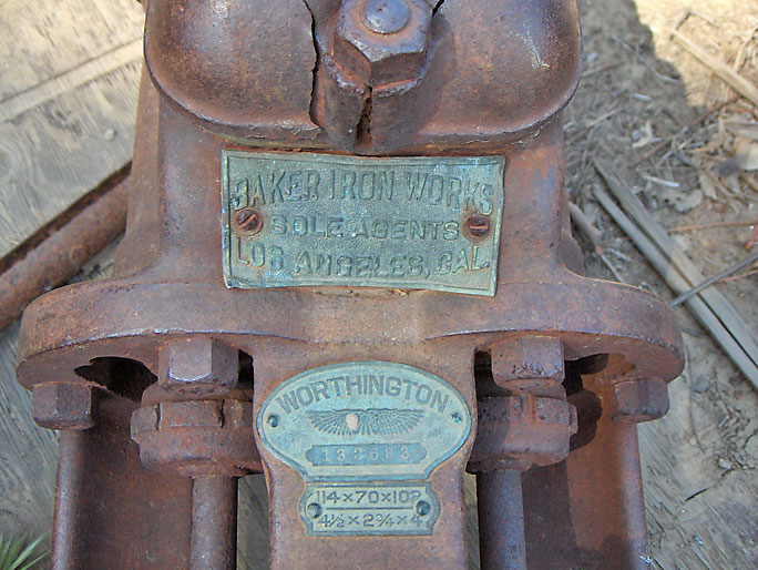
Close-up. "Baker Iron Works - Sole Agents - Los Angeles, Cal - Worthington - 114x70x102 - 4 1/2 x 2 3/4 x 4" (3/22/2008)
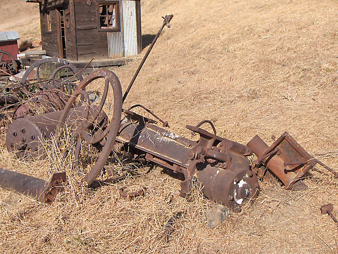
Pile of stuff with engine in the background (3/30/2008)
Looking at that engine. (3/30/2008)
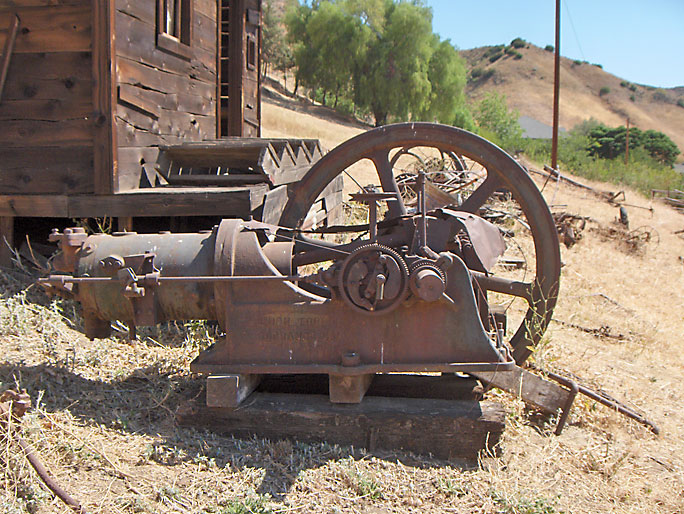
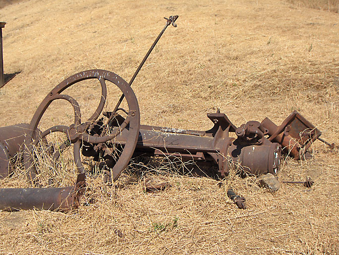
Still another engine at the end of the pile of stuff (obviously the photo was taken at a different time of the year). See my Pico engines page for more info on the engines here. (3/22/2008)
Next to the engine is an incomplete set of center irons on the right. (3/30/2008)
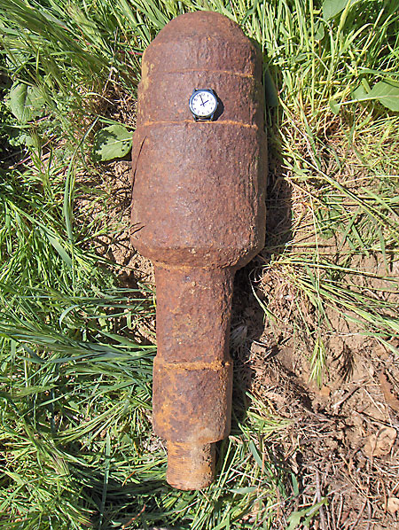
Unknown impressive 27-inch long threaded object. (3/22/2008)
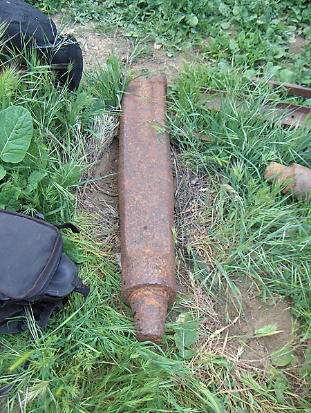
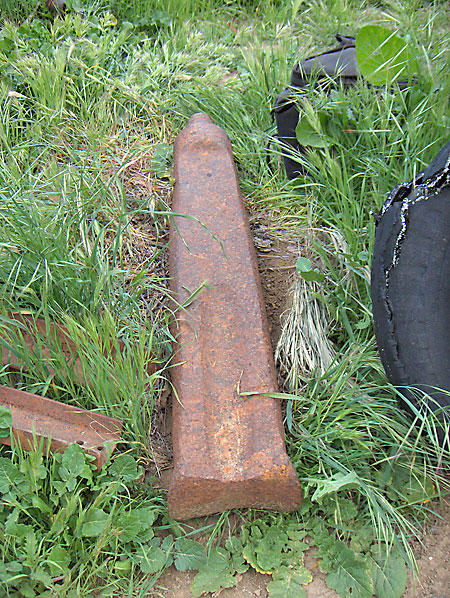
45-inch long cable tool bit. The far end (in this picture) of the bit is what pounds over and over into the rock at the bottom of the well. Notice the tapered threads at the closer end. (3/30/2008)
View of the "working" end (3/30/2008)
Pump adjuster. Located on the walking beam holding the polished rod. Sometime after this photo was taken in 2008, the adjuster was removed (probably stolen). (3/23/2008)
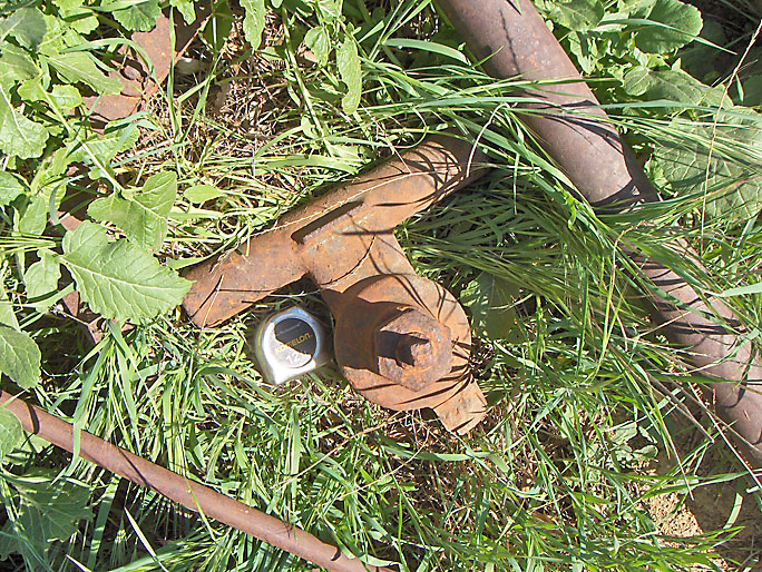
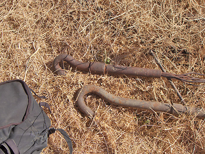
Jackline hooks (3/23/2008)
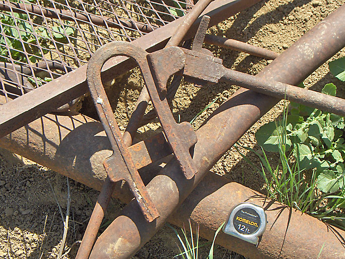
More stuff (3/23/2008)
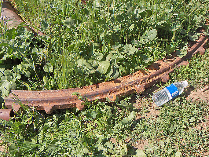
Section of a sprocket tug rim from a calf wheel (3/23/2008)
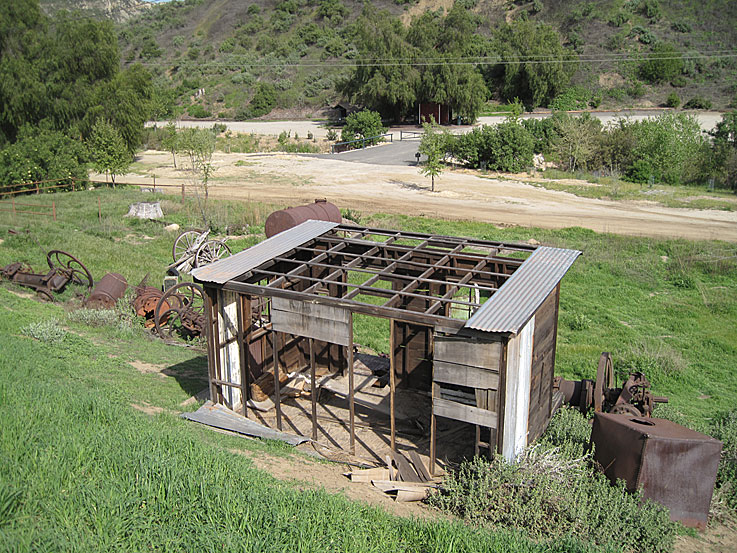
Shack on 4/11/2011. This was built for a TV show (High Incident) in 1996 or 97 and should just be removed. There is nothing historic about it and is just breaking apart, creating more of a hazard then anything else. (4/11/2011)
The shack was finally removed about two months before this photo was taken on 6/8/2016. I was told that someone stepped through the wooden floor.
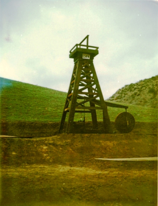
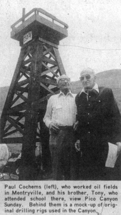
For the June, 1976, 100 year celebration of CSO (Pico) 4, a model of CSO 4 was built. Here it is at the base of Mustard Hill just east of the schoolhouse during the celebration. Photo may have been taken by Tom Mason. From the Santa Clarita Valley Historical Society, Tom Mason Negatives.
September 26, 1976. Photo by Barbara Sitzman. Also during the From the Santa Clarita Valley Historical Society, Sitzman Collection.
From the Signal of September 29, 1976.
Poor quality image from the Signal of May 13, 1979.
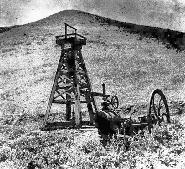
This photo was taken by Barbara Morris in 2002. The little oil rig model is still there but without its top. It is not there now, so either the MRCA got rid of it or they hid it away somewhere.
This image is NOT in the public domain and was used by permission of Barbara C. Morris
On 3/14/2009 there was a St. Patrick's Day run starting in Mentryville. That's why the parking lot is so crowded in this view toward the east from Tank Hill.
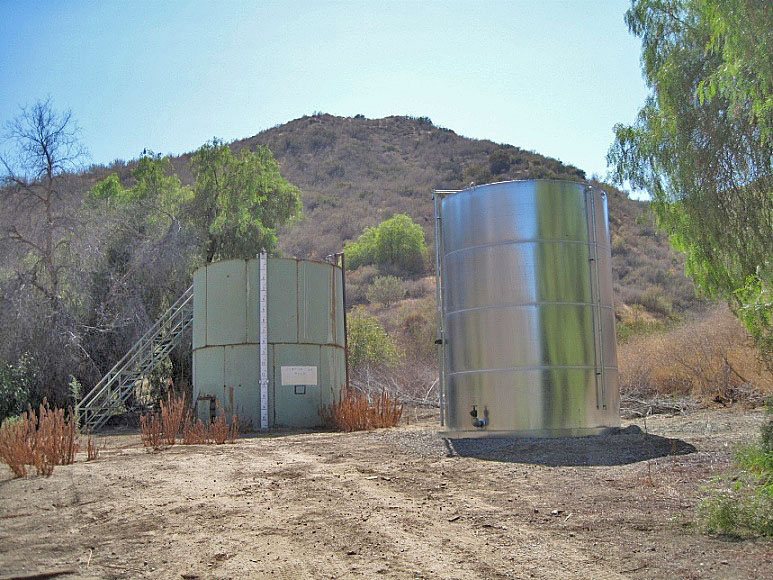
Sometime in 2013, a second tank was added. The first tank is apparently no longer used and the metal stairway to the top of the tank was dismantled. (8/21/2013)
You can still see the trace of the Tank Hill road running diagonally in this photo. See the Mentryville historical photos page for more views of the Tank Hill road. (3/21/2012)
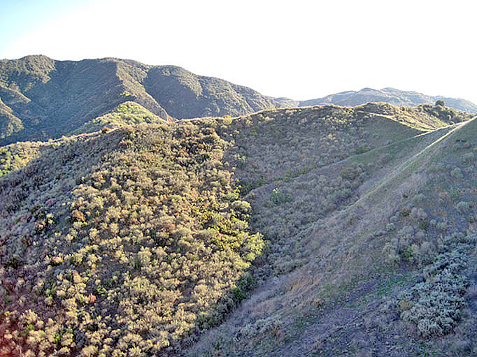
As you hike out of Mentryville you come to this gap. On both sides you can see how steep the angle of beds of the Pico anticline are. Straight ahead on the other side of the creek are the remains of the bakery. The canyon running in from the left is called Minnie-Lotta or Minna-Lotta Canyon. Thow girls used to hike up the canyon to a waterfall and the canyon was named for them. (5/3/2008)
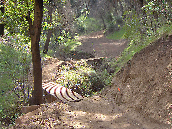
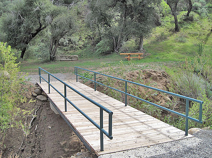
Just before the gap, a new trail has been started up the Minnie-Lotta Canyon. The goal is evidently to get near the waterfall, but as of 3/14/09 it just deadends up the canyon after about 1/2 a mile. The MRCA has put a lot of effort in constructing the trail, building at least four bridges, so maybe they have bigger plans. (3/29/2009)
Here are two of the bridges (3/14/2009)
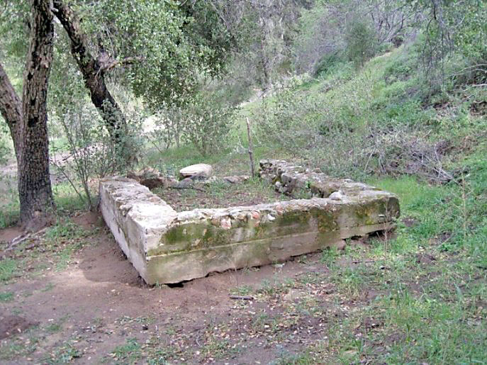
The foundation of the bakery furness. It is located near the start of the new trail on the other (south) side of the main creek bed just past the gap. It is about a 10 foot square with one of the sides missing. (3/18/2012)
The bakery was built by Anthony Cochems in 1897 (Reynolds, 1985). In the 1910 United States Census, Anthony Cochems is listed as a baker for Standard Oil Company. Also in that 1910 census, William Cochems is listed as his 14 year old son. William would later become an oil worker for Standard and, in honor of his retirement, have the replica derrick built for him in Johnson Park.
In 2011, a new bridge was installed over Pico creek to for the trail. Here is the bridge with the foundation and a picnic bench in the background. (3/18/2012)
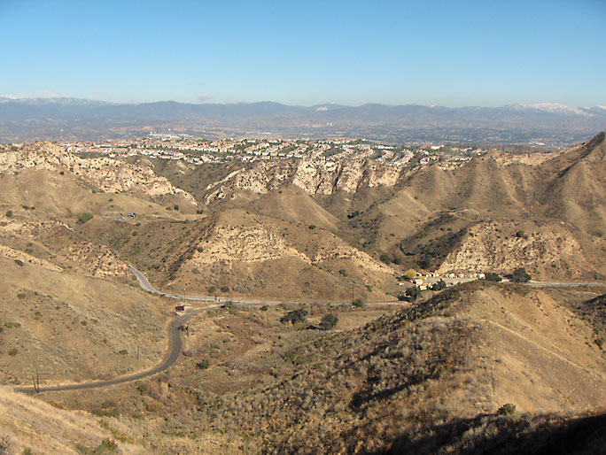
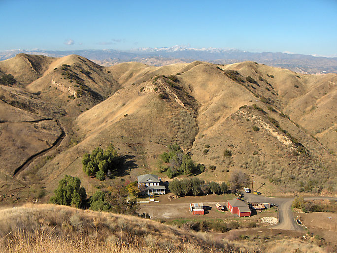
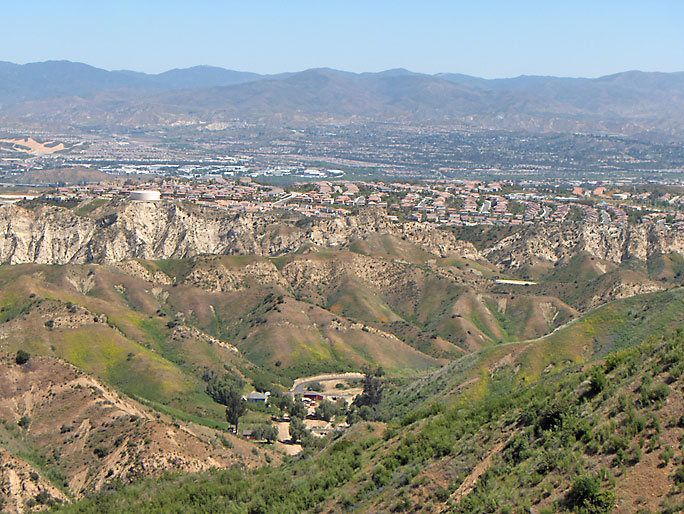
Mentryville with the Santa Clarita Valley in the distance. Looking toward the northeast from near the top of the so-called "Christian Hill". (4/12/2008)
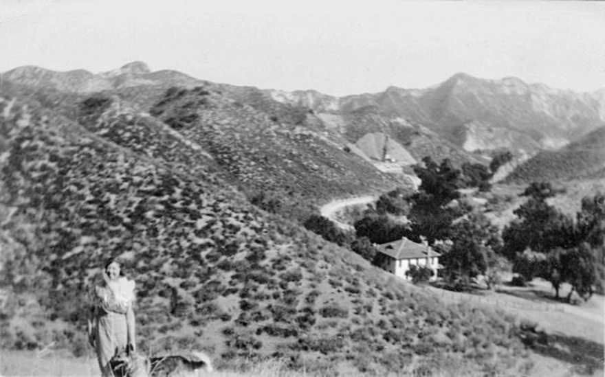
This photo of Ethel Blaney with Mentryville in the background was taken in 1939. It is on the Santa Clarita History in Pictures website in the Mentryville: Cheney Family Photos section. There is an oil derrick in the distance. What well is that?
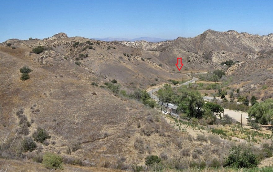
Here is about the same view today (4/7/2016) with a red arrow where the well was. After taking GPS coordinates of that location and comparing them to all the wells in the area, only one well fits the bill. The Downey Oil Company No. 1 (API # 03712601) was spudded in early 1937 and abandoned in April of 1939.
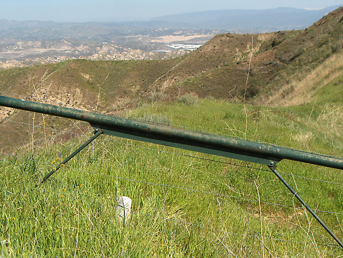
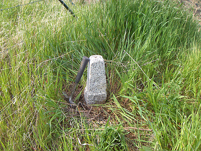
Different angle showing a current boundary marker next to the stone. (3/29/2009)
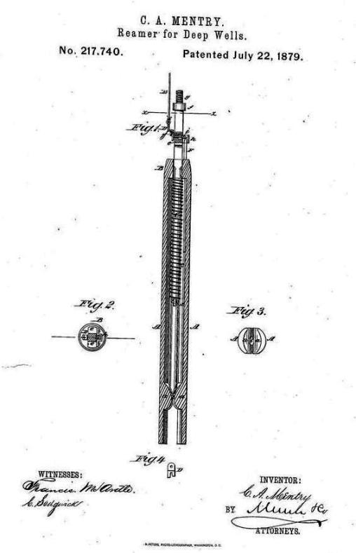
Mentry was awarded a patent for a "reamer for deep wells" on July 22, 1879 (No. 217740)
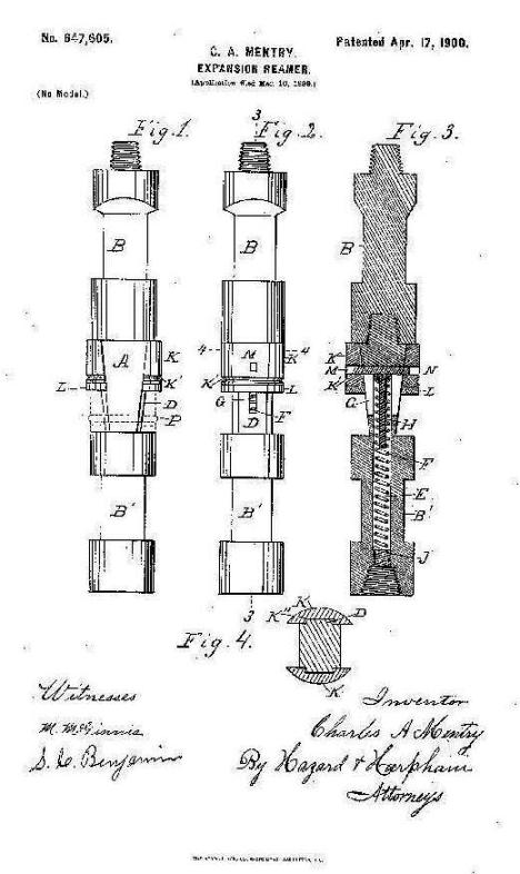
He also received a patent for an "expansion-reamer" on April 17, 1900 (No. 647605)
From the Los Angeles Herald of October 5, 1900
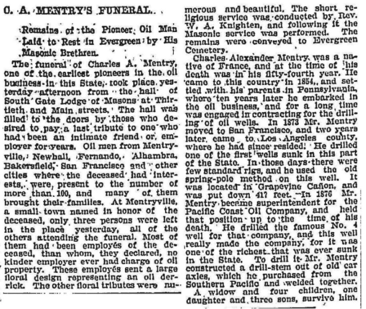
Report of Mentry's funeral from the Los Angeles Times of October 8, 1900
From the Paint, Oil and Drug Review weekly magazine of October 17, 1900
The last residents of the Pico Cottage (a.k.a. The Big House). Damage from the Northridge earthquake of 1994 forced them to move out. From the Los Angeles Times of May 22, 1986.