Those men came before permits, subsidies. They stood on their own feet. In that day, if you flopped – that was your business.
You could have gone out the old Pico Road even then – but let’s start at a beginning and re-hash the Story of Pico – a Ghost Camp.
Away back in 1865, County Records tell of the formation of the “San Fernando Petroleum Mining District,” blanketing public lands, bounded by the Land Grants of Rancho San Francisco, Simi and Mission San Fernando. As of today, say westerly of Highway 99, including the canyon areas of Lyon, Wiley, Rice, Gavin, Tousley, Leaming, Dewitt, More and Pico. Each of those names memorialized a local pioneer.
It is true, that today’s maps substitute Wickham for Big More. Little More was once Dewitt. Try and find Lyon Canyon – although that family still owns and occupies it.
The Pico Road? My suffering saints! It antedated Newhall. It is also true that Pico camp was really named Mentryville, but that name didn’t stick, and, as there was never a post office there you can’t prove anything. And why should folks have to start with three blocks only called Tenth St. to Newhall Ave. The street name has become “Lyons” (and that particular pioneer never spelled his name with an “s” on the end of it) for a couple of miles to 99.
So you crossed 99. On your right is the ranch field Jake Swall used to lease, back in the 1890’s. It ran from Newhall Ave. westerly to the Pico foothills. Back in the early twenties, the ranch sold quite a chunk of it mighty cheap. Reputedly the deal helped to hold down taxes.
South of the Pico road, Kenny Powell had a homestead. Ken was a son of Mike, nephew of old Judge John. The Powell brothers were running cattle here way back in Indian days – same as Civil War times. The Powell’s had a homestead up in Dry Canyon, with orchards and everything, but when the City put in its reservoir, the rising water level drowned out the trees. Think of that – as of today.
At 1.65 miles from 99, you’re passing Little More canyon on your left. The Navy is supposed to have some kind of project there with No Welcome on the doormat for visitors. Just beyond, Larinan’s apiary marks old Big More (now called Wickham) canyon. One of these “More’s” was originally Dewitt.
At 2.4 from 99, Dead Cow canyon is on your right and at 2.55, still on right, is Spring Canyon, now called Dead Horse, and paved over to the potrero, once the Barnsdall Oil Company’s pride and joy. It opened most successfully in 1937. Now it is a part of the Sun Ray Oil Mid Continent oil layout.
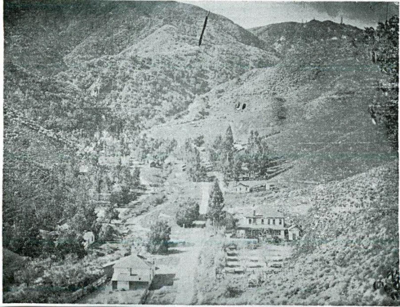
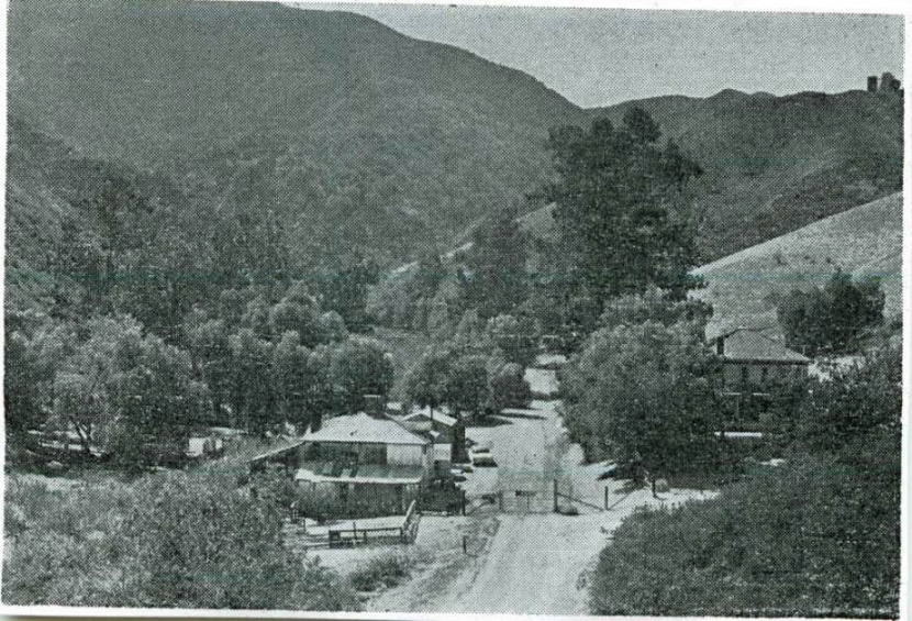
Only a short distance further, a big square comfortable house looms up. There’s a slightly decrepit stable, just across the dirt road. There’s a fence. There’s a gate. If you haven’t arranged an invitation from the Standard Oil Company of California, maybe you’re through for the day.
From the gate, it’s 1.6 miles to “the Works,” once the center of petroleum activity in California. By the time you reached “the Works,” you had come completely through the old Camp, although you might not believe that without pictures. You saw no buildings. They aren’t there any more.
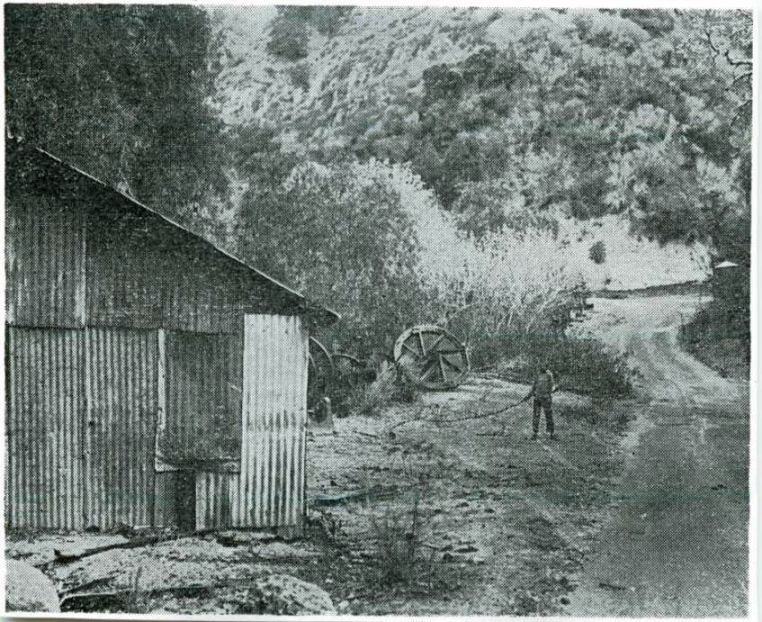
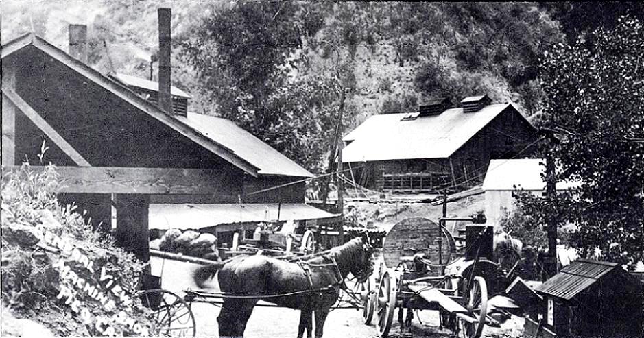
Look around closely from “the Works.” That’s quite a title for an open front sheet iron shed, slightly skewed, and a decayed cabin across the dirt that hasn’t fallen down yet, but it does have a little further to sag.
Know what that wreck is? Believe it or not, ‘twas the Field office of old Pico. The shed was an old storage shed. The Machine shop, wherein absolutely anything could be evolved, dreamed up, or otherwise fabricated – if it had to do with an old field, used to stand above the field office, both at the base of the CSO hill. Across the road, a bridge carries over the Pico creek (named maybe by an unconscious humorist) by the gasoline plant – only the plant isn’t there any more either.
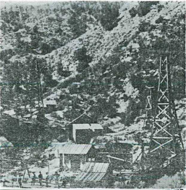
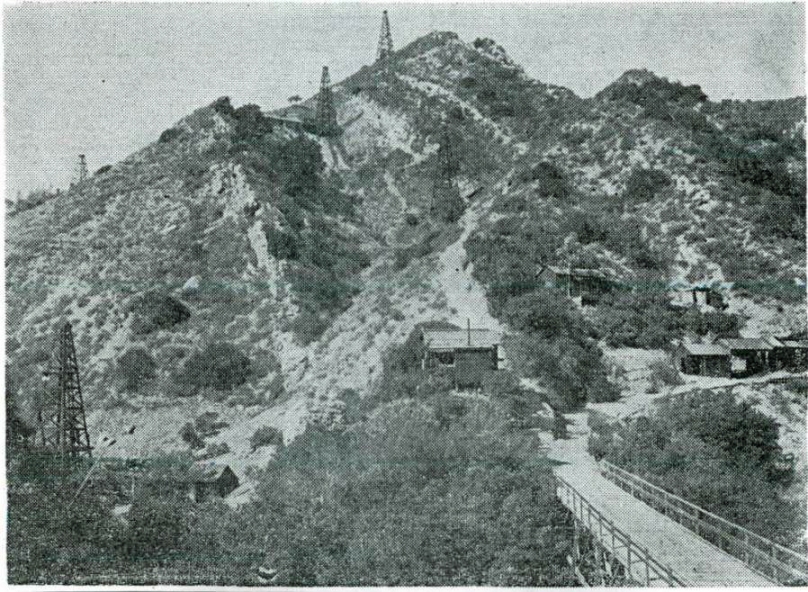
Right by the field office, there’s a modern pump, and a plaque which marks #4 (either CSO or PCO), probably the first commercially successful oil well in California. It “went on the pump” in 1876. It still produces oil – in gallons instead of barrels.
It can be truthfully said that No. 4 sparked the drilling of 74 oil wells in the Pico. By 1911, 43 wells were producing. 33 had been abandoned. Two were drilling. Annual production was from 90 to 100 thousand barrels. There’s nothing like a little production in a mining camp to stimulate interest. The statement applies to either petroleum or gold.
No. 4 was drilled by Alec Mentry a graduate of the Pennsylvania oil fields, and led to Mentry’s superintendency of D. G. Scofield’s Pico interests. The job lasted the rest of Mentry’s life. So did No. 4.
The well was probably drilled on land leased, or borrowed from Beale and Baker. Edward Fitzgerald Beale always reminds one of a Dumas character, a d’Artagnan in a more modern setting. Romance hung about his career in California from his barefoot race with Kit Carson from Kearny’s beleaguered troops at San Pasqual, to San Diego, to his death as the owner of a quarter million acre ranch in the San Joaquin, still existing as La Liebre.
Beale pioneered, successfully, so many things – for example, Beale’s Cut. That’s a gash in the mountain crest between Newhall and San Fernando that made the Toll Road possible. Beale and Baker ran sheep on a baronial scale. They even pioneered in California oil.
D. G. Scofield also pioneered in California oil. Primarily, he was on oil man, trained by the vicissitudes and tribulations, of the great Pennsylvania oil boom that followed the success of Col. Drake’s first oils well at Titusville.
It was Scofield that inveigled Alec Mentry into coming west. With Mentry attending to the field interests, Scofield was free for promotion, first maybe in the California Star Oil Works Company, operating in Pico. Later, Scofield’s concept of Pico possibilities, let to the promotion of the Pacific Coast Oil Company, around 1879, which swept up the hungry little under-capitalized oil optimists of the Santa Clara, San Francisco, and Star oil companies, and glued them together into a going concern that kept on going till it became the Standard Oil Company of California and Scofield became its president.
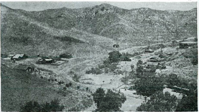
The Pico Canyon is narrow up by the wells. Right where Petroleum canyon, with its oil springs, took off to the right as Pico canyon took off 90 degrees to the left was a rather small, but wider, space, and it was here that such buildings as the machine shop, field office, and storage sheds were strung out. The gasoline plant didn’t come till much later.
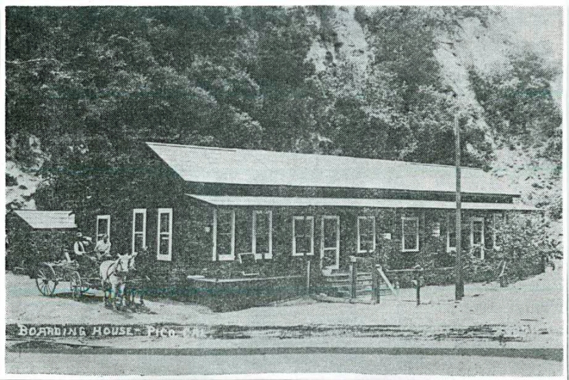
It was 7 ˝ miles down to Newhall, a metropolis of maybe 50 people – but average saloon capacity for a much larger population, a couple of stores, a railroad station and a post office. It was altogether too far to walk, so, naturally, as the little 42 foot derricks hatched, there might be a shack courteously designed as a cabin or one, or two, or three, scattered about it in the Pico Camp.
Finally the shacks got to be a handicap, crowding operations. Then, too, about 1880 Alec Mentry got tired of trying to train Californian vaqueros into a life on the derrick floors, and an importation of Pennsylvania oil field workers marked the infancy of the Pacific Coast Oil Company.
This isn’t a story of oil – just the story of California’s first oil camp. In other words, of the life of the folks as they developed the industry and the early community. It may have been the migration of some 20 eastern drillers et al that inspired the Boarding House, and also a two story dormitory for bachelors across the canyon.