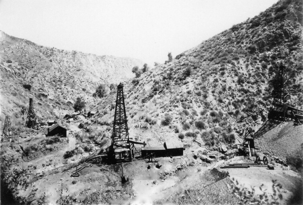
This 1877 photo (view toward the north) by Carleton Watkins shows (from right to left) Pico 2, Pico 3, Pico 1, Pico 4, and the short Sanford Lyon well on the far left. We can positively identify these wells because of surveys done in 1877 and 1878.
There were two early surveys of the Pico Oil Springs that I have found information on.
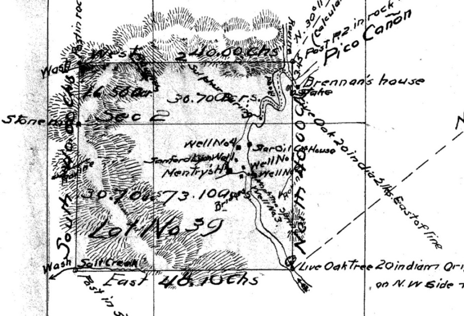
On August 15, 1877, Robert S. Baker made out an application to the U.S. Survery General for California for a survey with a plat map of the Pico Oil Springs Mine, claimed by Baker and E.F. Beale. Baker planned to patent the claim and needed an official plat map. The survey was done by Deputy Mineral Surveyor Albert G. Ruxton on October 29th and 30th of 1877. Baker and Beale would eventually obtain their patent on September 14, 1880.
Here is the complete plat map of the survey (PDF 5.9MB) obtained from the US Department of Interior, Bureau of Land Management, for California.
Note: Surveys were done in those days with a Gunter's chain. It was an actual chain consisting of 100 links (abbreviated lks). The full length of the chain was 66 feet. Each link was therefore 100/66 = .66 foot = 7.92 inches long.
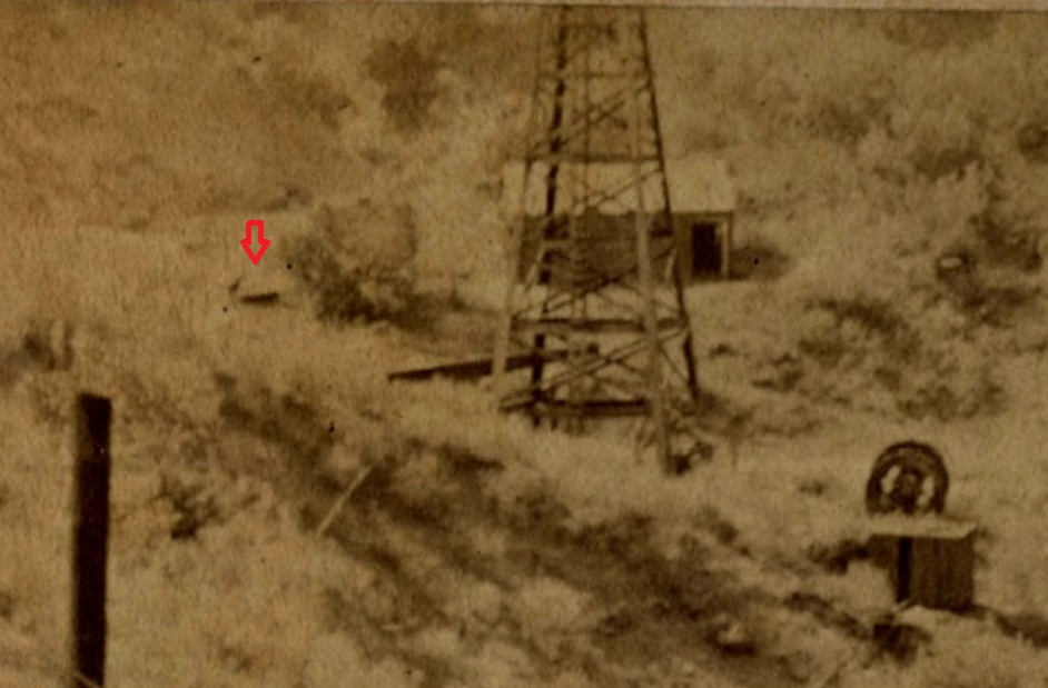
This is a close up of the well positions from Ruxton's 1877 map based on his survey. A Naptha spring is directly between well no. 2 and 3. Mentry's first house is located below the Lyon well in the mouth of the canyon from the west that is now blocked off. To the left of well no. 3 is an unmarked square, which is Sanford Lyon's house (mentioned in the field notes of the survey). There is also a bridge across the creek near of Lyon's house.
Here is a closeup of Pico 1 showing Lyon's house in the background and the bridge at the left (from a different Carleton Watkins 1877 photo)
From Well #
To Well #
Distance (feet)
Compass (0-360 deg from N)
4
Lyon
153
183
Lyon
1
138
133
1
2
183
105
2
3
76
82
1
3
117
120
Since the location of Pico 4 is known, we can use the Ruxton survey notes and a land survey computer program to find the distances and compass directions between all the wells.
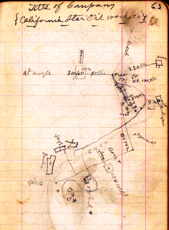
The second survey was done by Frederick B. Taylor from April 2, 1878 until April 9, 1878, for the California Star Oil Works Company. Taylor was the General Manager of the company. This survey is not as professionally done as was Ruxton's.
Taylor's rough map of the wells from his field notes