Abandonment of Oil Wells in San Gabriel Fault Zone, Placerita Oil Field
May of 2022 thru May of 2023
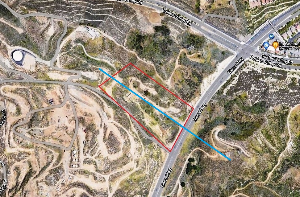
Aerial image from Google. Wells in red box. This is at the northeast corner of Confusion Hill. The San Gabriel Fault zone (blue line) runs diagonally through there.
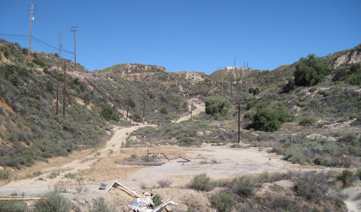
Street level view from Sierra Highwy looking northwest. (Photo taken on 4/23/2016)
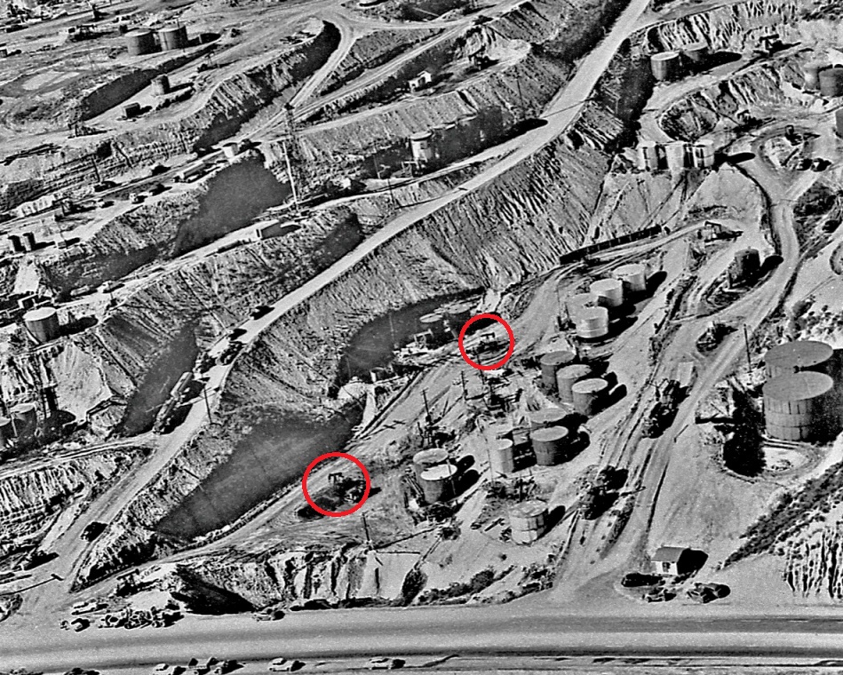
Early 1950's aerial photo showing Sierra Highway on the bottom with Sindell Community 1 in the lower red circle and Fee 6 in the upper red circle. Both wells are on the pump. (photo from scvhistory org)
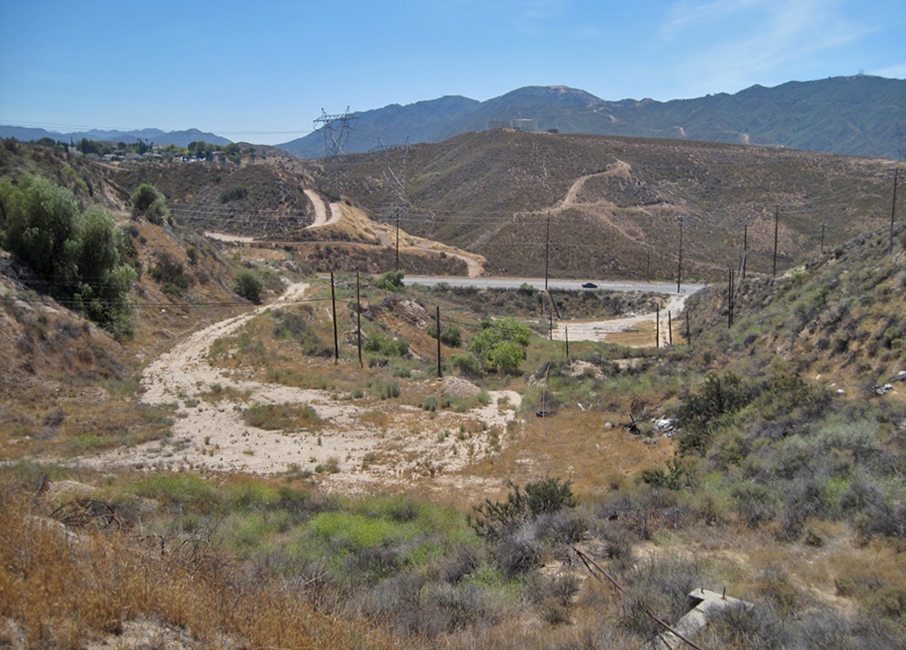
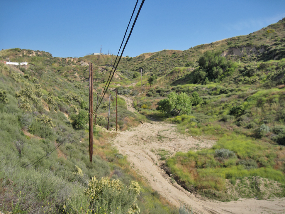
Reverse view looking southeast. Sierra Highway is the road in the distance. (6/3/2016)
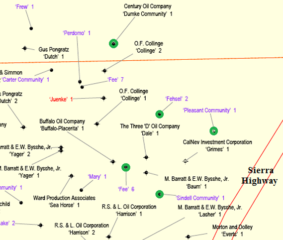
Part of CalGem (DOGGR) map 251 showing all the wells in this area. The five wells that were abandoned have green circles. Map 251 covered the whole Placerita oil field.
INTRODUCTION
In 2021, CalGem (California Department of Conservation, Geologic Energy Management Division - formerly DOGGR) ordered that the wells in this area to be properly abandoned. Since the last operator no longer existed, the state contracted for its abandonment using funds that were already set up for these kinds of oil wells (called "orphans"). The extimated cost to abandon each well was $10,000. General Production Service (GPS) was selected to do the work. They already do much of the work for the Placerita field. GPS specializes in servicing oil wells, providing workover rigs, coiled tube units, cement trucks, vacuum trucks, and other equipment.
The CalGem description (from their website) of legally plugging and abandoning an oil well:
"A well is plugged by placing cement in the well-bore or casing at certain intervals, as specified in California laws or regulations. The purpose of the cement is to seal the well-bore or casing and prevent fluid from migrating between underground rock layers. Cement plugs are required to be placed across the oil or gas reservoir (zone plug), across the base-of-fresh-water (BFW plug), and at the surface (surface plug). Other cement plugs may be required at the bottom of a string of open casing (shoe plug), on top of tools that may become stuck down hole (junk plug), on top of cut casing (stub plug), or anywhere else where a cement plug may be needed. Also, the hole is filled with drilling mud to help prevent the migration of fluids."
The well had to be cleaned out. Tubing (casing), pumping rods, and any stuck tools needed to be pulled out. The site had to be left in a "natural" state, which meant burying the wellhead hole and removing all the oil field hardware laying on the ground.
The wells drilled in this area, and in much of Confusion Hill, seemed to have started out with an impressive initial production that quickly dropped. Within a few years the amount of oil produced was not commercial. These wells were then converted to waste water disposal (injection) wells. The waste water would come from other wells in the Placerita field. Large volumes of water was obtained while drilling for oil and gas and that water was not drinkable by man or beast or suitable for agriculture. A place to dispose of it was needed and the water waste wells fit that need.
NOTE that for each well, I do not show all the steps. I could not be there every day and could only be there during certain times of the day.
DUMKE COMMUNITY 1 (037-11734)
Dumke was spudded (drilling began) on August 9, 1949, by the Serago Oil Company. Drilling was completed on August 16, 1949, at a depth of 1765 feet. The initial production was 359 bbl per day. After 30 days, it was 125 b/d (barrels per day). However, by December of 1949, the well had stopped producing. It was then evidently just deserted.
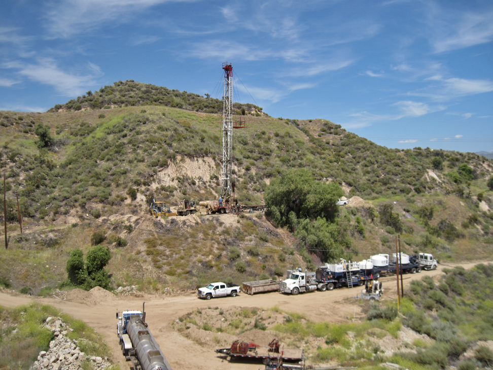
Dumke being abandoned. The rig is commonly called a workover rig. All the trucks there were used during the abandonment procedure. There is a cement truck on the far right with the two tanks. (5/9/2022)
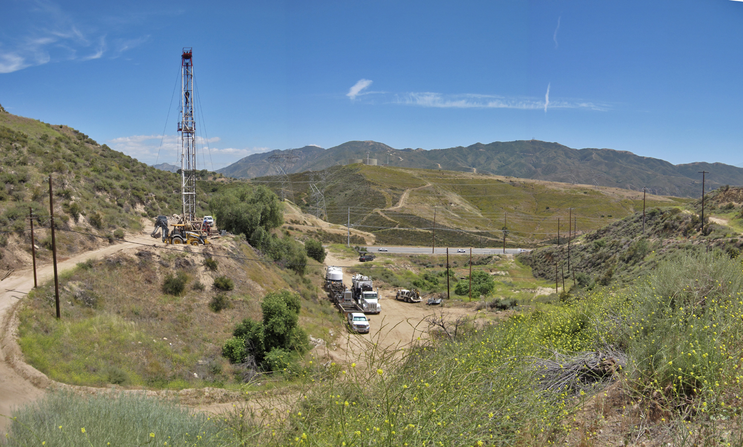
Different view with Sierra Highway in the distance. (5/9/2022)
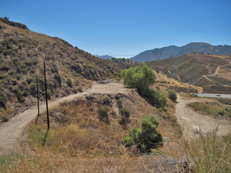
Abandonment completed. (6/19/2022)
FEHSEL 2 (037-11708)
Fehsel 2 was spudded by the Trical Oil Company on July 17, 1949, and completed on September 1, 1949, at a total depth of 1726 feet. Initial production was 1033 b/d and after 10 days it was 525 b/d. It last produced in March of 1950. It was converted to water waste well in 1954. It served that purpose off and on until the 1980's when it was deserted.
Here, the well has been marked for its planned abandonment. (6/19/2022)
Site starting to be cleaned up. Sierra Highway in background. (12/3/2022)
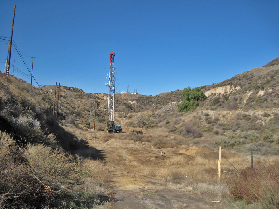
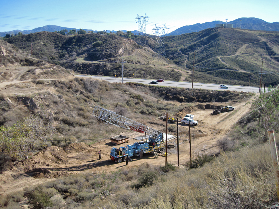
Workover rig over the well starting the abandonment process. Photo taken from Sierra Highway. (12/23/2022)
At the well head. (12/25/2022)
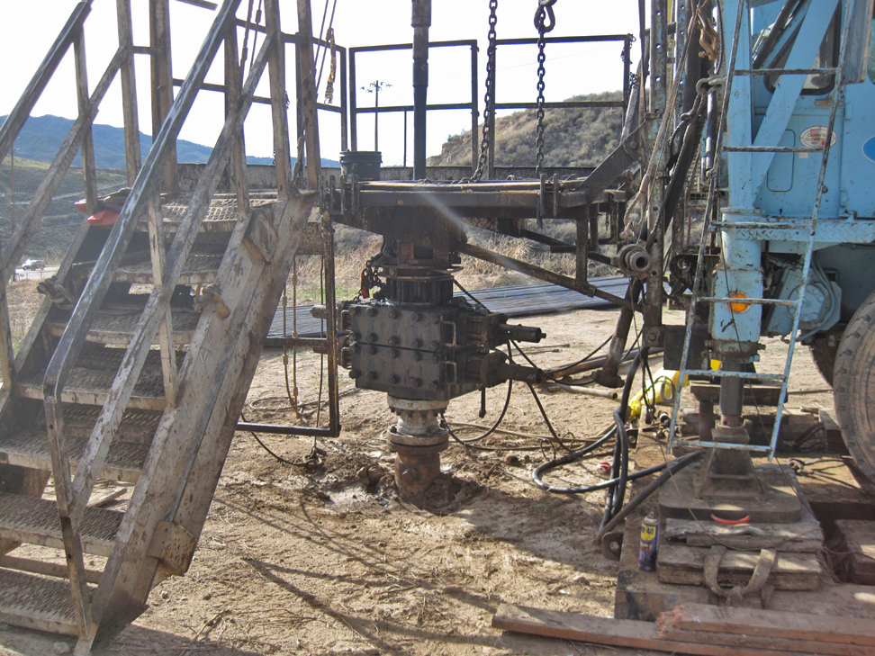
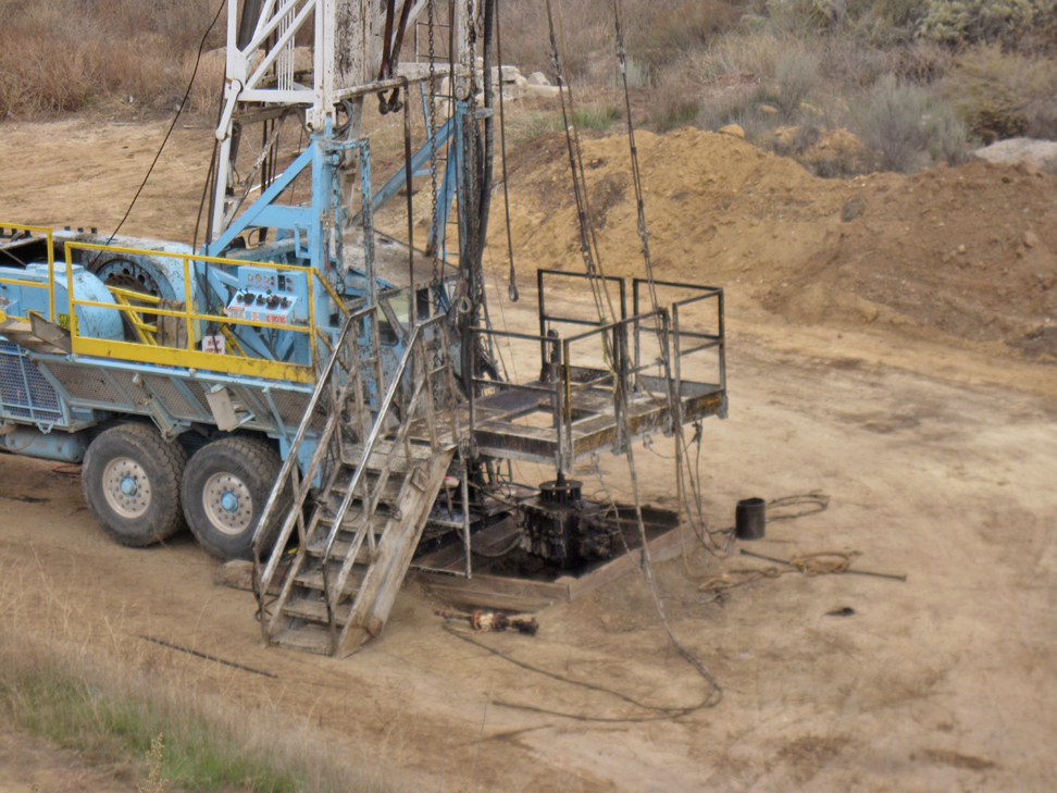
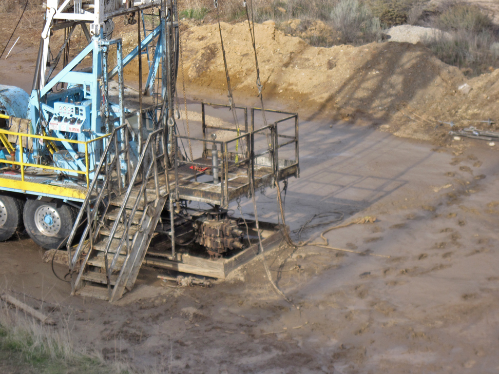
Looking at the BOPE attached to the well head. Blowout protection equipment is always required. Without it, the intense gas pressures underground could cause the well to blow, which would not be good for anyone in the area or for the rig. (12/25/2022)
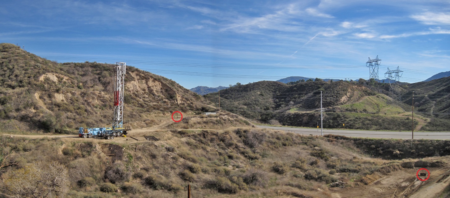
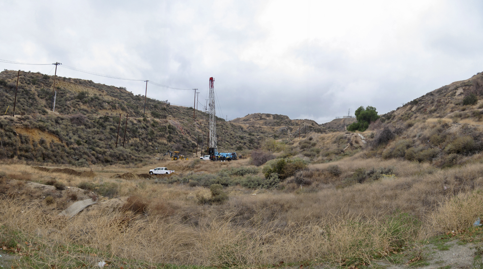
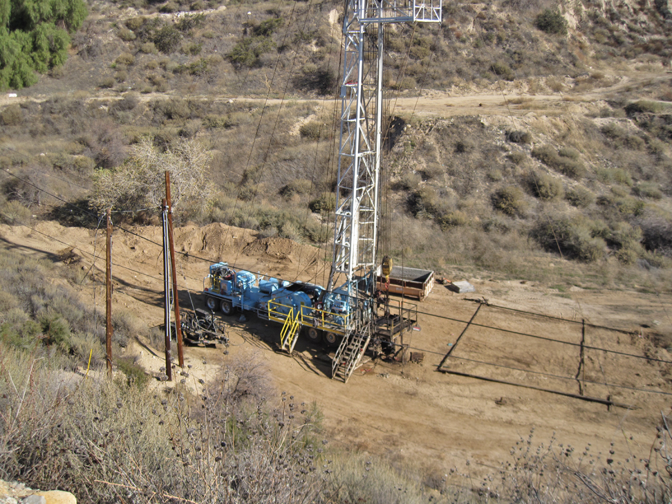
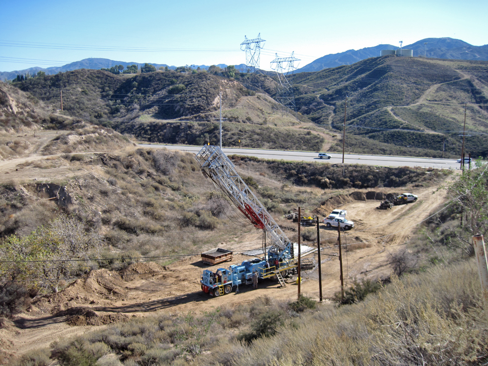
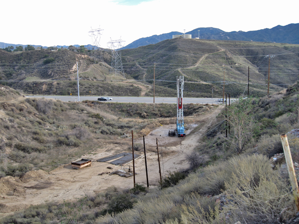
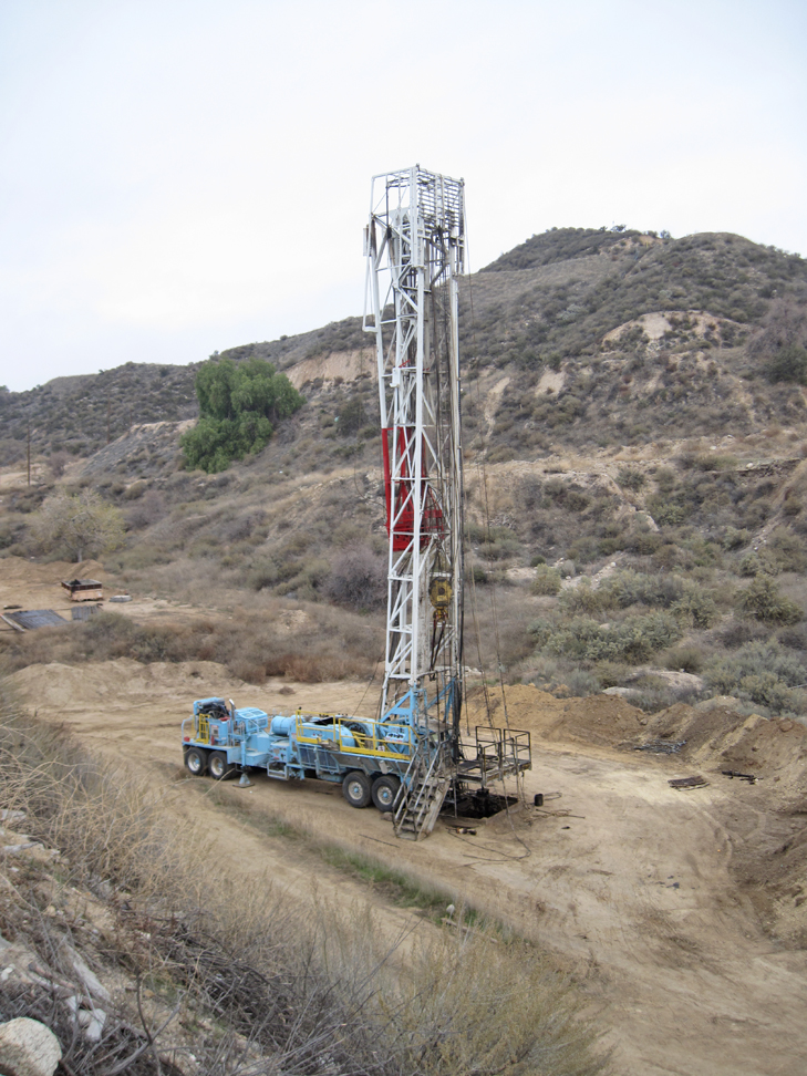
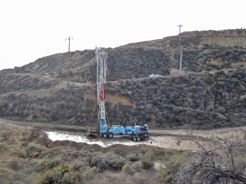
The rig from a distance. When not in use but still in place (like on a weekend or holiday), the top section of the derrick is usually folded down. Well Pleasant Community 1 is in the red circle above right and Sindell Community 1 is in the red circle on the far right. Sierra Highway is the road. (12/25/2022)
Cement work done and hole dug around casing. The casing at the wellhead will soon be cut off about five feet below ground level. (1/28/2023)
Another view closer up. (1/28/2023)
The casing has now been cut off below the level of the ground. The final step will be to weld on a steel plate with the well number. (2/2/2023)
Closer view. (2/2/2023)
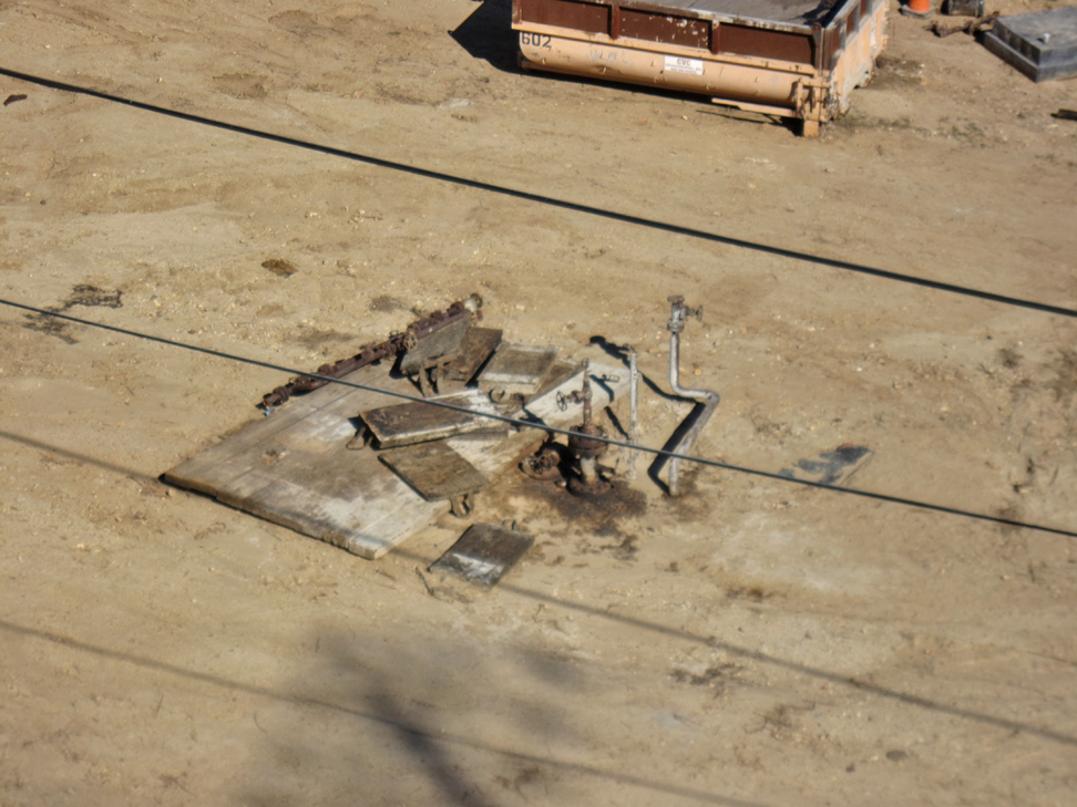
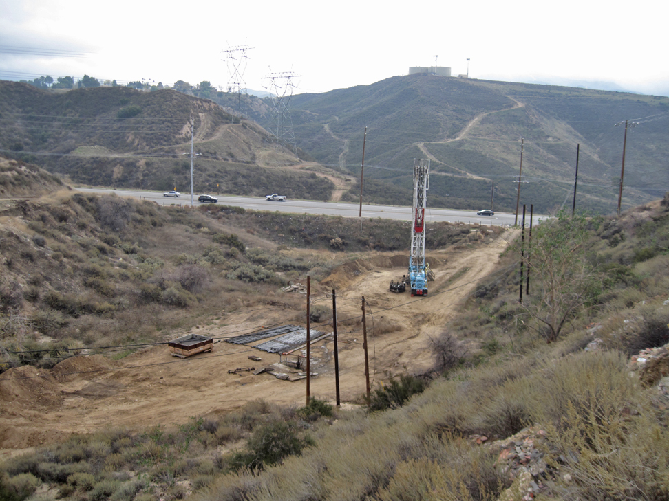
Done. Hole has been filled in and all hardware and pipes around the well removed. While this abandonment was going, on the road in the distance (Mad Road) was repaired to fill in the undercutting going on. Then it was resurfaced and K-Rails (the white concrete barriers) were added on the side facing the slope. The photo was taken in May, but the abandonment was completed in February. It just took me a while to get back here. (5/21/2023)
PLEASANT COMMUNITY 1 (037-00516)
Pleasant Community 1 was spudded on September 3, 1949 by the Rothschild Oil Company, and completed on September 12, 1949. The total depth was 1731 feet. This well never produced. It was converted to a waste water injection well in 1955. That was ended sometime in the 1980's.
Rig on site. (11/30/2022)
Another view. (11/30/2022)
Closeup of wellhead. Whatever work that the rig was doing is complete. Probably cleaning out the well bore was done. (12/3/2022)
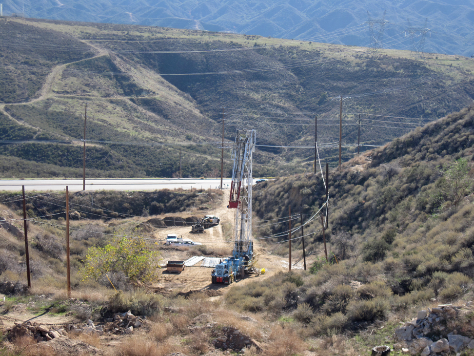
Rig is back at Pleasant Community. More work was evidently needed in the well bore. The well below Pleasant Community in the red circle is Fehsel 2. The well circled in the below right of the image is Fee 6. (12/21/2022)
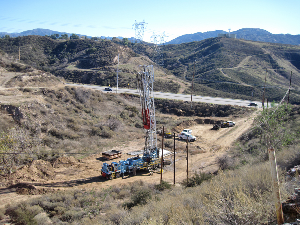
The rig was moved to Fehsel 2. Pleasant Community is in the foreground. (12/25/2022)
Here is the Pleasant Community wellhead again. There also used to be an oil tank at this site. Hardward for the tank is visible near the trash bin. It will eventually be removed during the site clean-up. (12/25/2022)
Finally, they are almost done. The cement work is completed and a hole has been dug in preparation of the casing being cut off about five feet below the surface. (1/28/2023)
The casing has been cutoff below the surface. There will be a steel plate with the well number welded somewhere on the casing, probably right on top. (2/2/2023)
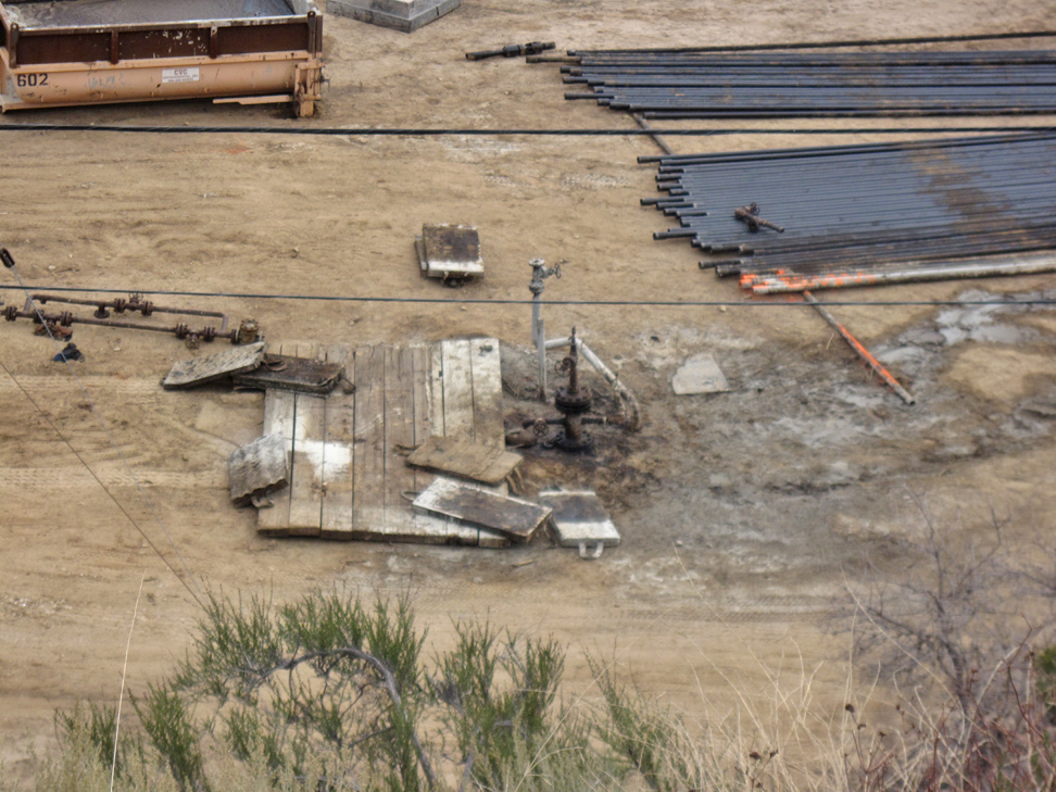
Abandonment completed. Site restored to a "natural" condition. (5/21/2023)
FEE 6 (037-13437)
Fee 6 was spudded August 20, 1949, by Tevis F. Morrow. The total depth was 1800 feet. On September 6, 1949, the initial production was 825 b/d. By February 13, 1950, production was down to 5 b/d. Records state that it last produced in April of 1951 and that was only 1 b/d. In the 1980's and 1990's, it was used as a waste water injection well.
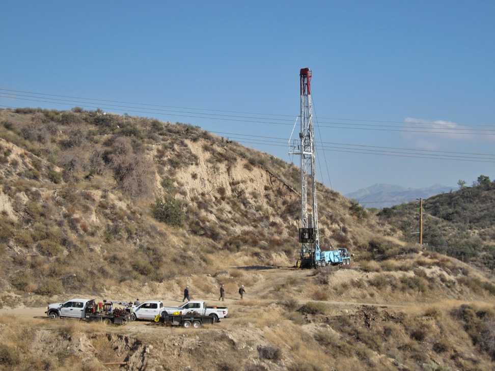
A workover rig at the Fee 6 well. (12/1/2022)
Another view on another day. The well Sindell Community 1 is right in front between the well and the photographer (me). (12/03/2022)
A view from further away looking at Sierra Highway in the distance. (12/03/2022)
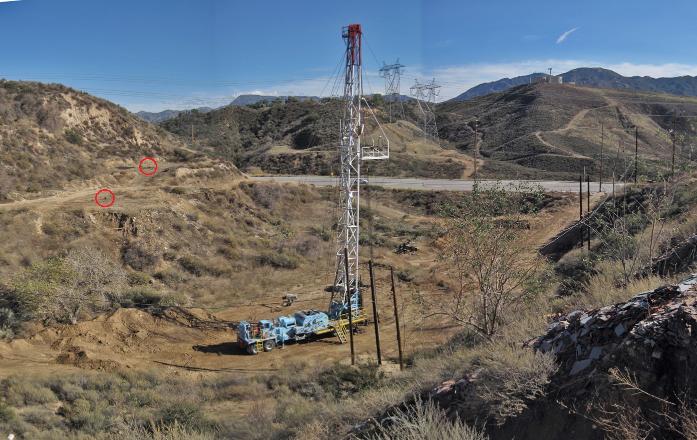
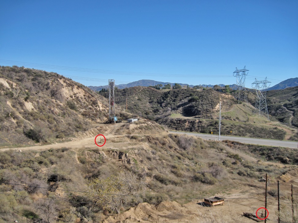
Still another view. Fehsel 1 in the left red circle and just above that is Pleasant Community 1. (12/03/2022)
Still working on the well. (12/7/2022)
Today they are done with using the workover rig. (12/9/2022)
The top of the derrick is folded over. (12/9/2022)
The rest of the derrick is beginning to fold down. (12/9/2022)
Folding. (12/9/2022)
More folding. (12/9/2022)
Almost there. (12/9/2022)
Done. The derrick is totally on the truck. (12/9/2022)
Whatever work was done by the rig is now complete. It probably cleaned out the well bore and removed much of the casing, which is now on the ground (12/10/2022)
The rig has been moved down to Sindell 1. (12/17/2022)
More work needs to be done on Fee 6. (12/21/2022)
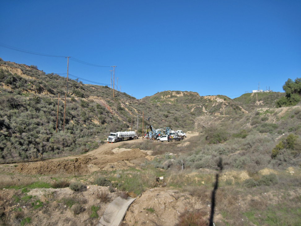
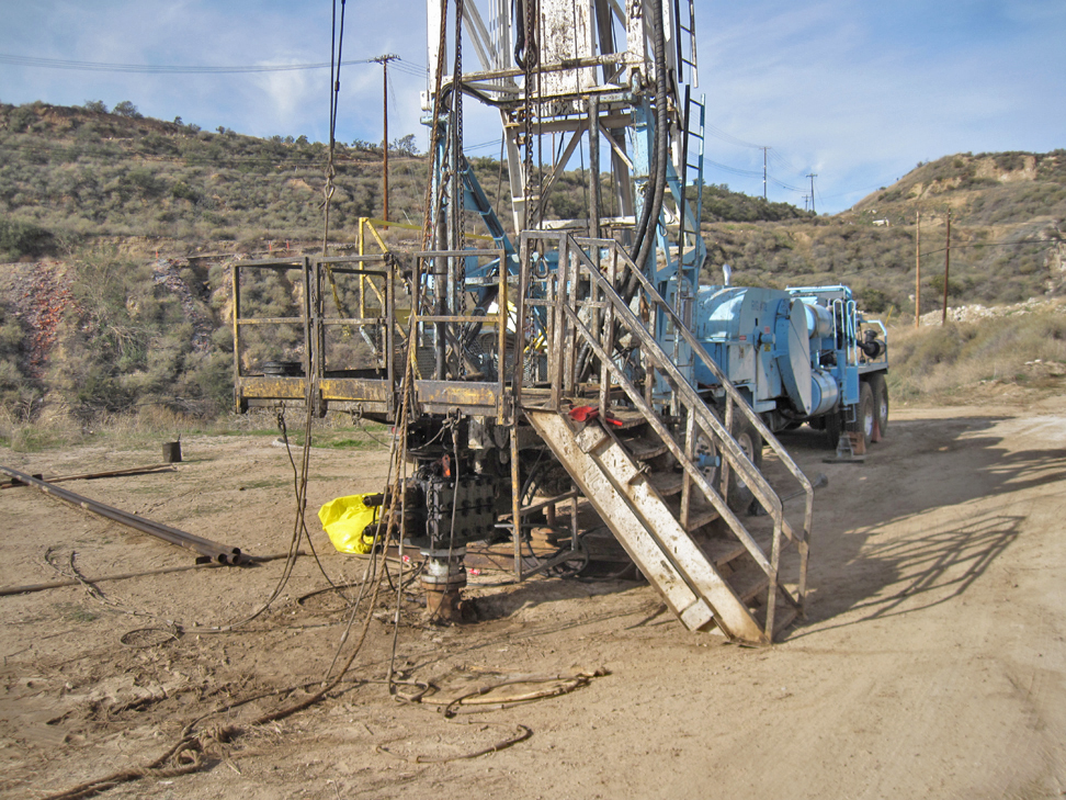
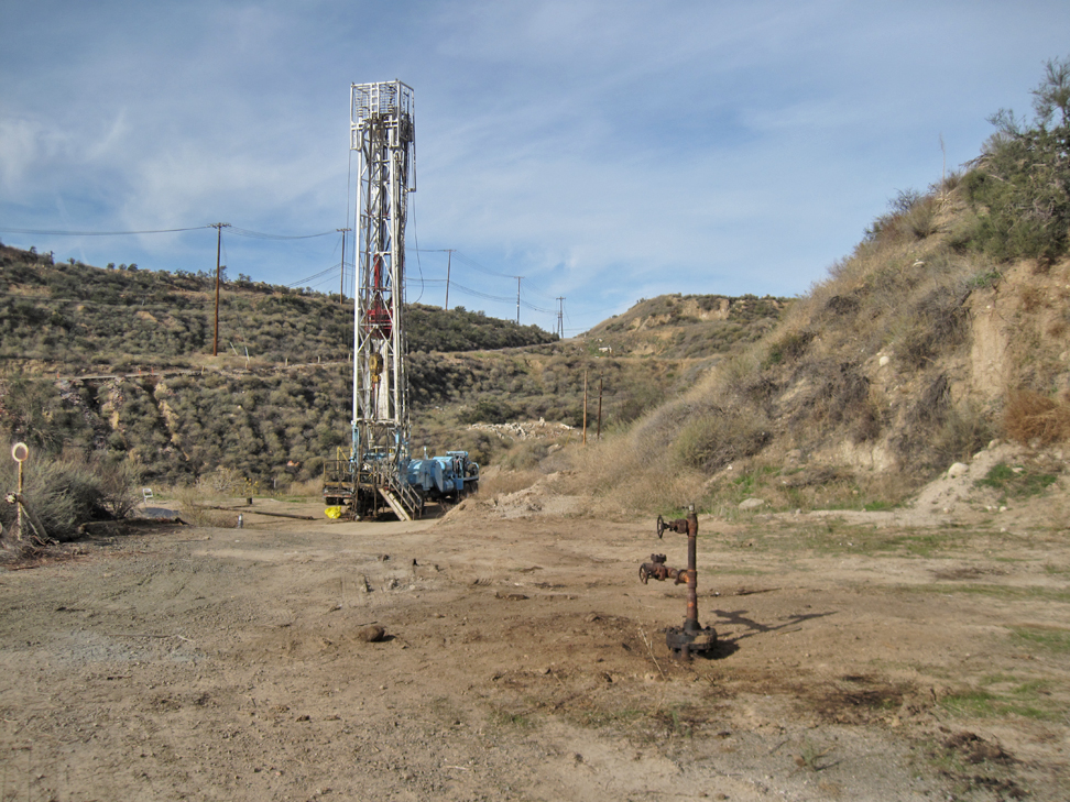
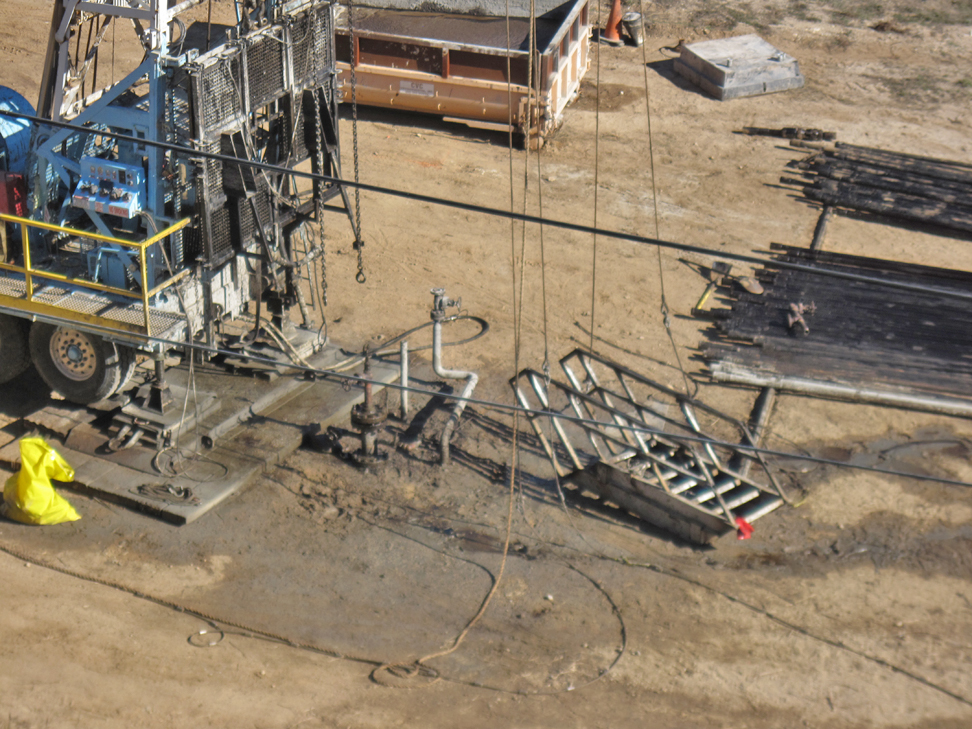
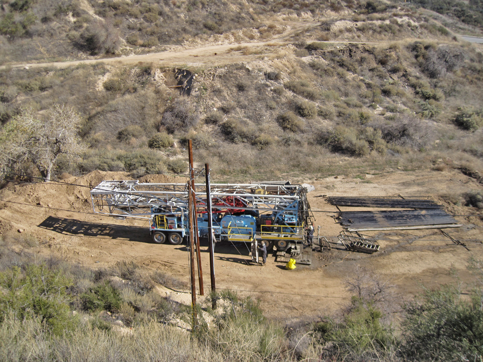
Now there is a CT (coiled tube) unit on site. A coiled tube unit can do many of the tasks that a regular workover rig can do, like the cement work. (1/24/2023)
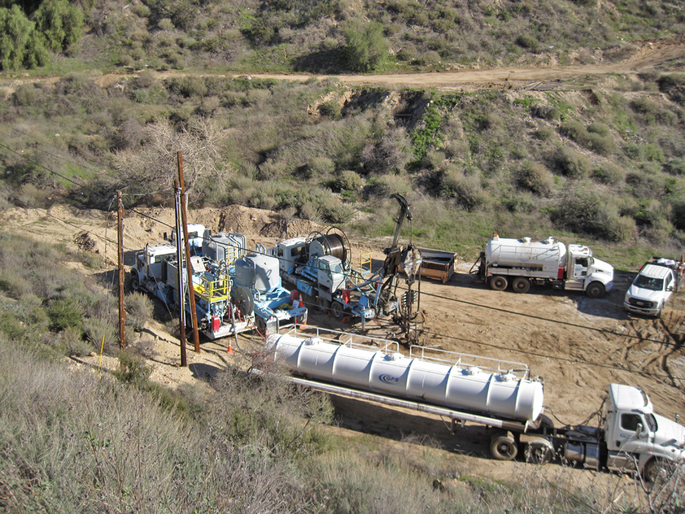
Here we have a closer view. The truck with the two vertical tanks is a cement truck. All the trucks have the company logo (with "GPS") marked on them. (1/24/2023)
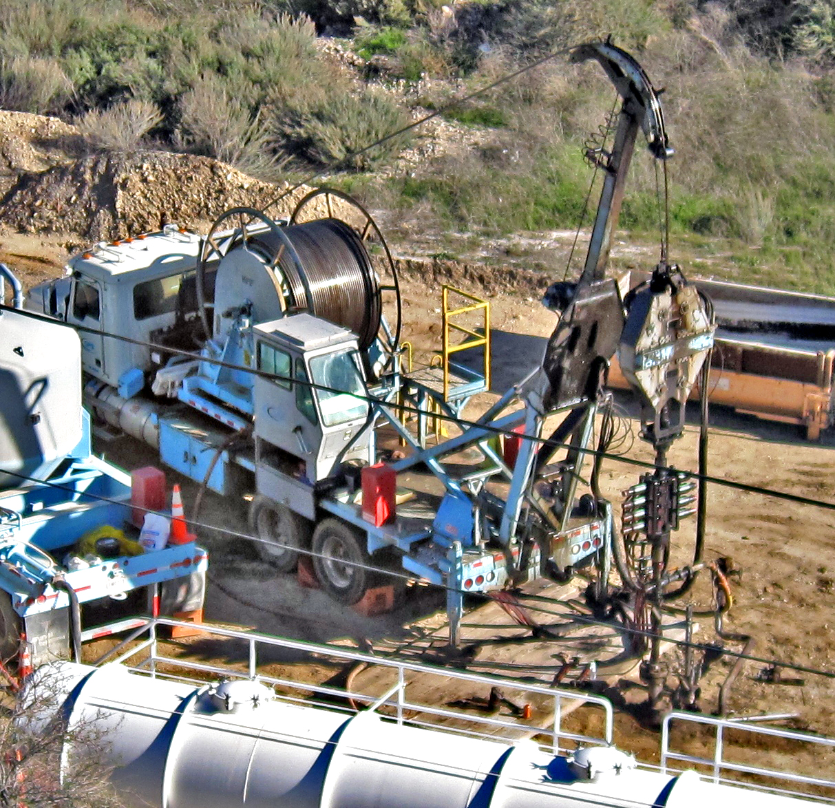
Here is the CT unit joined with the wellhead. (1/24/2023)
The well is now ready for the final steps. (1/28/2023)
Closer view. (1/28/2023)
Casing has now been cut off. The steel plate will soon be welded on. (2/2/2023)
A few months later (not that it took them that long - it just took me that long to get back here.) The site has been restored. (5/21/2023)
SINDELL COMMUNITY 1 (037-00517)
This well was spudded Rothschild Oil Company by the on August 4, 1949, and completed on August 7, 1949, at a total depth of 1617 feet. Initial production was 811 b/d. After 30 days it had dropped to 340 b/d. Production fell further so in February of 1950, the well was deepened to 1820 feet. After that it was producing 20 b/d. The last production was in July of 1950 at 12 b/d. In 1954, it was converted to a water waste injection well, which it remained as for many years.
2016 view of the well site. (4/13/2016)
Site cleaned up and now ready for the rig. (12/03/2022)
(12/07/2022)
Rig now on site. (12/10/2022)
Rig in position right over the wellhead. (12/10/2022)
Another view. (12/10/2022)
Interrupted by rain. (12/17/2022)
Closer view of wellhead with the BOPE unit attached. (12/17/2022)
Rig gone. Well has been cleaned out. (12/21/2022)
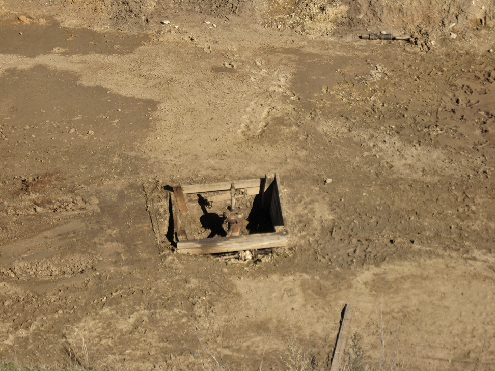
Pit dug around well. (1/28/2023)
Close up of pit. (1/28/2023)
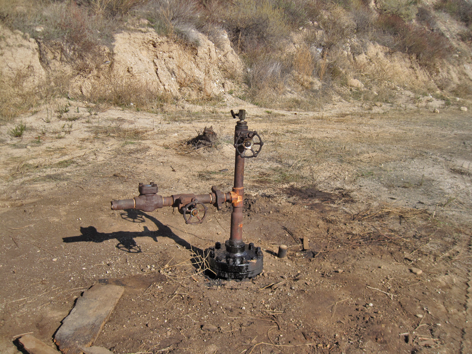
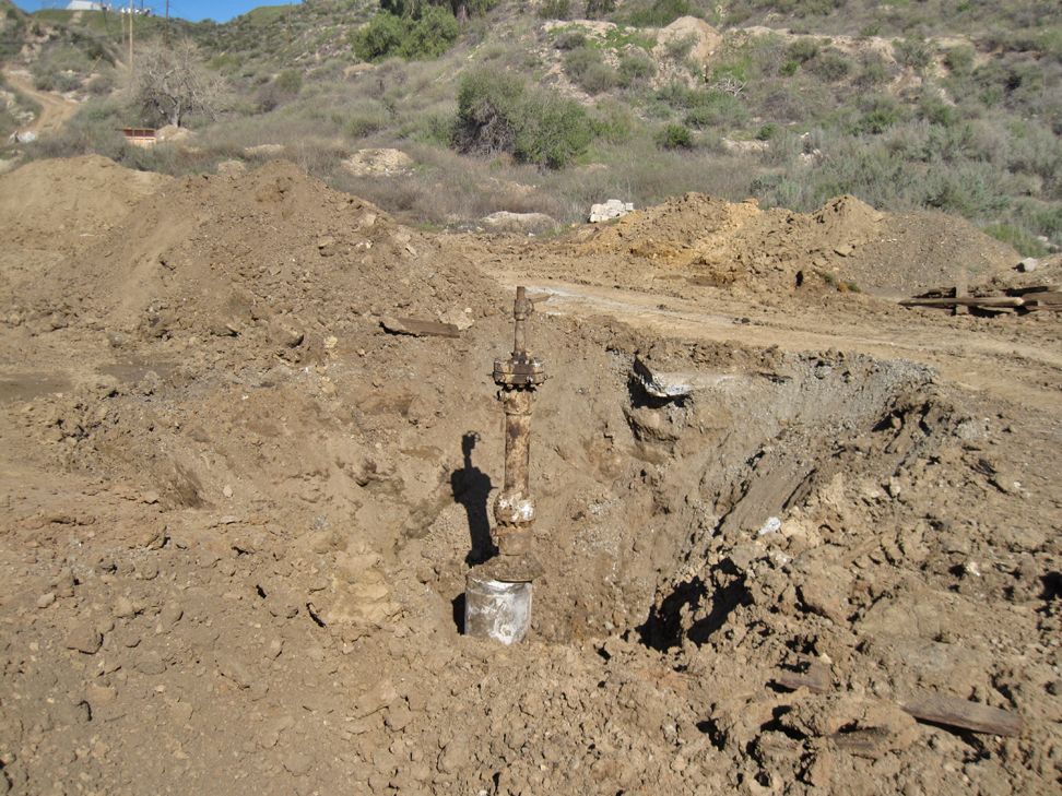
Casing cut off about five feet below ground level. (2/2/2023)
Closer view. Once the plate with the well number is welded on, the hole will be filled in. (2/2/2023)
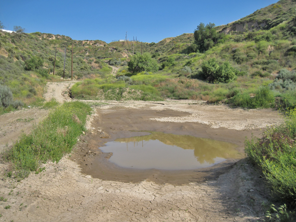
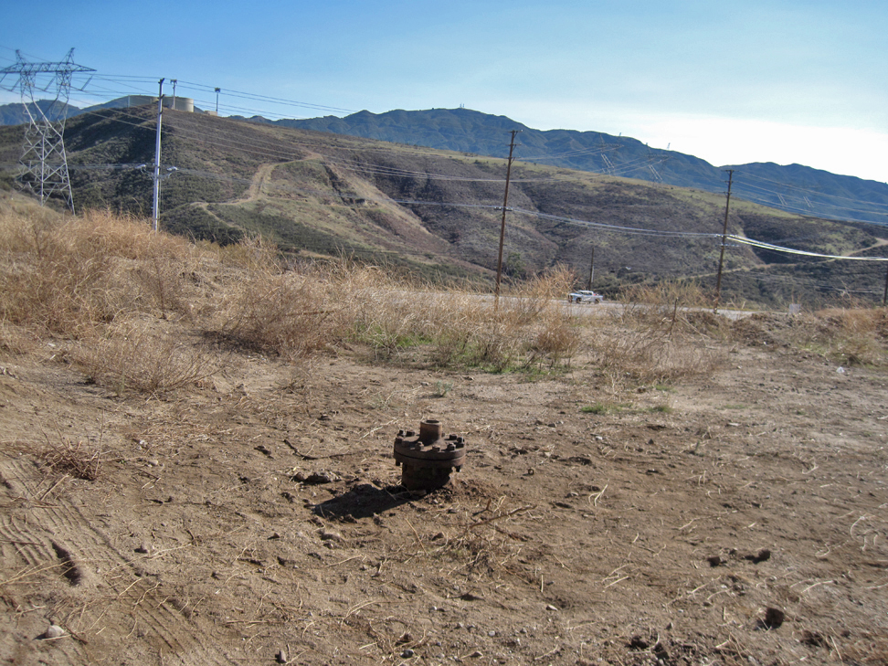
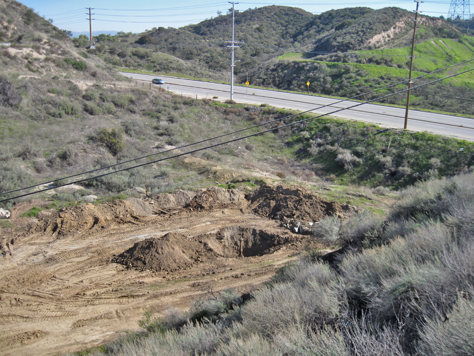
Hole was filled in a couple of months ago. Ground covered with water at this low spot where the well was. (5/21/2023)
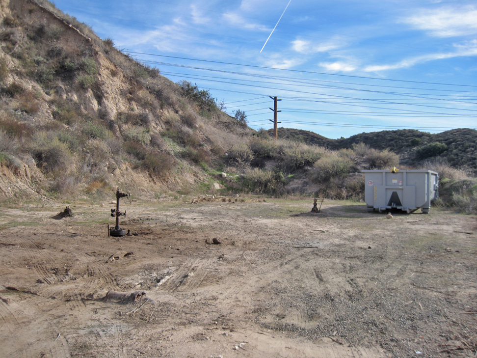
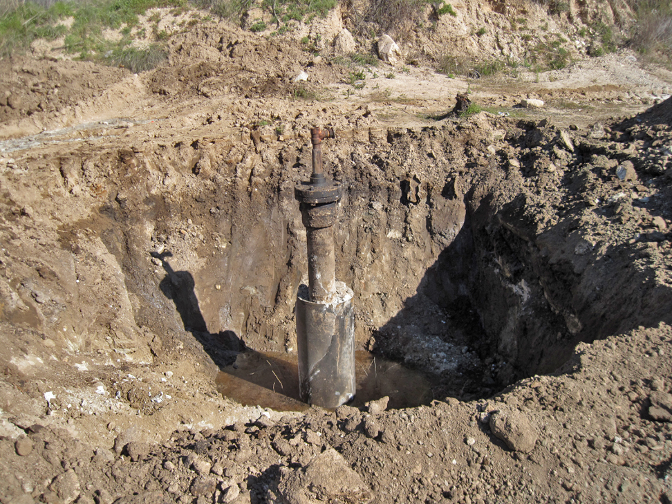
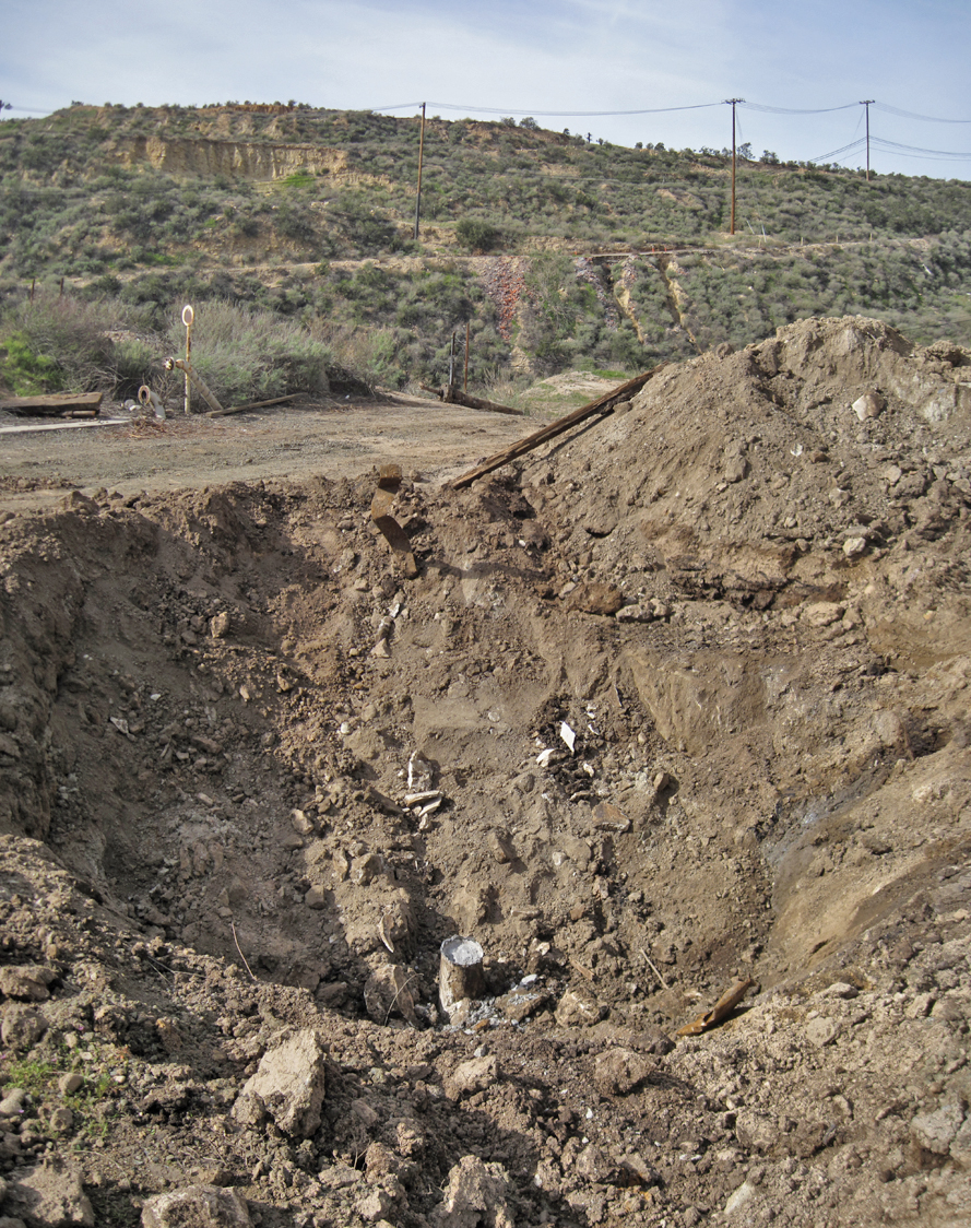
UNKNOWN WELLS
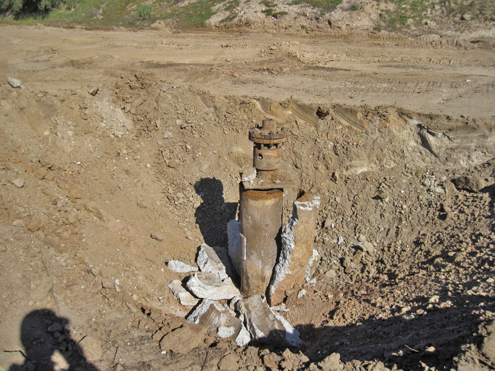
The top of the casing for these two previously plugged and abandoned wells were exposed and probably tested for integrity. They were then just buried after passing the test. I couldn't put a name to these wells because of the number of wells in the area.
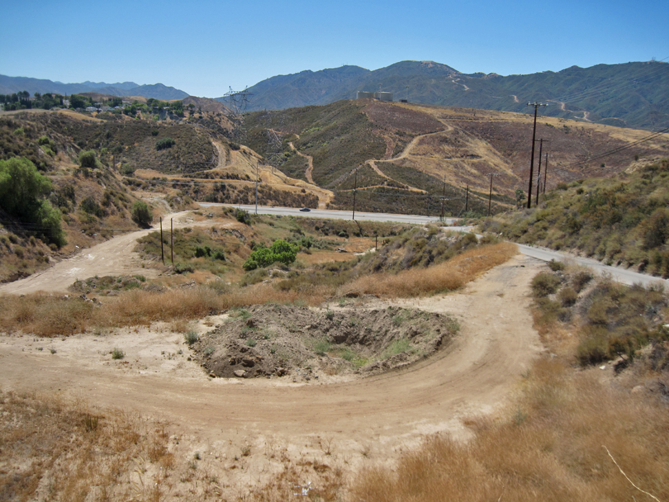
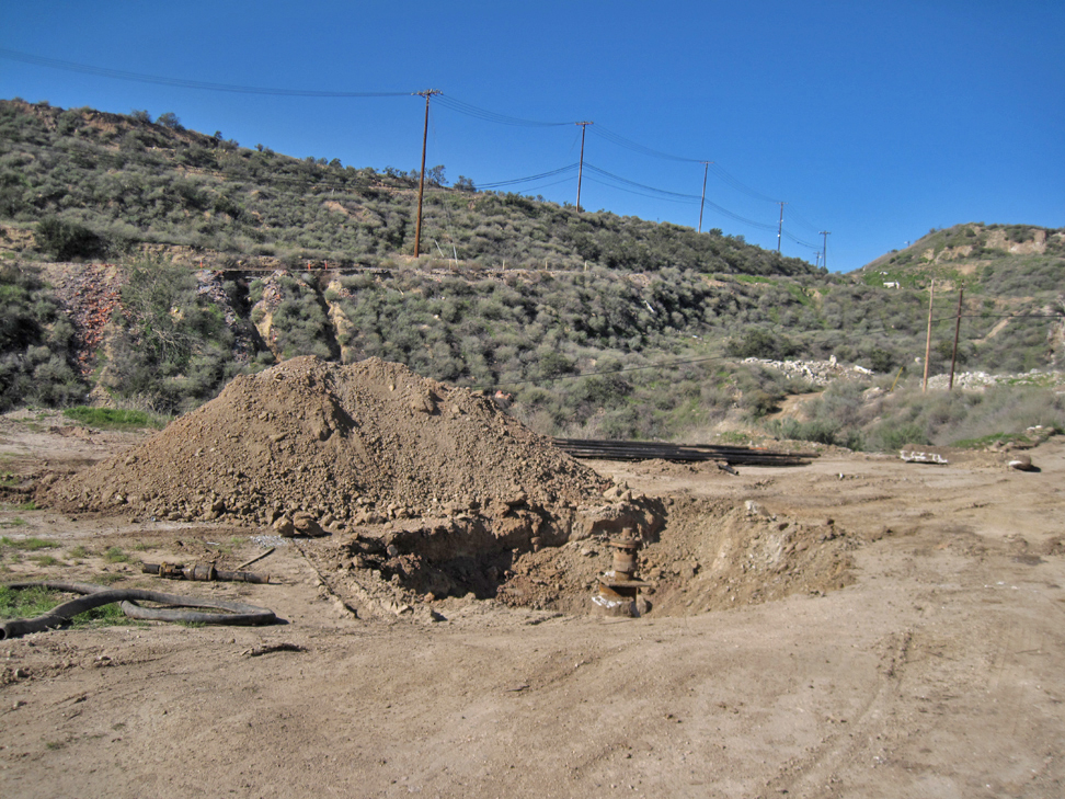
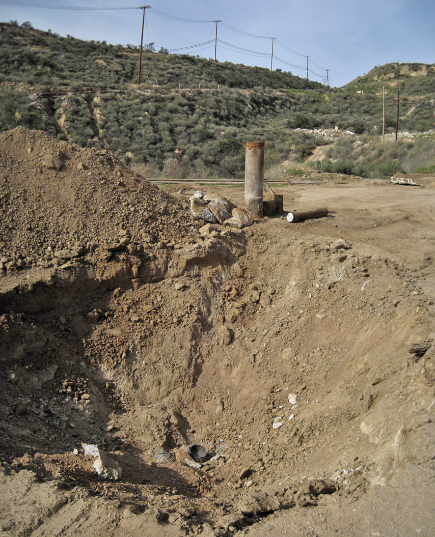
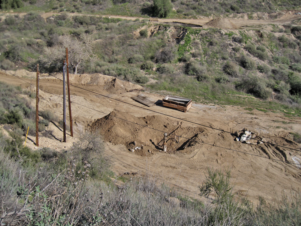
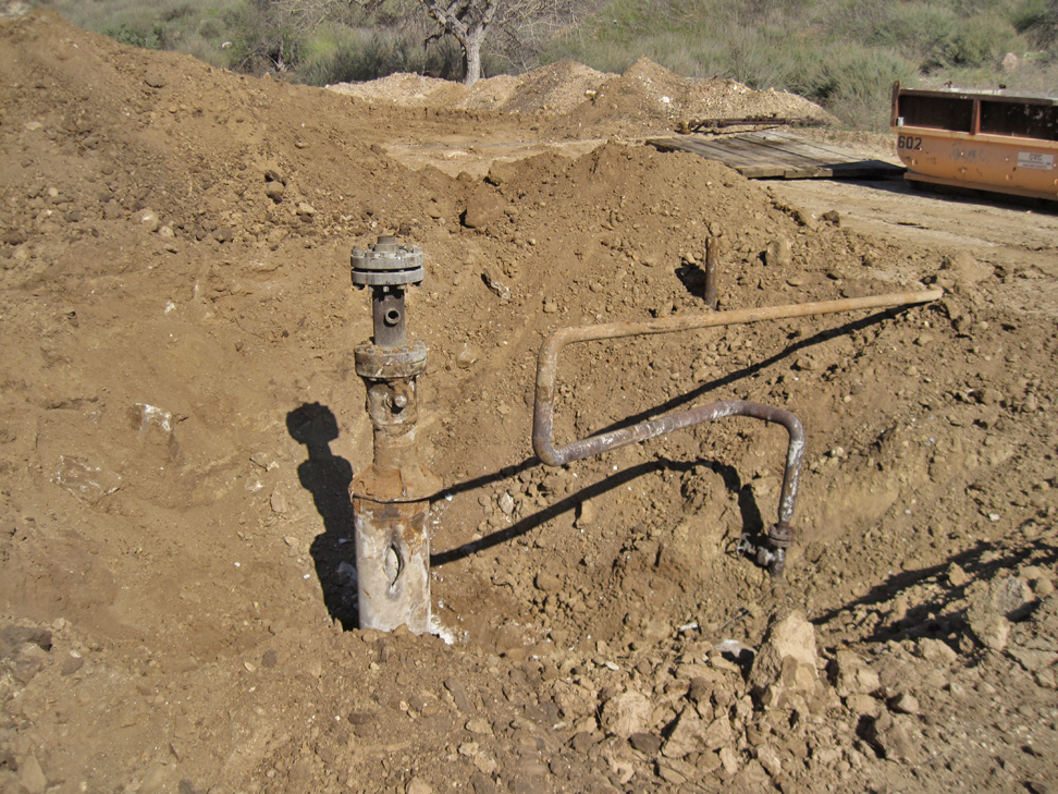
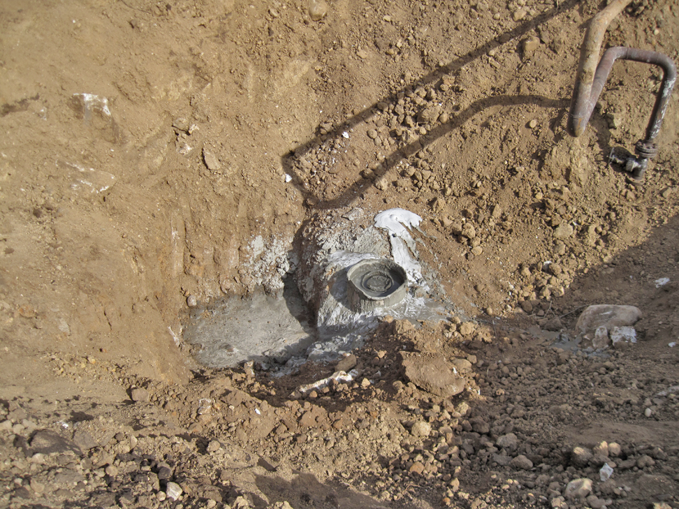
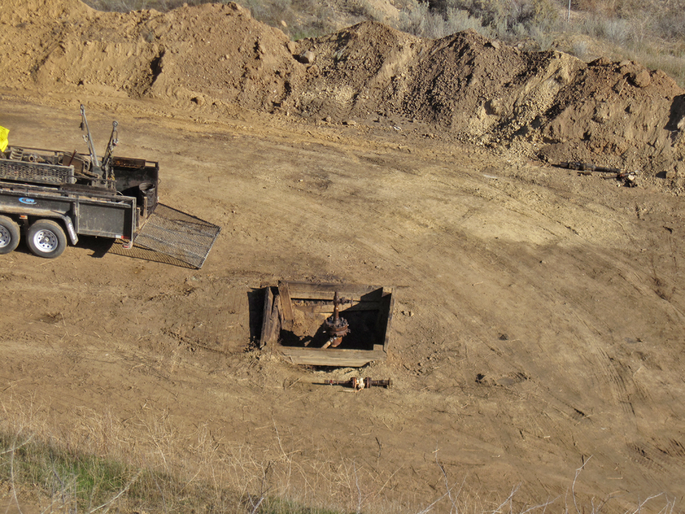
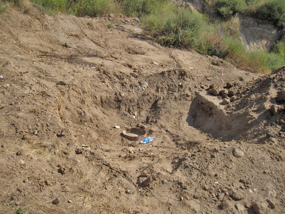
Hole in foreground exposes the top of a previously abandoned well. (6/19/2022)
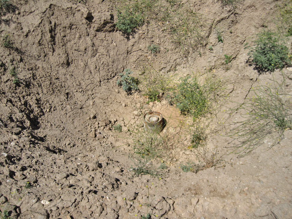
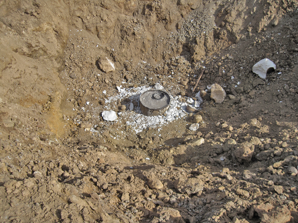
Here is the top that well. It has no identification plate. I don't know if there ever was one or there was one, and it was removed. If it was removed, they would have welded on a new plate. (6/19/2022)
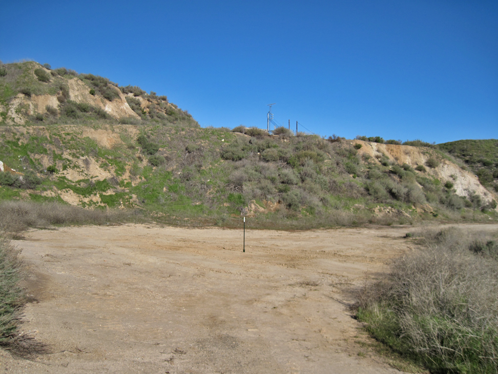
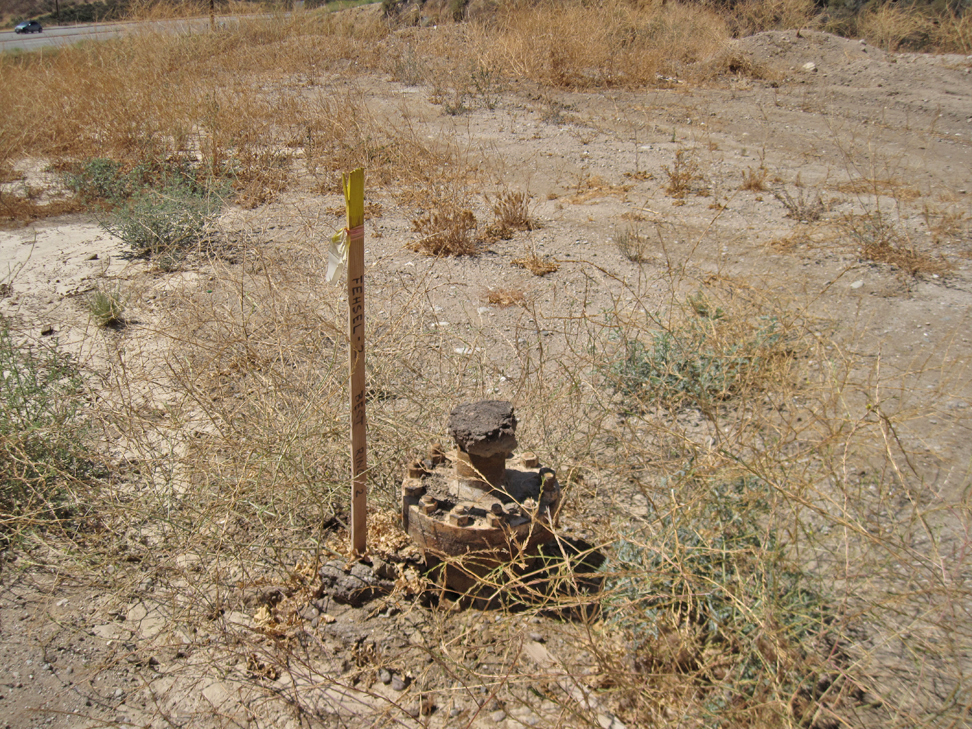
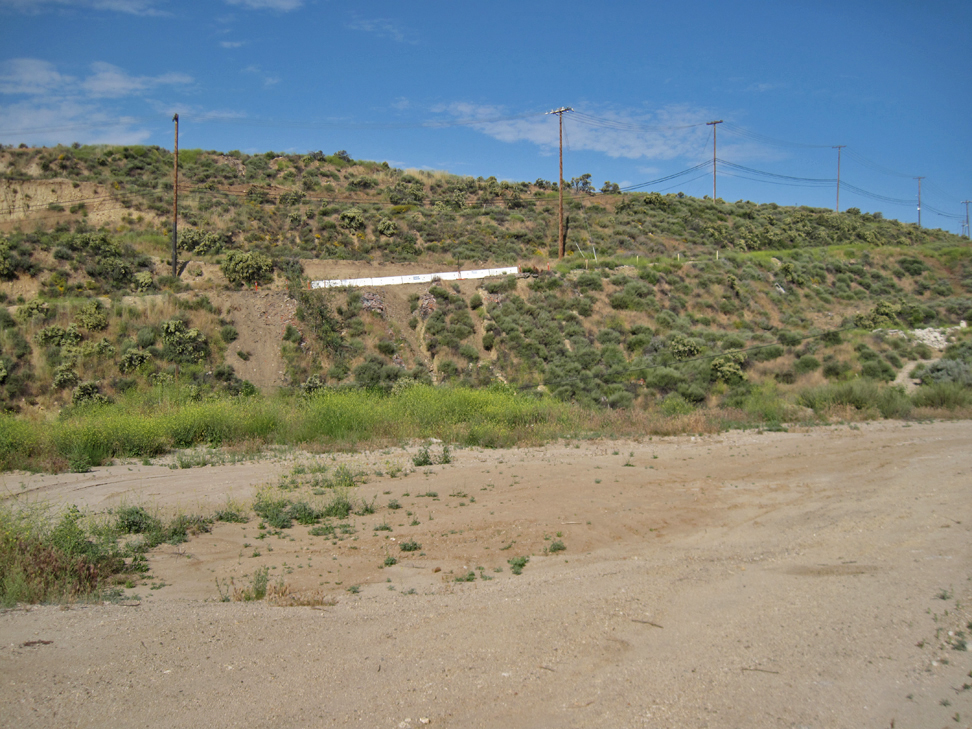
Here is that site after the hole was filled in. Well site marked with metal pole. (1/24/2023)
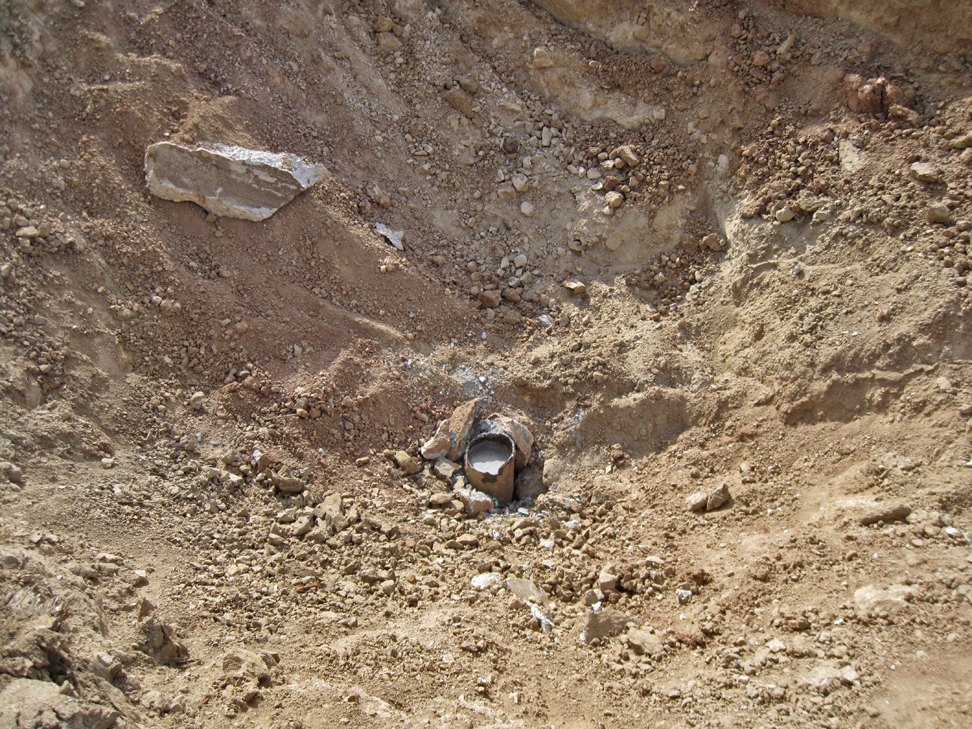
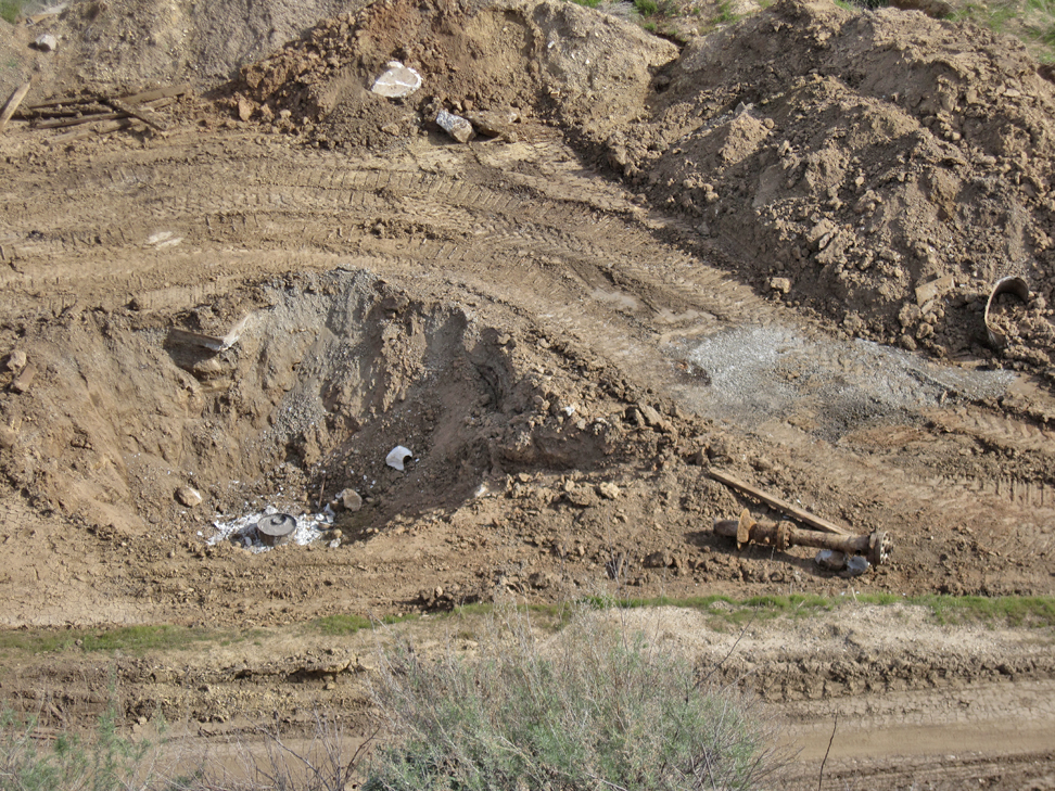
Below the last well was this second hole with a previously abandoned well. (5/21/2023)
Close-up of top of well. Again, no identification plate. (5/21/2023)
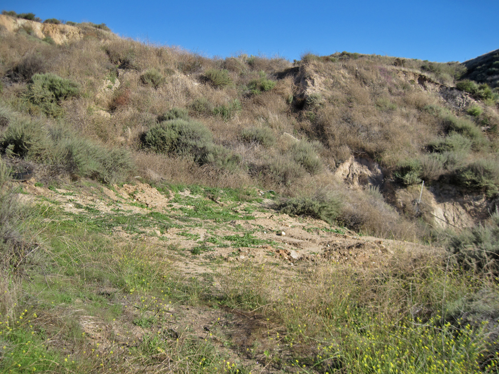
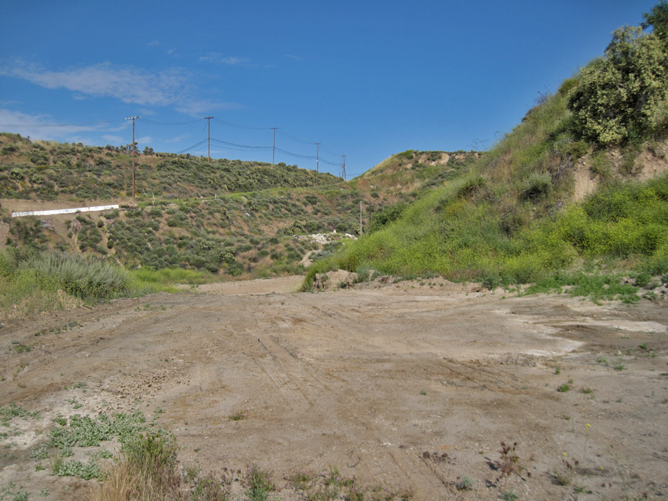
Hole filled in. (10/4/2023)