Placerita Canyon Photos
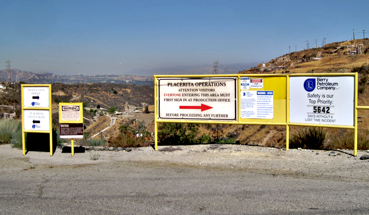
At the main entrance to the Placerita Oil Field looking west from Sierra Highway. Berry no longer owns this oil field. It was sold to Shadow Wolf Energy LLC. in 2021. (7/20/2017)
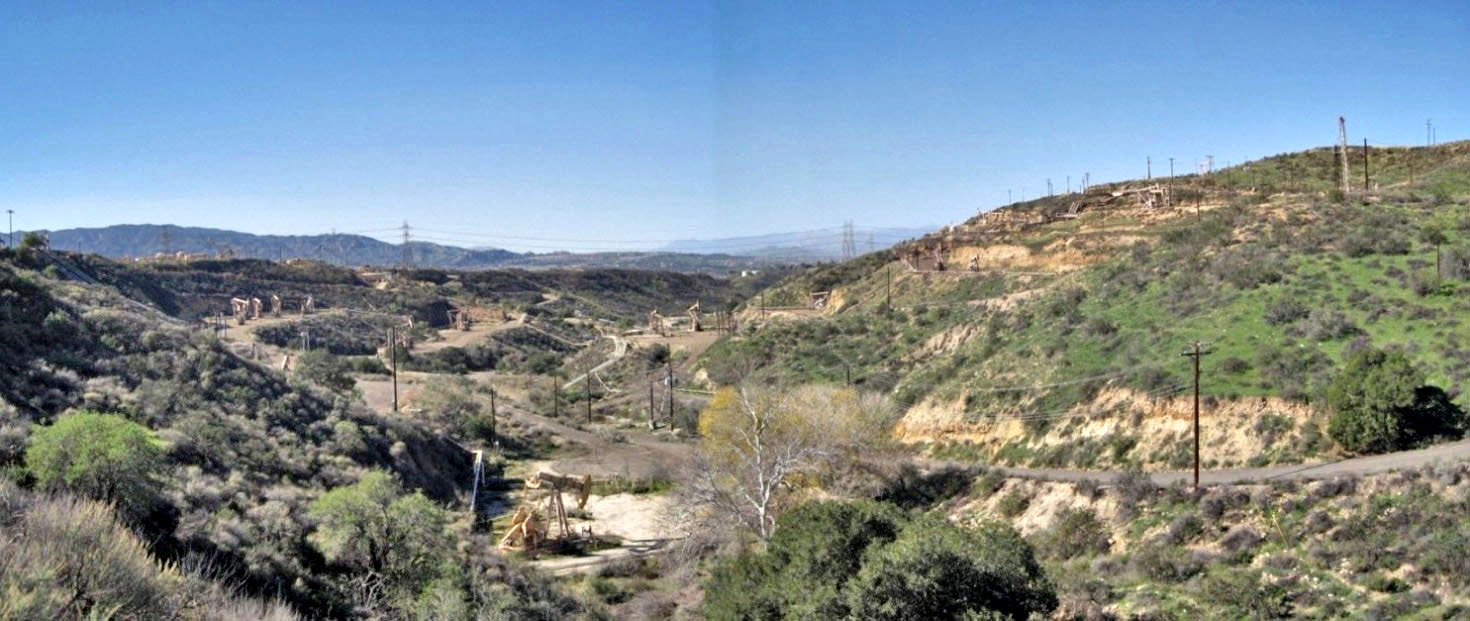
Looking west from Sierra Highway down Quigley Canyon, just north of Placerita Canyon. I'm standing next to the above signs. (1/24/2015)
Looking east down Quigley Canyon with Sierra Highway in the distance. The big pipe in the foreground is the Quigley Canyon siphon of the first Los Angeles Aqueduct. This siphon is 612 feet in length and 11 feet in diameter. The total cost was $9,629 and was completed sometime in the 12 months before June 30, 1912. (8/12/2015)
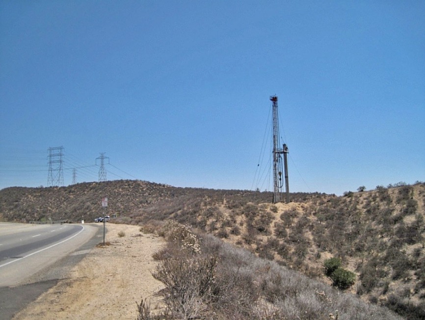
New well being drilled on the south side of Golden Valley Road. (7/6/2013)
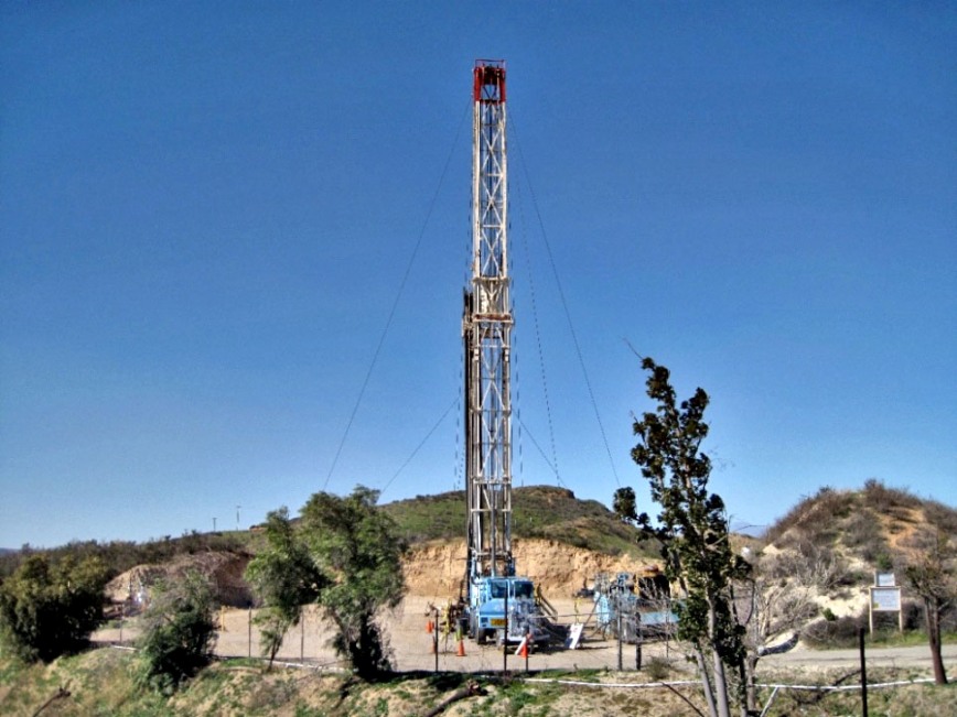
More drilling on the same well in 2015. (1/24/2015)
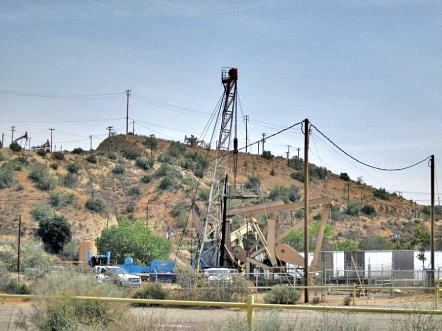
Workover rig at pump site in Placerita Canyon. (8/10/2015)
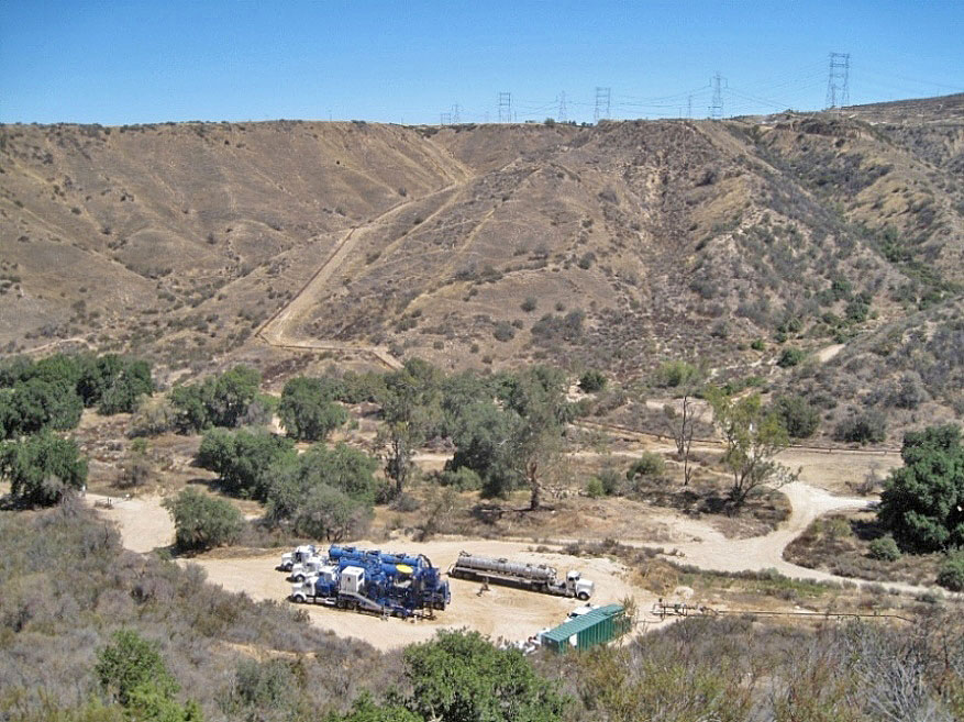
Workover rigs are not the only technology being used in the Placerita Field on the existings wells. Here is a CT (coiled tube) truck along with other trucks needed for the work that they are doing on a well site in Quigley Canyon just past the end of the canyon trail there. I do not know what they are actually doing. CT trucks were used in Elsmere Canyon to clean out the wells there that were capped in 2011. (6/12/2015)
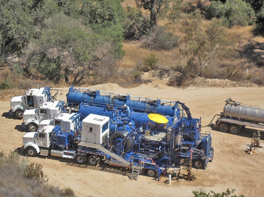
Closer view of the CT truck (in front) at work (8/12/2015)
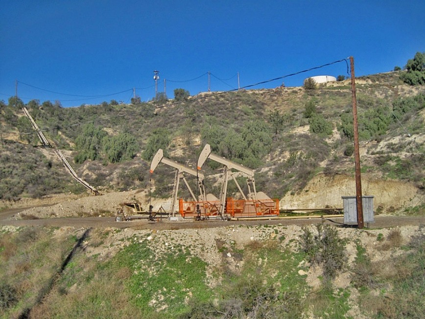
These two pumps on west side of Sierra Highway replaced a single pump. (1/23/2015)
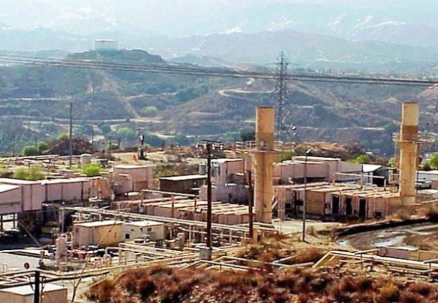
This is the cogeneration facility in Placerita Canyon (image from 2004 Berry Petroleum Company presentation). Cogeneration produces steam and electricity from natural gas. Berry sells the electricity to either Edison or PG&E. From the 2013 SEC form 10-K (filed 3/31/2014):
"The Company believes one of the primary methods to keep steam costs low is through the ownership and efficient operation of three cogeneration facilities located on its properties. These cogeneration facilities include a 38 megawatt (“MW”) facility and an 18 MW facility located in the Midway-Sunset Field and a 42 MW facility located in the Placerita Field. Cogeneration, also called combined heat and power, extracts energy from the exhaust of a turbine to produce steam and increases the efficiency of the combined process consuming less fuel."
This flat area east of the Nature Center was part of the New Century Oil Company claim and contained at least one, and maybe more, wells. Placerita Canyon Road in the distance. (5/20/2012)
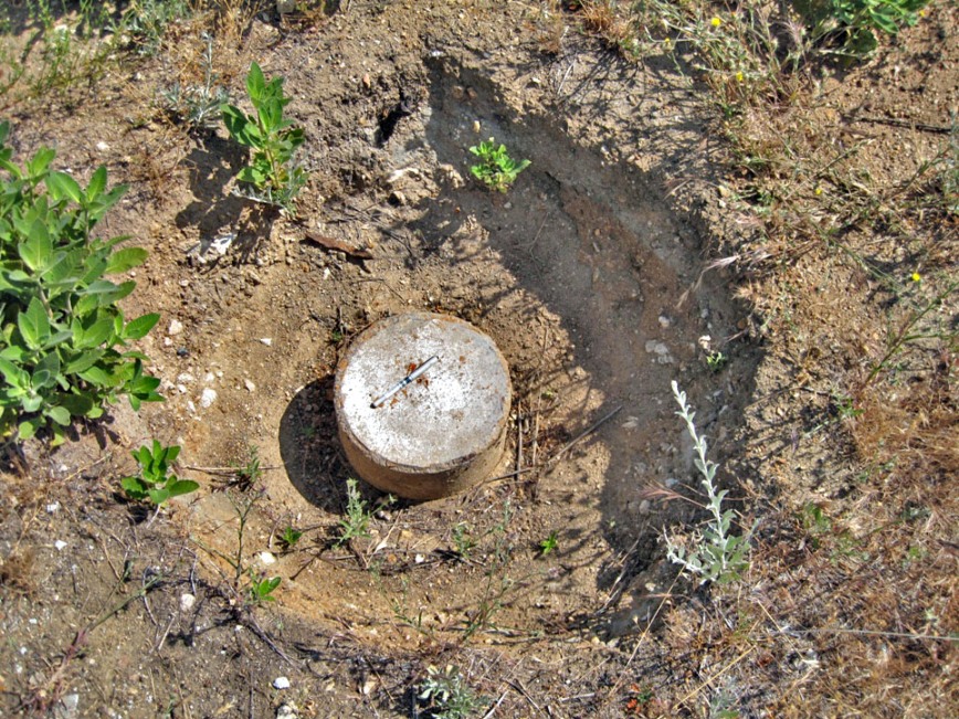
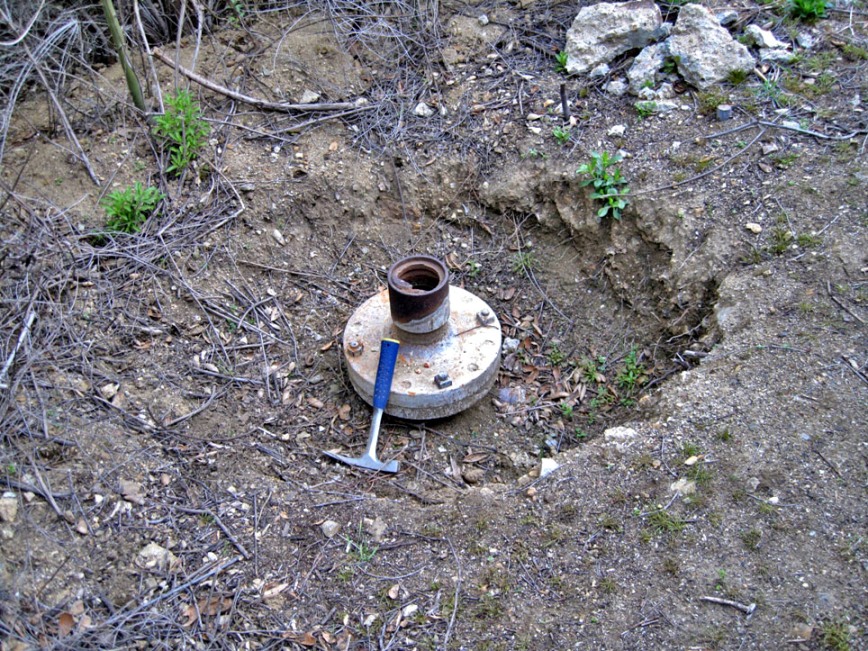
Here is one of the wells. It was exposed by the landowner (this is on private property). It is probably Puccio-Doshay 1 (037-05782), spudded on 11/14/1951 and completed on 5/5/1951 at a total depth of 1200 feet. No commercial quantities of oil or gas were found. Well records state that it was "capped with a welded steel plate level with the ground." That description matches this well. (6/2/2012)
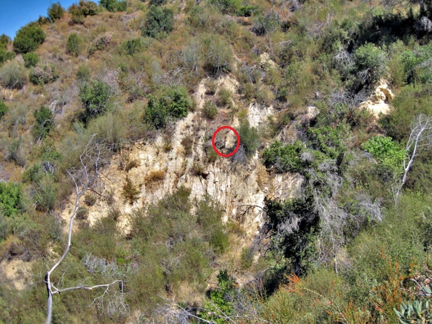
Old wellhead high up a cliff above the Canyon Trail. It was never capped. This is probably a Freeman & Nelson White Oil Company well. Landslides have removed the well pad and exposed the pipe. (7/17/2012)
From the previous wellhead, looking down at the trail with Placerita Canyon Road in the distance. (3/9/2013)
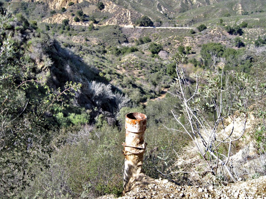
This well was also exposed by the landowner and is also on the old Freeman & Nelson White Oil Company claim. It is probably Willhoit 1 (037-06253), spudded on 2/19/1951 and completed on 5/5/1951 at a total depth of 1173 feet. No commercial quantites of oil or gas were found. (3/9/2013)
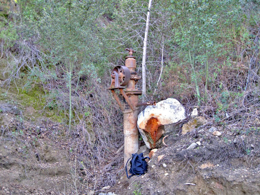
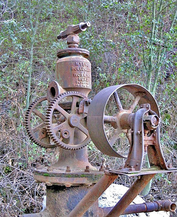
Another old well on the Freeman & Nelson White Oil Company claim. On top is a Myers Bulldozer Working Head water pump. The question is whether the pump was used to extract water or crude oil. Many wells became flooded with water and were used as water wells (for example, see the below Townsend-Allen 1 well). However, the white oil from this area was famous for being pure, kerosene-like. And the pump was advertised that it could also be used for oil (see below). The Los Angeles & Kern Oil Mining Company leased the Freeman & Nelson White claim in 1912. They did drill one well. There is a good chance that they used the water from this well for their boiler, but it is also possible that they tried to extract the white oil. Either way, they failed. No well in the white oil district in Placerita Canyon was commercially successful. (3/9/2013)
Closer view showing an April 30, 1901, patent date on the air chamber. Here is a PDF of the patent. (3/9/2013)
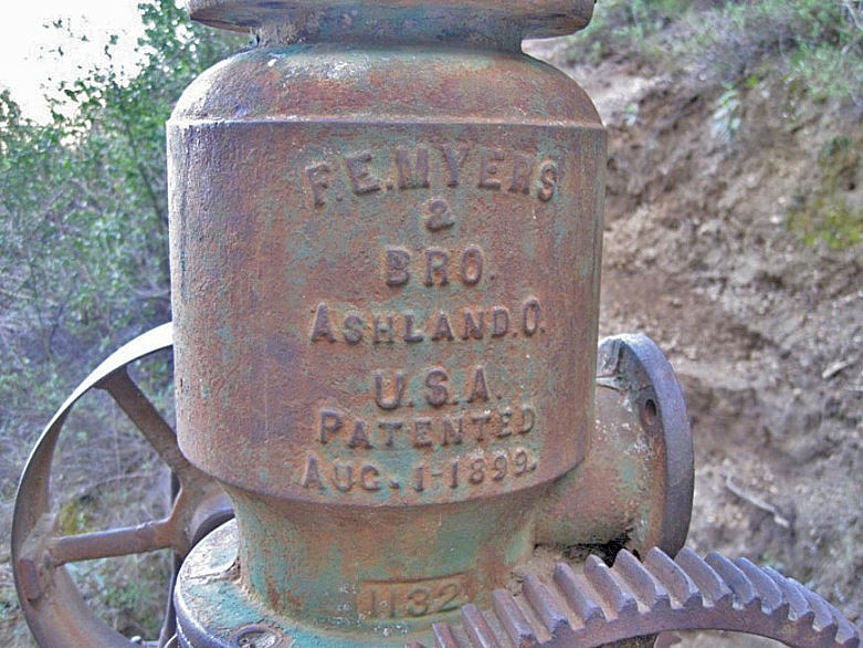
Oddly, on the back of the air chamber there is an August 1, 1899, patent. Maybe that is suppose to be the date the patent was applied for. (3/9/2013)
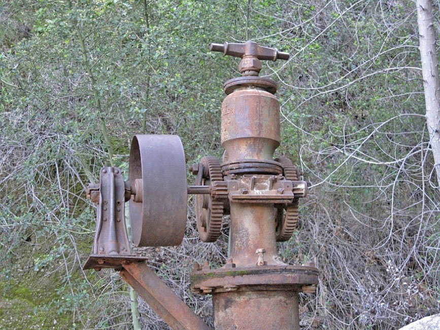
Another close up. (3/9/2013)
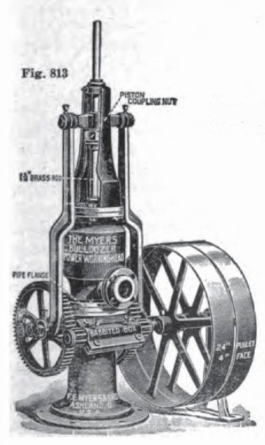
Here is how the complete pump looks like. Part of ad from Gas Power magazine of January 1911 (p. 98). Obviously, there are some missing parts on the pump we see today. In particular, the two pitmen are missing (see patent). The pitmen connect the two geared wheels with the connecting crosshead (the horizontal bar on near the top). As the geared wheels turn, the pitmen go up and down pushing and pulling the crosshead up and down. The piston rod is connected to the middle of the crosshead and powers the pump.
Although this is a water pump, it could also pump oil with a change of parts. From an old Myers catalog "...can be furnished for handling crude oil, kerosene or gasoline by fitting it with brass valves and canvas plungers."
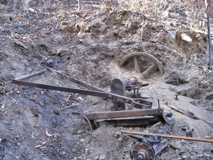
These artifacts were exposed by the Sand Fire of July 2016 and found by Ron Kraus. There is part of a partially buried pump jack and also what appears to be the base of a small vehical (and other stuff). (11/3/2016)
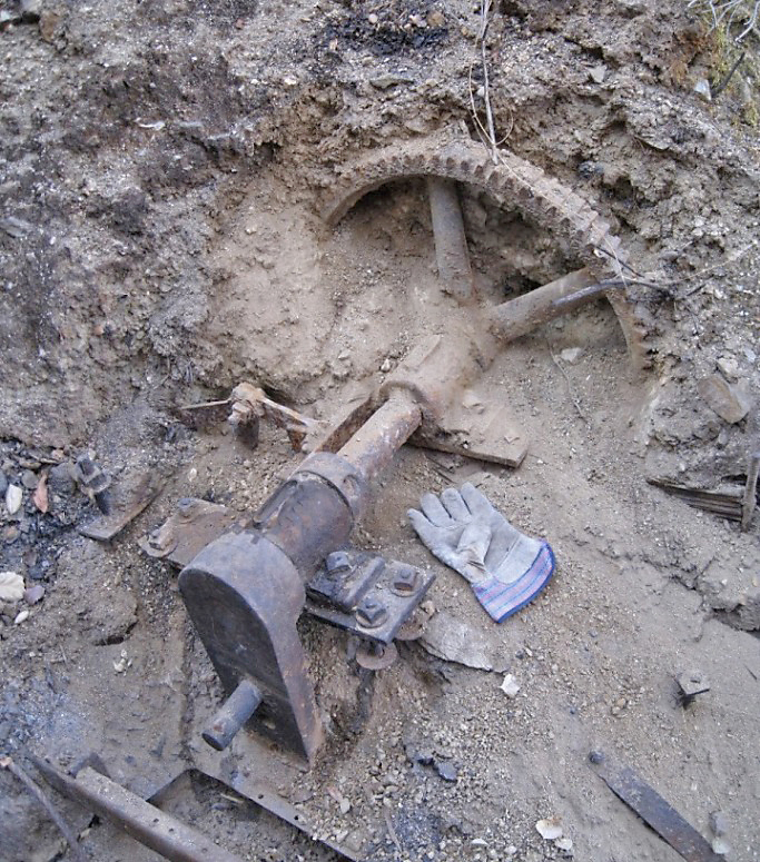
Here is the pump jack part. (11/3/2016)
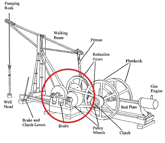
This is a diagram of a pump jack with the circle around the part that Ron found.
This is well Townsend-Allen 1 (037-20985). Charles C. Townsend started drilling on January 14, 1970, and stopped on July 23, 1970, when the tools became stuck. The total depth was 1601 feet. The tools could not be fished out so the hole had to be abandoned. The well was converted to a water well per the request of the land owner, Milton A. Allen, so it was never capped. Another well (Tommy Walker 1) was drilled about 20 feet to the west of this one. It was dry. (7/13/2012)
Here is an abandoned portable workover rig very near the Townsend-Allen 1 well. It is unknown why Charles Townsend abandoned it. (2/16/2013)
Townsend-Allen 1 after the Sand Fire of July 2016. (9/10/2016)
Abandoned rig with Townsend-Allen 1 in the green area on the right after the Sand Fire. (9/10/2016)
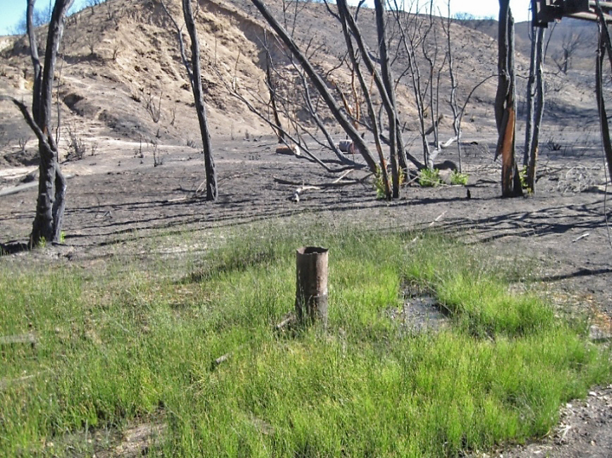
After the Sand Fire of July 2016, this well was found by Ron Kraus. It matches the location of G.G.H.O. 1 (037-22312), spudded on August 18, 1981. No other known wells were drilled here except that one. No oil was found after drilling to a total depth of 1030 feet. It was abandoned in 1982 by plugging with cement from 150 - 5 feet. This exposed pipe is not mentioned in the DOGGR records. The records say that the "site has been restored to original condition except for wooden collar frame," which was filled in. Was the pipe added later? It's hard to tell whether the damp area is coming from an underground well leak or is just natural ground water. (photo 9/10/2016)
Here's how it looks on 4/29/2018, almost hidden by the new plant growth.
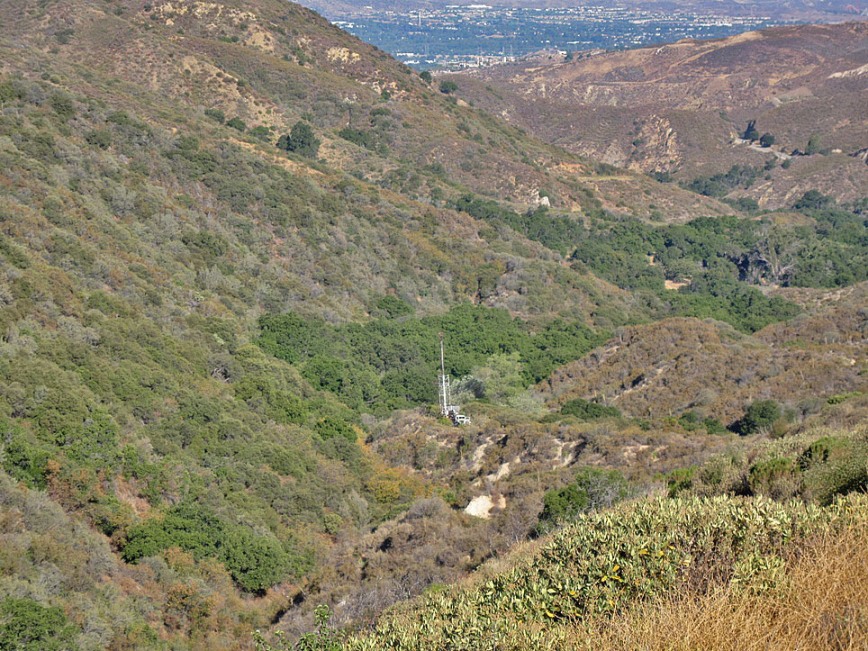
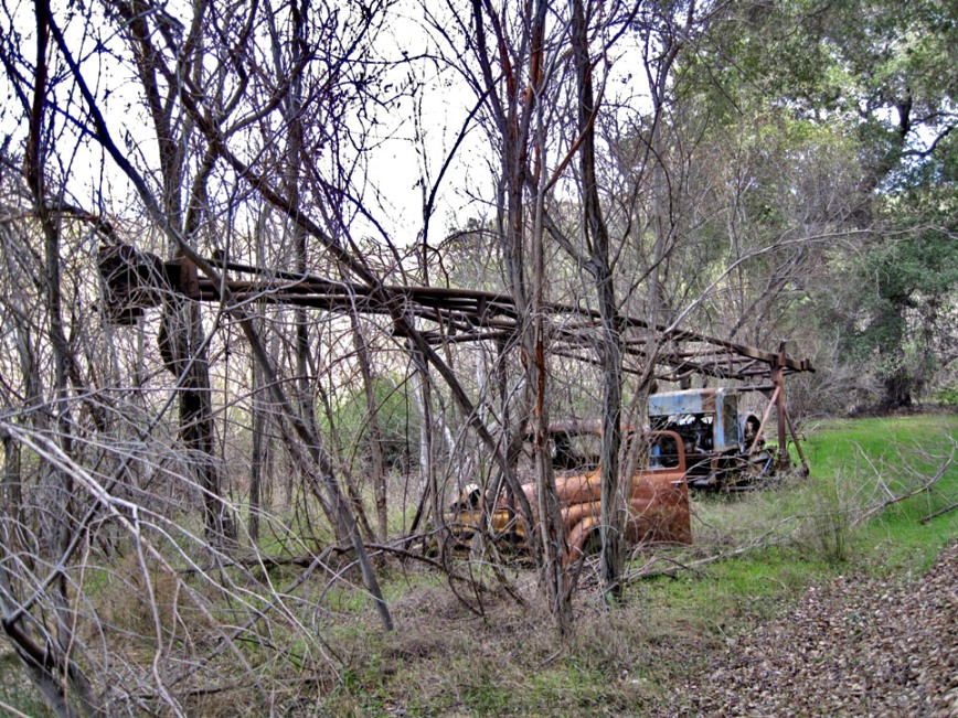
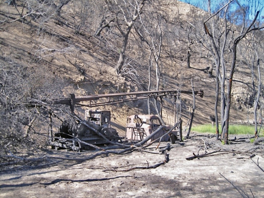
This portable rig can be seen from one of the trails in upper Placerita Canyon. (2/16/2013)
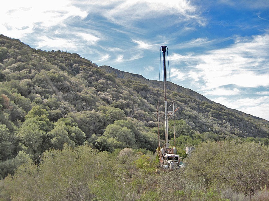
You can hike right up to it (beware of ticks). Note that the mast (the large pipe in the middle) is fully extended. It is telescopic and can be raised or lowered. (2/16/2013)
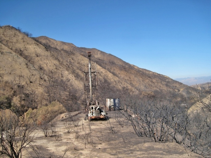
Here is the site after the Sand Fire of July 2016. The mast is now in the lowered position. Probably the heat from the Sand Fire melted the cables holding up the upper mast enough so that the weight of the mast pulled them apart and down it went. (9/10/2016)
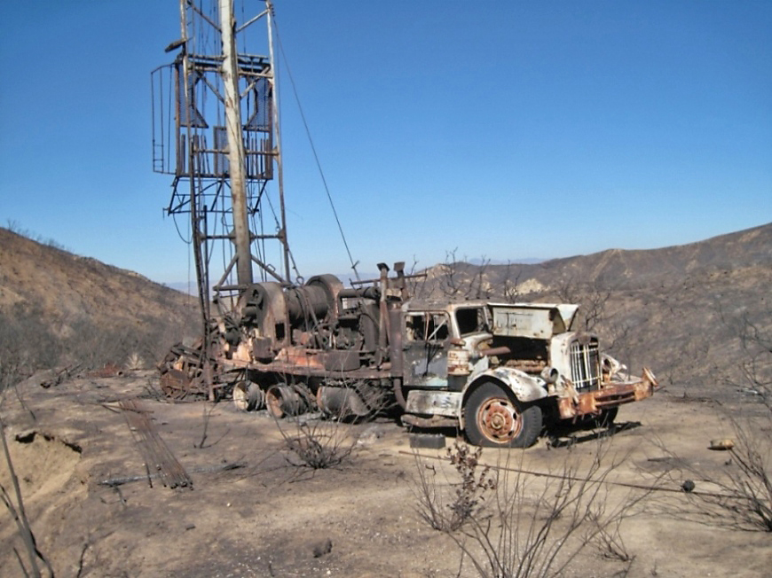
Truck fire damage. It was already in bad condition before the fire. (9/10/2016)
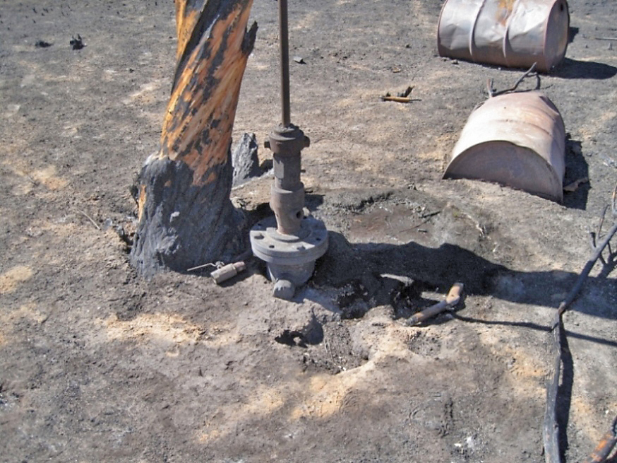
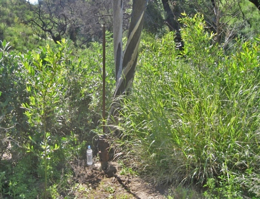
At the wellhead. This well was illegally drilled probably by Charles C. Townsend in the 1970's or early 1980's since he had already drilled Townsend-Allen 1 and Tommy Walker 1 at that time. There are no records on file at DOGGR. However, DOGGR does know about it and calls it Charles Townsend Well No. 1. Why the well was abandoned in this condition is a mystery. It looks like everything to drill a well is still there. (2/16/2013)
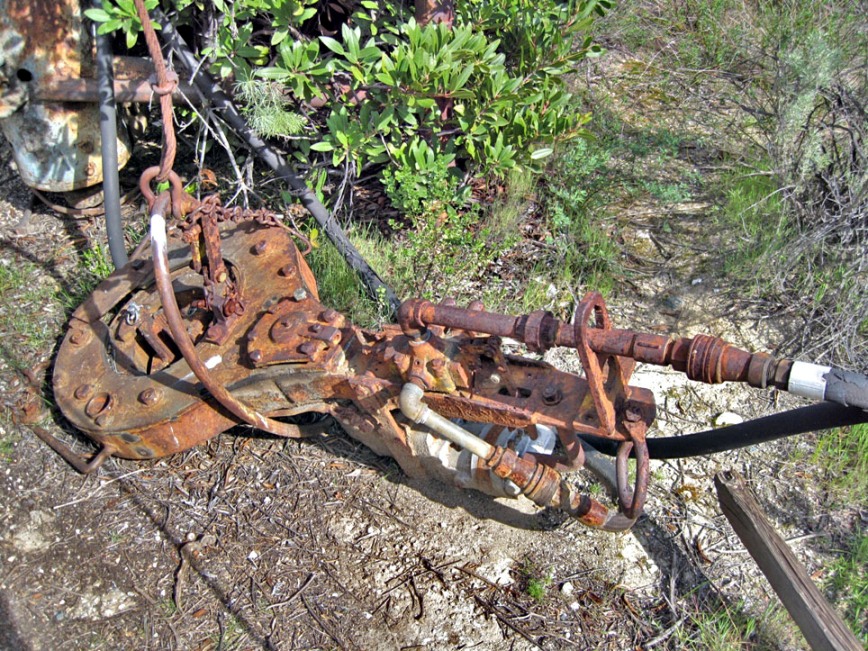
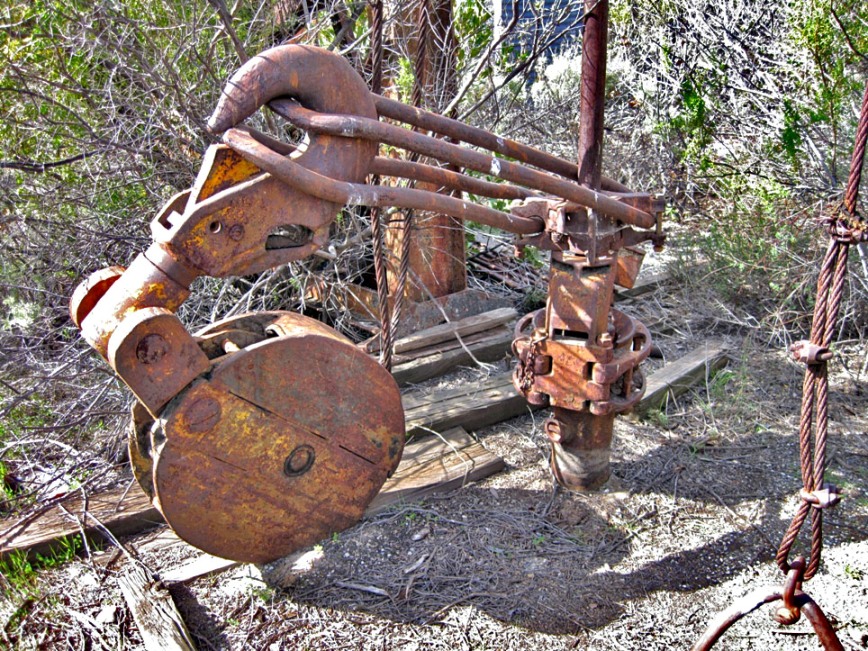
This is a rotary machine, the fundamental unit in the rotary system of drilling oil wells. There is also a pump, engine for a pump, a tank, and a large number of sucker rods at the site. (2/16/2013)
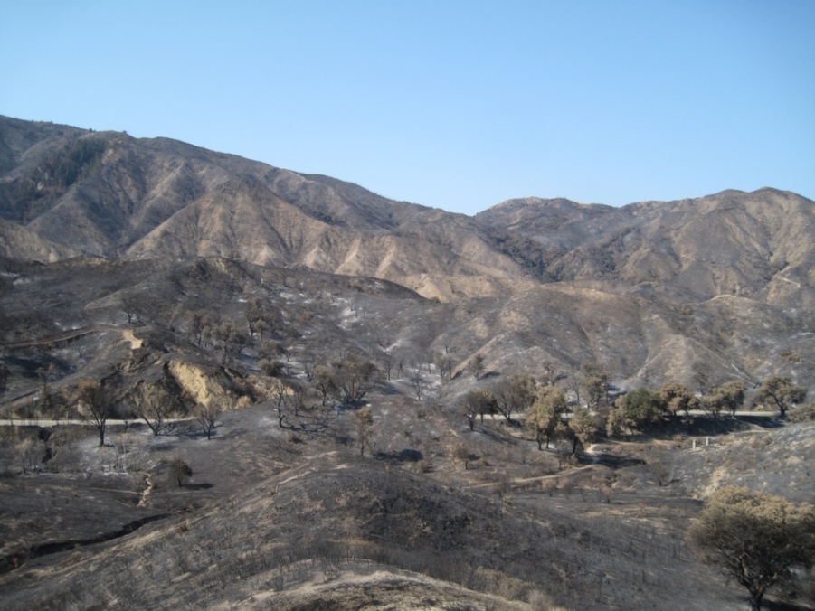
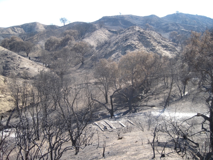
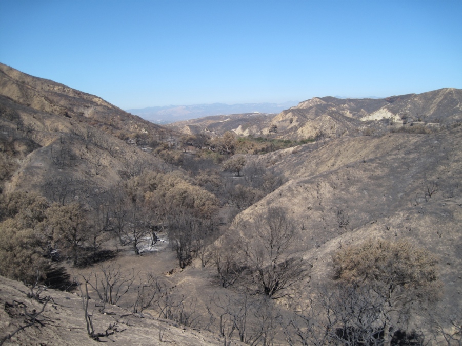
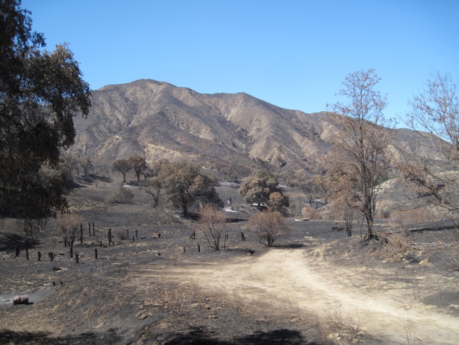
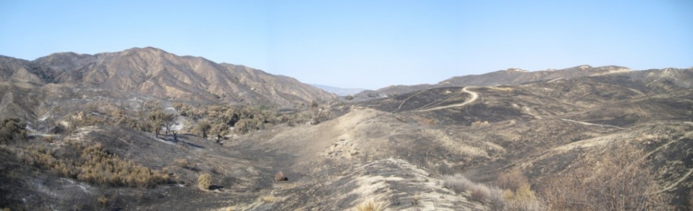
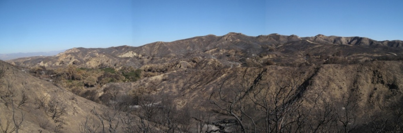
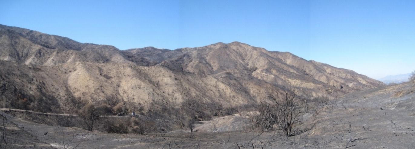
The following seven photos show the aftermath of the Sand Fire of 2016 in the upper part of the canyon. The Sand Fire started on July 22, 2016, and was 100% contained on August 3.
8/23/2016
9/10/2016
9/10/2016
9/10/2016
8/23/2016
9/10/2016
9/10/2016