Tick Canyon - Sterling Borax Mine, California
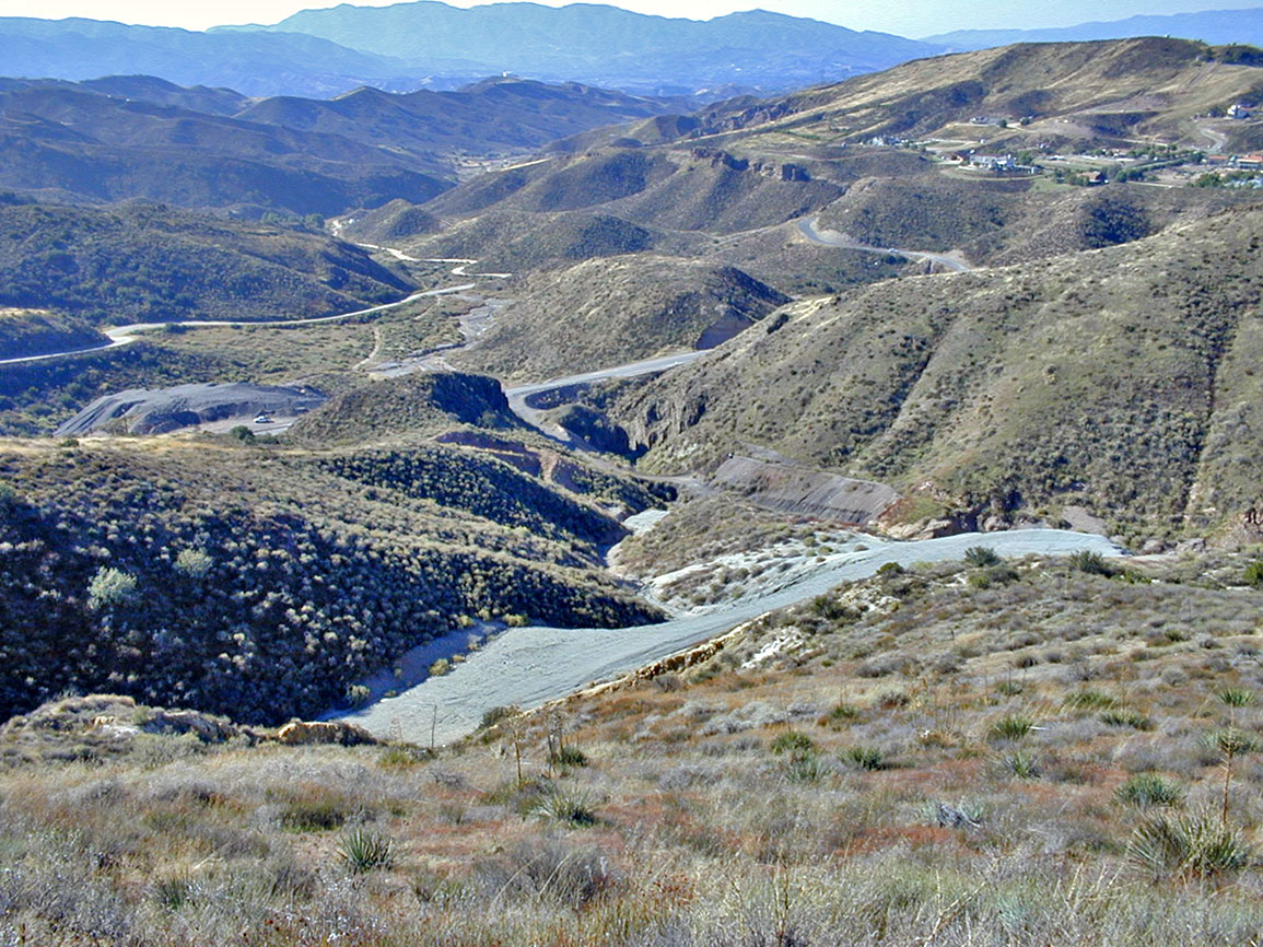
Looking south down Tick Canyon from above Davenport Road and the old Sterling Borax Mine dumps (photo taken 10/30/2011)
Tick Canyon is located in the northern part of Los Angeles County. Tick Canyon creek empties into the Santa Clara River in Soledad Canyon just east of the intersection of Shadow Pines Blvd and Highway 14 in northeastern Canyon Country.
The Sterling Borax Mine, which produced ore from 1908 until 1921, is located in Tick Canyon.
As one travels from its mouth to its upper reaches, the rocks become successively older. There are basalt flows and borax deposits north of Davenport Road. Many different minerals have been found in and around these deposits. North of the borax mine are a few old gold mines. All in all, a pretty interesting canyon.
How did Tick Canyon become Tick Canyon? According to Jerry Reynolds in his History of the Santa Clarita Valley it was named by Lieutenant R.S. Williamson during his historic Southern Pacific Railroad Survey of 1853 because "he was attacked by the little insects there". Unfortunately, I could not locate this statement in Williamson's reports, which are all available online here. Is this another example of Reynolds' historical fiction? The earliest reference to Tick Canyon that I could find was from the Los Angeles Herald of 9/15/1897 in the Real Estate Transfers section:
J.W. Wenzel to J.J. Smiley and W. Bollinger - half interest in Lottie and Sousa Mines in Tick Canyon Mint Mining district; $1000.
Same to L. Ebinger - 1/4 interest in said mines; $1000.
Another interesting mention of Tick Canyon was in the New Suits section of the Los Angeles Herald of 5/29/1898:
B. Hemns and James Robinson sued J.W. Winzel and others for $2000 in damages and to have them ousted from the Moonrise claim, in Tick Canyon, Mint mining district, in this county, which the plaintiffs allege was jumped in September last by defendents and from which they extracted ore to the amount for which they claim damages.
These claims must have been for gold mines. More information on L. Ebinger is on the Sterling Borax Mine page.
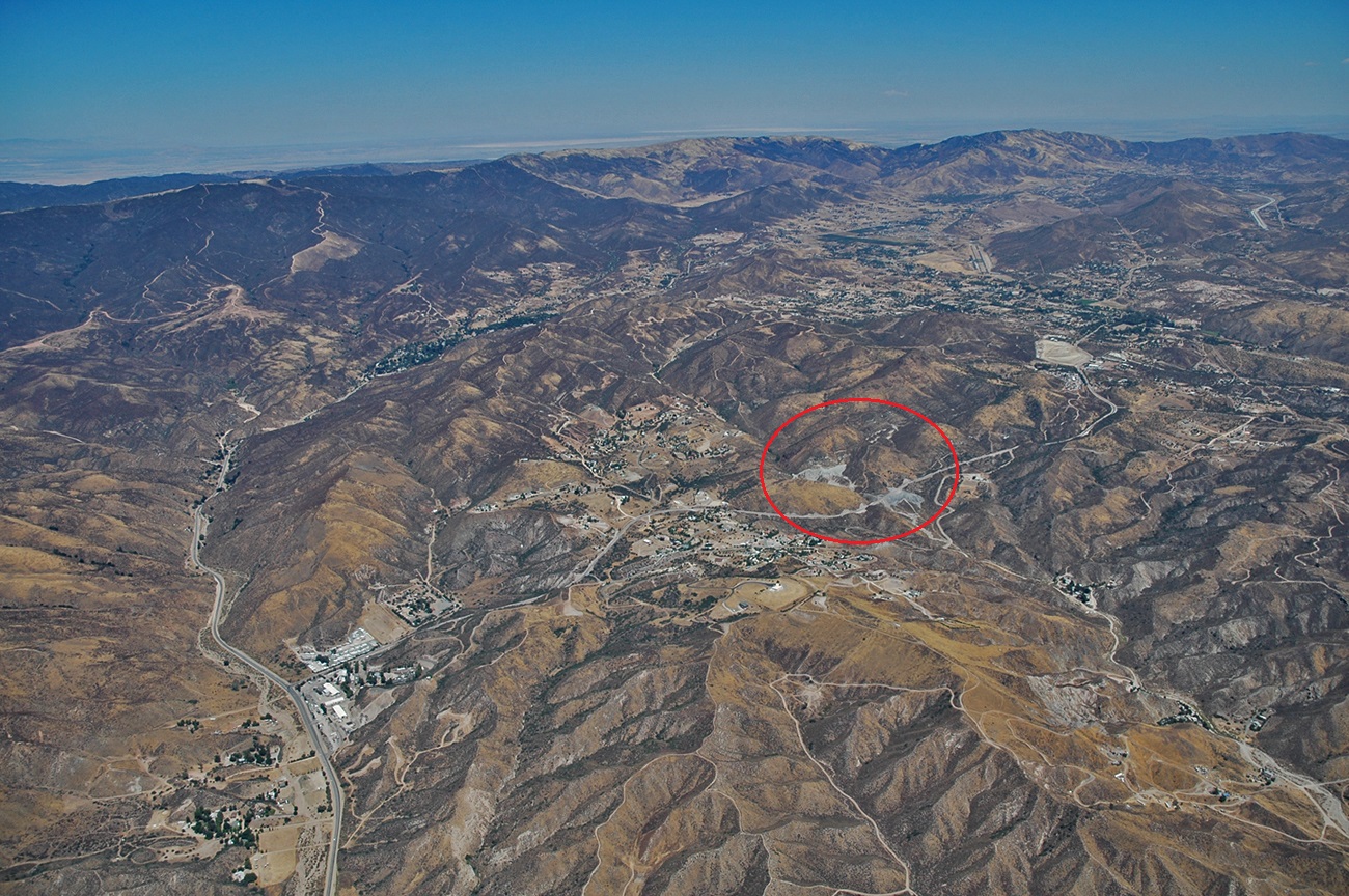
Tick Canyon from the air. View toward the north. Sierra Highway is on the left (in Mint Canyon).Davenport Road is the main left to right road. The borax mine dumps are in the red circle. You can trace Tick Canyon from the center of the photo to the lower right.
Photo by Bruce Perry, Department of Geological Sciences, CSU Long Beach.