Towsley Canyon Geology
The Pico Anticline is nicely exposed in Towsley Canyon, especially in "the Narrows" area. The anticline is very tightly folded with the south flank dipping about 55 degrees and the north flank from 65 to 70 degrees. The axis of the anticline is cut by at least four faults (see Bailey's geologic map below).
Unlike Pico Canyon, the Modelo Formation (the oldest formation - Upper Miocene - marine) is exposed in a narrow strip at the anticline's axis. Due to tightness of the folding, the Modelo shale is highly fractured and distorted. All the productive Towsley Canyon wells were drilled in the Modelo Formation.
The other formations seen in the canyon are the Towsley Formation (Lower Pliocene - marine), Pico Formation (Pliocene - marine), and the Saugus Formation (Upper Pliocene to Lower Pleistocene- continental). Outcrops of the Saugus Formation are found only around the mouth of canyon.
The Towsley Formation was named for exposures in Towsley Canyon by Winterer and Durham in 1954 in Bulletin 170 of the California Division of Mines. This formation is best seen in "the Narrows", where conglomerates, sandstones, and siltstones are exposed in nearly vertical beds.
There are virtually no fossils in any of the formations south of the Narrows in Towsley Canyon. However, in the Pico Formation near the parking lot, fossils have been found.
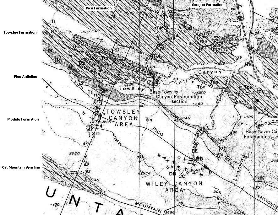
Here is a geologic map of the Towsley and Wiley Canyon area from Winterer and Durham (1962). The Pico Anticline runs from just above the center left to the lower right.
The formation symbols are, from newest to oldest, QTs = Saugus Formation, Tpc Tps Tp = Pico Formation, Tt Ttc Tts = Towsley Formation, Tm = Modelo Formation.
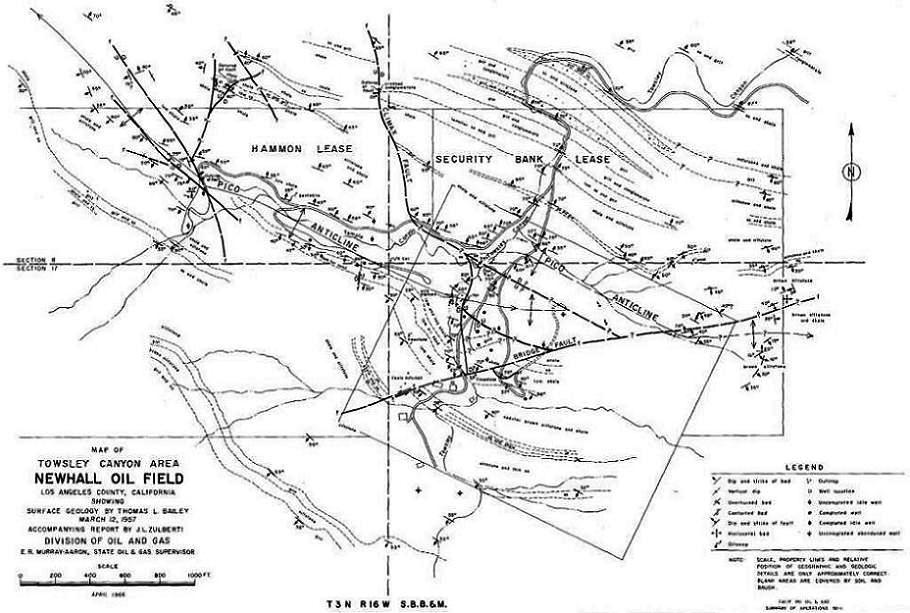
Here is a more accurate geologic map of just Towsley Canyon. This one shows offsets to the Pico Anticline caused by faults. This map was done by Thomas L. Bailey for Waterford Oil Company in 1957. It was obtained from Zulberti's DOG report on Towsley Canyon (1966).
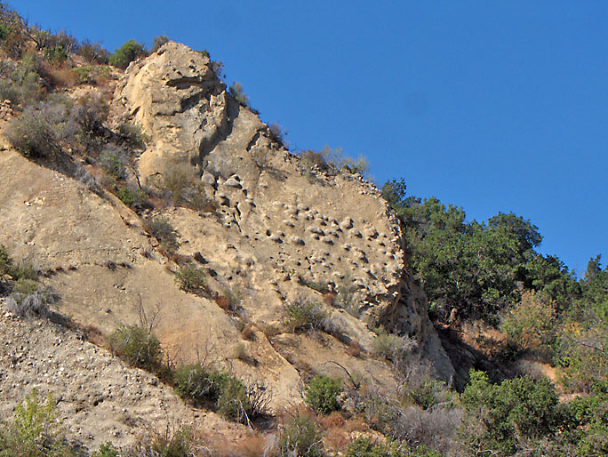
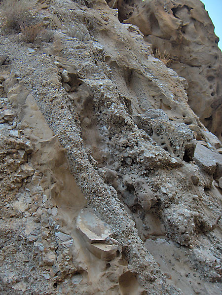
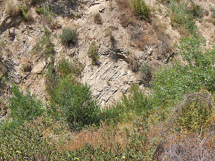
North of the Narrows are these odd bumps in this Towsley Formation bed. This bed is in the steeply inclined north flank of the Pico Anticline. (Photo taken on 8/16/2008)
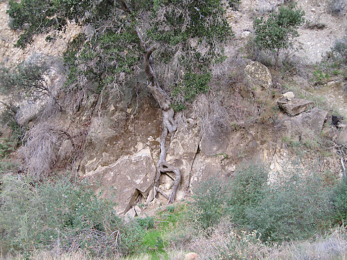
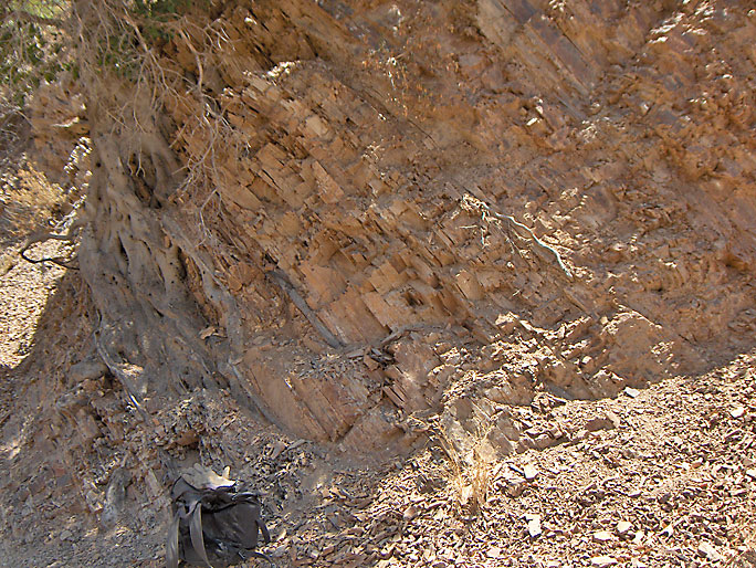
Still north of the Narrows is this tree where the roots grew between the steep bedding plane of the anticline and helped break the beds apart as it grew. (8/2/2008)
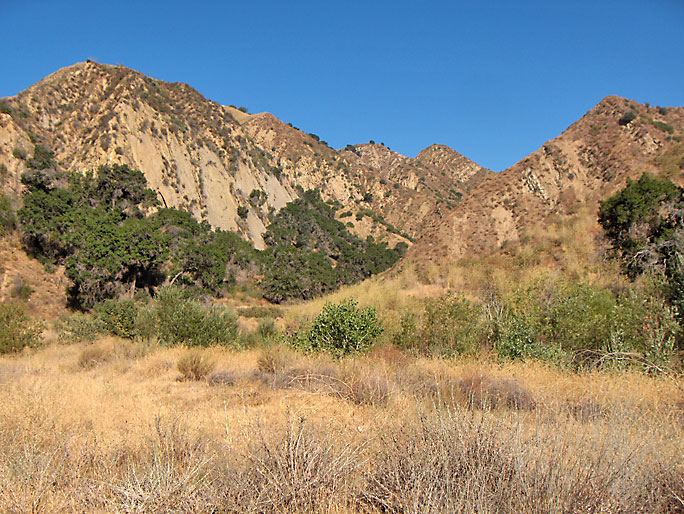
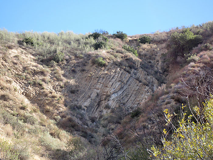
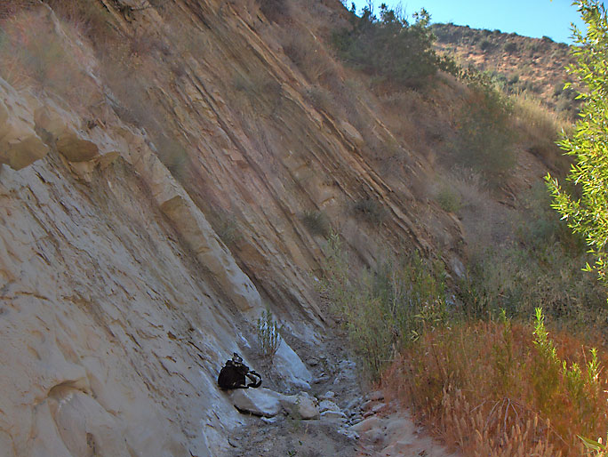
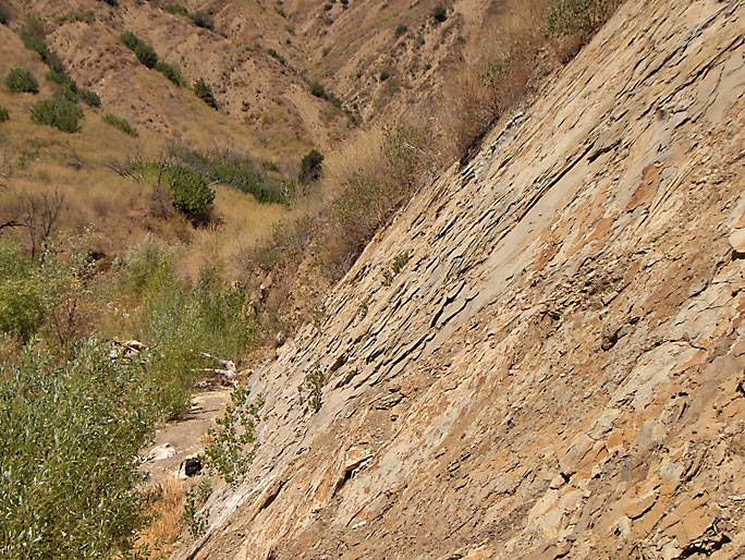
Looking west at the steeply dipping north flank of the Pico Anticline. The entrance to "the Narrows" is in the left center of the picture where all the trees are. The road makes a left hand turn to the south there. (8/2/2008)

Wider view (11/21/2009)
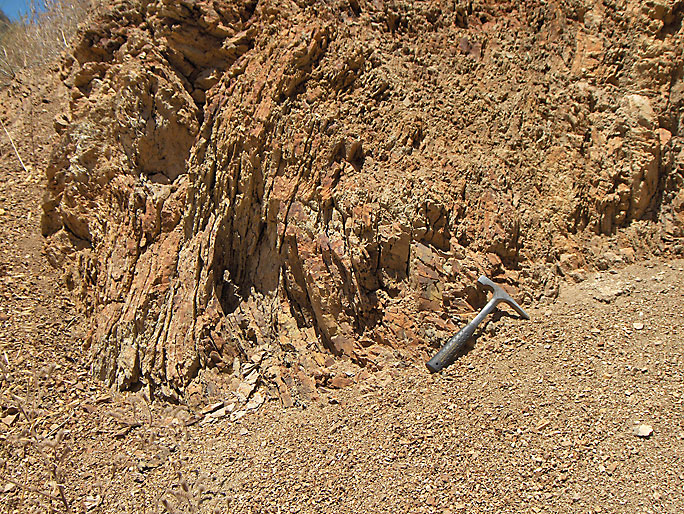
Near vertical beds of conglomerates and sandstones in the Narrows (8/9/2008)
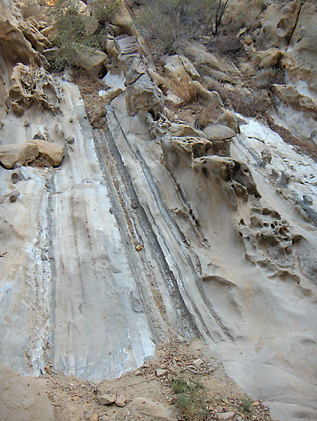
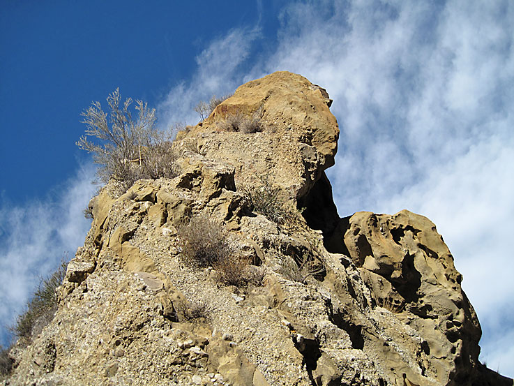
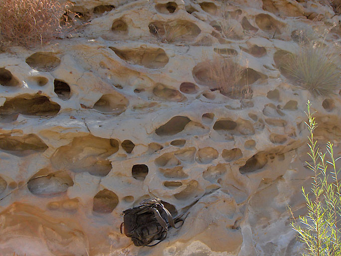
Unusual erosional features in the Narrows (7/19/2008)
(11/21/2009)
(11/21/2009)
Beds of conglomerate and sandstone in the Narrows (8/9/2008)
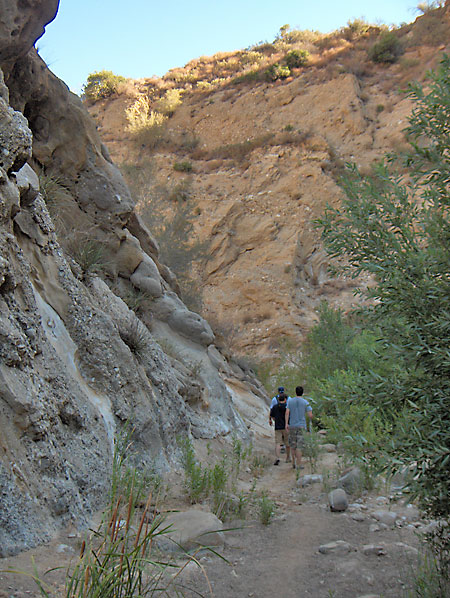
Group of hikers going north in the Narrows (8/2/2008)
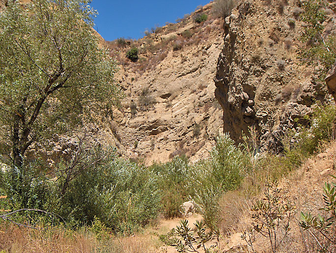
One last look north into the Narrows. These are Towsley Formation beds in the steeply dipping north flank of the Pico Anticline. (8/23/2008)
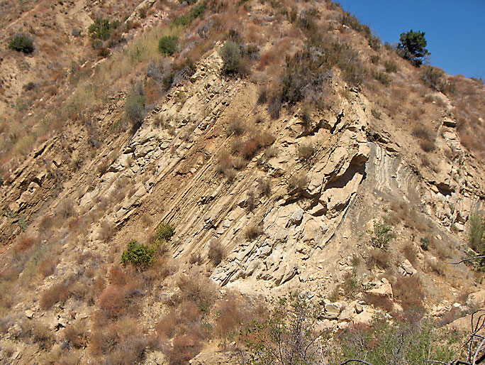
These north flank beds look very similar to beds in Pico Canyon. We are now just south of the Narrows. (11/21/2009)
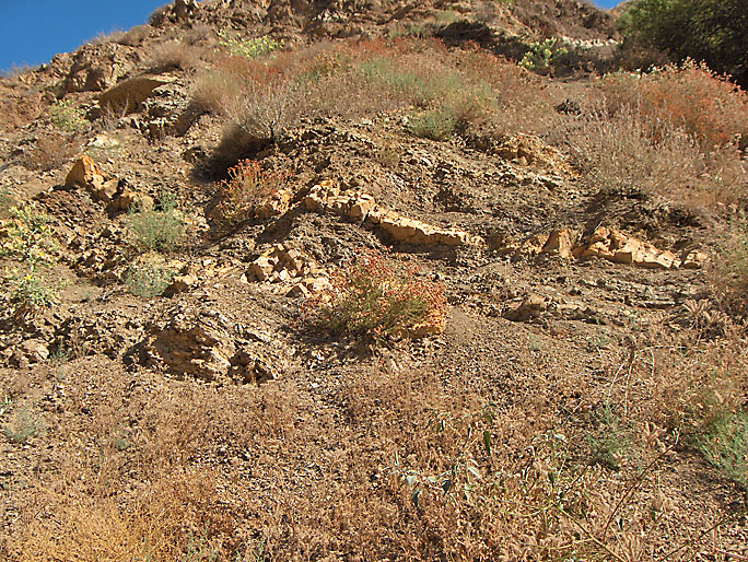
Here are some Modelo Formation shale beds on the north flank of the anticline. These beds are west of the main trail on the old oil road into Temple Canyon, the first major canyon south of the Narrows. This canyon was named after the Temple claim, which was located here - see the oil history page. (8/2/2008)
More Modelo beds. These shale beds are highly fractured due to being folded in the anticline. (8/2/2008)
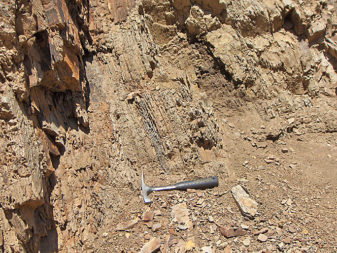
Here are some thinly bedded Modelo shale beds (8/2/2008)
These beds are near the previous photo and are slightly overturned in places (8/2/2008)

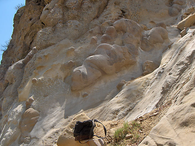
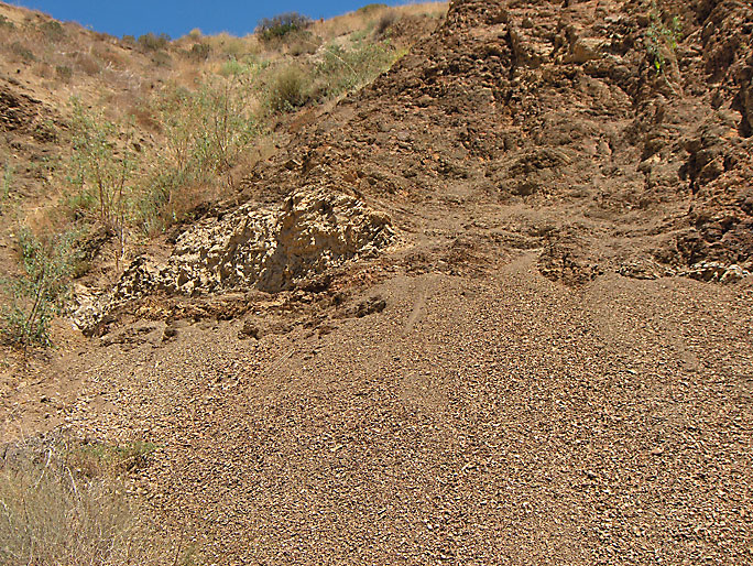
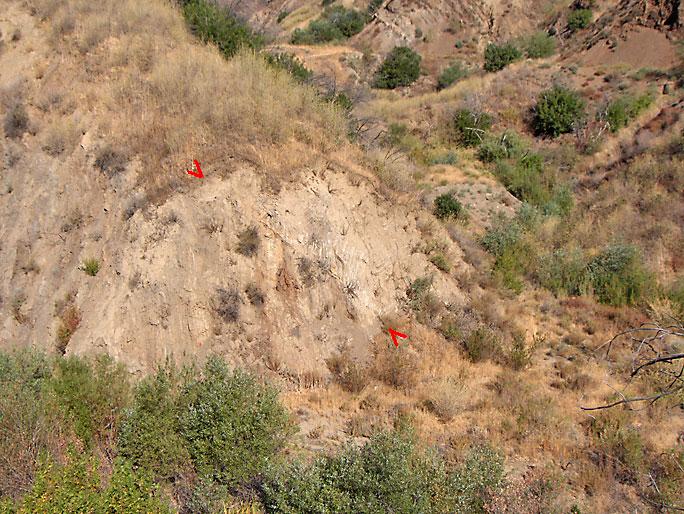
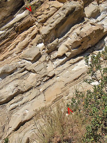
This fault (indicated by the two red arrowheads) is just south of Temple Canyon facing the roads just on the west bank of the creek. Based on Bailey's geologic map, it must be the Climax fault. That's my black backpack at the bottom of the fault. (8/16/2008)
Here is the same fault from further away (8/23/2008)
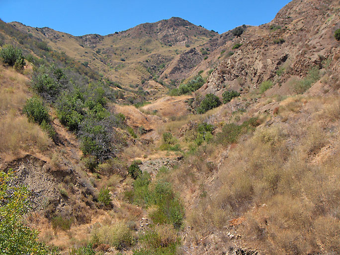
Here is the view looking west into Temple Canyon from the trail. Hear at the mouth the axis of the anticline is just left (south) of the canyon. About 2/3 of the way up, the axis crosses into the canyon (see geologic map). In the exposed face in the lower left of the photo is where the Climax fault, shown in the previous pictures, can be seen. (8/2/2008)
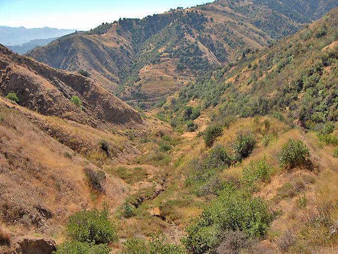
Here is an opposite view of the previous picture. We are deep in Temple Canyon looking east toward the trail. On the left is the north flank of the Pico Anticline. Far in the distance you can barely see the zig-zagging trail as it makes its way up the mountain and eventually into Wiley Canyon on the other side. (8/2/2008)
Looking west just south of Temple Canyon (and just south of previous picture) you can see that we are on the south flank of the Pico Anticline. The beds are dipping in the opposite direction of the north flank beds. They are also not quite as steeply dipping. (8/2/2008)
Right next to the trail on the east side you can see how the roots of a tree grew into the bedding planes in the south flank of the anticline. If you look back north toward the Narrows you can see the north flank of the anticline. (8/2/2008)
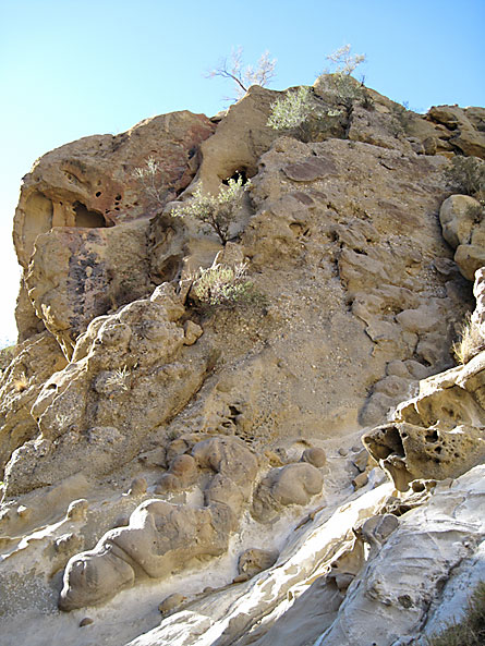
Following the creek bed south of the previous pictures is this interesting sandstone bed in the south flank of the Pico Anticline. Erosion has created all these little caves. (8/2/2009)
Here are the beds just above (younger in age) the previous bed with the holes (8/9/2008)
This is past the previous picture looking west at the south flank. This creek has washed away all the talus at the foot of the slope. The slope is actually a bedding plane so it would be very easy to measure the degrees of dip here. (8/23/2008)
Here is another picture of the south flank. I am showing a lot of south flank photos because from the trail, there are very few south flank exposures that can be seen. (8/23/2008)
The red arrowheads mark a small fault in the south flank of the anticline (8/9/2008)
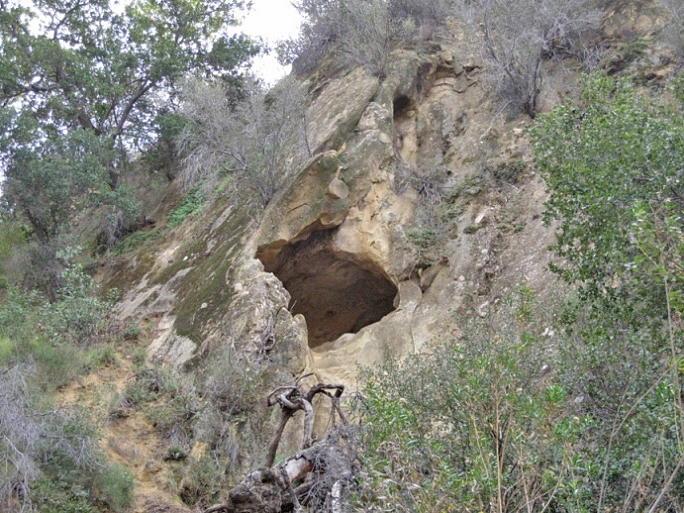
Natural caves are not uncommon in the canyon. This one is visible from the main trail. (1/16/2010)