Whitney Canyon Geology
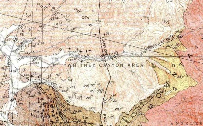
From Winterer and Durham, 1962, Geology of Southeastern Ventura Basin, Los Angeles County, California, USGS Professional Paper 334-H. Geology mapped in 1949-52.
Legend: Qal=alluviam; QTs=Saugus formation; Tp=Pico formation; Tt,Tts,Ttc=Towsley Formation; bc=basement complex
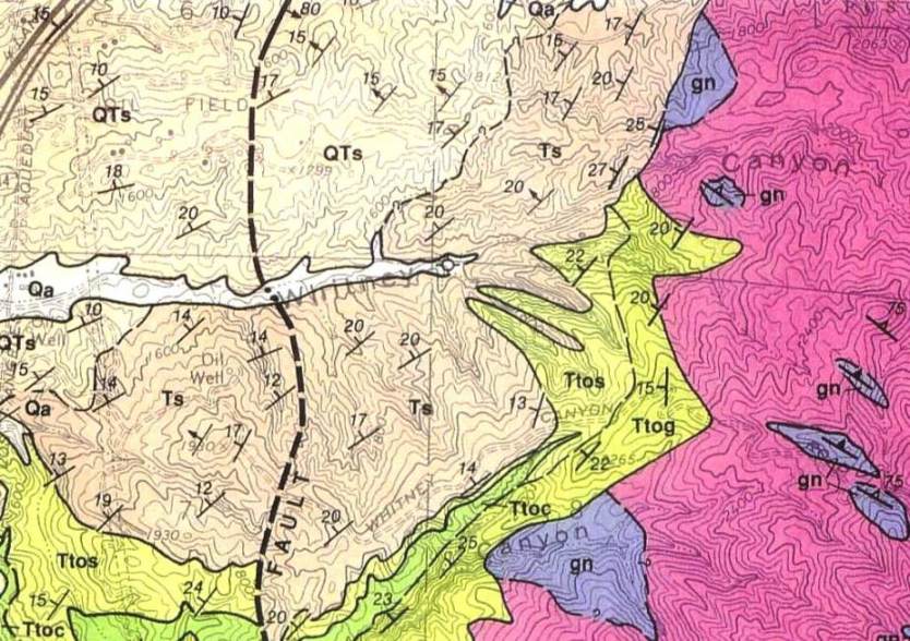
From Thomas W. Dibblee, Jr., 1991, Geologic Map of the San Fernando and Van Nuys (North 1/2) Quadrangle (DF-33). Sources for this geologic map - Winterer and Durham (1958-62) and Dibblee (1938-40). Dibblee is calling the Pico formation in the Whitney Canyon area the Saugus formation.
Legend: Qa=alluvial gravel; QTs=,Ts=Saugus formation; Ttos,Ttoc,Ttog=Towsley Formation; gn=gneissic rocks; qd (pink,containing gn) quartz diorite (gn and qd part of basement complex)
Formations exposed in Whitney Canyon include the Saugus formation, Pico formation, a little Towsley formation, and the basement complex. Dibblee's above map calls the Pico formation the Saugus formation but says that it is equivalent to the Pico formation in age. I will use the Pico formation as it makes more sense with me. Standing at one spot on the Whitney Parkway road between Elsmere and Whitney Canyons I can see the Pico beds in Elsmere Canyon and the same beds in Whitney Canyon. I'm not sure why Dibblee did not use the Pico formation name.
The Saugus and Pico formations dip between 15 and 25 degrees in a northwesternly direction. I know of no fossils ever found in any formation in the canyon.
The lower Pleistocene Saugus formation consists of light-colored, poorly consolidated conglomerate and sandstone resting on brown sandstone and greenish mudstone and conglomerate of the continental brackish-water Sunshine Ranch member. As you enter the canyon, you are walking on the greenish mudstones.
The Saugus formation rests on the fine-grained late Pliocene Pico formation sandstone with lenses of pebble conglomerate. Oil saturation is common in the sandstone. This you will see further up the canyon and up some of the southern tributaries.
The Pico formation partially rests both on the Towsley formation and partially on the basement complex. The early Pliocene Towsley formation seems to be only represented by a mudstone deep in the canyon. Due to its relative location and the fact that there are some concretions in it, I think it is the Towsley. It can't be the Saugus because it would be below the Pico, although it still might be Pico. There is no clear contact between the Pico and the Towsley. The Towsley probably pinches out around the creek bed. It would also rest on the basement complex in Whitney Canyon.
Well logs have also shown Eocene rocks below the Pico formation just above the basement complex west of the Whitney Canyon fault, but no Eocene rocks are exposed in the canyon.
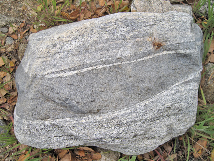
The basement complex is visible at the end of the hiking trail mainly as the metamorphic rock gneiss. It is Cretaceous age or older.
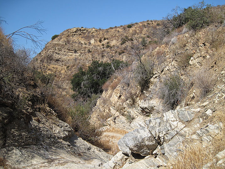
The major structural feature of the canyon is the Whitney fault (also known as the Swall-Ferrier fault), first postulated by Walling (1934). It runs north-south and is not evident in Whitney Canyon. However, it is evident in Elsmere Canyon. It is the eastern limit of oil production in Placerita, Whitney, and Elsmere canyons.
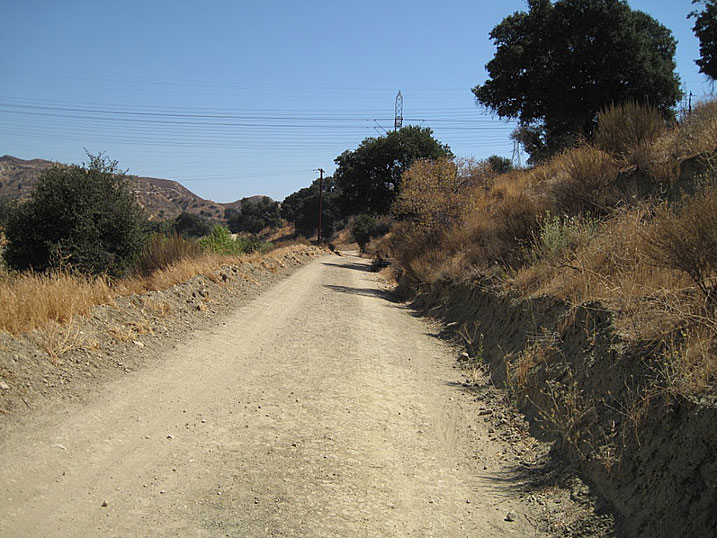
As you enter the canyon you begin walking on the Sunshine Range member of the Saugus formation. Notice how greenish the dirt and road cuts are. This is mudstone. (Photo taken on 9/19/2009)
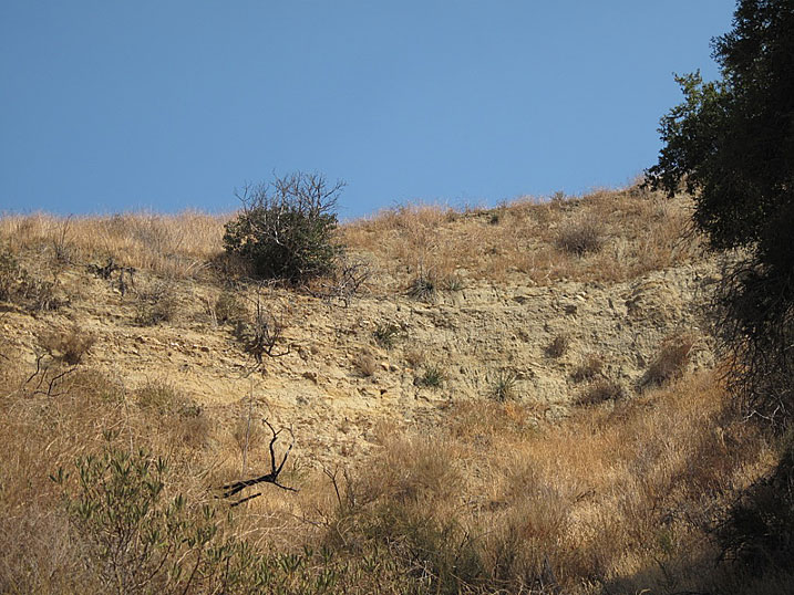
Another exposure of the Sunshine Range member of the Saugus formation deeper in the canyon and higher up above the Banner 3 oil well. (9/5/2009)
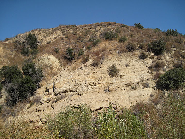
On the north side of the creek is this last good exposure of Saugus formation. It looks very similar to the exposures of the Saugus formation in Elsmere Canyon on the north face where the aqueduct is. (9/20/2009)
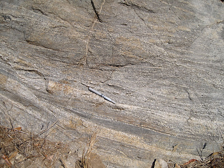
Closer view of Saugus formation (3/27/2011)
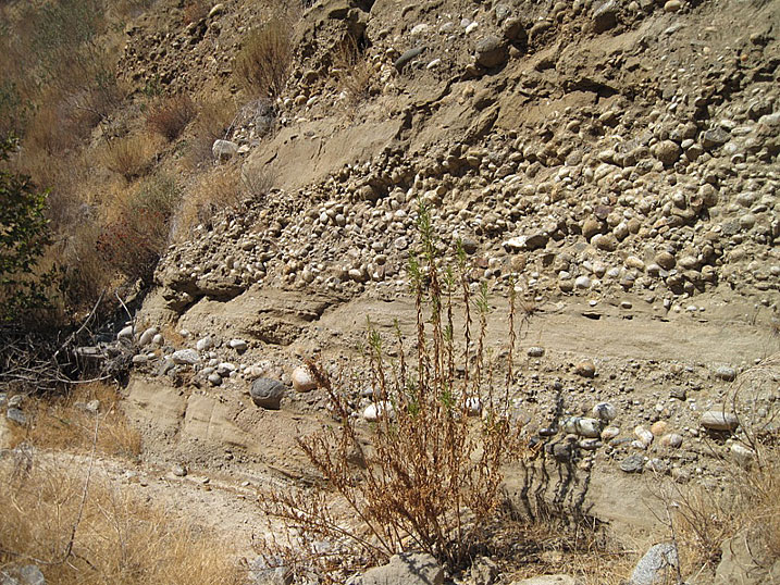
Oil saturated Pico formation on south side of canyon (9/4/2009)
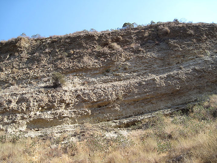
Northwesternly dipping beds of the Pico formation on the south side (9/4/2009)
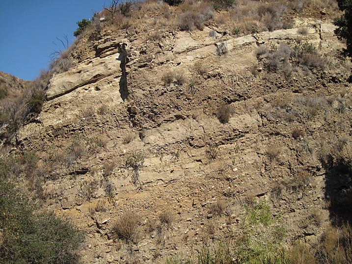
Pico formation on the north side of the canyon (9/4/2009)
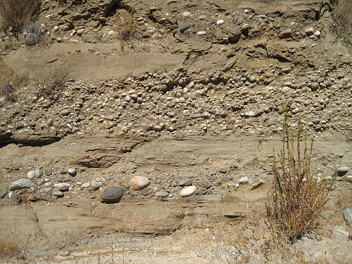
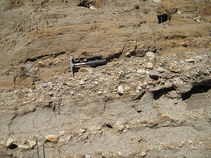
Close up of Pico formation showing alternate beds of sandstone and conglomerate (9/4/2009)
Another close up of same beds right next to the creek bed (9/4/2009)
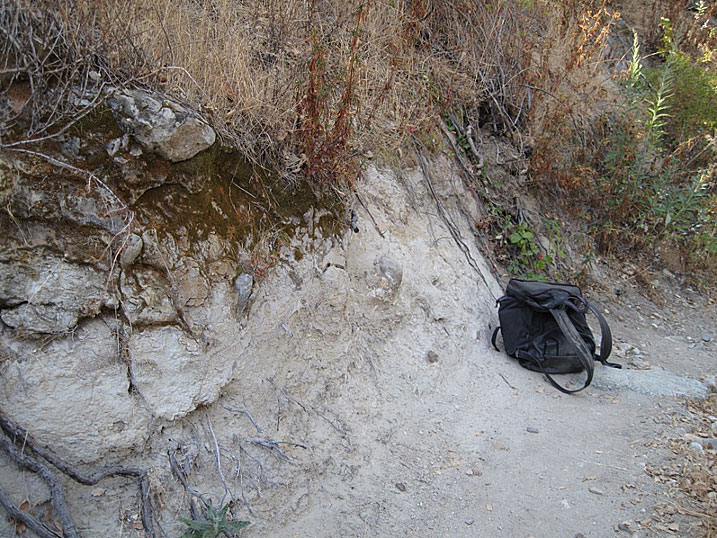
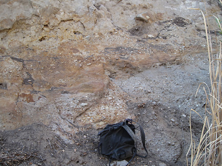
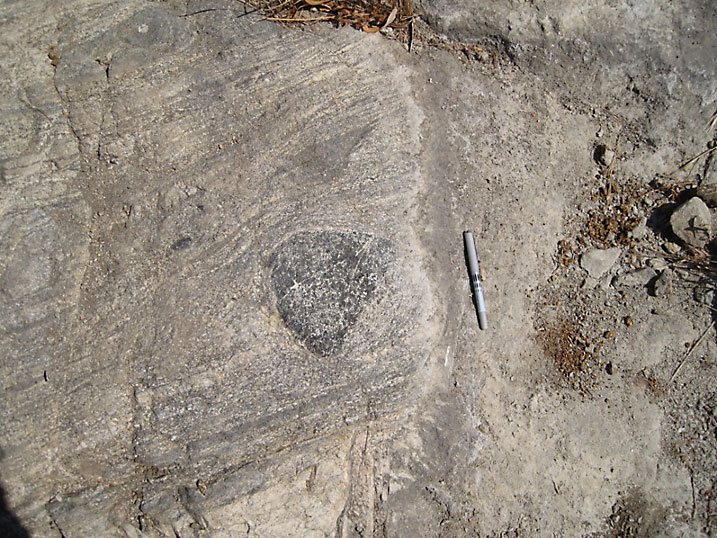
There is a small exposure of what looks to me like the Towsley formation on the south side of the trail. There are some concretions in the bed. Concretions are common in the Towsley formation in Elsmere Canyon. But this could also be the basal Pico formation. The basal part of a formation is the lowest or oldest part. Underneath the basal Pico formation would be the youngest part of the older Towsley formation. (9/20/2009)
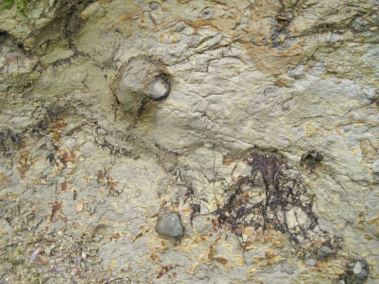
Closeup of the above beds. The rocks are wet. (3/27/2011)
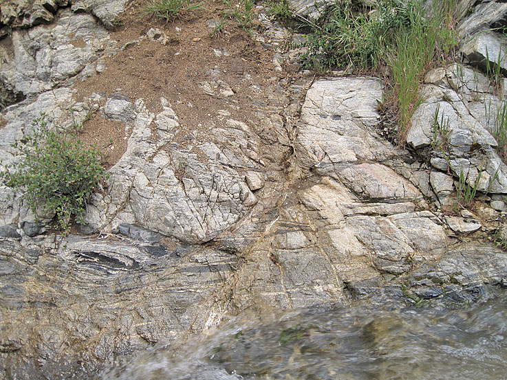
Metamorphic rocks in the foreground with the Pico formation in the background (9/4/2009)
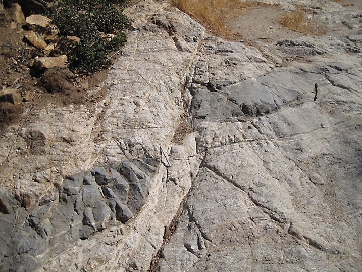
Fault in basal gneiss (9/4/2009)
Another apparent fault (3/27/2011)
What's going on here? (8/13/2022)
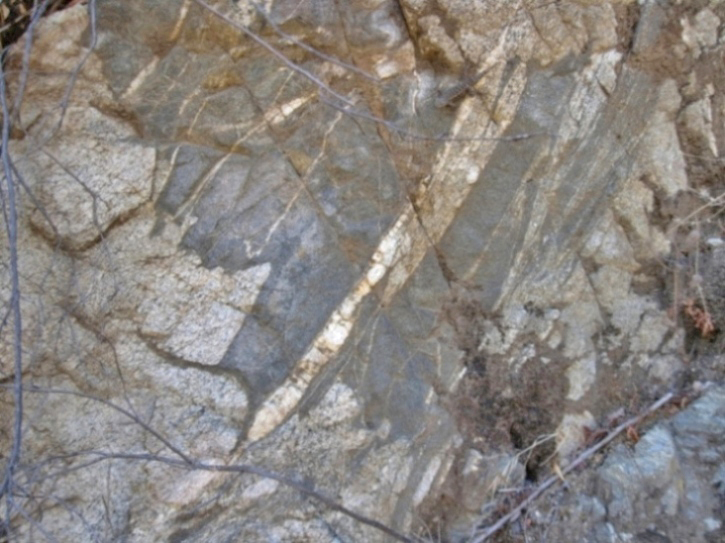
Close up of gneiss showing banding (9/4/2009)
This dark body in the gneiss may be called an inclusion (9/4/2009)
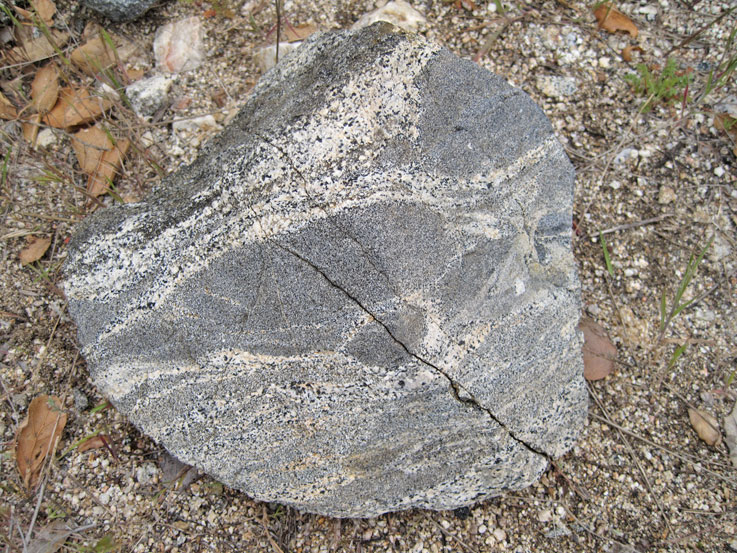
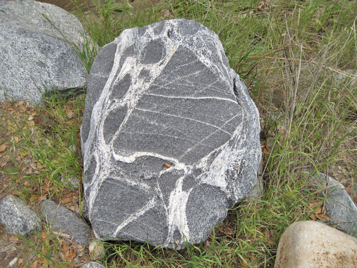
There are a lot of interesting looking rocks from the basal formation laying in the creek bed (3/27/2011)
(3/27/2011)
(3/27/2011)