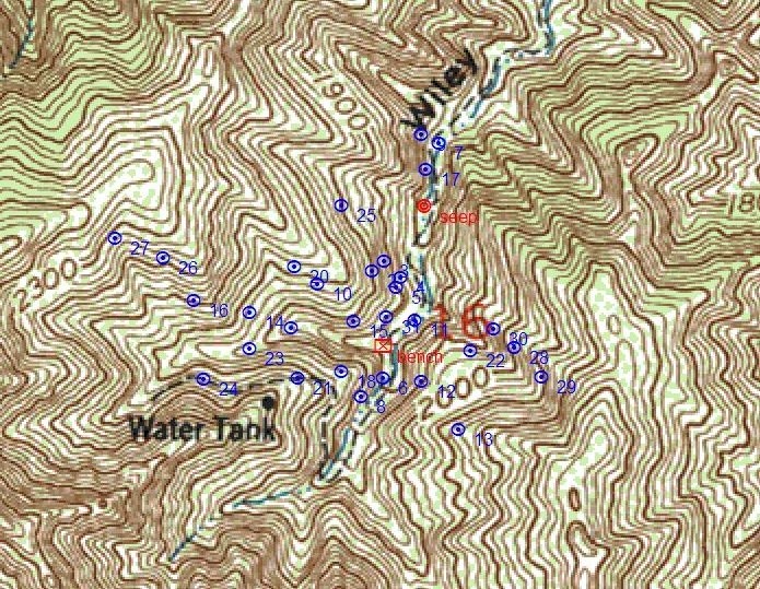
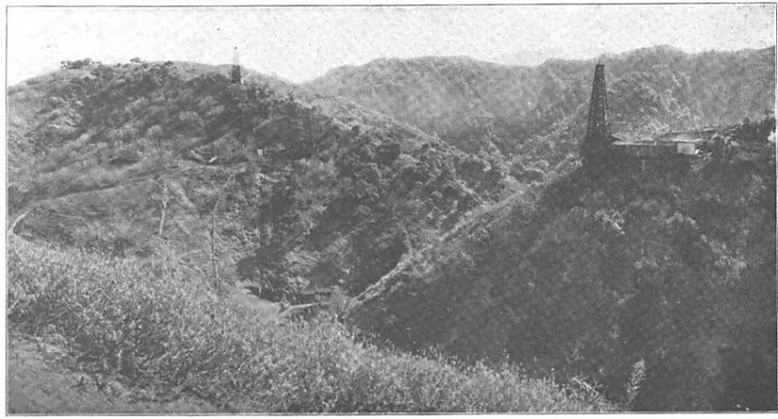
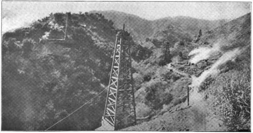
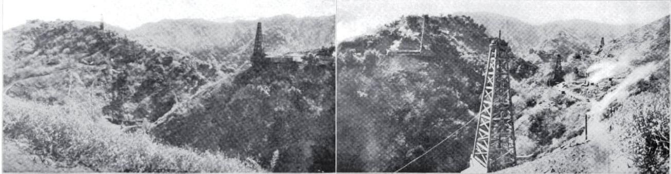
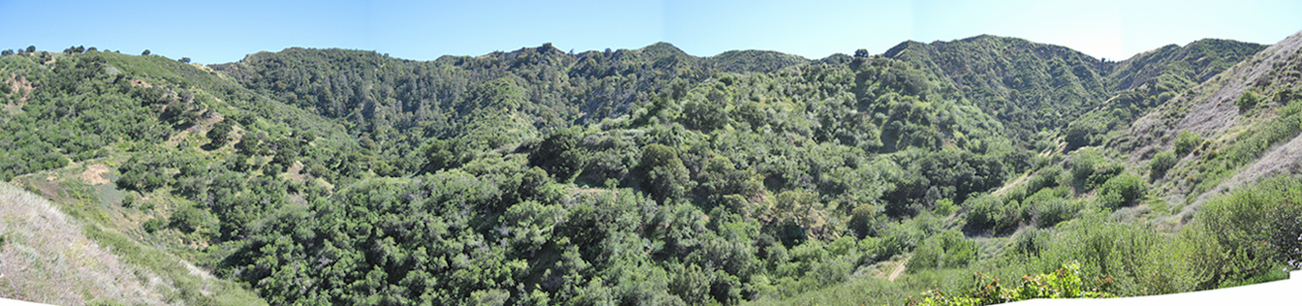
| Well No. |
Drilled By |
Year Drilled |
Original/Max depth(ft) |
Initial Prod (bpd) |
Remarks |
| ? |
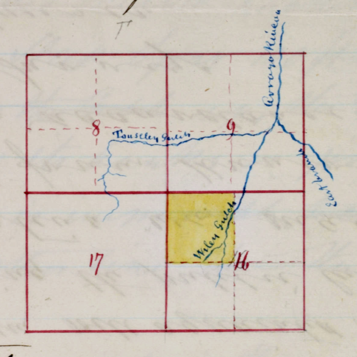
Wiley Springs Oil Co |
1865-66 |
130 |
? |
Spring-pole well reported by Peckham |
| Wiley 1 |
Pacific Coast Oil Co. |
? |
? |
? |
Probably drilled by PCO |
| Wiley 2 |
Pacific Coast Oil Co. |
? |
? |
? |
Probably same Location as Wiley 1. Abandoned before 1890. Plugged in 1972. |
| Wiley 3 |
Pacific Coast Oil Co. |
? |
? |
? |
Abandoned before 1890. Plugged in 1991. |
| Wiley 4 |
Pacific Coast Oil Co. |
1883-84 |
1275 |
2 |
Probably abandoned in 1884. Plugged in 1991. |
| Wiley 5 |
Pacific Coast Oil Co. |
1888 |
1408 |
5 |
Troubled with water and abandoned in 1890. Plugged in 1991. |
| Wiley 6 |
Pacific Coast Oil Co. |
1888 |
435/1258 |
1 |
April 1917, 1 bpd. Plugged in 1972. |
| Wiley 7 |
Pacific Coast Oil Co. |
1889 |
1200 |
0 |
Hole junked with tools and abandoned in 1889. Plugged in 1991. |
| Wiley 8 |
Pacific Coast Oil Co. |
1890-91 |
970 |
0 |
Crooked hole at 150ft and had to start new hold. At 560ft had 14 week fishing job. During this time Landslide caused oak tree to crash into and destroy derrick. Finally, too much water and hole was abandoned. Plugged in 1991. |
| Wiley 9 |
Pacific Coast Oil Co. |
1889 |
1650 |
0 |
Moved rig from Wiley 7 here. Junked in 1890 with lost tools. Plugged in 1991. |
| Wiley 10 |
Pacific Coast Oil Co. |
1891-92 |
860 |
1.5 |
Tried to straighten crooked hole with diamond drill, but started new hole at 580ft. Pumped 3 days, averaged 1.5 bpd oil and 15 bpd of water. Abandoned in 1892. Plugged in 1991. |
| Wiley 11 |
Pacific Coast Oil Co. |
1898 |
1325 |
? |
At 355ft rig burned down (5/29/1898). Water below 800 feet. Abandoned 1911. Plugged in 1991. |
| Wiley 12 |
Pacific Coast Oil Co. |
1898-99 |
1030/1735 |
? |
30 bpd for 2 weeks at 990 feet. Abandoned 1919. Plugged in 1991. |
| Wiley 13 |
Pacific Coast Oil Co. |
1899 |
1395/1395 |
16 |
April 1917, 3 bpd. Rig burned down 7/25/1940. Plugged in 1977. |
| Wiley 14 |
Pacific Coast Oil Co. |
1899-1901 |
1648 |
? |
April 1917, 7 bpd. Plugged in 1972. |
| Wiley 15 |
Pacific Coast Oil Co. |
? |
0 |
0 |
Never Drilled |
| Wiley 16 |
Pacific Coast Oil Co. |
1901-02 |
1730 |
? |
April 1917, 6 bpd. Abandoned 1921. Plugged in 1991. |
| Wiley 17 |
Standard Oil Co. |
1909 |
1111 |
0 |
No production, abandoned while drilling. Plugged in 1972. |
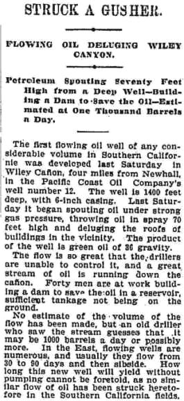
| Wiley 18 |
Standard Oil Co. |
1909-10 |
2207 |
83 |
Well flowed while drilling between 1000-1528 ft. Hole redrilled many times after well completion. Plugged in 1972. |
| Wiley 19 |
Standard Oil Co. |
1910 |
1786 |
109 |
April 1917, 6 bpd. Plugged in 1972. |
| Wiley 20 |
Standard Oil Co. |
1910-11 |
2600 |
? |
Flowing water at 2600 ft. Plugged in 1991. |
| Wiley 21 |
Standard Oil Co. |
1910-11 |
2412 |
0 |
Unable to shut off water; junked and abandoned in 1911. Unable to plug in 1991 because Chevron could not locate well even after excavating several feet below the original level. |
| Wiley 22 |
Standard Oil Co. |
1910-11 |
390/2280 |
9 |
Excessive water below 500 ft. Plugged in 1977. |
| Wiley 23 |
Standard Oil Co. |
1910-11 |
2181 |
0 |
Excessive water and running sand, abandoned in 1911. Plugged in 1977. |
| Wiley 24 |
Standard Oil Co. |
1910-11 |
1500 |
? |
Flowing water at 845-860ft; abandoned while drilling. Plugged in 1991. |
| Wiley 25 |
Standard Oil Co. |
1910-12 |
3835 |
? |
Excessive water. Abandoned 1914. Plugged in 1991. |
| Wiley 26 |
Standard Oil Co. |
1916 |
1702 |
60 |
Plugged in 1972 |
| Wiley 27 |
Standard Oil Co. |
1917 |
1712 |
21 |
Plugged in 1972 |
| Wiley 28 |
Standard Oil Co. |
1917 |
420 |
4 |
Plugged in 1977 |
| Wiley 29 |
Standard Oil Co. |
1917 |
420 |
2 |
Rig destroyed by brush fire on 7/25/1940. Plugged in 1977. |
| Wiley 30 |
Standard Oil Co. |
1917 |
400 |
3 |
Plugged in 1977 |
| Wiley 31 |
Standard Oil Co. |
1956 |
2015 |
0 |
Only well in Wiley Cyn that used a rotary drill from start to finish. Plugged and abandoned in 1956. No production |