John B. Lang and Howard A. Slayton - Identical Patents
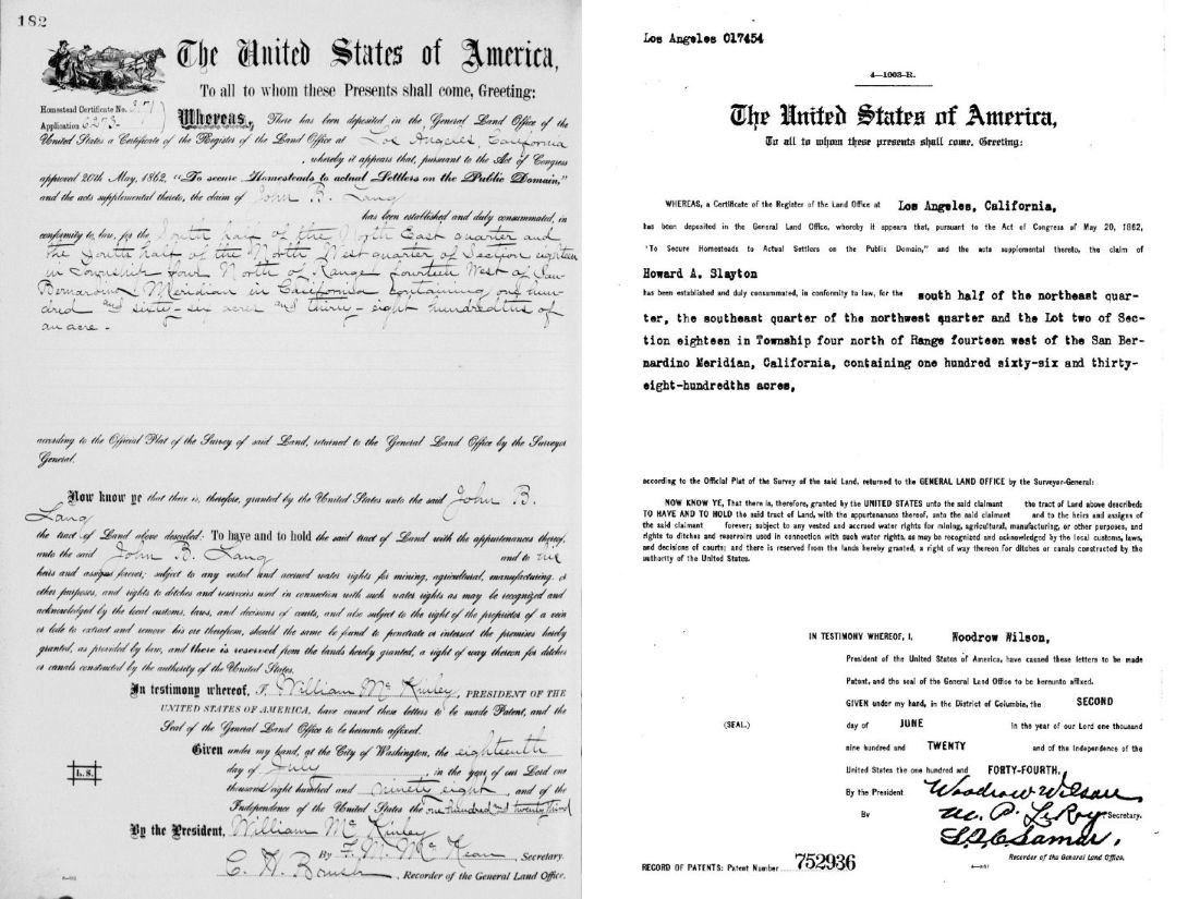
Patents for J.B. Lang (1898) and H.A. Slayton (1920).
Look at the description for the plot of land on both patents.
For J.B. Lang's: South 1/2 of the NE 1/4 and the South 1/2 of the NW 1/4 of Section 18, T4N, R14W, SBM, 166 38/100 acres.
For H.A. Slayton's: South 1/2 of the NE 1/4 and the SE 1/4 of the NW 1/4 and Lot 2 of Section 18, T4N, R14W, SBM, 166 38/100 acres.
However, Slayton's Lot 2 is actually the SW 1/4 of the NW 1/4 of Section 18. If you have both the SW 1/4 and the SE 1/4 of the NW 1/4, then you actually have the South 1/2 of the of the NW 1/4 (see below map).
On February 26, 1917, Slayton had filed a homestead record for S 1/2 of the N 1/2 of Section 18 (plus a little land in Section 17 not on the patent). This is exactly the same as J.B. Lang's patent, just with the quarters combined into halfs.
As you can see, sections can be divided into 1/2's and 1/4's, with lot numbers thrown in, sometimes making for confusing land descriptions. But, in the end, both plots of land are exactly the same. The size of both plots are also an unusual 166 38/100 acres. Somehow, two patents were issued for the same plot of land 22 years apart. That should not have happened. Slayton should never had even been able to homestead a patented plot of land. A patent definition from the internet: "A land patent is a legal document that serves as the highest form of title to land in the United States. It is typically issued by the federal or state government and grants ownership rights to the individual named on the patent, as well as their heirs and assigns. This means that the rights to the land are passed down indefinitely." If the current owner deeds (sells) that land to someone else, the new owner obtains all the rights of the old owner.
If multiple patents were granted to the same plot of land, then obviously there could be a big problem. That's why, it's never done. And patents aren't cancelled or revoked. I don't know the history of ownership of this property, so I don't know if there has ever been any problems, but there certainly was, and still is, a potential for conflicts. I think that by 1917, no one was living on the property. Previous landowners had just abandoned it because, by then, Lang was just a lonely railroad station. Slayton was running the station and living nearby, or maybe on the property, and thought that the land was available, so he applied for a patent. The government didn't object, so he got his patent. There were no computerized records so they evidently didn't realize that it was already patented.
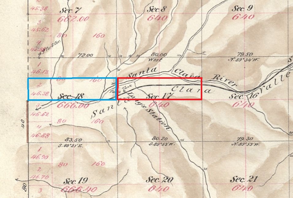
The blue rectangle contains the land of both patents. This map has lot numbers. The red rectangle is J.B. Lang's father's homestead, patented in 1882. Section of Plat Map for Township No. 4 North, Range No. 14 West, San Bernardino Meridian. Surveyed by W.H. Norway in 1879. Approved by Survey-General's Office, San Francisco, California, March 10th, 1880.
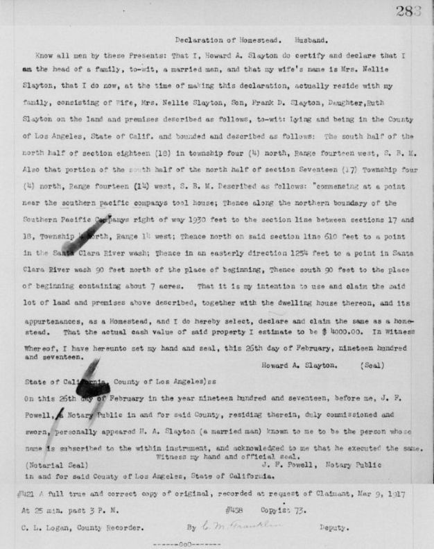
The homestead record of Howard Slayton filed on February 26, 1917. (LA Recorder's Office, Homesteads, Book 69, pp. 283-284.)