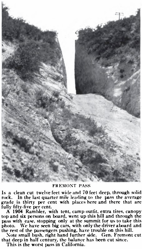
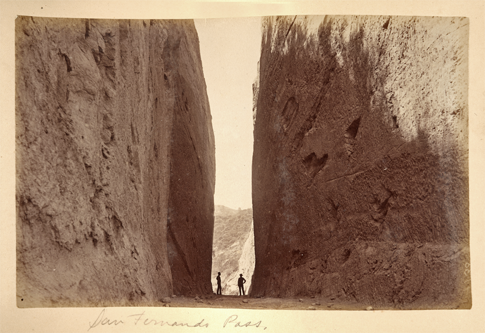
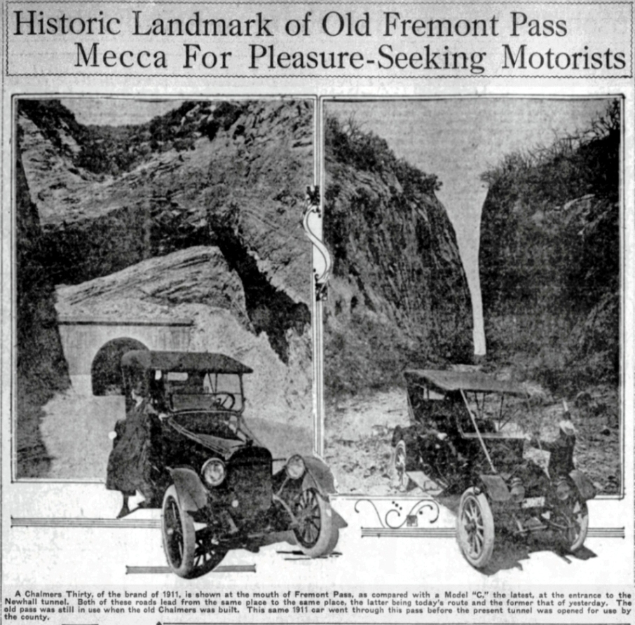
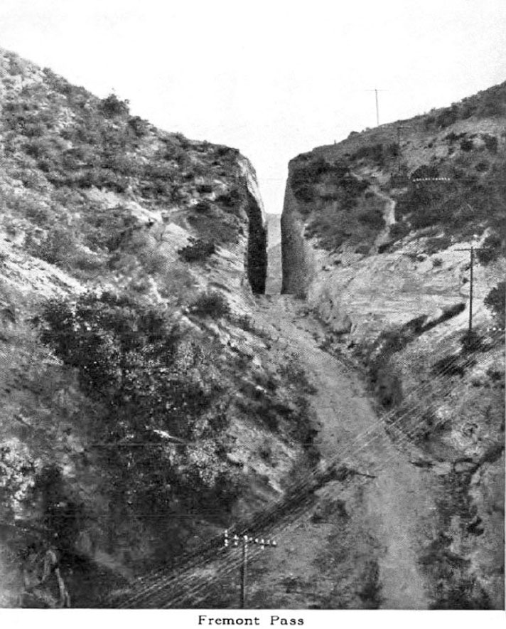
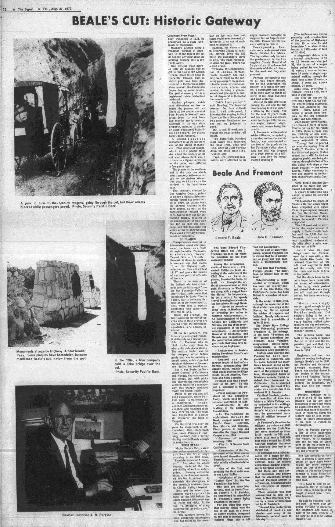
Beale's Cut (Fremont Pass)
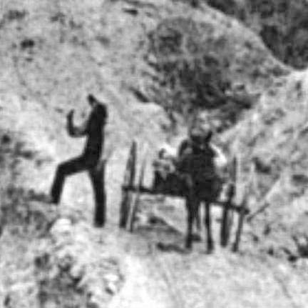
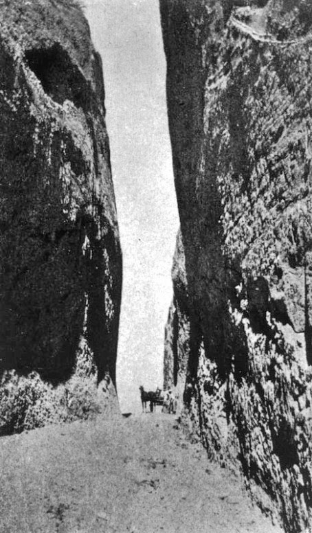
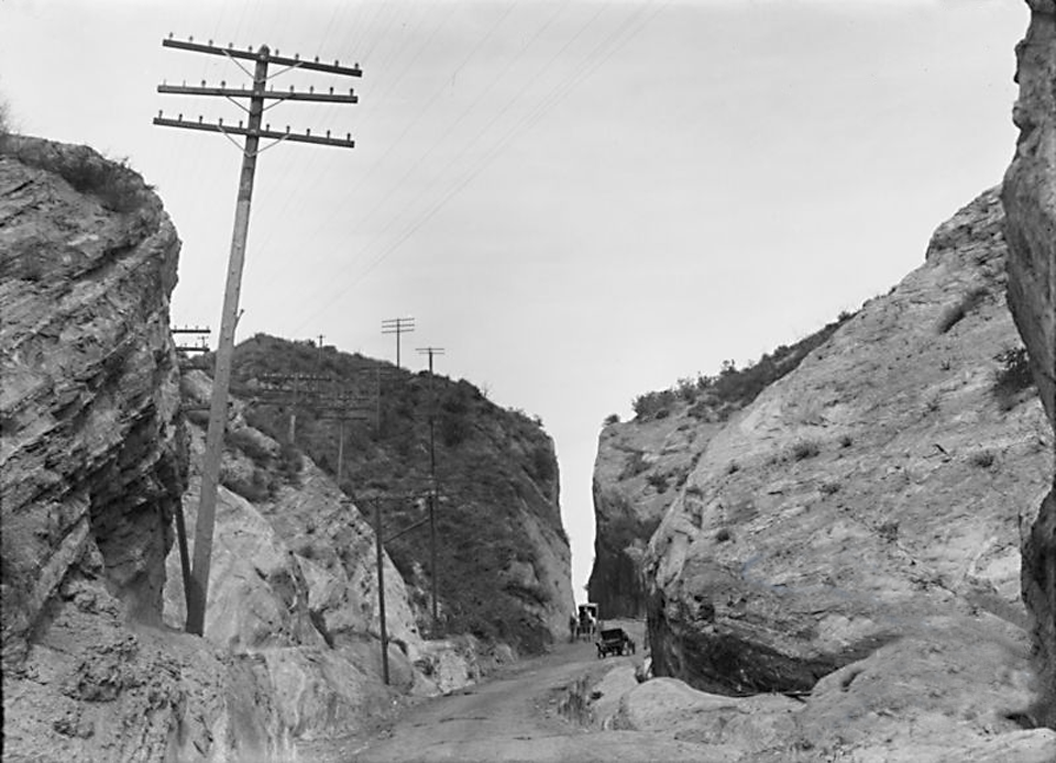
Title - "Top of Newhall Grade". Photo by William H. Fletcher dated 1889.
Copyright Note: This image is NOT in the public domain and is protected by the copyright laws of the United States.
Ana Bégué de Packman Papers (Collection 1491). Department of Special Collections, Charles E. Young Research Library, UCLA.
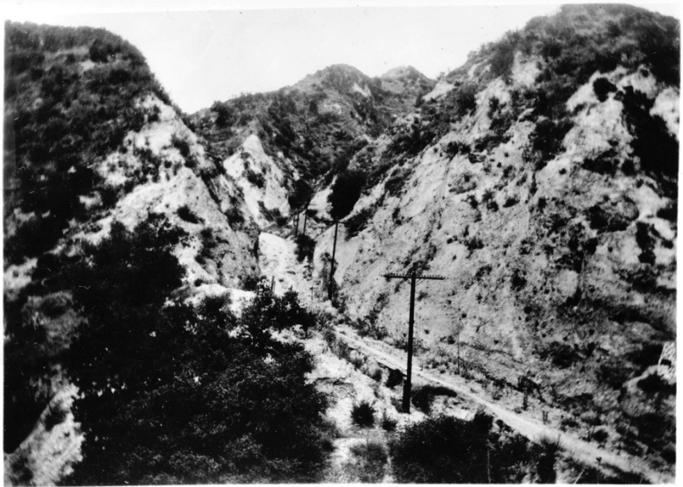
Beale's Cut, with a new road, replaced the Old Road in the 1850's and was located in the next small canyon west of the canyon where the Old Road was (although the Old Road was still there). The cut would be less than a quarter of a mile west of the Old Road. A replacement for the Old Road was necessary because wagons were getting bigger, longer, heavier and more frequent. In the north, Fort Tejon was just opened and new mines were being established. More supplies were needed for both. The Old Road was too difficult for wagons to travel. Instead of improving the Old Road, a new road would be constructed that would run from the north side of the then San Fernando Mountains, south up a canyon, over a ridgeline, and down though another canyon on the other side into the present San Fernando Valley. The pass could be made even lower by cutting down the sharp ridgeline at the top.
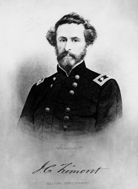
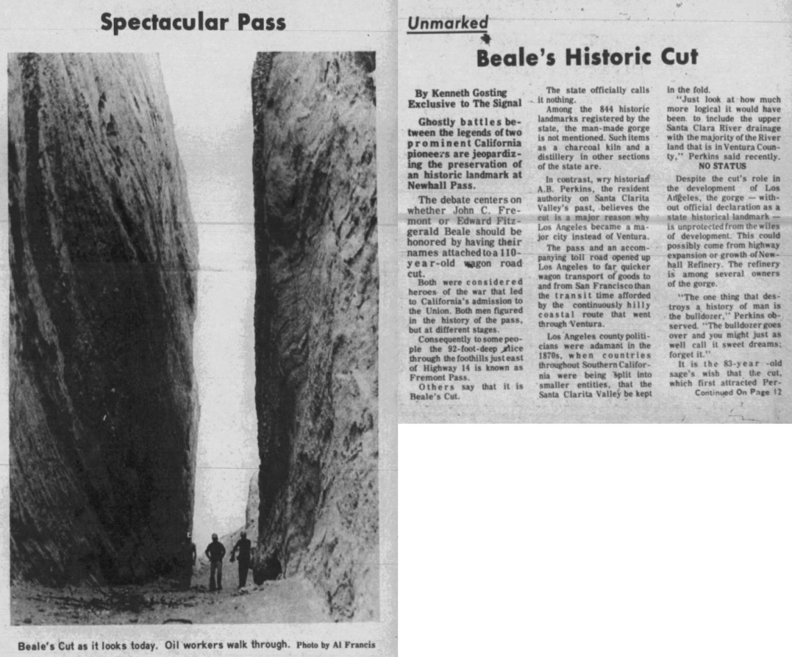
Beale's Cut was not actually called that until the 1920's. Before that, it was most commonly called Fremont Pass and the San Fernando Pass. It has also been called the Newhall Pass and the Newhall Cut. John C. Fremont passed near there in 1847 and had nothing to do with digging the cut. Fremont just wanted to get his soldiers over the pass to the San Fernando Valley as quickly as possible. They were ready for fighting not digging.
However, it was long believed that Fremont did make the first cut when his troops passed over the mountain in 1847. The Los Angeles Times of January 5, 1908, reported that:
"General Fremont first used this route as a road, and did the first road work, cutting a hole in the top of the mountain some twelve feet deep."
"Following up the canyon, he [Fremont] found at the summit an abrupt hill, the backbone of the San Fernando Mountains. The brass cannon had been hauled by his men, and here it seemed impossible to pull the small field piece up the hill, so hastily a trail was made and then a cut in the top of the hill. That was the origin of this awful hole through the peculiar formation of the Sierra de San Fernando."
But none of the written first-hand accounts of Fremont's journey mention anything about digging a cut at the top of a hill. They were in a hurry to get to the other side and had no time for digging anything.
From the Signal of April 21, 1927:
"The writer, in company with Auguste Farrier [an early rancher in Newhall] took a look over the mountains in the vicinity of the [Newhall] tunnel and the 'Fremont Pass', Tuesday. From a careful observation, and without survey, it seemed almost impossible to consider the cut known as the pass as a feasible route for a road. At least fifty feet additional depth would be required to make the grade at all passable from the south, and the north is almost as bad...And by the way the supposed Fremont Pass, is not the Fremont road at all Mr. Farrier states. He showed a path, which plainly had been a trail over the mountain, and had been at one time a wagon road. This, he says, was the real road used by Fremont, while the pass was cut for a toll road, and was so used for many years."
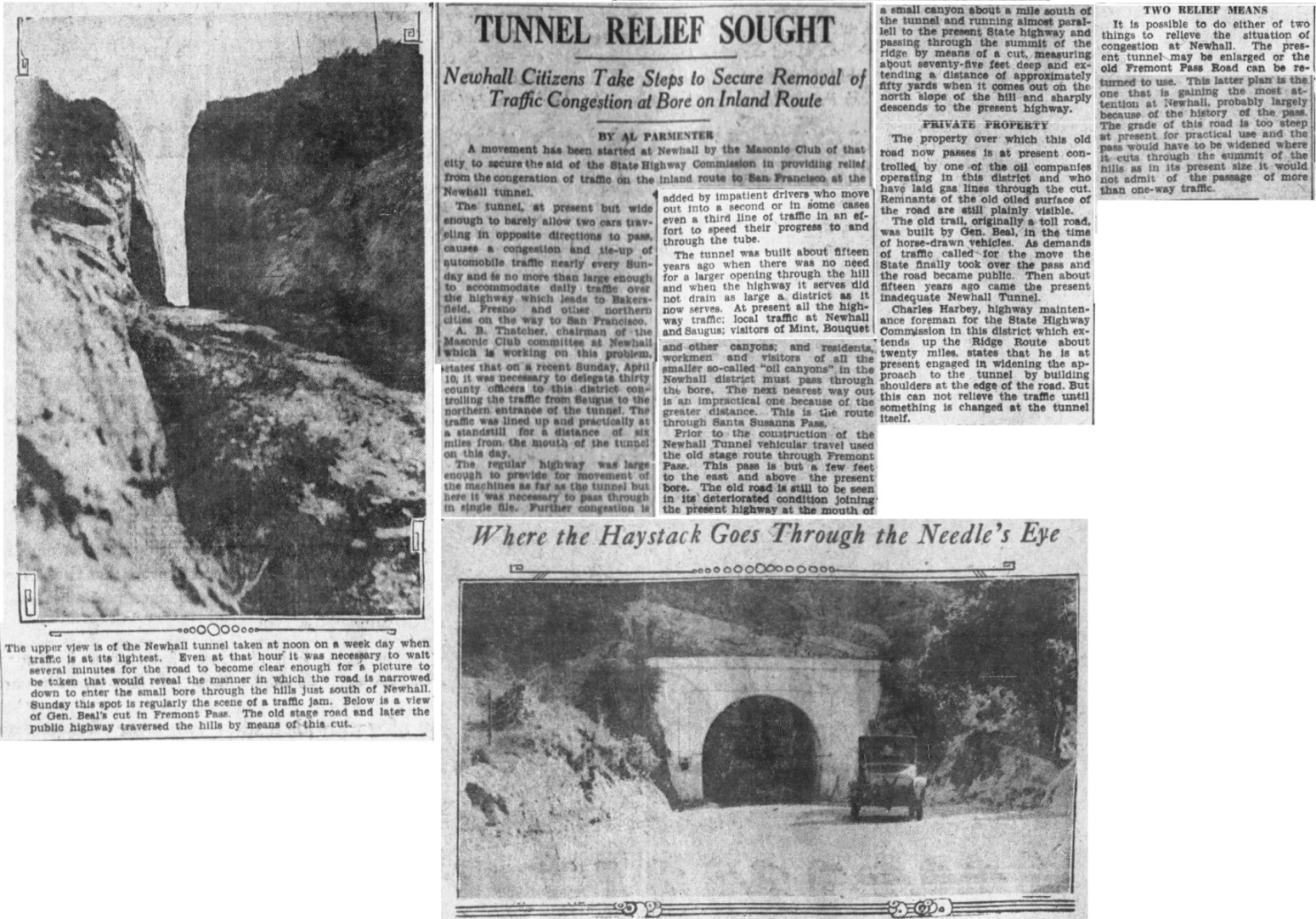
The earliest written reference to "Beale's Cut" that I have found is from the Los Angeles Times of April 17, 1927, although the cut was in Fremont Pass. The caption to a photo showing the cut says "Below is a view of Gen. Beal's cut in Fremont Pass." The Newhall Signal of July 11, 1935, had a story about the annual celebration called Placeritos Days. They report that one of the floats was "Fremont Pass by Saugus Community Club. This was one of the finest floats ever presented in these celebrations. It was made by Mr. and Mrs. Walter Baugher, and represented the old road thru Beale's Cut, the only road to Newhall in 1880." From the Newhall Signal of May 28, 1936, again talking about Placeritos Days, they mention "Beale's great cut". The Newhall Signal June 4 follow-up to the May 28 story, says "the striking Beale Cut float entry which won first Theme prize last year."
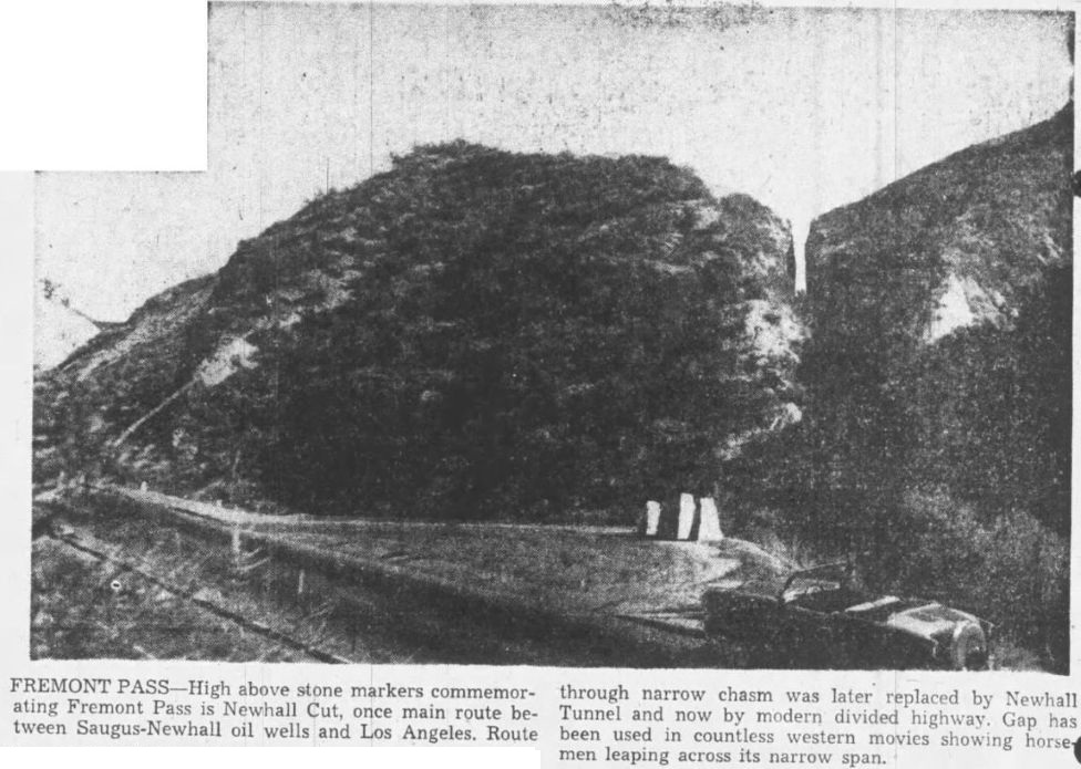
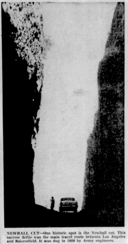
In The Highway Magazine, Volume 29, Armco Drainage & Metal Products, 1938 (p.87) it says: "In 1910 a tunnel, known as Newhall Tunnel, was excavated by the Los Angeles County Road Department about 400 feet west of the old Beale cut, and through this the road has run until the present time."
In a 1948 newspaper article (Bakersfield Californian, January, 13, 1948), historian Vernette Ripley argued that the pass should have been named after Beale and not Fremont, showing that Fremont Pass was still commonly used then. Today, "Beale's Cut" has taken over as the name used, but it is not the historical name.
Those interested in the history of the pass should read Vernette Ripley's "The San Fernando Pass and the Pioneer Traffic that Went over It" from The Quarterly of the Historical Society of Southern California, 1947-48. This is on the SCVHistory website.
A windlass was often needed to get over the pass. In "Reminiscences of a Pioneer" (Annual Publication of the Historical Society of Southern California, Volume 7, 1906, p. 59) Jacob Kuhrts writes:
"In 1857, in company with John Searles, I left San Francisco with a big mule team for Slate Range and Los Angeles."
"...over San Fernando Pass, where it took four yokes of cattle and a windlass to bring my team over the pass into San Fernando Valley, and thence to Los Angeles."
There is a drawing of Wiley's Windlass on the SCVHistory website. However, no historical account of traveling throught the pass has even mentioned Wiley's windlass, although Henry C. Wiley did live at the pre-Lyon's station at the base of the pass near the entrance to present-day Eternal Valley Cemetery from about 1864 to 1868. In 1868, Sanford Lyon took over and Lyon's Station came into being. The myth of Wiley's Windlass seems to have been started by someone at the SCV Historical Society.
In 1858, the first Butterfield Overland Mail stage used the pass. On board was only passenger - Waterman L. Ormsby, a 21 year old special correspondent for the New York Herald. He writes ("The Butterfield Overland Mail" by W.L. Ormsby, The Huntington Library, San Marino, Ca, 1942):
"The road leads through the New Pass, where it strikes the old road from San Bernardino to the Tejon Pass of the Sierra Nevada mountains. The canyon road is rugged and difficult. About the center of the pass is, I believe, the steepest hill on the whole route. I should judge it to be a full 800 feet from the level of the road, which has to be ascended and descended in the space of a quarter of a mile. Perhaps my idea of the distance is not correct; but certainly it is a very steep hill, and our six horses found great difficulty in drawing our empty wagon up. The road takes some pretty sharp turns in the canyon, and a slight accident might precipitate a wagon load into a very uncomfortable abyss."
From the "Notes of a Trip to Los Angeles" in The Daily Alta California of October 7, 1860, the cut is only 20 feet deep:
"Crossing the San Fernando Pass, where a cut about twenty feet deep and about ten feet wide has been made into the summit of the mountain, we emerged upon the plain of San Fernando..."
The pass obviously needed improvement for the Butterfield Overland Mail stage. In 1860, the L.A. Board of Supervisors awarded a contract to Gabe Allen, J.S. Griffin, J.B. Winston, and J.C. Welsh, to widen and lower the road over the summit. Allen's improvements were done that year.
However, the pass still needed improvement. In 1861, a state legislative act gave a franchise to Charles Brinley, Andres Pico, and James Vineyard, to cut down the pass by at least 50 feet. They would also be able to collect tolls for a period not to exceed 20 years.
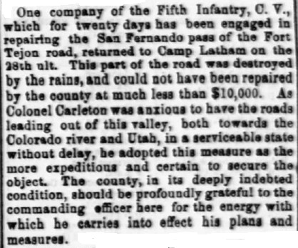
In the meantime, the winter of 1861-62 so greatly damaged the pass that wagons could not get through at all. In March, the road was repaired by soldiers under the command of Major Theodore Coult of the Fifth California Volunteer Infantry, who was headquartered at Camp Latham, California, at the time. Wagons carrying ammunition could not get to Fort Yuma, Arizona. (From Official Records of the War of the Rebellion, Washington, D.C.,Government Printing Office, 1897, and LA Herald of 3/5/1862.)
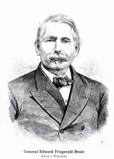
In 1862, Beale took over the franchise from Brinley, Pico, and Vineyard. By April of 1863, Beale, probably using Chinese laborers, finished the work required by the act. It is sometimes claimed that Beale used troops from Fort Tejon, but this is not true. For one thing, he was not in the army anymore and had no authority over any troops. And there were no troops at Fort Tejon at this time. The fort was abandoned in May of 1861 and not re-occupied until July of 1863, this time by California volunteers. On September 11, 1864, the fort was forever abandoned.
However, the L.A. Board of Supervisors were not willing to ratify Beale's franchise without more work (see article below). Beale reluctently agreed and by 1864 the extra work was done and approved by the supervisors. Beale began to collect tolls from travelers going through the cut. The toll would remain for 20 years.
Jose Jesus Lopez worked for Beale from 1874 until Beale's death in 1893. He knew Beale well and talked to him often. From "Saga of Rancho El Tejon" (see The Old Road page), Lopez recounts (pp. 195-197):
"Understand, the cut was made by hand labor with pick and shovel and the use of powder. Even after the cut was made, it was a steep grade to climb with teams and loaded wagons. My father used to keep two span of oxen and a driver there to help pull rigs and wagons and the stages over it. Teamsters from the San Joaquin Valley, Tehachapi, and the Cummings Valleys had to have a lift through the cut, even after the telegraph line was built. Teamsters would telegraph my father when they would be at the cut, and he would have double yokes of oxen there to help them make the pull."
In the Los Angeles Herald of November 30, 1891, Beale tells the reader about the cut:
"General, you built that road over the mountains south of Newhall that we travel over in going to Los Angeles, didn't you?"
"Yes, Andres Pico, Fellows and Forbes got a franchise for twenty-one years to build a toll road over that pass. [Beale was wrong here - it is documented that it was Pico, Brinley and Vineyard.] I bought the franchise of them and built the road. From the way it looks now you have no idea of the great amount of work we did there. In one place we had a fill of forty-five feet. Before I built that road everything had to come from the north (Stockton.) The first time I crossed that mountain we had to plant massive posts in the ground, and then, fastening ropes to the wagon and round the posts, the mules pulled down hill and drew the wagon up to the posts. Here it was blocked until the ropes were put round another post, etc. I made just about as much out of the toll road as it cost."
After the Newhall railroad tunnel was completed in 1876, traffic through the cut steadily decreased.
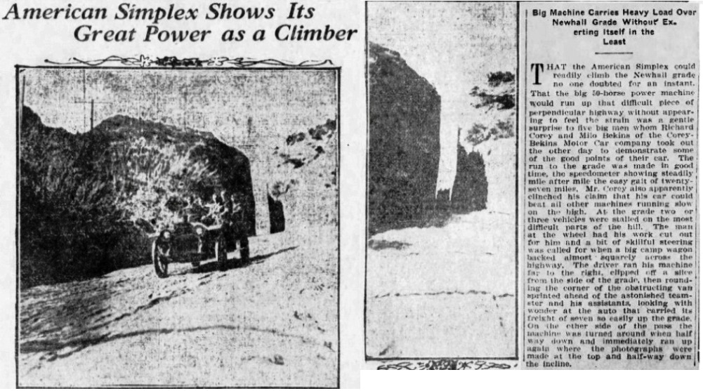
In 1902, car dealer Ralph Hamlin drove the first car (an "Autocar") through the cut accompanied by the new owner. The grade (called the "Newhall grade") was so steep, gasoline would not flow to the carburetor and he had to climb up in reverse. Both men had to jump out of the car to block the wheels with rocks each time the engine stalled.
In 1904 the cut was again deepened by a few feet and the approaches to the cut were improved for autos.
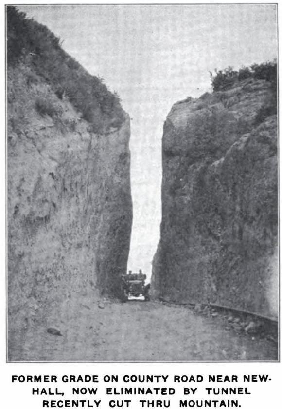
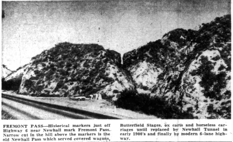
As more and more autos used the cut, it was clear that some other way to cross the mountain was needed. By 1907, a tunnel bypassing the cut was planned by the county. It was finished in December of 1910.
In the Pasadena Star-News of August 12, 1965, Russ Leadabrand wrote in his "Off the Beaten Path" column: "I have heard that Beale's Cut, that historic narrow slot in the hills there, will go the way of all freeway obstacles and will be bulldozed away." Luckily, that did not occur.
On May 11, 1992, Beale's Cut Stagecoach Pass was listed as California State Historical Landmark Plaque #1006. The description reads:
"Beale's Cut is the only physical and cultural feature of its kind in the entire Los Angeles Basin. At the time of its construction in 1862, the actual creation and maintenance of the Cut was considered a significant technological and physical feat consisting of breaching the former impassable geographic barrier of the San Gabriel and Santa Susana Mountain ranges. General Edward F. Beale is attributed with the construction of a toll road across the mountains. Beale's Cut was also used as a favorite film-making location by pioneer film maker, David Wark Griffith, and others."
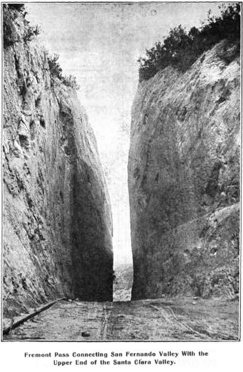
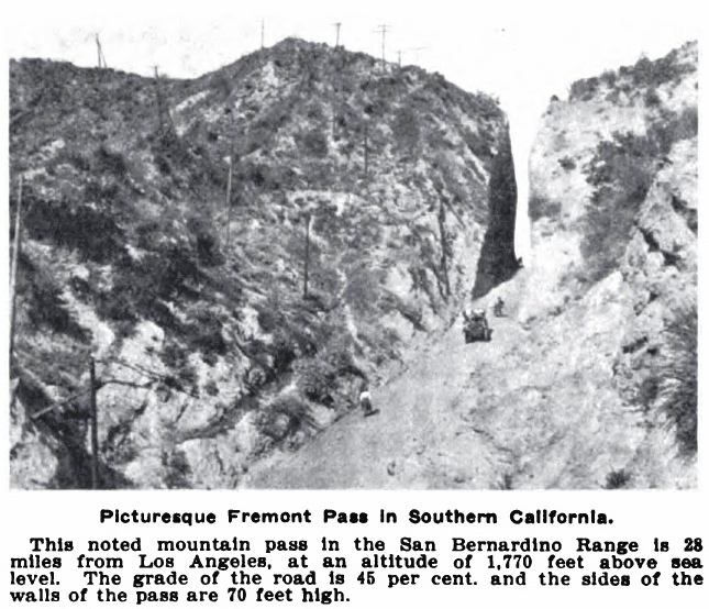
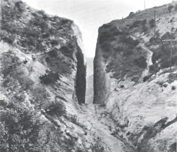
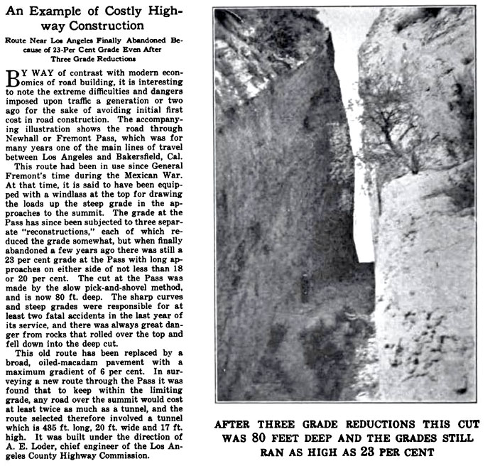
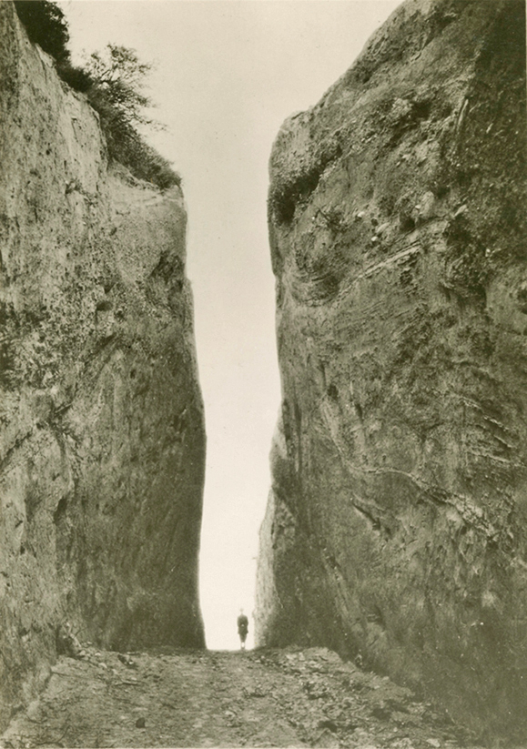
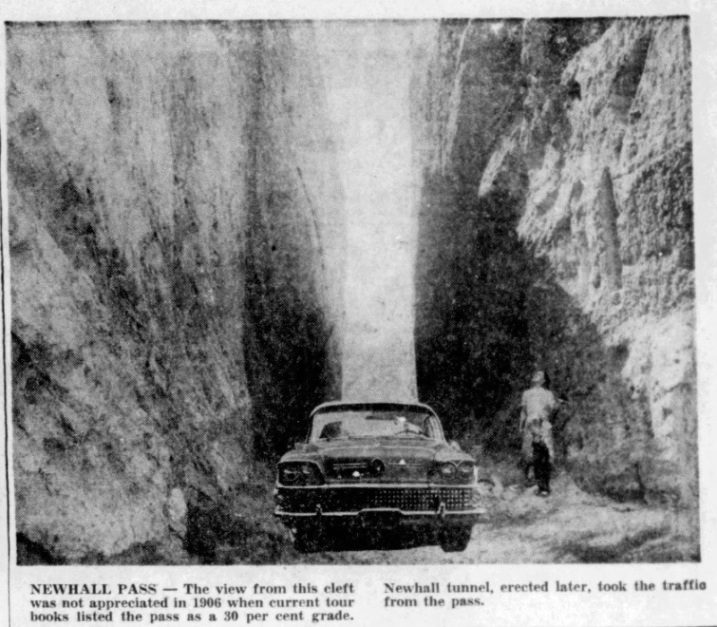
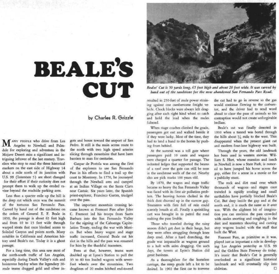
The final depth of the cut has been variously reported as being between 50 and 156 feet. Ripley gave no depth in her 4-part San Fernando Pass series in the Southern California Historical Society Quarterly of 1947-48. California Highways and Public Works magazine issue of January, 1938, stated that the depth of the cut was 50-60 feet. H.E. Rensch writes in "Historic Spots in California" (Oxford University Press, 1932) that the depth was "from fifty to sixty feet." Other publications state 80-90 feet. John Bourke ("The Diaries of John Gregory Bourke, Volume One, 1872-1876") claimed it was 156 feet, a record depth. Based on looking at many photos, I think that the depth was about 65 feet.
More information and photos can be found on the SCV History website.
Fort Tejon opened in June of 1854. This article from the Los Angeles Herald of November 22, 1854, shows that solders found that work on the road in the pass was progressing.
Soldiers repairing the road after rain damage in 1862. Article of left from the Los Angeles Herald of March 5, 1862. Article of the right from the Los Angeles Star of March 15, 1862.
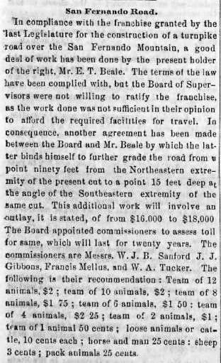
Los Angeles Star of April 4, 1863. Beale finished the cut work, but the LA County Supervisors were not satisfied and demanded more. They wanted him "to further grade the road from a point ninety feet from the Northeastern extremity of the present cut to a point 15 feet deep at the angle of the Southeastern extremity of the same cut." That's a confusing way to say that they wanted it 15 feet deeper. I wonder if some people thought that the 90 feet from the northeastern extremity meant that the cut was to be 90 feet deep. Also note the recommended toll rates.
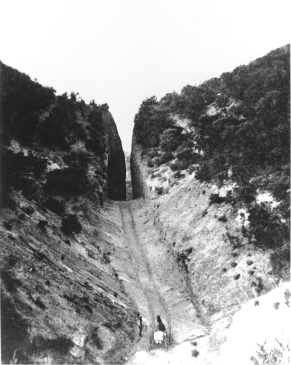
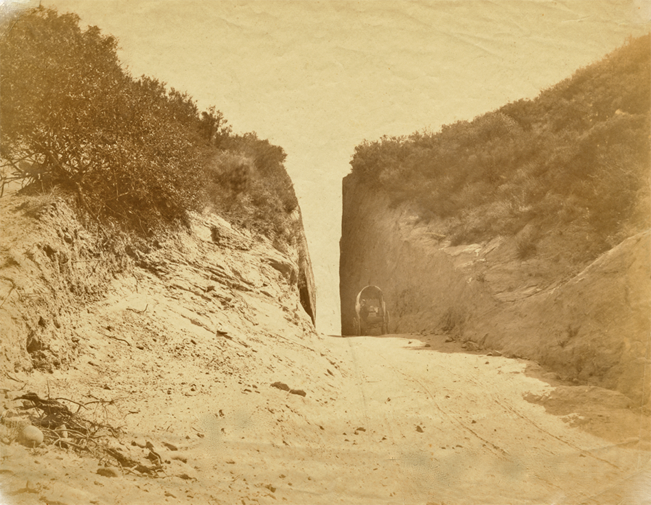
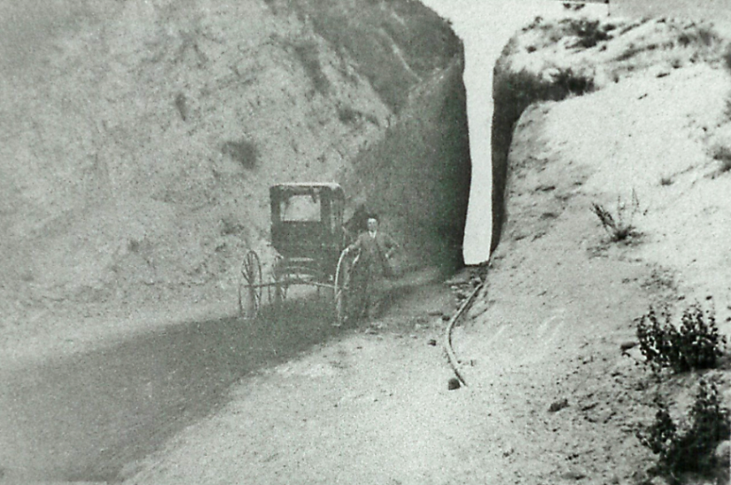
1872 (?) photo of north entrance to cut (looking south). The date of this, and the following photo, is very questionable. This photo, and the next one, are dated 1882 in The San Fernando Pass and the Pioneer Traffic that Went Over It by Vernette Snyder Ripley, Part IV, The Quarterly, Historical Society of Southern California, June 1948, Vol. XXX, No. 2. This photo is also shown in the book San Fernando, Rey De Espana: An Illustrated History (by Pauley and Pauley, Arthur H. Clark Co., Spokane, Washington, 2005) as ca. 1884. The owner of that photo is the Lopez Adobe Archives.
Photo used by permission of the Santa Clarita Valley Historical Society
1872 (? probably ca. 1882) photo of south entrance to cut (looking north)
Photo used by permission of the Santa Clarita Valley Historical Society

Beale's Cut toll house, dated post 1863. Probably ca. 1882.
Photo used by permission of the Santa Clarita Valley Historical Society
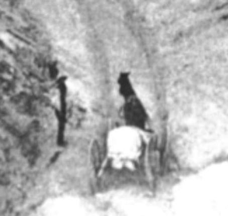
You may have noticed that the previous two photos of Beale's Cut show the same man and carriage in both photos. But if you compare the man and carriage in the toll house, they also look the same. Same hat, same dark outfit, same white shirt sleeves. The carriage style looks the same and it is carrying the same type of load. The horse has a white spot on his forehead and you can just see it on the middle photo. The horse has black front ankles and white back ankles. You can also barely see one white back ankle on the middle photo. Therefore, I believe that the three photos were taken on the same day by the same photographer.
Approximate site of toll house about 300 yards south of Beale's cut on Sierra Highway (5/2010). The original road has been lowered and widened making duplication of the old photo impossible.
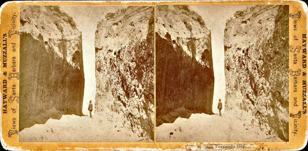
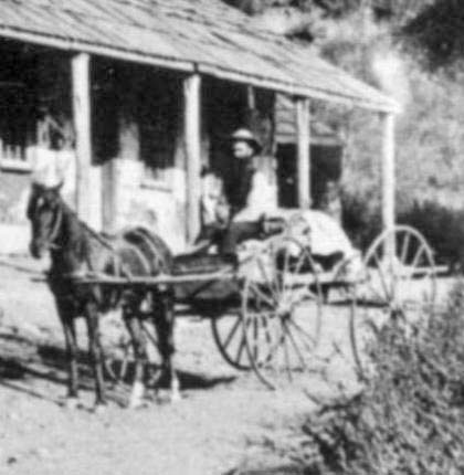
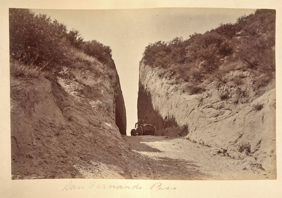
On the front: "San Fernando Gap". On the back: "San Fernando Stage Road. Los Angeles, Ca. D 1875".
Copyright Note: This image is NOT in the public domain and is protected by the copyright laws of the United States.
From the Beinecke Rare Book & Manuscript Library, Peter E. Palmquist Collection.
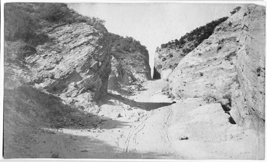
Title - "San Fernando Pass at Beale's Cut". Photo by William H. Fletcher, ca. 1890
Copyright Note: This image is NOT in the public domain and is protected by the copyright laws of the United States.
Courtesy of the California History Room, California State Library, Sacramento, California.
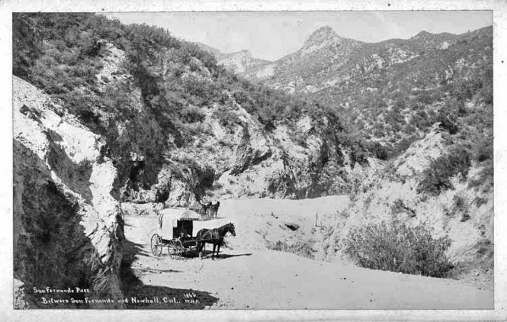
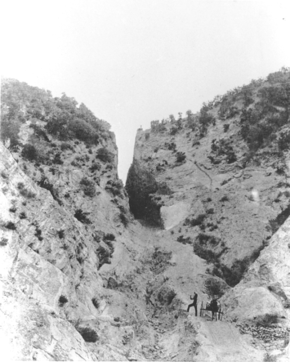
Title - "San Fernando Pass between San Fernando and Newhall, Cal". Photo by William H. Fletcher, ca. 1890. View towards the northeast with Beale's Cut at Fletcher's back. This is the road from the north exit of the cut with the rock tower in the distance.
Copyright Note: This image is NOT in the public domain and is protected by the copyright laws of the United States.
Courtesy of the California History Room, California State Library, Sacramento, California.
Another similar image, dated August 1, 1948.
Copyright Note: This image is NOT in the public domain and is protected by the copyright laws of the United States.
Ana Bégué de Packman Papers (Collection 1491). Department of Special Collections, Charles E. Young Research Library, UCLA.
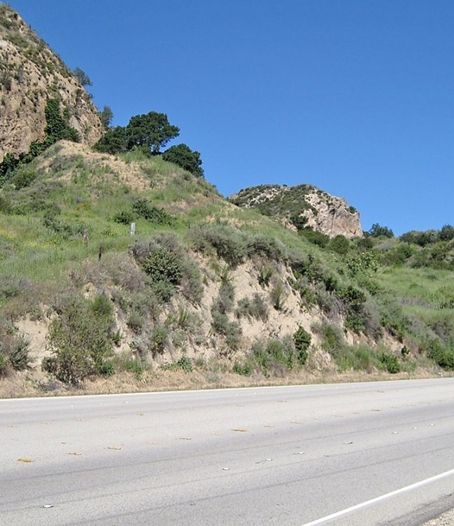
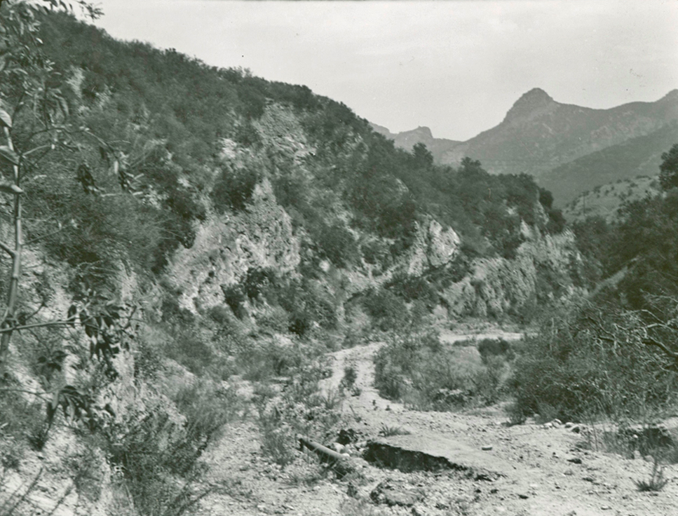
Today's view is hampered by the grading for the Newhall Refinery and more plant life. (3/11/2012)
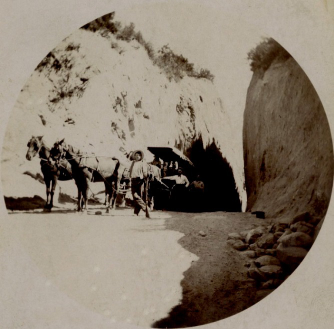
Image from the Michael J. Semas Collection taken mid 1890s by Howland & Chadwick of Los Angeles. The Semas Collection has its own page on Facebook and I highly recommend that you check it out.
Early photo
Copyright Note: This image is NOT in the public domain and is protected by the copyright laws of the United States.
Used by permission of the Security Pacific National Bank Collection/Los Angeles Public Library.
Unknown date. From the Lancaster Museum and Art and History

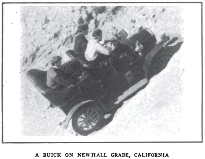
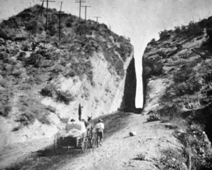
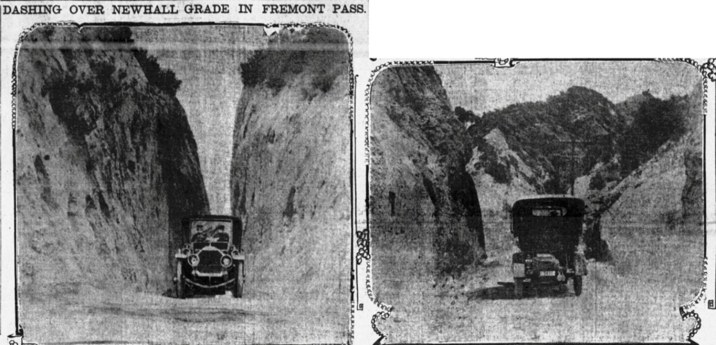
"On the Newhall Grade" from the The Wasp, Vol. L, No. 10, August 29, 1903, San Francisco. Probably the first photo with an automobile in the pass.
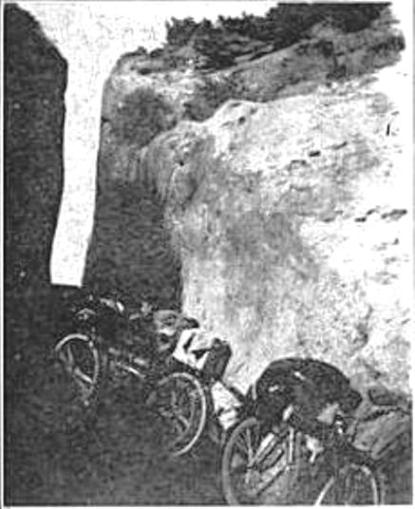
Date unknown. Warren C. Dickerson Collection, Seaver Center for Western History Research.
from the Rambler magazine of August 1905
San Fernando Pass (undated) from the S. L. Walkley Photograph Albums, The Huntington Library, San Marino, California.
San Fernando Pass (also undated) from the S. L. Walkley Photograph Albums, The Huntington Library, San Marino, California.
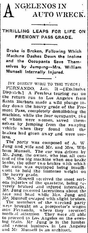
Fremont Pass accident from the Los Angeles Times of February 1, 1905.
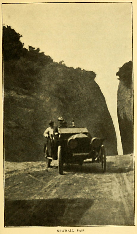
Newhall Pass, 1906
Copyright Note: This image is NOT in the public domain and is protected by the copyright laws of the United States.
University of Southern California, Automobile Club of Southern California negatives, 1892-1963

Newhall Pass, 1906
Copyright Note: This image is NOT in the public domain and is protected by the copyright laws of the United States.
University of Southern California, Automobile Club of Southern California negatives, 1892-1963
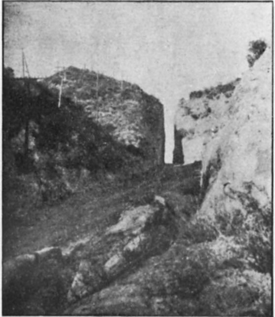
Title: "Fremont Pass" (6-17-1907)
Over the years, this pass has been called Fremont Pass, Newhall Pass, and San Fernando Pass. Photo was taken by J. B. Lippincott, assistant chief engineer of Los Angeles Aqueduct project.
Source: Lippincott Collection, Water Resources Center Archives - University of California, Berkeley
Copyright Note: This image is NOT in the public domain and is protected by the copyright laws of the United States.
Used by permission of the University of California, Berkeley, Regents.

Title: "Newhall Cut, San Fernando" (1907)
Source: Lippincott Collection, Water Resources Center Archives - University of California, Berkeley
Copyright Note: This image is NOT in the public domain and is protected by the copyright laws of the United States.
Used by permission of the University of California, Berkeley, Regents.
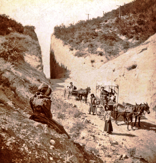
Beale's Cut
Copyright Note: This image is NOT in the public domain and is protected by the copyright laws of the United States.
Hisotory Collections, Los Angeles County Museum of Natural History, Warren C. Dickerson (1853-1936) Collection, circa 1890-1920
From the Los Angeles Times of September 15, 1907.
From the Los Angeles Times of October 20, 1907. The lady in the back seat is getting a rear view of the pass.
Beale's Cut
Copyright Note: This image is NOT in the public domain and is protected by the copyright laws of the United States.
History Collections, Los Angeles County Museum of Natural History, Warren C. Dickerson (1853-1936) Collection, circa 1890-1920
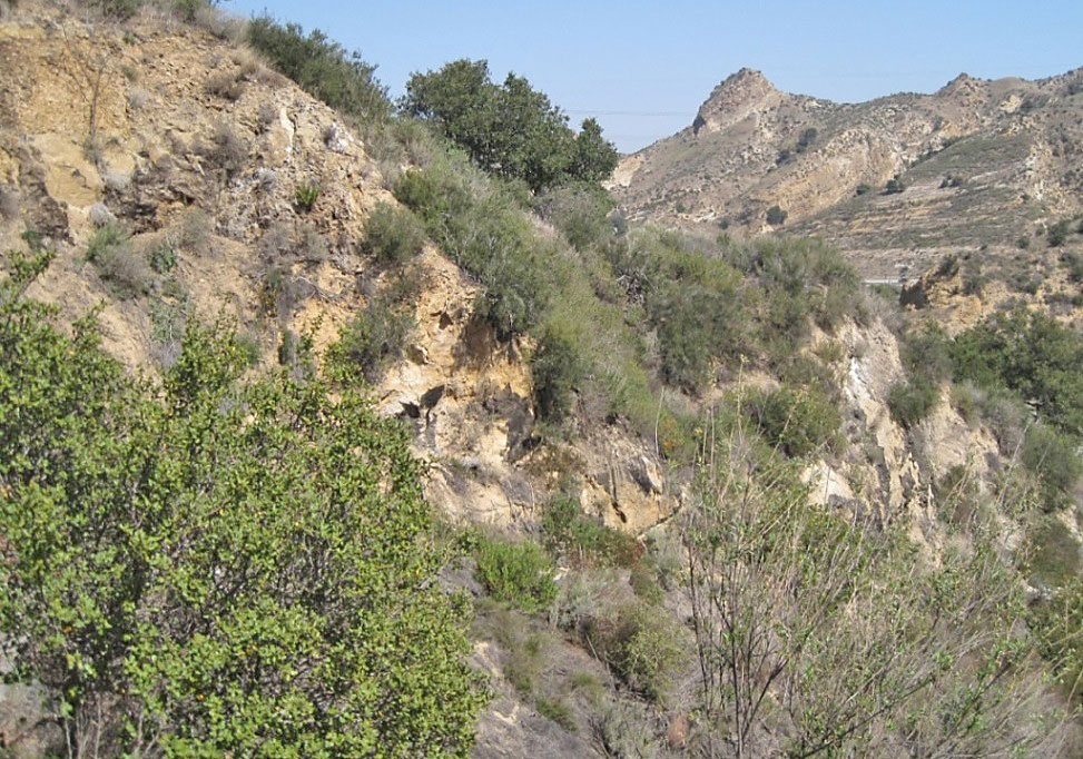
About the same view on 1/25/2017
Beale's Cut
Copyright Note: This image is NOT in the public domain and is protected by the copyright laws of the United States.
History Collections, Los Angeles County Museum of Natural History, Warren C. Dickerson (1853-1936) Collection, circa 1890-1920
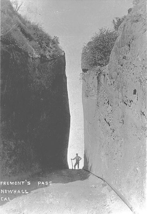
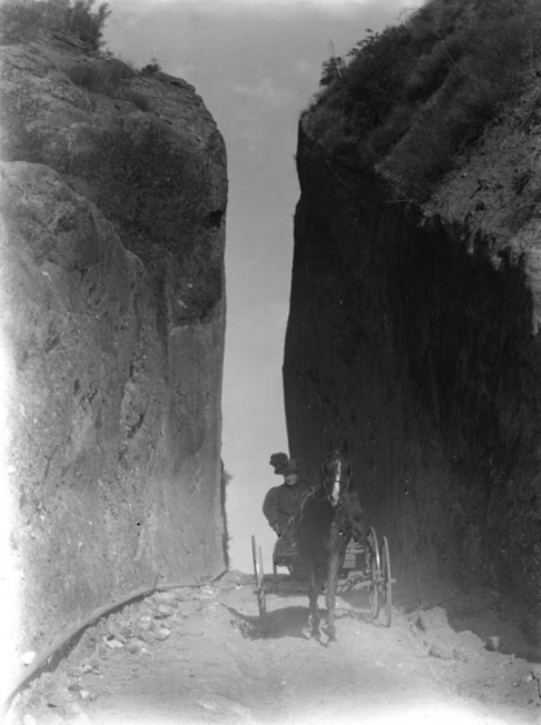
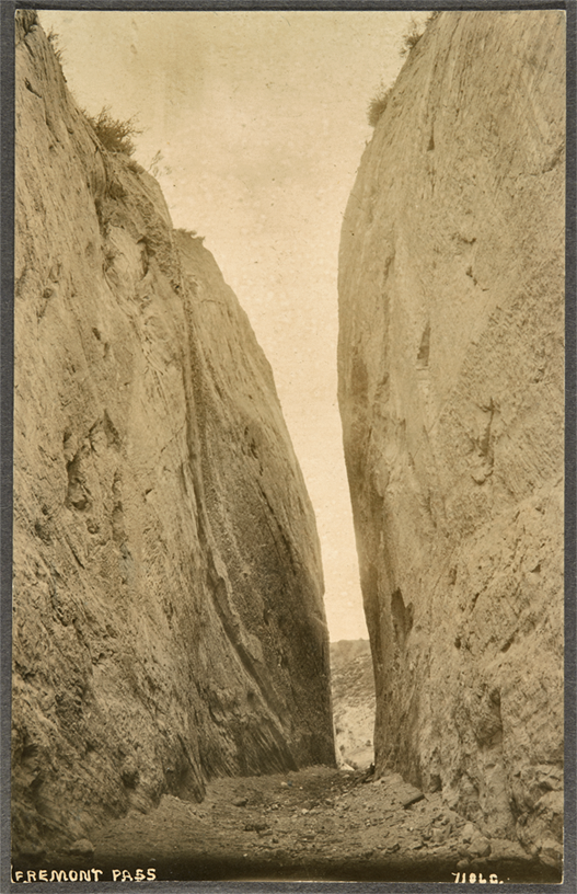
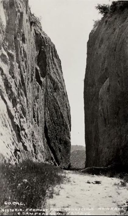
Fremont's Pass, Newhall California"
Photo used by permission of the Santa Clarita Valley Historical Society
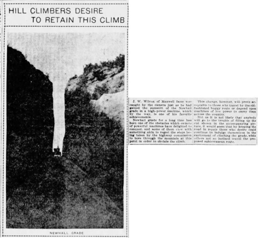
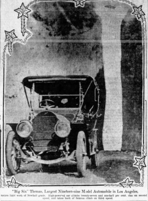
Beale's Cut was very popular test for autos (The Motor Way magazine of January 11, 1906) and motorcycles (Motorcycle Illustrated of January 1, 1909)
From the Los Angeles Times of January 5, 1908.
From the Los Angeles Evening Express of May 23, 1908.
From the Los Angeles Times of January 10, 1909.
From the Pacific Rural Press of March 3, 1909.

Colorized 1909 postmarked postcard using same photo from above.
From the Automobile magazine of April 8, 1909.
From the Los Angeles Herald of May 16, 1909. Photo by Mrs. J. W. Snider.
From the Los Angeles Herald of July 4, 1909.
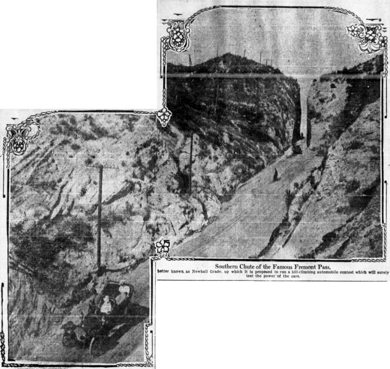
"Newhall grade, one of the heart-breaking climbs of the course." From the Los Angeles Herald of July 25, 1909.
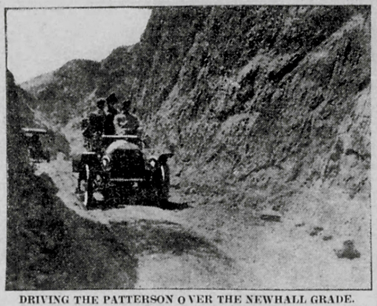
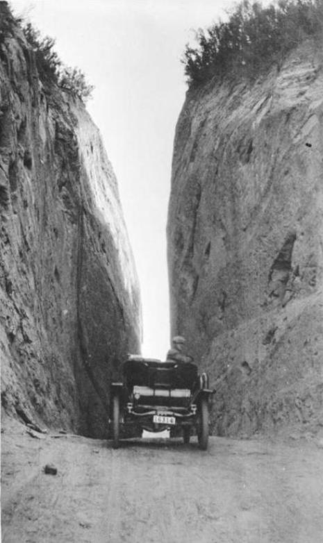
Los Angeles Evening Record, October 16, 1909. At the south entrance, view towards the south. The Patterson automobile is being driven northbound.
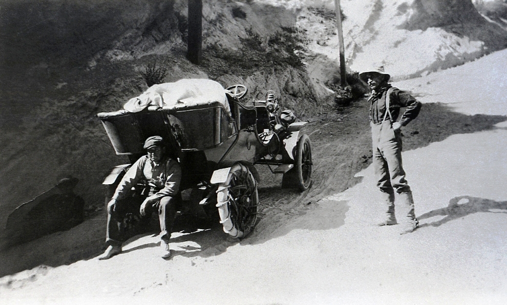
Looks like they are waiting for the horses. The ropes around the rear tires did not give them enough traction to get up the grade. 1905-1910
Photo used by permission of the Santa Clarita Valley Historical Society
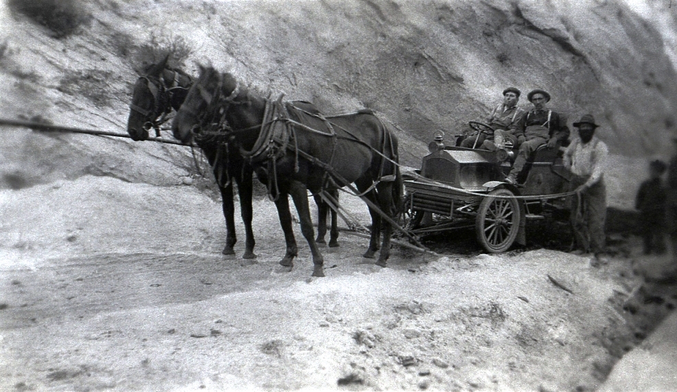
The horses are bringing them up. 1905-1910
Photo used by permission of the Santa Clarita Valley Historical Society
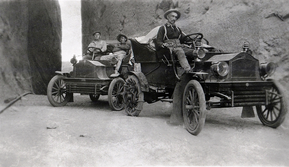
At the top. Acting like they made it up on their own. 1905-1910
Photo used by permission of the Santa Clarita Valley Historical Society
Newhall Pass from "Retracing the Pioneers, From West to East in an Automobile" by Hugo Alois Taussig, Privately Printed, San Francisco, 1910, p. 15.
c 1910. Clarence Gerblick at Beale's cut - From the Lancaster (Ca) Museum of Art and History
From the Los Angeles Herald of June 19, 1910. Photo by L. H. Morrison.
Ebay item labeled circa 1910.
From the Title Insurance and Trust Company's Historical Collection (date unknown)
From the Los Angeles Evening Express of April 4, 1911. New road to the tunnel on left. Road to Beale's Cut on the right. If the cut was clogged up with dirt in 1911, then it must have been cleaned out because later photos don't show that.
From the cover of The Oil Age magazine, Vol. IV, No. 5, August 25, 1911.
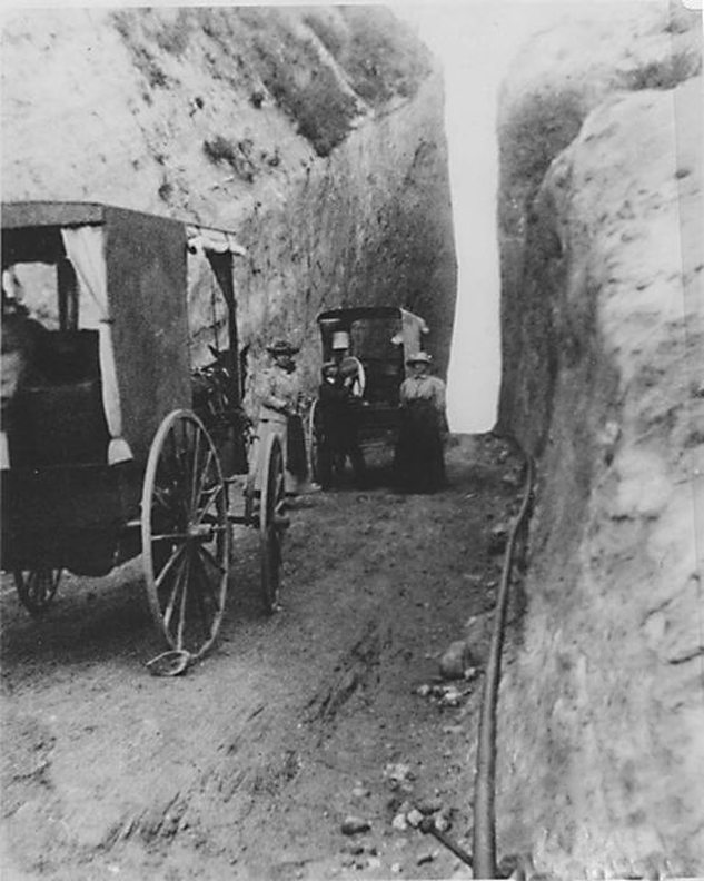
From the Engineering Record - A Weekly Journal Devoted to Civil Engineering and Contracting, Volume 72, Number 4, July 24, 1915, page 102. There seems to be a woman standing on the left side of the cut in the photo.
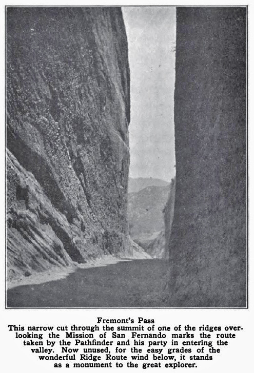
Title: Freemont [sic] Pass. Between Fernando Valley and the Soledad. Showing the old road, and the cut in the pass. This is a favorite place for the movies. Photographer: William H. Frick.
From: The Los Angeles Aqueduct, Itinerary of the Water of the Los Angeles Aqueduct From its Source to 1837 Canyon Drive, 1917.
The Huntington Library, San Marino, California.
From the Los Angeles Evening Express of May 23, 1917.
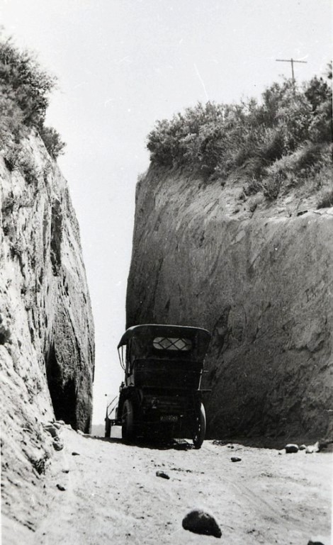
Newhall Pass, ca. 1912-1918
Copyright Note: This image is NOT in the public domain and is protected by the copyright laws of the United States.
University of Southern California, Automobile Club of Southern California negatives, 1892-1963
Date unknown
Photo used by permission of the Santa Clarita Valley Historical Society
Fremont Pass , ca. 1920. From the Charles F. and Mira Culin Saunders Collection of Photographs and Negatives. The Huntington Library, San Marino, California.
From California History by Harr Wagner and Mark Keppel, Harr Wagner Publishing Company, San Francisco, Ca., 1922, p. 120.
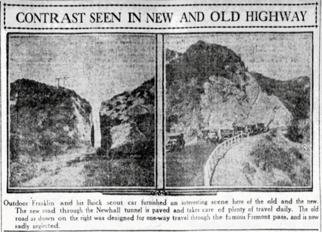
From the Los Angeles Evening Express of March 26, 1924. The old road is shown on the left, not on the right.
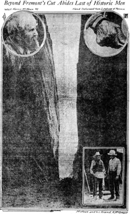
Los Angeles Time of May 25, 1924. Image from story about the death of 92 year old miner West Harris McKean, who was living in Placerita Canyon.
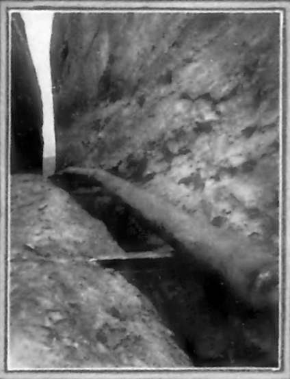
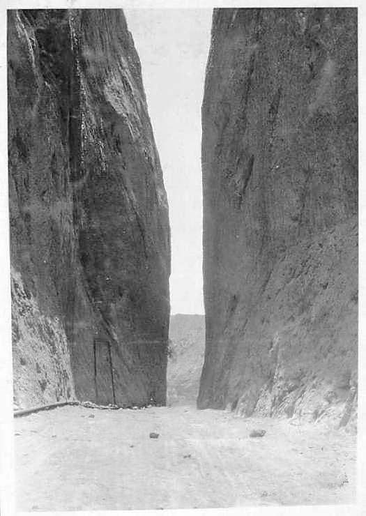
Gas pipe in Beale's Cut. "View of natural gas transmission line constructed between Ventura and Los Angeles by Southern Counties Gas Company" - Caption of the image in the June 1925 issue of Western Gas magazine, Vol. 1 No. 2, p15.
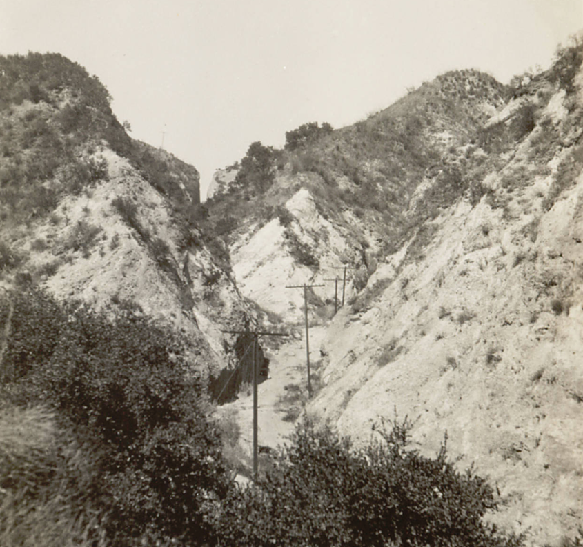
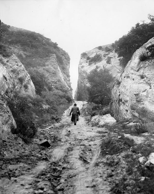
Approach to the cut from the San Fernando Valley. ca. 1926. Photographer - Charles Prudhomme.
Copyright Note: This image is NOT in the public domain and is protected by the copyright laws of the United States.
University of Southern California, California Historical Society Collection
1920's. From "The History of the San Fernando Valley with Special Emphasis on the City of San Fernando", 1930, unpublished master thesis by Clifford M. Smith, University of Southern California, p. 87 (photo credit not given).
Date and person unknown
Copyright Note: This image is NOT in the public domain and is protected by the copyright laws of the United States.
Ana Bégué de Packman Papers (Collection 1491). Department of Special Collections, Charles E. Young Research Library, UCLA.
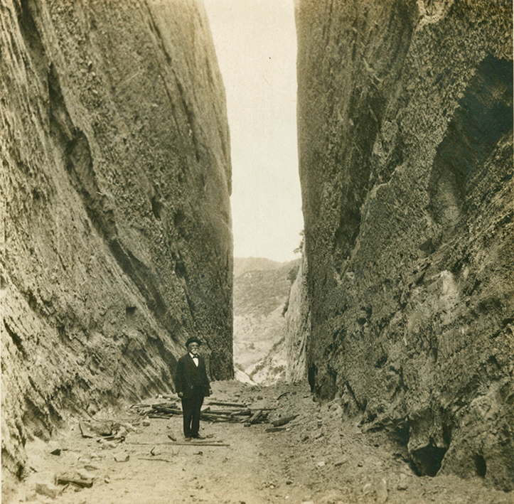
In the Ana Bégué de Packman Papers, the source of this photo, the date and person is unknown. However, the man is Charles J. Prudhomme, who died in 1934. This photo is also in The San Fernando Pass and the Pioneer Traffic that Went Over It by Vernette Snyder Ripley, The Quarterly, Historical Society of Southern California. The photo has a description of "Newhall Cut, 1927, with Charles J. Prudhomme standing." and is from the Collection of J. Gregg Layne.
Copyright Note: This image is NOT in the public domain and is protected by the copyright laws of the United States.
From the Ana Bégué de Packman Papers (Collection 1491). Department of Special Collections, Charles E. Young Research Library, UCLA.
Los Angeles Times, April 17, 1927. "View of Gen. Beal's cut in Fremont Pass", maybe the first use of the phrase "Beal's cut" (in the photo caption).

"The famous 'Beale Cut' as it appeared in 1933, when visited by the Author and Don Jose Lopez. We were there while the pipelines were being installed." Photo by Frank Latta. From Saga of Rancho El Tejon by Frank Latta, Bear State Books, 2006, p. 196.
Undated postcard
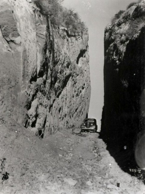
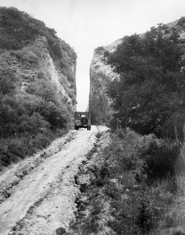
1937 photo from CalTrans, entering
1937 photo from CalTrans, exiting
Looking north from across Sierra Highway - 1937
Copyright Note: This image is NOT in the public domain and is protected by the copyright laws of the United States.
Used by permission of the Security Pacific National Bank Collection/Los Angeles Public Library.
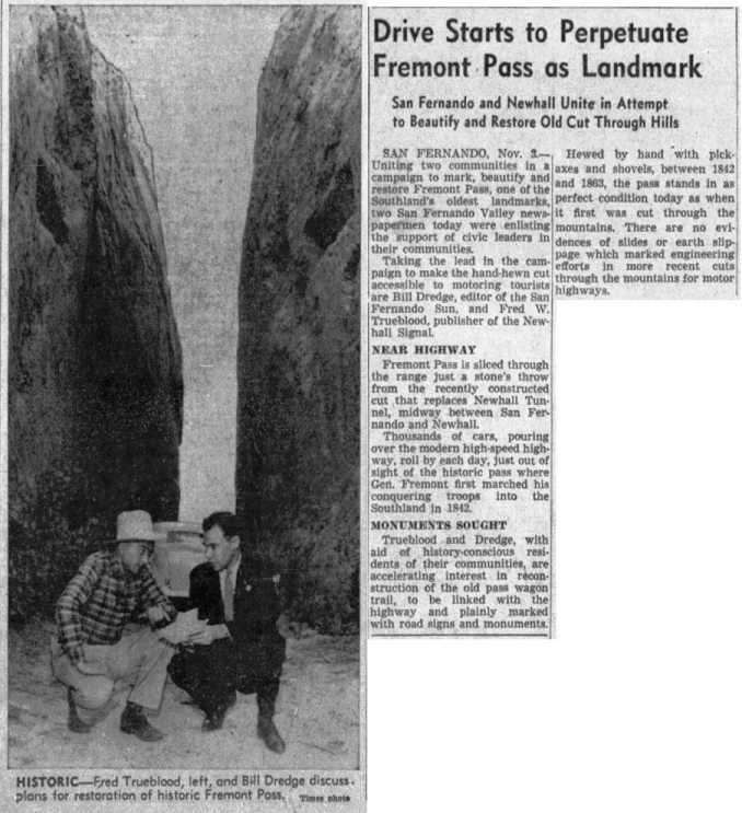
Newhall Signal, October 18, 1940
A good idea that never happened. From the Los Angeles Times of November 4, 1940
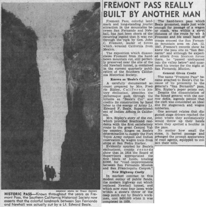
Normally called Fremont Pass, Mrs. Ripley, author of "The San Fernando Pass and the Pioneer Traffic that Went over It" published in four parts in 1947-48 in the Quarterly of the Historical Society of Southern California, pushed to call it Beale's Cut. From the Los Angeles Times of January 11, 1948
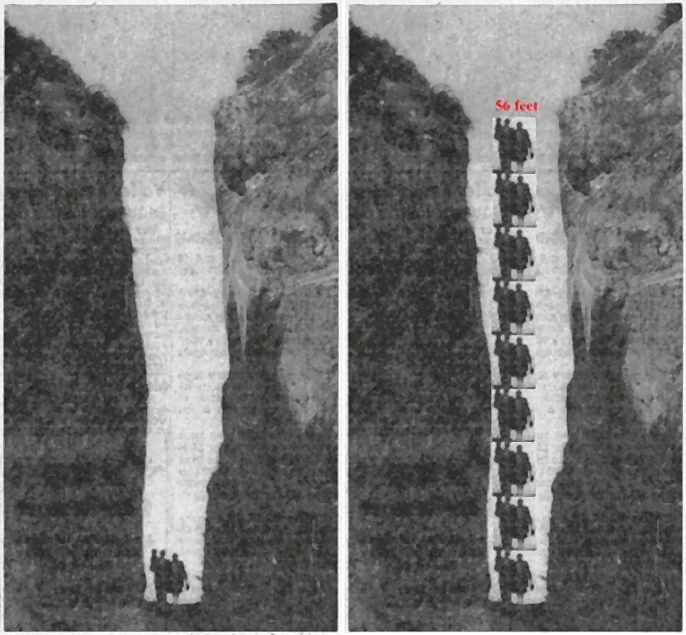
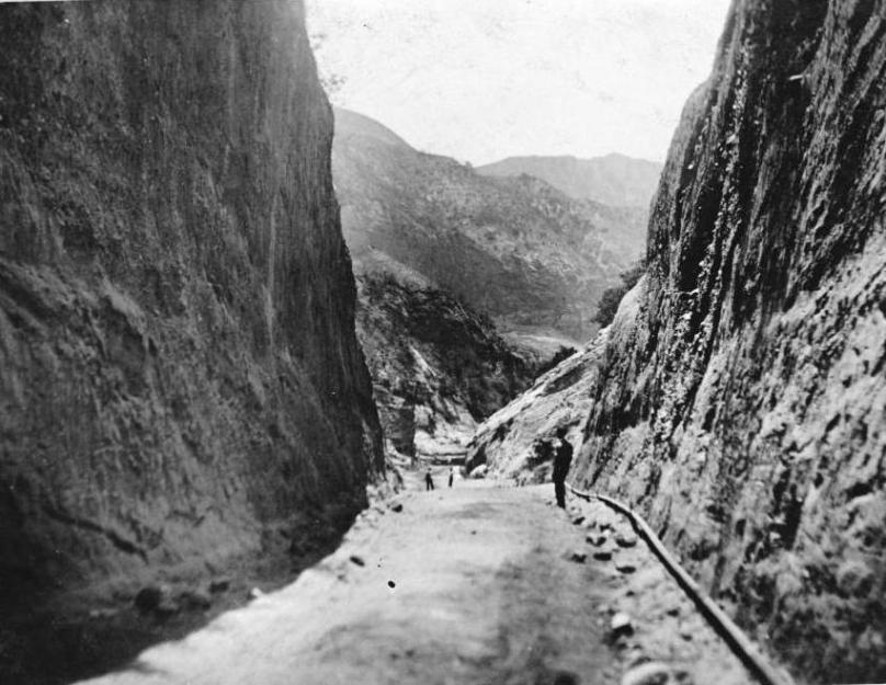
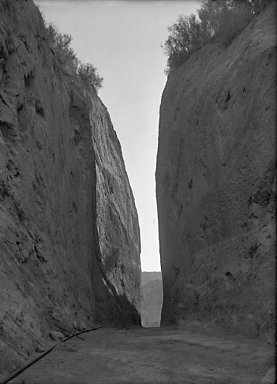
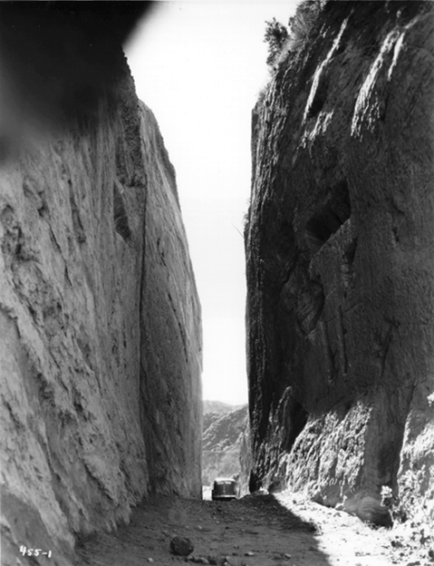
The cut from the previous photo. The depth is commonly overstated. 90 feet is used many times. Here I assume the man is 6'2" to come up with this estimate. Adding 10 feet to my calculation, this shows that the cut was no more than 65 feet deep. It certainly wasn't 90 feet.
1948
From the Valley Times Collection, Los Angeles Public Library
December 11, 1948
From the Valley Times Collection, Los Angeles Public Library
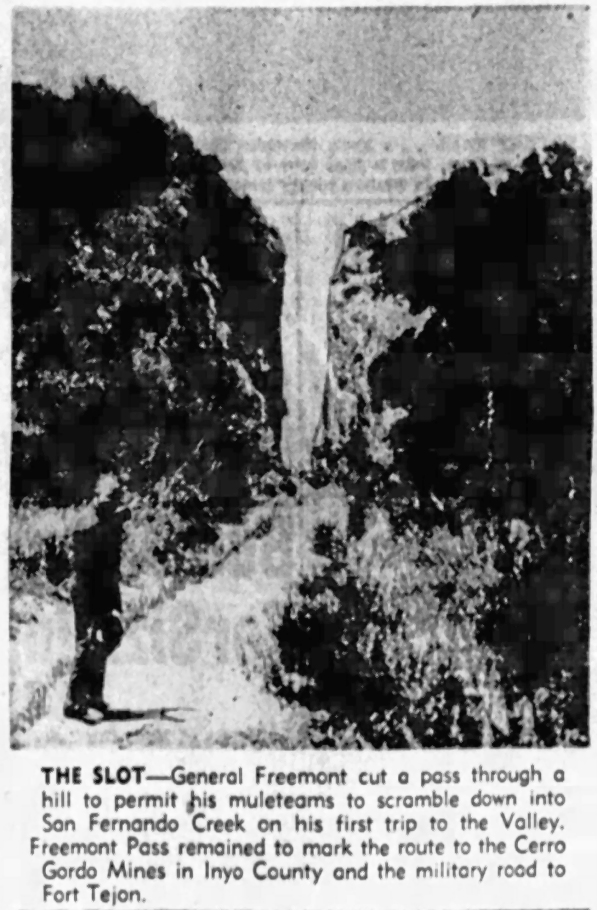
The Valley Times of July 21, 1950. General Fremont (not Freemont) did not cut this pass.

San Pedro News Pilot, April 6, 1954.
Torrance Daily Breeze, April 6, 1954.
San Pedro News Pilot, December 27, 1955.
Torrance Daily Breeze, January 10, 1956.
1955 or 56. Still from film "Rio Santa Clara", Myna Lou Productions, 1956. Complete film (with many historical sites) at the SCVHistory website.
San Pedro News Pilot, November 26, 1957. I wonder about the car. It looks to me like it was added to the Beale's Cut photo.
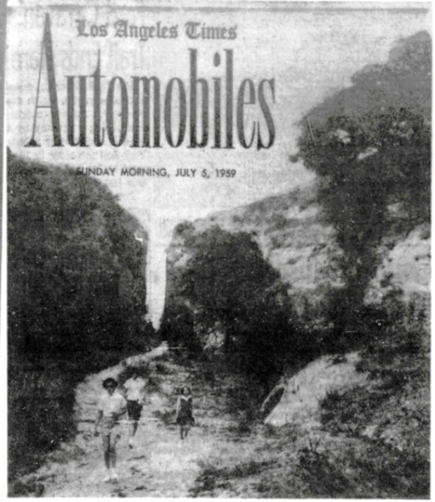
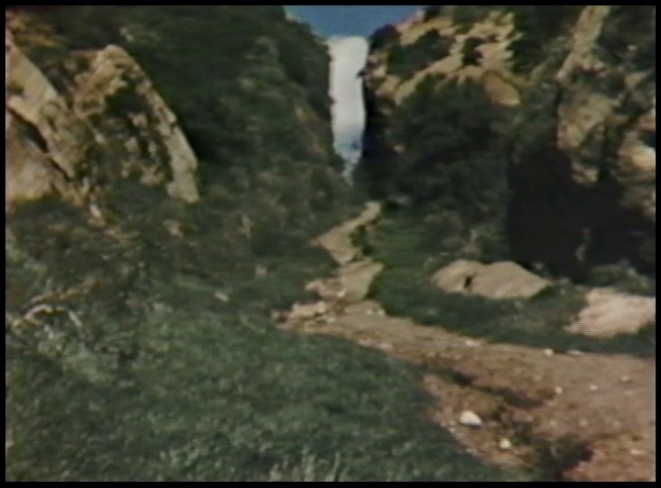
1959

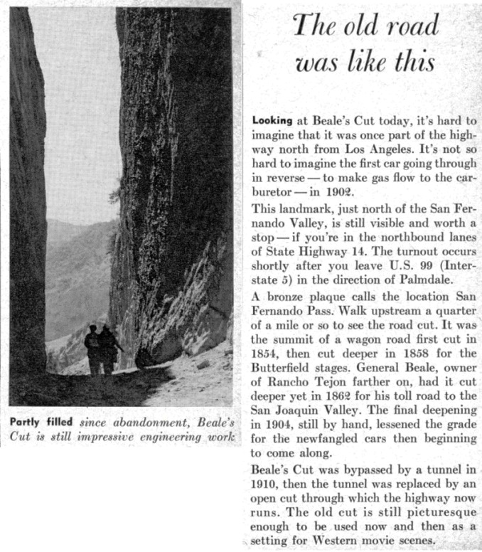
Beale's Cut in the 1960's (from "A Guidebook to the San Gabriel Mountains of California" by Russ Leadabrand, Ward Richie Press, 1964)
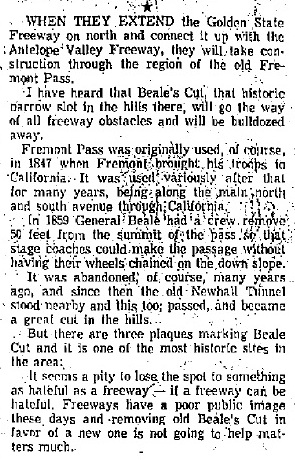
In the Pasadena Star-News of August 8, 1965, Russ Leadabrand reports that Beale's Cut may be eliminated by freeway construction. Luckily, that turned out not to be true.
From Sunset Magazine, January 1967
Story from Desert Magazine, March 1969
Newhall Signal, August 31, 1973 (Part 1)
Newhall Signal, August 31, 1973 (Part 2)
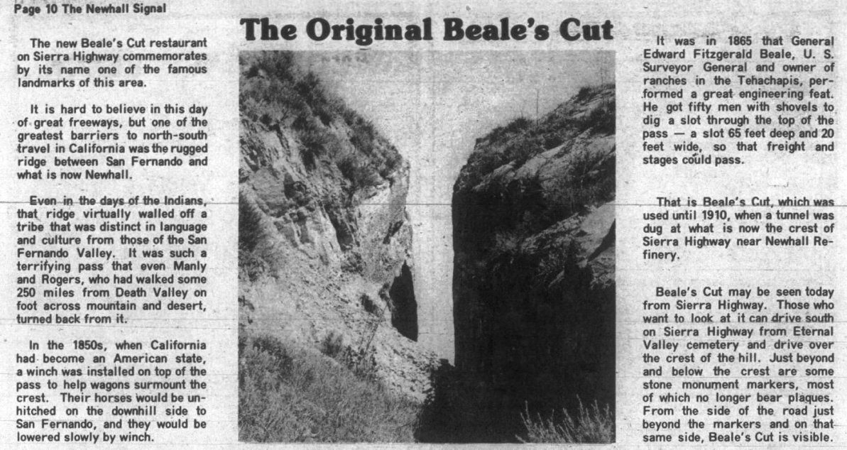
Newhall Signal, October 1, 1975
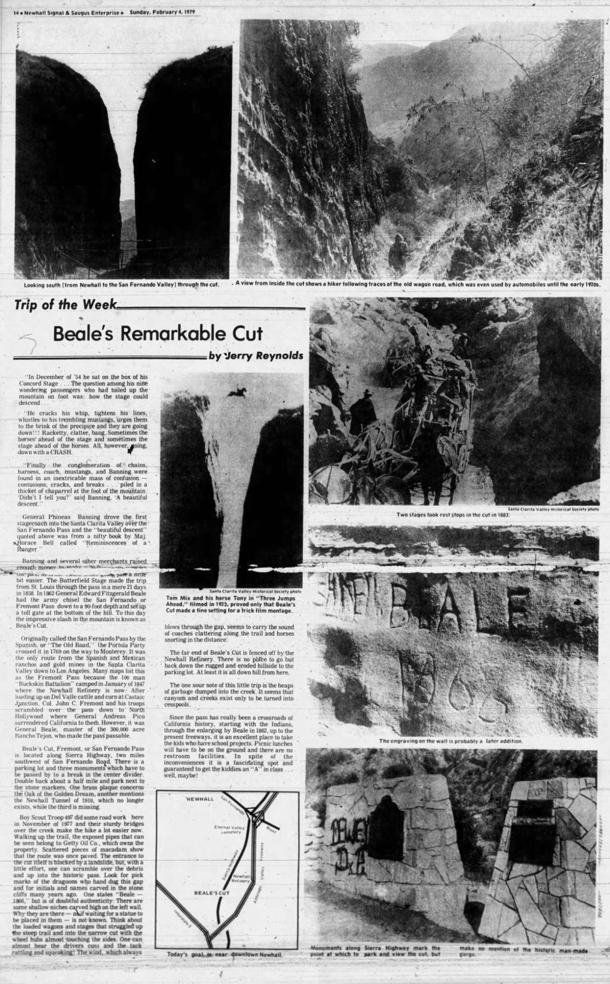
Newhall Signal, February 4, 1979
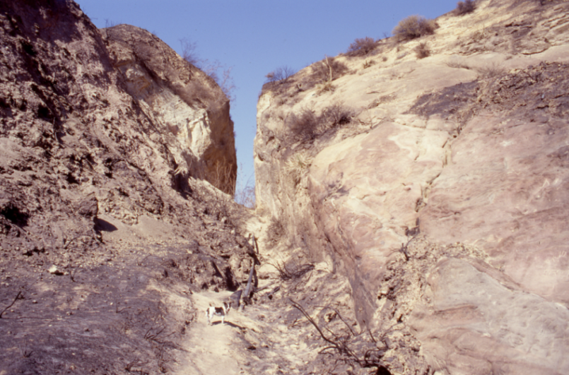
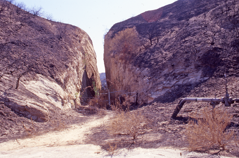
Photo from October of 1997 just before the storm damage of 1997-98 (unknown photographer). There has been a little landsliding at the south entrance, but the cut is pretty open. From the Beale's Cut photographic slide collection, 1997-1998, Special Collections & Archives, Oviatt Library, California State University, Northridge. Since this website is only for educational purposes, I am displaying the CSUN photos under the fair use doctrine.
Pretty clear in the cut. Photo from October of 1997 just before the storm damage of 1997-98 (unknown photographer). From the Beale's Cut photographic slide collection, 1997-1998, Special Collections & Archives, Oviatt Library, California State University, Northridge.
North entrance clear. Photo from October of 1997 (unknown photographer). From the Beale's Cut photographic slide collection, 1997-1998, Special Collections & Archives, Oviatt Library, California State University, Northridge.
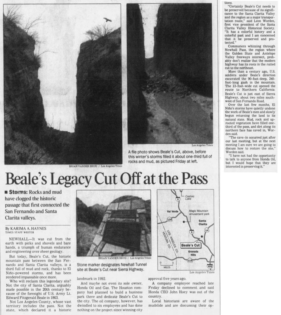
Los Angeles Times, March 28, 1998
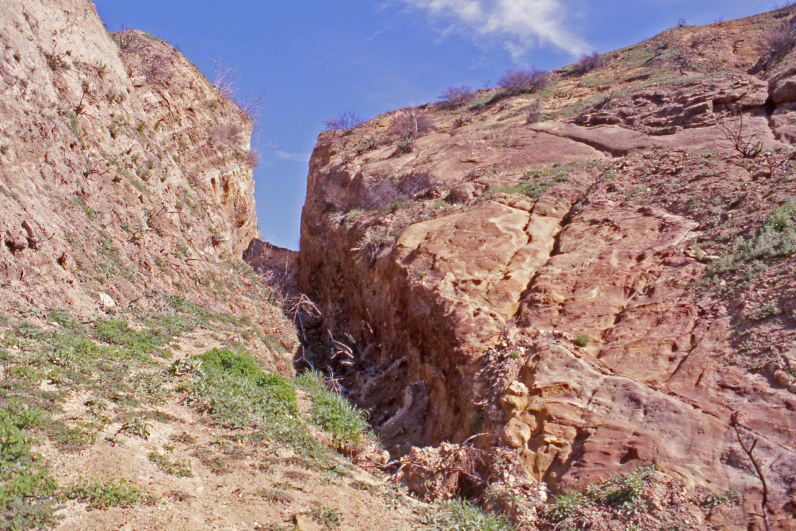
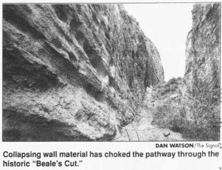
Photo from April of 1998 just after the storm damage of 1997-98 (unknown photographer). The landsliding in the cut is very obvious. From the Beale's Cut photographic slide collection, 1997-1998, Special Collections & Archives, Oviatt Library, California State University, Northridge. Since this website is only for educational purposes, I am displaying the CSUN photos under the fair use doctrine.
Closer view of the partially filled in cut. Photo from April of 1998 just after the storm damage of 1997-98. (unknown photographer). From the Beale's Cut photographic slide collection, 1997-1998, Special Collections & Archives, Oviatt Library, California State University, Northridge.
From the Signal of June 12, 1998.

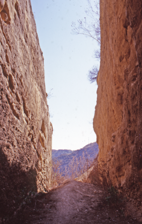
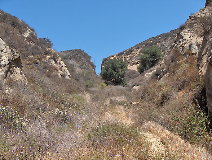
North entrance to Beale's Cut on 6/23/2007. Compare this to the north entrance photo from 1997.
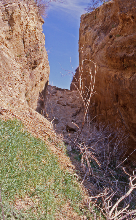
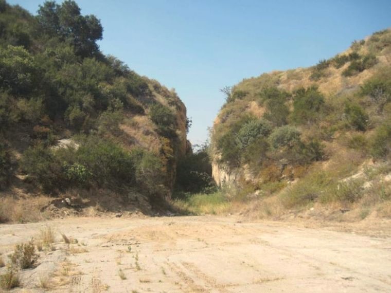
South entrance on 6/23/2007
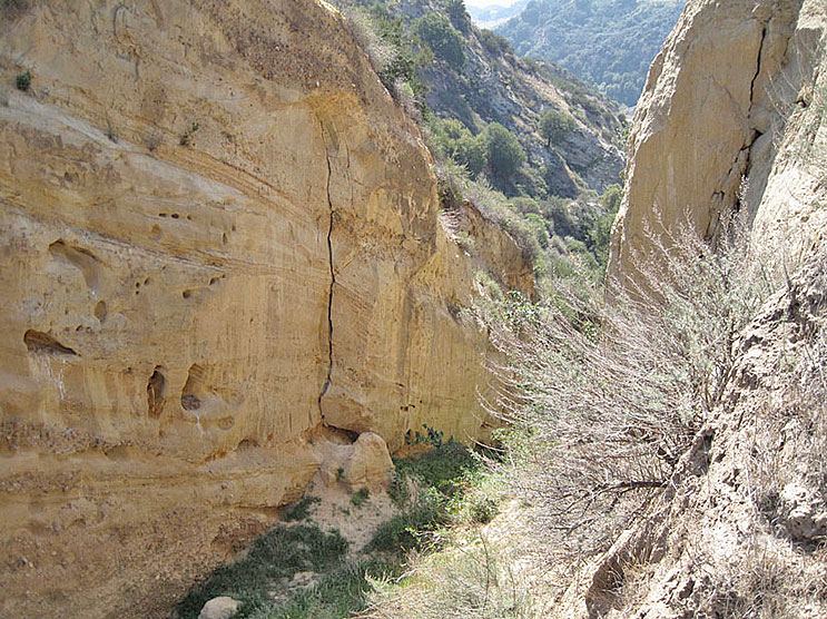
3/11/2012 - The walls are still in danger of collapsing
June 21, 2026. North side. The City of Santa Clarita now owns this.