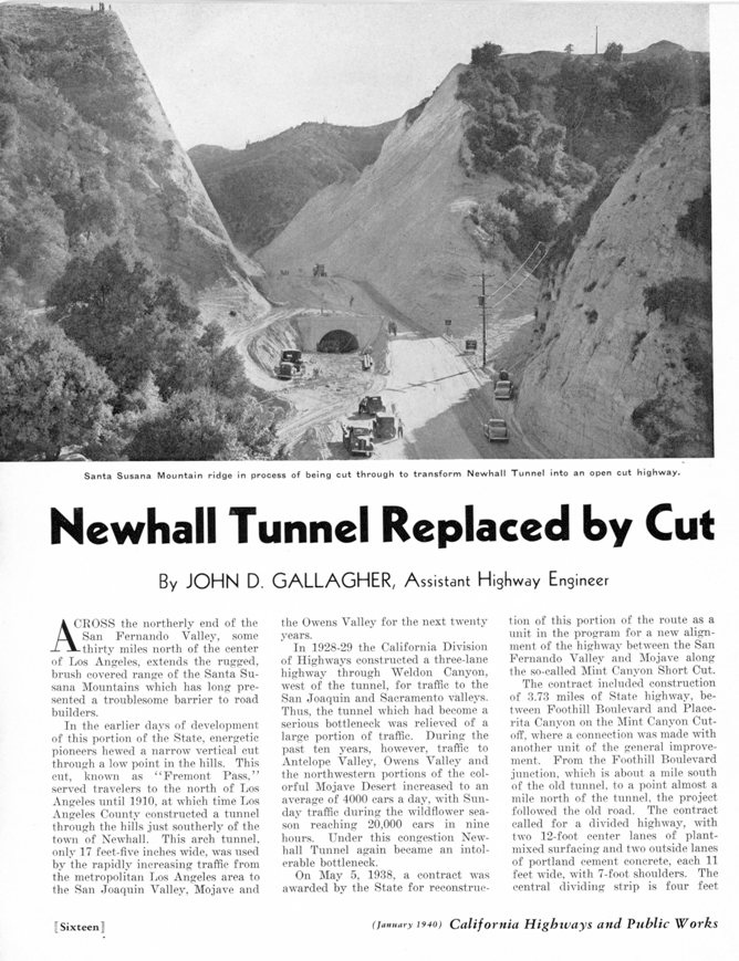
Newhall Cut
At a little over 17 feet wide, the Newhall Tunnel could only allow two cars traveling in opposite directions to pass. As traffic increased, the situation at the tunnel was becoming unbearable and a solution was needed.
The LA Times of April 17, 1927, reported that the Newhall Masonic Club has started a movement to secure the aid of the State Highway Commission in providing relief from the congestion of traffic at the tunnel. The Sunday traffic of April 10 was lined up and practically at a standstill for 6 miles from the mouth of the tunnel to Newhall. Two means of relief were suggested. The present tunnel could be enlarged or Beale's cut could be returned to use if the pass was widened and deepened. The second plan actually had the most attention in Newhall.
From the LA Times of May 4, 1927: "On Sundays and holidays automobiles are often lined up from the northern portal of the tunnel to the very outskirts of Newhall waiting an opportunity to pass through." "It is so poorly lighted that a driver plunging into the darkness on a bright day is confused and forced to steer almost by instinct." "It has no provision for pedestrian traffic." "On a recent Sunday 19,000 automobiles squeezed throught the Newhall tunnel between 6 a.m. and 10 p.m., according to a census taken by State traffic officers." "It is time for State highway officials to devise means for widening the tunnel."
In 1928, the State Highway Commission approved a plan to build a new road northwest through Weldon and Gavin Canyons as the solution to relieving the tunnel buttleneck. Also approved was the realignment (by straightening out) of San Fernando Road (today's Sierra Highway) from the north portal of the tunnel north for about a mile. Today that would be at the intersection of Remsen Street and Sierra Highway. One of the plans rejected was extending Glenoaks Blvd. (or Remsen Street) in the northern end of the San Fernando Valley northwest over (and maybe partially through) the mountain joining the San Fernando Road and today's Remsen Street, bypassing the Newhall Tunnel to the east. See here to read about that.
The the three-lane highway through the two canyons was completed in July of 1930 by the California Division of Highways. Soon after that, the realignment of San Fernando Road was also completed. This would bypass the new Andrew's refinery (which would later become the Newhall Refinery). Congestion was temporarily relieved through the Newhall Tunnel. (See story below.)
But changes were soon planned. The Newhall Signal of November 8, 1934, reported that "Surveys have been made by the highway commission for a cut to take the place of the present Newhall tunnel, but so far no appropriation has been made for the work, the plans not being complete."
From the Signal of January 10, 1935:
"Action by the State Highway Commission this week started the movement that will make the famous Newhall Tunnel a thing of the past. An item in the 1935 budget provides the sum of $100,000 for the construction of a cut which will be, according to previously discusssed plans, fifty feet wide, and will occupy the present tunnel site. Officials who have spoken of the plan, say that the work will be done some time in the present year, probably starting quite early. The statement was made that the construction will not be allowed to interfere with the travel until the work comes to a point where the tunnel walls will have to be torn out. This will make several weeks detour necessary, during which time travel will be routed over the Weldon Canyon road to Pico, and then into Newhall."
When the work was finally done and not in 1935, travel did not need to be routed elsewhere.
Some people thought that it might be better just to widen the old Fremont Pass (Beale's Cut) instead of removing the tunnel. From the Signal of November 28, 1935:
"Some have been wondering if it would not be possible to locate the proposed cut that will be made south of Newhall at some other point than directly on the present location of the tunnel. At the old site of the Fremont Pass, the formation is such that in the 65 years since that the cut was made, it has not caved. This ought to count for something, when it is considered that the cut is about fifty feet deep. Of course that might mean a return of the road to its old route, but that would not be a calamity, when the ease of the grade is considered."
The May 17, 1936, edition of the Los Angeles Times reported that "A study is being made of plans to eliminate the bottle-neck at the Newhall tunnel either by widening or by drilling of another tunnel there." Evidently, the final decision had not been made yet. On October 8, 1936, the Signal stated that "Authoritive word has been received from the state highway department that there is no intention to do any work on the tunnel south of town, this year, and probably not until late next year, if at all. This ought to quiet the rumors that have been going about that the work is to begin soon."
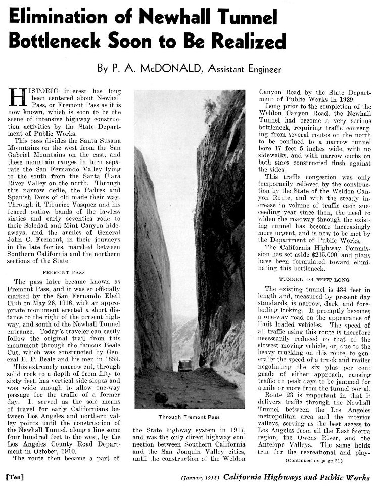
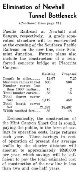
In the January, 1938, issue of California Highways and Public Works magazine it is stated:
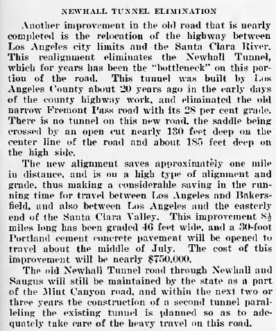
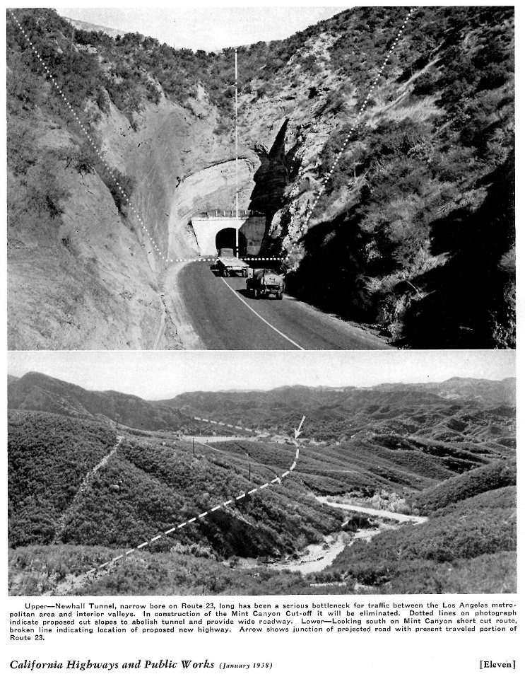
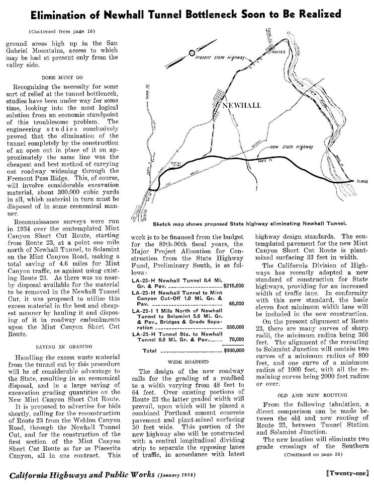
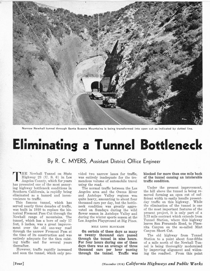
"Recognizing the necessity for some sort of relief at the tunnel bottleneck, studies have been underway for some time, looking into the most logical solution from an economic standpoint of this troublesome problem. The engineering studies conclusively proved that the elimination of the tunnel completely by the construction of an open cut in place of it on approximately the same line was the cheapest and best method of carrying out roadway widening through the Fremont Pass Ridge. This, of course, will involve considerable excavation material, about 300,000 cubic yards in all, which material in turn must be disposed of in some economical manner."
Articles from the Ventura County Star Free Press of January 19, 1938, and the Los Angeles Times of January 23, 1938, provide more information.
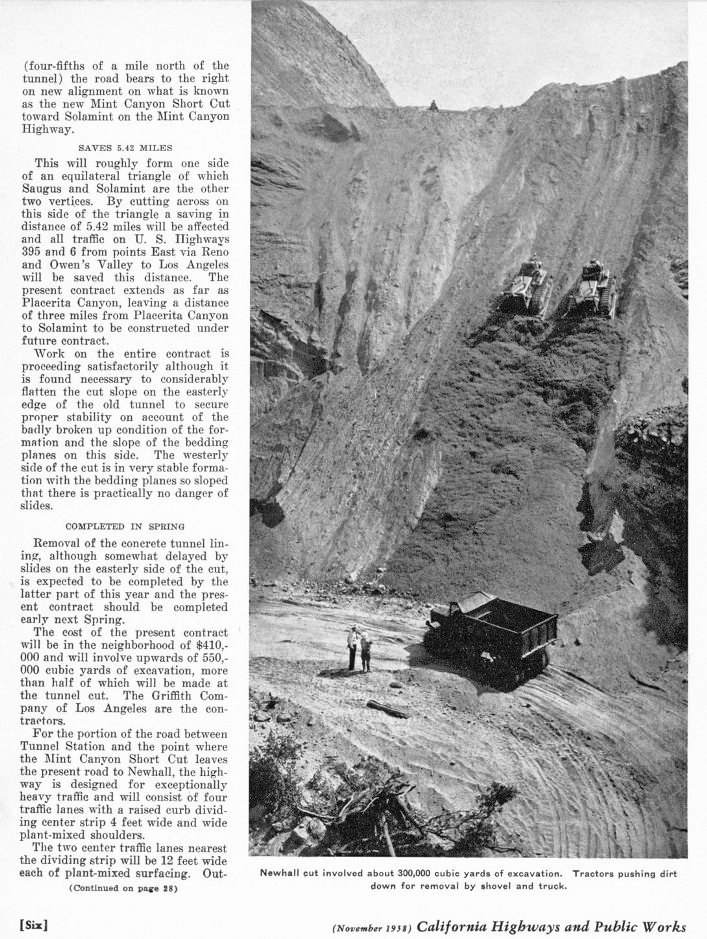
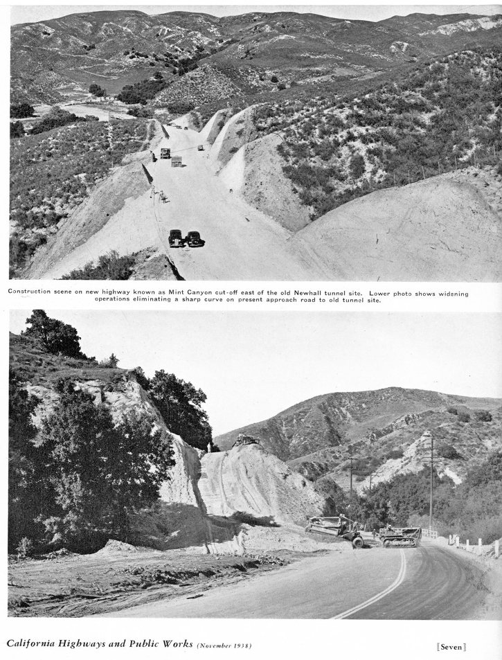
Besides the "daylighting" of the tunnel, the project would also include a new road - the Mint Canyon short-cut. This would be a new road north from today's intersection of Sierra Highway and Newhall Avenue directly to Placerita Canyon. Another project would extend the road from Placerita to Solemint, the intersection of Soledad Canyon Road and Mint Canyon Road. $900,000 was allocated for the project in January of 1938.
In early May of 1938, the state awarded the contract to replace the Newhall tunnel and the construction and improvement of the highway between Tunnel Station and Placerita Canyon to the Griffith Company of Los Angeles. (Signal, May 5, 1938) From Tunnel Station to the intersection of Sierra Highway and Newhall Avenue, the construction would follow the existing road. From there, a new road would be built to Placerita Canyon. The construction from Placerita Canyon to Solemint would be part of a different contract.
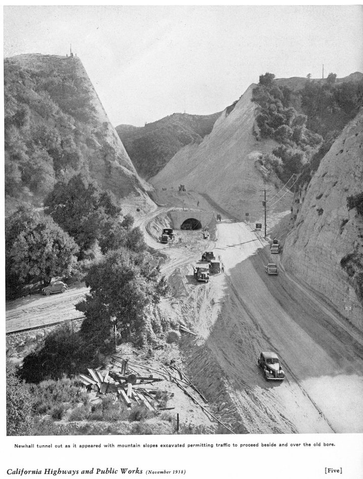
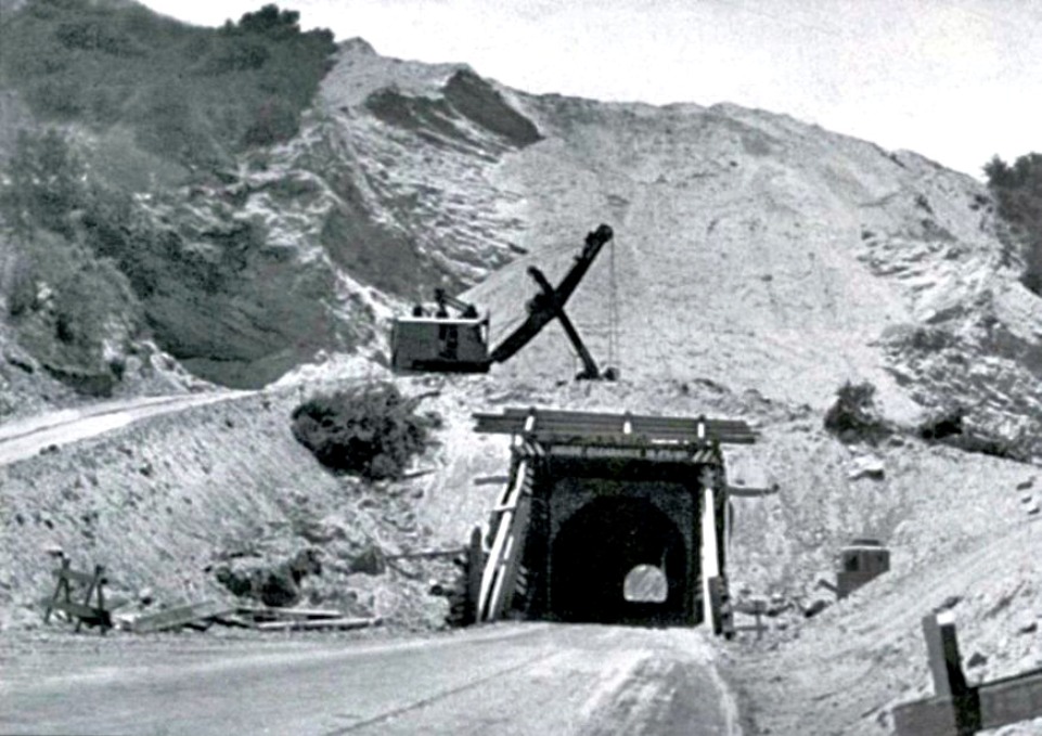
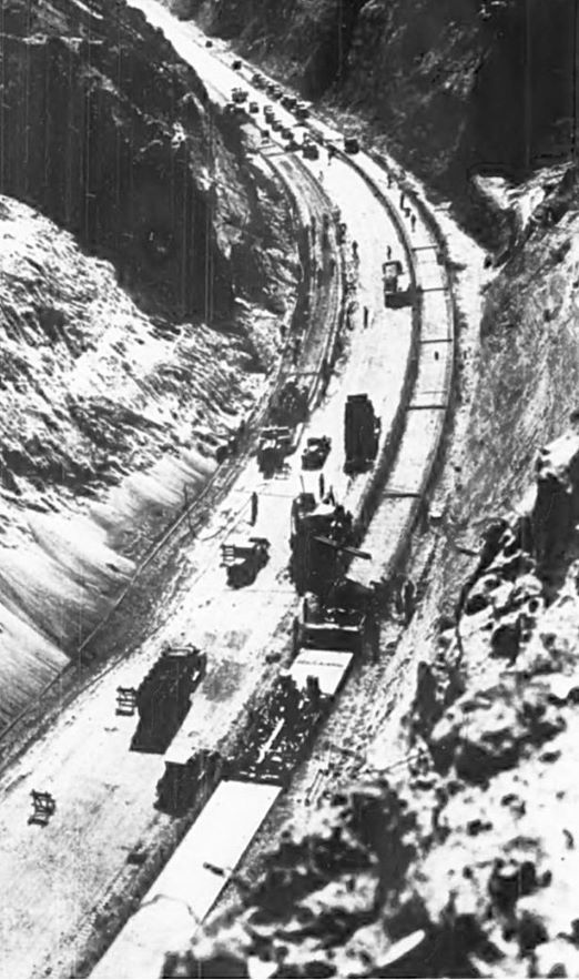
To protect the traffic through the tunnel during the construction, 30-foot wooden extensions were used first at the north portal and then at the south portal. When the cut was deep enough, ramps were constructed from the existing road to above the tunnel. No blasting was done in the removal of the upper 120 feet. It was loosened with machinery and bulldozed down. At 60 feet above the tunnel, drilling and blasting was done. Since the general dip of the rocks is to the west, at this point they had problems with landslides on the east side of the cut forcing the angle of the cut to be increased. This more than doubled the amount of material that had to be removed. Read more about the construction of the cut in the January issue of California Highways below. The entire project cost $475,700.
There is really no single date that the project was officially completed. All through construction they tried to keep the road open. However, it was closed many times due to landslides from the east side (the rock layers dipped to the west so that was the direction of slippage). As late as February of 1939, the contractor still had landslides that needed to be cleaned up. However, sometime in early 1939, the project was completed.
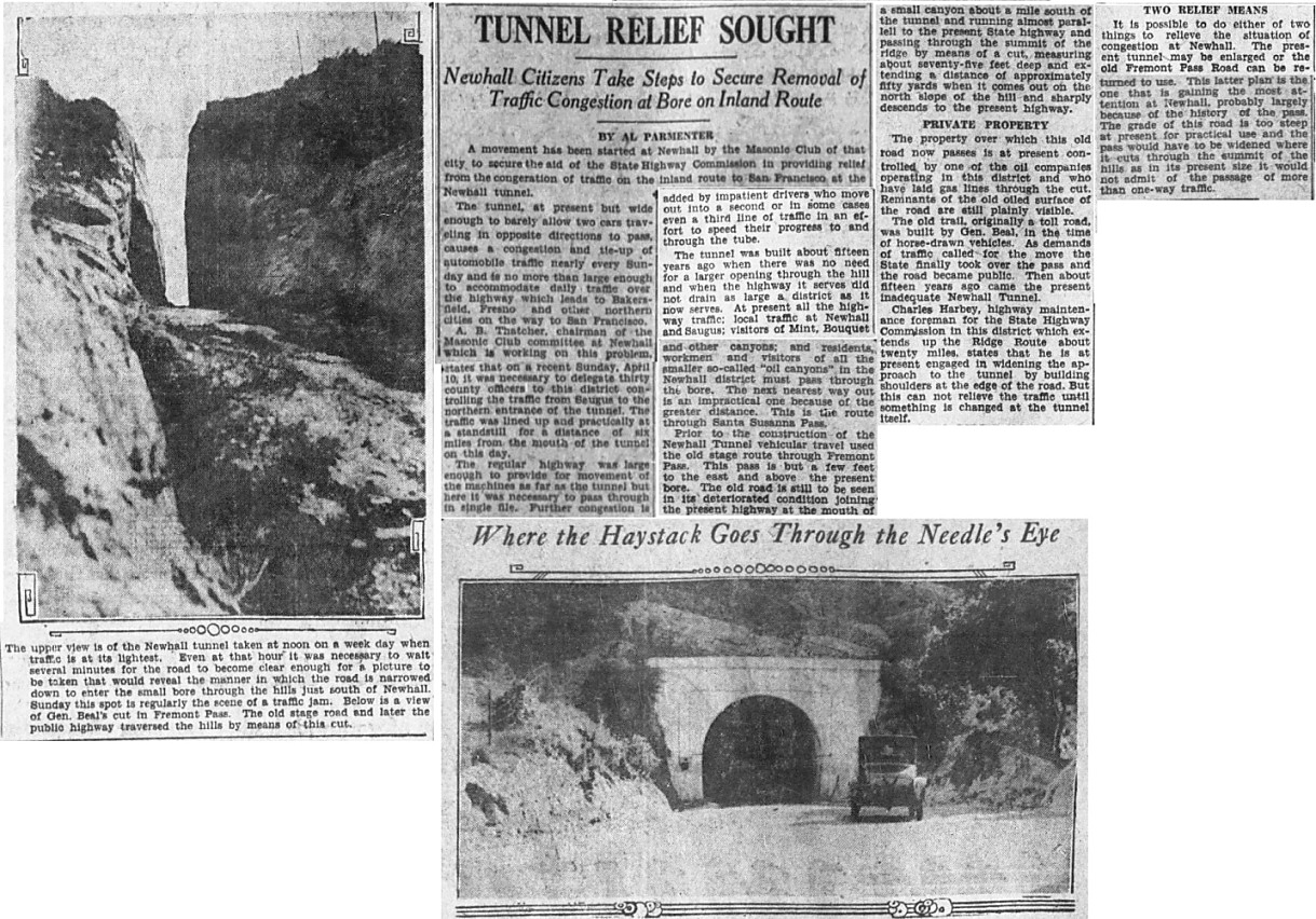
From the Los Angeles Times of April 17, 1927
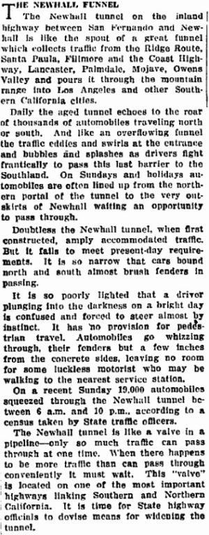
From the Los Angeles Times of May 4, 1927
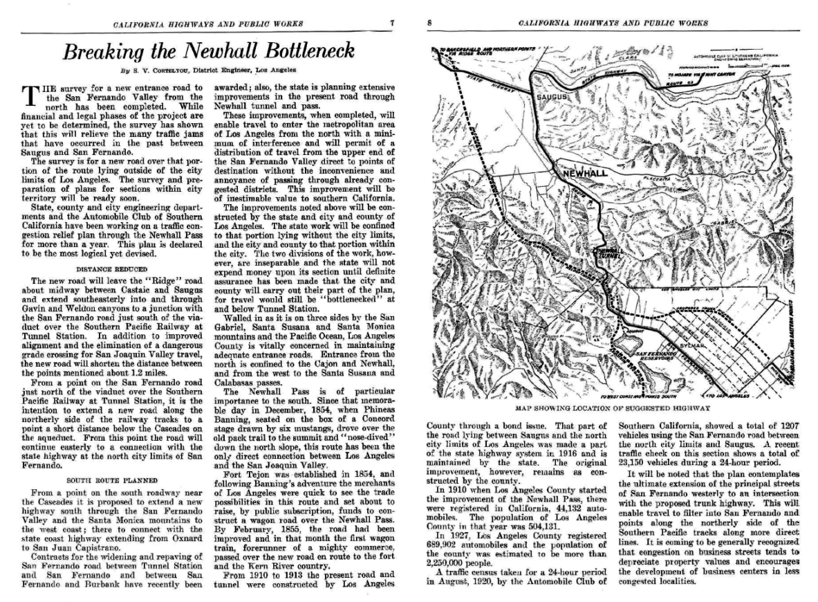
From California Highways and Public Works of May-June 1928
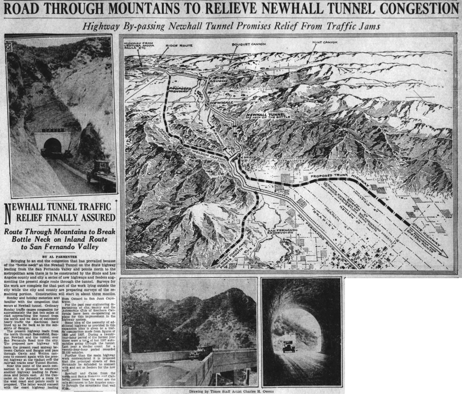
From the Los Angeles Times of July 1, 1928. Construction on the Weldon/Gavin Canyon road will be started soon.
Article from California Highways and Public Works magazine of July-August 1930 reporting on the completion of the Weldon Canyon Road. Many years later this road would become the Golden State Freeway. Note that it says a second tunnel running parallel to the existing tunnel is planned within the next two or three years. This obviously never happened.
The below article is from the California Highways and Public Works magazine of January, 1938
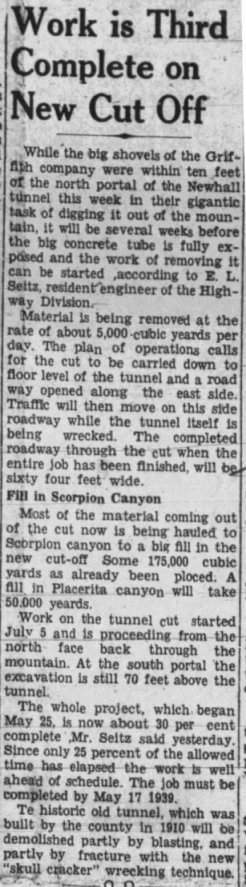
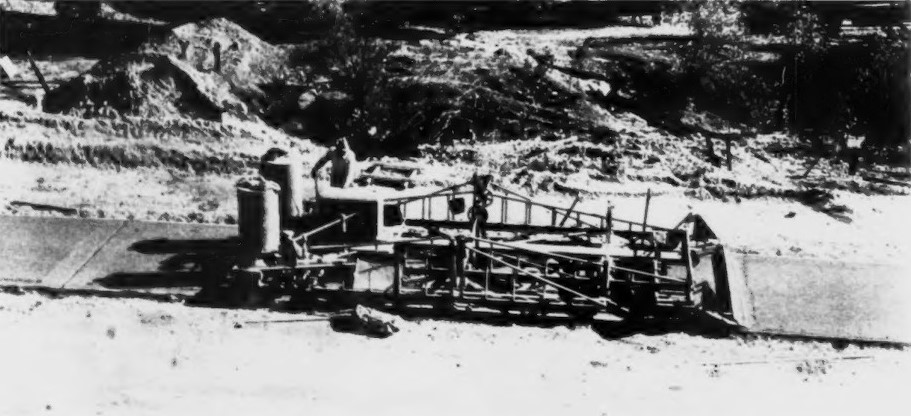
How the tunnel shell will be removed. A skull cracker is a wrecking ball. From the Newhall Signal of August 18, 1938
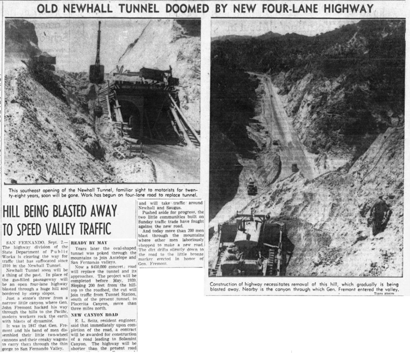
From the Los Angeles Times of September 3, 1938
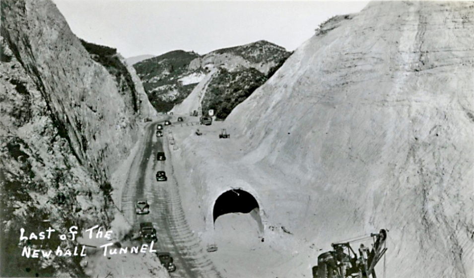
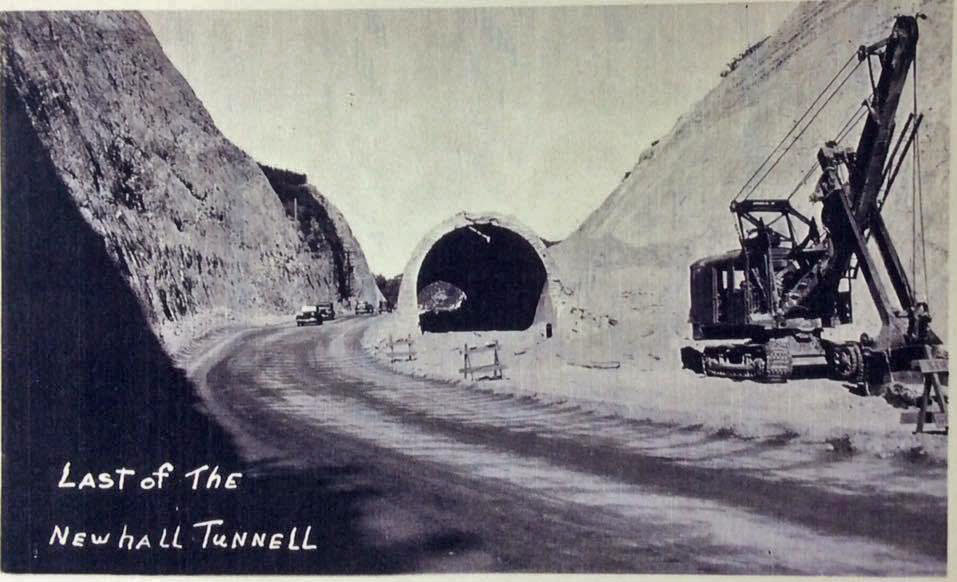
This photo and the next three, were from a group of about 12 spoiled negatives at UCLA. They show enough of the original to still be worthwhile to look at. Los Angeles Times Photographic Archives, UCLA Library Special Collections, Charles E. Young Research Library, University of California, Los Angeles.
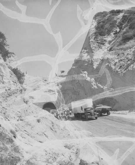
Los Angeles Times Photographic Archives, UCLA Library Special Collections, Charles E. Young Research Library, University of California, Los Angeles.
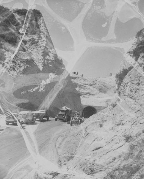
Los Angeles Times Photographic Archives, UCLA Library Special Collections, Charles E. Young Research Library, University of California, Los Angeles.
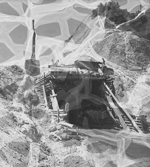
This photo was used the Los Angeles Times of September 4, 1938, shown above. Los Angeles Times Photographic Archives, UCLA Library Special Collections, Charles E. Young Research Library, University of California, Los Angeles.
From the Van Nuys News of October 20, 1938
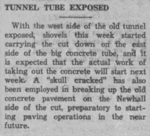
A skull cracked is another way of saying using a wrecking ball. From the Newhall Signal of November 11, 1938
The below article is from the California Highways and Public Works magazine of November, 1938
The below article is from the Engineering News Record of 2/23/1939. The top photo is the south portal and the bottom photo is the north portal.

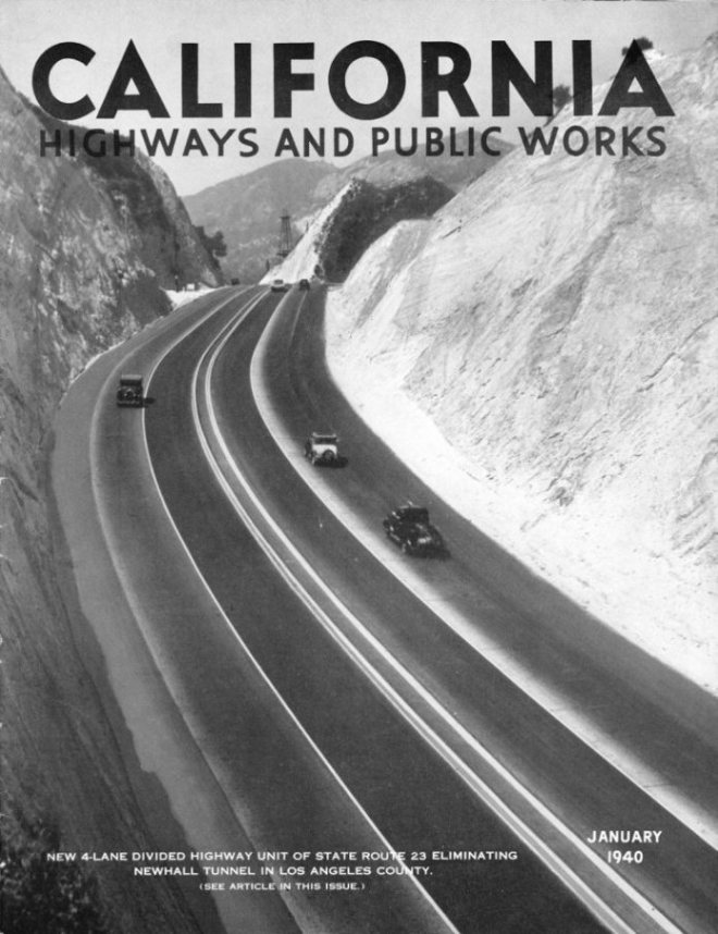
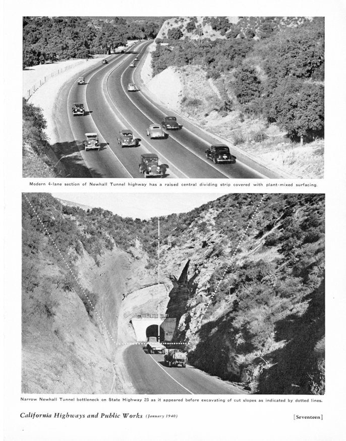
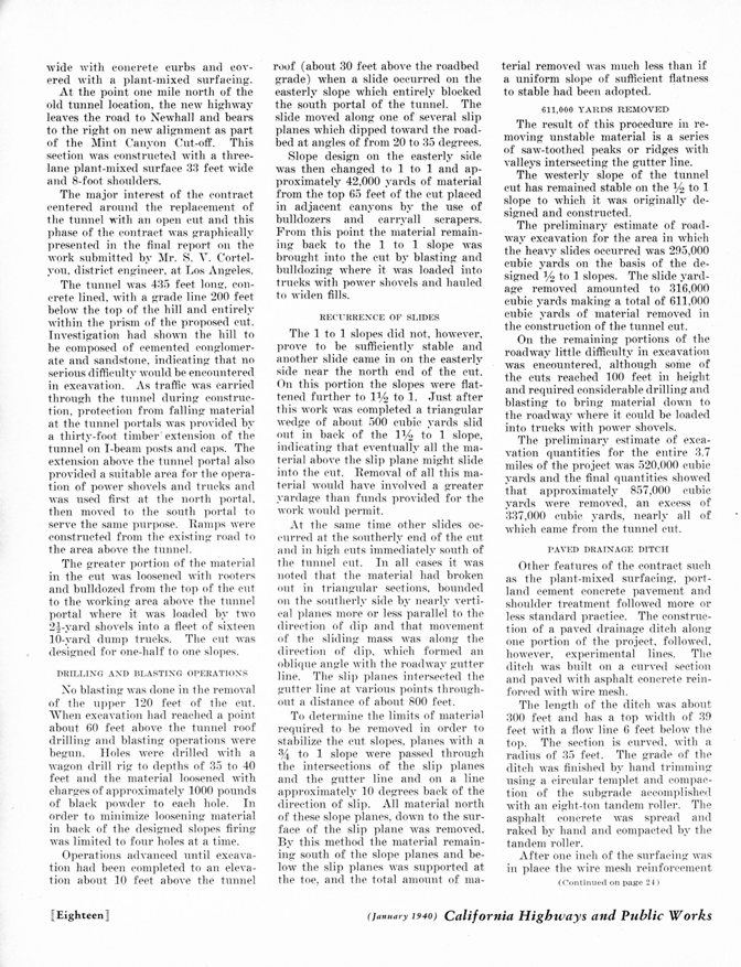
The below article is from the California Highways and Public Works magazine of January, 1940
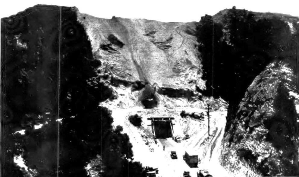
This is from Constuction Methods magazine of January 1940 showing the north portal face. Caption read: "Tunnel cut required removal of 611,000 cu. yd. of material, consisting of cemented conglomerate and sandstone, by power shovel on loading area fed by bulldozers. Traffic was maintained through tunnel during excavation of cut above it."
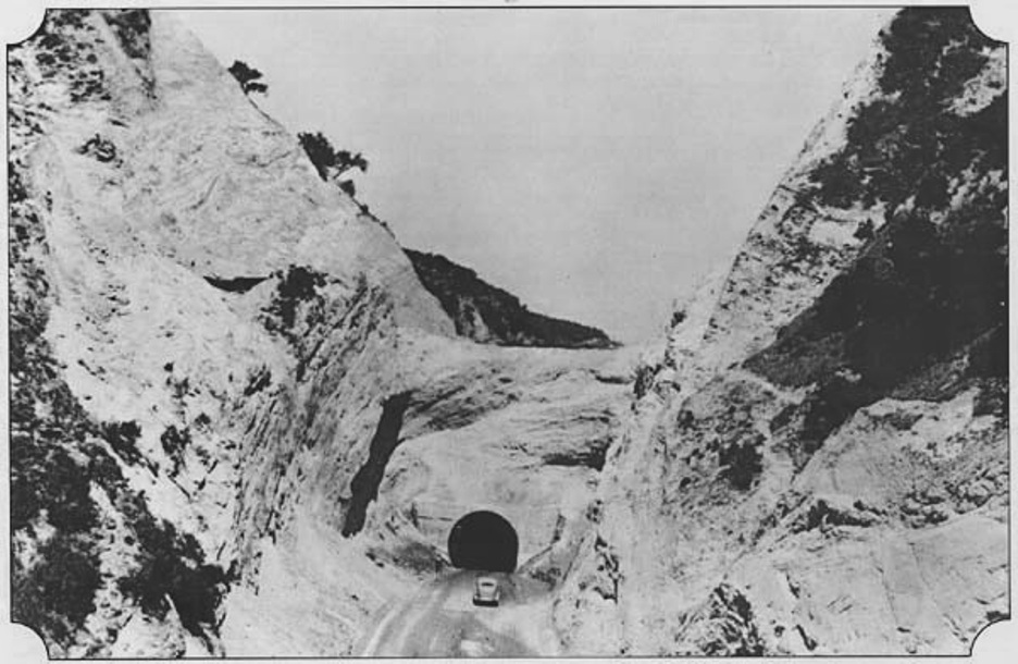
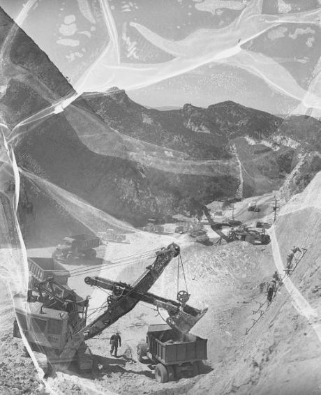
Photo of 1938 cut excavation above the Newhall Tunnel. This photo came from Mike Ballard's excellant highways website.
At ground level. Obviously, the shell will be removed and not buried, as was speculated by some people.
This image is NOT in the public domain. It is owned by Brad Therrien and used with his permission.
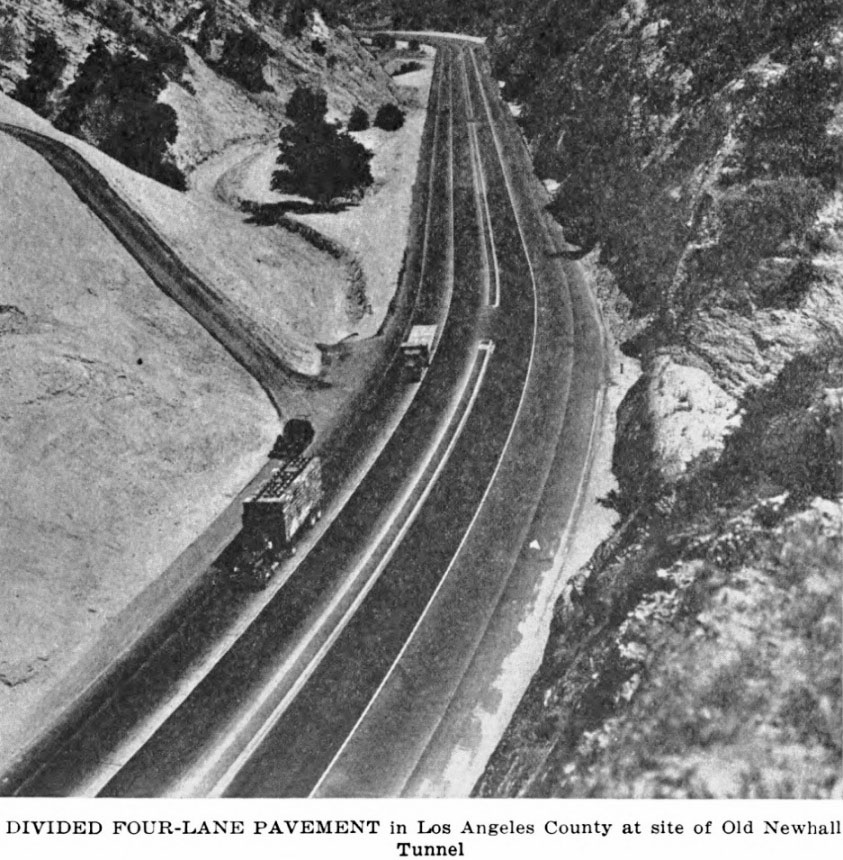
This is from Constuction Methods magazine of January 1940. Caption read: "New highway through deep cut is divided route with two 12-ft. center lanes of plant-mixed surfacing and two 11-ft. outside lanes of portland cement concrete."
This is from Constuction Methods magazine of January 1940. Caption read: "Concrete pavement slabs 11 ft. wide, forming outer lanes of Newhall cut are finished with Johnson mechanical drag float."
This is from Constuction Methods magazine of January 1940. Caption read: "South through tunnel cut completed roadway has 4-ft. center strip with white cement concrete curbs, two 12-ft. inner lanes of bituminous surfacing, two 11-ft. outer lanes of portland cement concrete and 7-ft. shoulders."
Looking south down the new cut. From The Twelfth Biennial Report to the Governor of California by the Director of Public Works: July 1, 1938, to June 30, 1940, p.18.
From Excavating Engineer magazine of May, 1940, pp. 306-307.
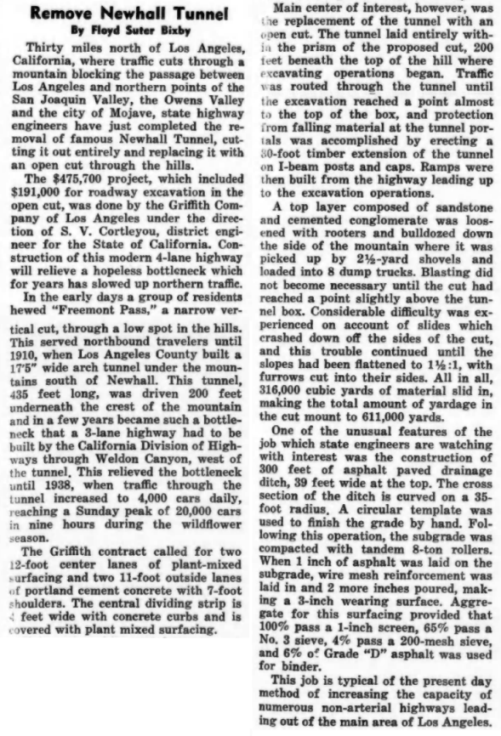
Photograph dated December 11, 1948. Note beacon hill in the background. You can just make out the beacon on top of it.
From the Los Angeles Public Library, Valley Times Collection

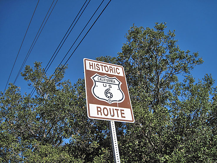
Similar view as the above image. The road was Route 23 and then Route 6 before becoming Sierra Highway. (Photo taken on 5/12/2010)
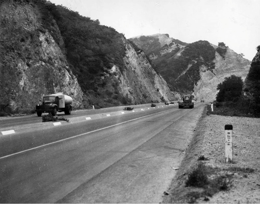
Close-up of sign. On January 30, 2007, this sign was installed by the City of Santa Clarita (Signal, January 31, 2007). In 2010, this sign was either removed or stolen. (Photo taken on 11/29/2009)
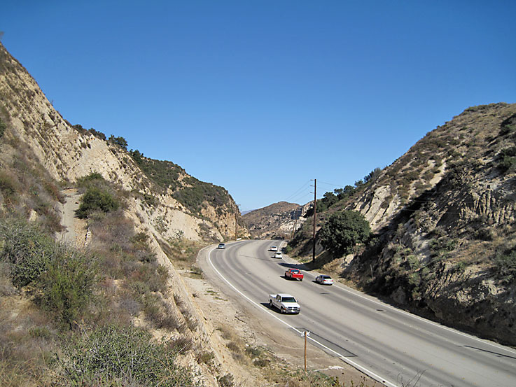
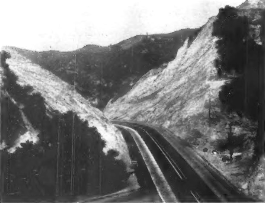
Newhall cut on 5/12/2010 looking north. The cut has been widened over the years.