Newhall Refinery Through the Years in Aerial Photos
The site of the Newhall Refinery has undergone many changes through the years. Here are some aerial photos from various years.
Some of these images are from the historical aerials.com website and some are from the University of Santa Barbara's Framefinder website.
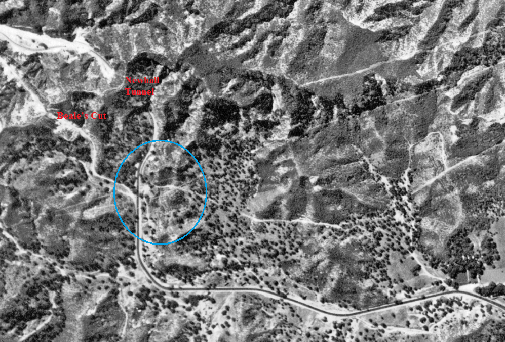
Aerial photo taken sometime in 1928 showing the future refinery site in blue circle. There is nothing there at this time.
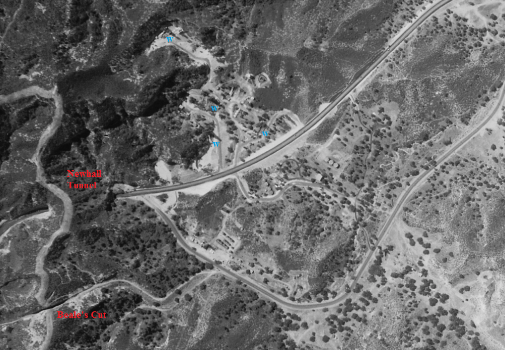
Aerial photo taken between 7/18/1930 and 8/25/1930. The refinery now exists. The re-alignment of what is now Sierra Highway has just been completed allowing the traffic to avoid the right-hand curve when they exited the tunnel from the south. There is also extensive activity on the other side of the new road alignment. This is an oil field. If you look closely you can see the shadows of 4 derricks (blue "w"). The new refinery is located on Clampitt Road. (Note: E.A. Clampitt was a pioneer oilman of the Tunnel Area and Elsmere Canyon. See more information about him on the Elsmere Canyon oil page.)
Aerial photo taken between 5/22/1938 and 7/28/1938. This is just before the start of the elimination of the Newhall Tunnel with the "Cut".
Aerial photo taken between 12/6/1938 and 1/31/1939. Work on the Cut has started. Also started is work on constructing a large tank on the south side of the refinery.
Aerial photo taken between 11/22/1944 and 2/23/1945. There is no visible evidence of the the 8/12/1944 fire. There are now two large tanks south of Clampitt Road. The second one was probably added when the second world war started in the early 1940's.
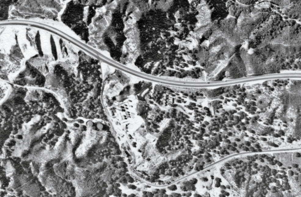
1952. Sierra Highway on the left. Highway 14 has not been built yet.
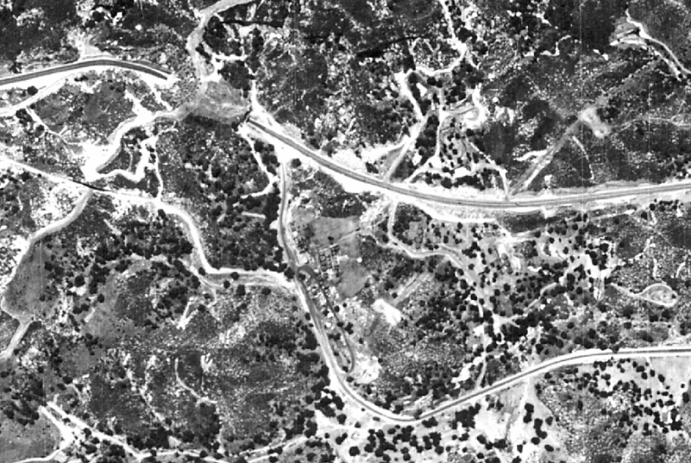
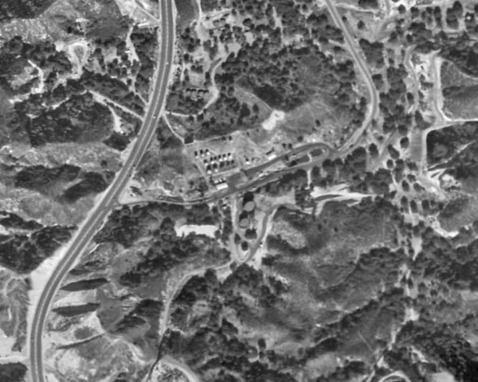
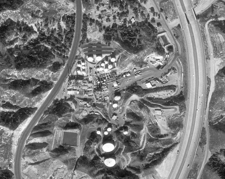
1969. More tanks, including two very large ones, have now been constructed south of Clampitt Road. The biggest change is the construction going on of Highway 14 on the right (east). It will be completed by 1972.
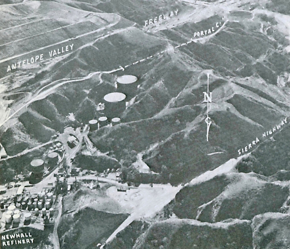
Photo from The Second Los Angeles Aqueduct, Department of Water and Power, City of Los Angeles, 1971, p. 24. Shows the route of the aqueduct near the refinery.
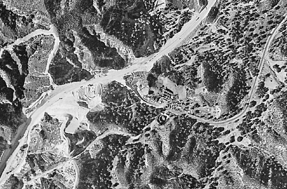
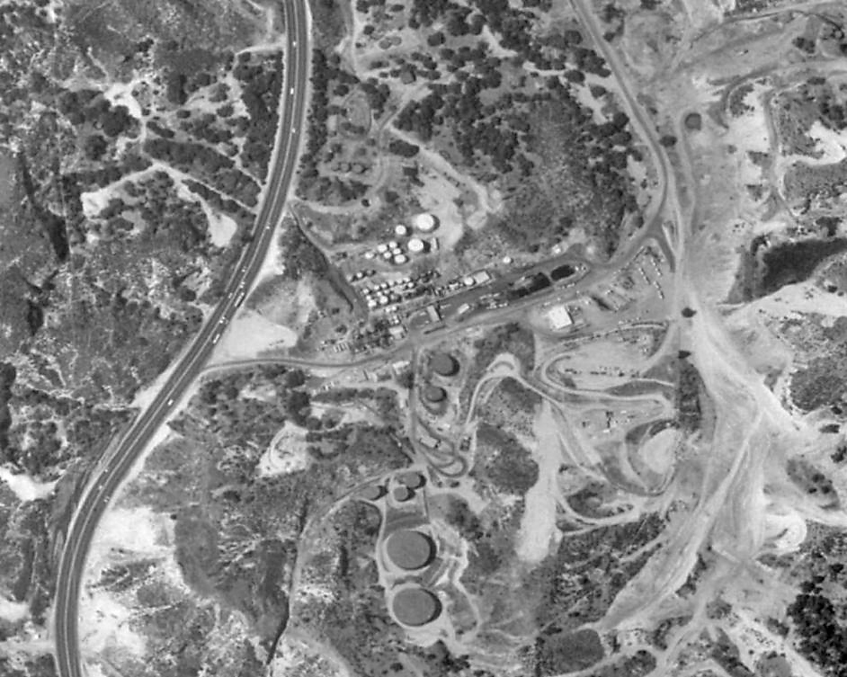
1980. A large square holding tank has been constructed just north of Beale's Cut. The refinery has been expanded on both sides of Clampitt Road. The Los Pinetos underpass to the freeway is in the upper right part of the photo. The part of Clampitt Road to the north of the underpass was, for some reason, renamed Remsen Road. That part of the road (and only the road) is owned by the City of Santa Clarita.
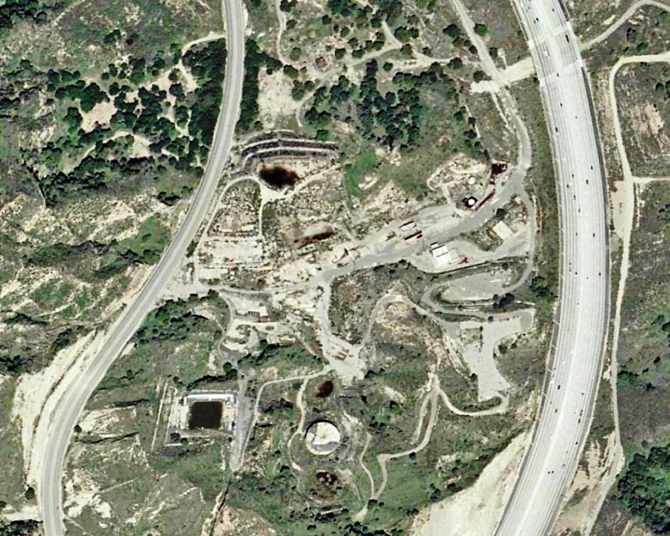
2003. The refinery had been closed since 1989 and most of the structures have been removed. Just one of the two large tanks remains.
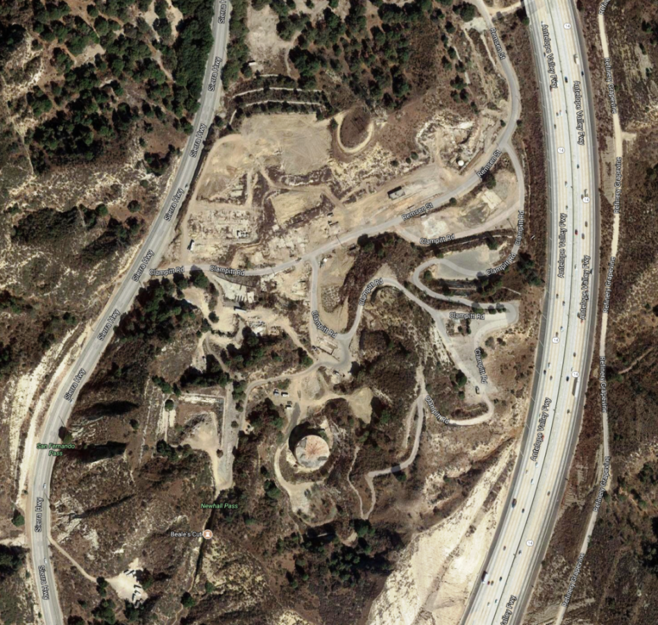
2017 (from Google maps)